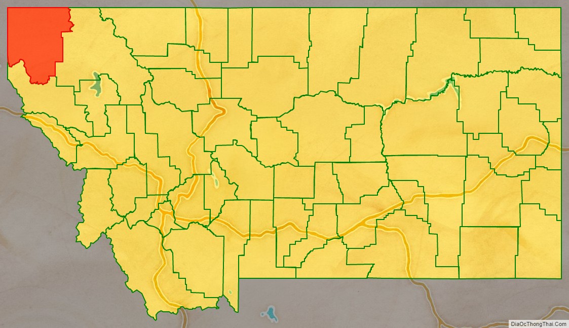
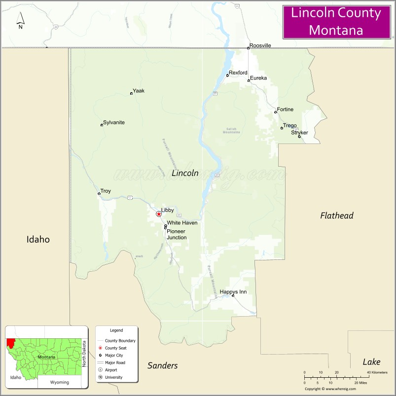
Lincoln County is a county located in the U.S. state of Montana. As of the 2020 census, the population was 19,677. Its county seat is Libby. The county was founded in 1909 and named for President Abraham Lincoln. The county lies on Montana’s north border and thus shares the US-Canadian border with the Canadian province of British Columbia.
This heavily wooded and mountainous county once was part of Flathead County until residents of Libby and Eureka petitioned the state legislature for separation. Libby won an election over Eureka to host the county seat.
| Name: | Lincoln County |
|---|---|
| FIPS code: | 30-053 |
| State: | Montana |
| Founded: | March 9, 1909 |
| Named for: | Abraham Lincoln |
| Seat: | Libby |
| Largest city: | Libby |
| Total Area: | 3,675 sq mi (9,520 km²) |
| Land Area: | 3,613 sq mi (9,360 km²) |
| Total Population: | 19,677 |
| Population Density: | 5.4/sq mi (2.1/km²) |
| Time zone: | UTC−7 (Mountain) |
| Summer Time Zone (DST): | UTC−6 (MDT) |
| Website: | www.lincolncountymt.us |
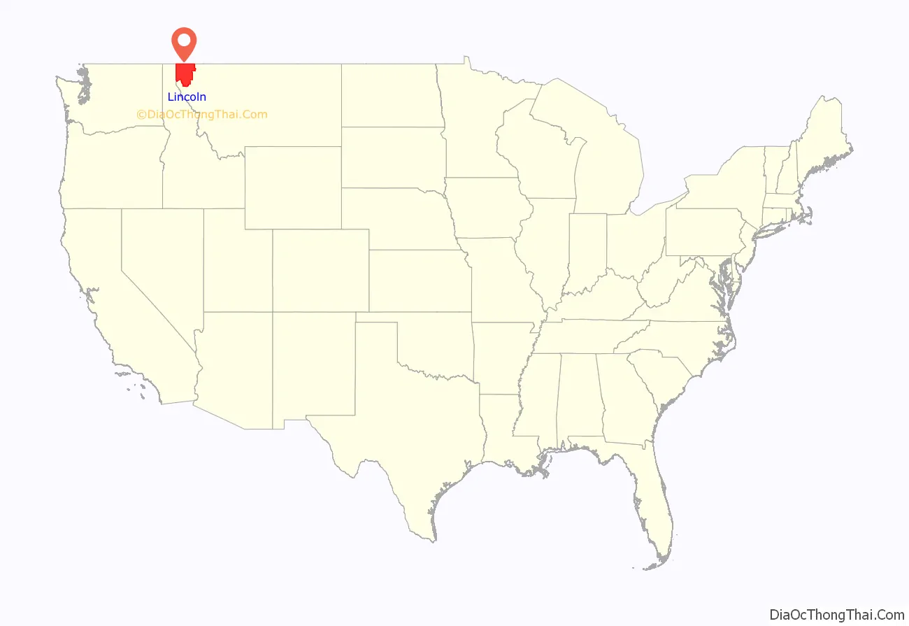
Lincoln County location map. Where is Lincoln County?
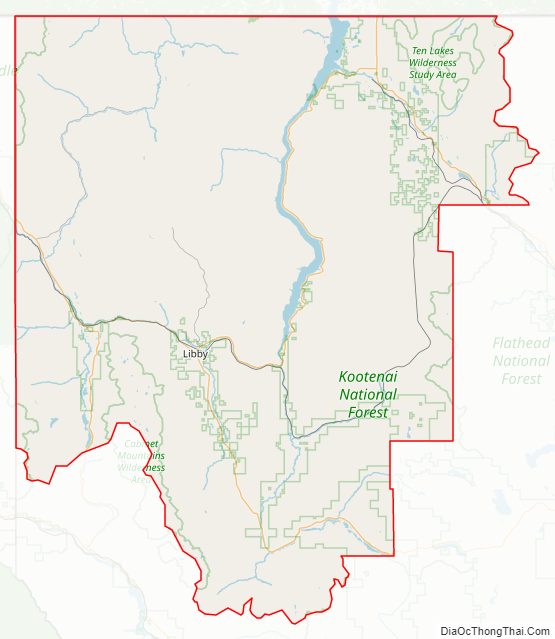
Lincoln County Road Map
Geography
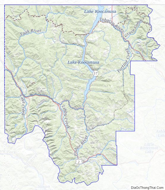
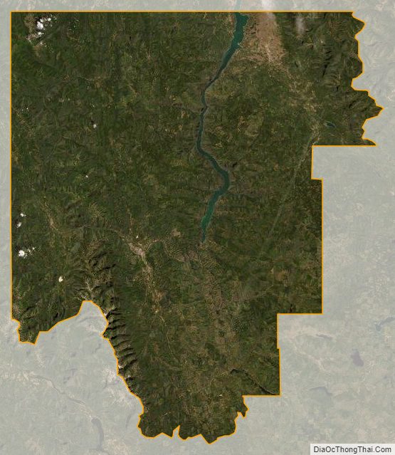
According to the United States Census Bureau, the county has a total area of 3,675 square miles (9,520 km), of which 3,615 square miles (9,360 km) is land and 62 square miles (160 km) (1.7%) is water. The county borders the Canadian province of British Columbia to the north. The lowest point in the state of Montana is located on the Kootenai River in Lincoln County, where it flows out of Montana and into Idaho. Upstream, Libby Dam backs up huge Lake Koocanusa (combination name of Kootenai, Canada, USA) into Canada’s British Columbia.
Adjacent counties and county-equivalents
- Regional District of Central Kootenay, British Columbia – northwest
- Regional District of East Kootenay, British Columbia – north
- Flathead County – east
- Sanders County – south
- Bonner County, Idaho – southwest/Pacific Time Border
- Boundary County, Idaho – northwest/Pacific Time Border
National protected areas
- Pacific Northwest National Scenic Trail (part)
- Flathead National Forest (part)
- Kaniksu National Forest (part)
- Kootenai National Forest (part)
Lincoln County Topographic Map
Lincoln County Satellite Map
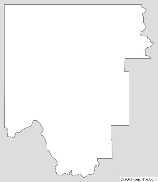
Lincoln County Outline Map