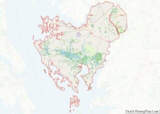
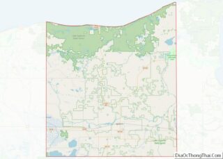
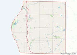
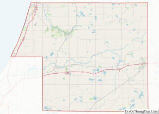
Map of Choctaw County

Map of Choctaw County, Alabama

Choctaw County is a county located in the southwestern portion of the U.S. state of Alabama. As of the 2020 census, the population was 12,665. The county seat is Butler. The county was established on December 29, 1847, and named for the Choctaw tribe of Native Americans. Choctaw County overview: Name: Choctaw County FIPS code: … Read more

Map of Etowah County

Map of Etowah County, Alabama

Etowah County is a county located in the northeastern part of the U.S. state of Alabama. As of the 2020 census the population was 103,436. Its county seat is Gadsden. Its name is from a Cherokee word meaning “edible tree”. In total area, it is the smallest county in Alabama, but one of the most … Read more

Map of Macon County

Map of Macon County, Alabama

Macon County is a county located in the east central part of the U.S. state of Alabama. As of the 2020 census, the population was 19,532. Its county seat is Tuskegee. Its name is in honor of Nathaniel Macon, a member of the United States Senate from North Carolina. Developed for cotton plantation agriculture in … Read more

Map of Sumter County

Map of Sumter County, Alabama

Sumter County is a county located in the west central portion of Alabama. At the 2020 census, the population was 12,345. Its county seat is Livingston. Its name is in honor of General Thomas Sumter of South Carolina. Sumter County overview: Name: Sumter County FIPS code: 01-119 State: Alabama Founded: December 18, 1832 Named for: … Read more

Map of Haines Borough

Map of Haines Borough, Alaska

Haines Borough is a home-rule borough located in the state of Alaska. As of the 2020 census, the population was 2,080, down from 2,508 in 2010. Haines Borough overview: Name: Haines Borough FIPS code: 02-100 State: Alaska Founded: August 29, 1968 Named for: Haines Total Area: 2,726 sq mi (7,060 km²) Land Area: 2,319 sq mi (6,010 km²) Total Population: 2,080 … Read more

Map of Wrangell-Petersburg Census Area

Map of Petersburg Borough, Alaska

Petersburg Borough is a borough in the U.S. state of Alaska. According to the 2020 census, the population was 3,398. The borough seat is Petersburg. Petersburg is the most recently created county equivalent in the United States. Petersburg Borough overview: Name: Petersburg Borough FIPS code: 02-195 State: Alaska Named for: Petersburg Seat: Petersburg Total Area: … Read more

Map of Yuma County

Map of Yuma County, Arizona

Yuma County is a county in the southwestern corner of the U.S. state of Arizona. As of the 2020 census, its population was 203,881. The county seat is Yuma. Yuma County includes the Yuma, Arizona Metropolitan Statistical Area. The county borders three states: Sonora, Mexico, to the south, and two other states to the west, … Read more

Map of Craighead County

Map of Craighead County, Arkansas

Craighead County is a county located in the U.S. state of Arkansas. As of the 2020 census, the population was 111,231. The county has two county seats — Jonesboro and Lake City. Craighead County is Arkansas’s 58th county, formed on February 19, 1859, and named for state Senator Thomas Craighead. It is one of several … Read more

Map of Independence County

Map of Independence County, Arkansas

Independence County is a county located in the U.S. state of Arkansas. As of the 2020 census, the population was 37,938. The county seat is Batesville. Independence County is Arkansas’s ninth county, formed on October 20, 1820, from a portion of Lawrence County and named in commemoration of the Declaration of Independence. It is an … Read more

Map of Monroe County

Map of Monroe County, Arkansas

Monroe County is located in the Arkansas Delta in the U.S. state of Arkansas. The county is named for James Monroe, the fifth President of the United States. Created as Arkansas’s 20th county on November 2, 1829, Monroe County is home to two incorporated towns and three incorporated cities, including Clarendon, the county seat, and … Read more

Map of Scott County

Map of Scott County, Arkansas

Scott County is a county located in the U.S. state of Arkansas. As of the 2020 census, the population was 9,836. The county seat is Waldron. Scott County is Arkansas’ 28th county, formed on November 5, 1833, and named for Andrew Scott, a justice of the Supreme Court of the Arkansas Territory. It is an … Read more

Map of Calaveras County

Map of Calaveras County, California

Calaveras County (/ˌkæləˈvɛrəs/ (listen)), officially the County of Calaveras, is a county in both the Gold Country and High Sierra regions of the U.S. state of California. As of the 2010 census, the population was 45,292. The county seat is San Andreas. Angels Camp is the county’s only incorporated city. Calaveras is Spanish for “skulls”; … Read more