| Name: | Berkshire County |
|---|---|
| FIPS code: | 25-003 |
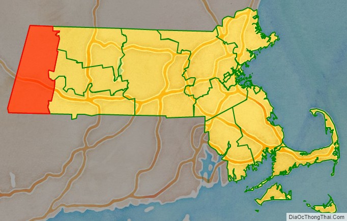
| State: | Massachusetts |
| Founded: | April 24, 1761 |
| Named for: | Berkshire, England |
| Seat: | Pittsfield |
| Largest city: | Pittsfield |
| Total Area: | 946 sq mi (2,450 km²) |
| Land Area: | 927 sq mi (2,400 km²) |
| Total Population: | 129,026 |
| Population Density: | 139.2/sq mi (53.7/km²) |
| Time zone: | UTC−5 (Eastern) |
| Summer Time Zone (DST): | UTC−4 (EDT) |
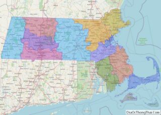
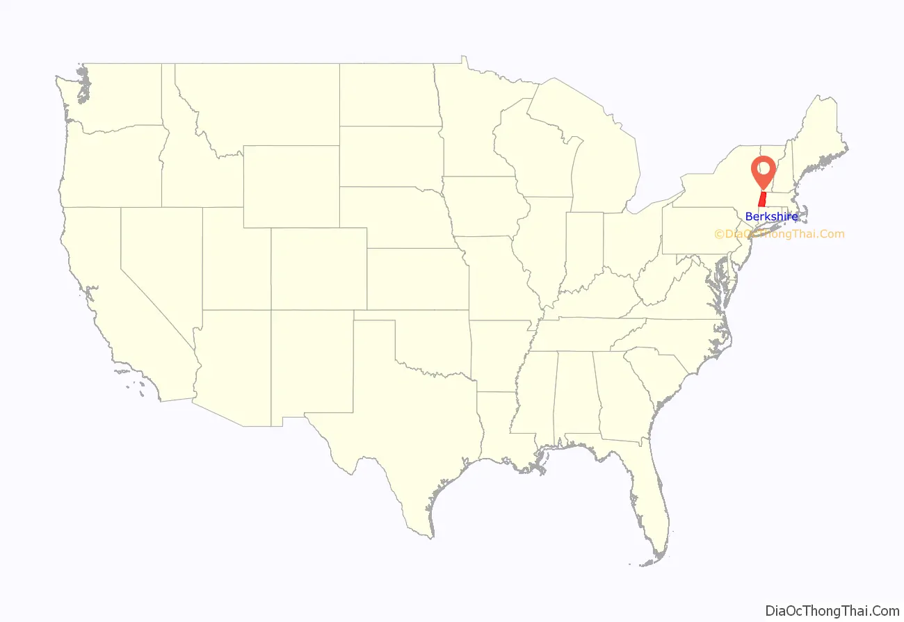
Berkshire County location map. Where is Berkshire County?
History
The Mahican (Muh-he-ka-neew) Native American tribe lived in the area that now makes up Berkshire County until the early 18th century, when the first English settlers and frontiersmen appeared and began setting up farms and homesteads. On April 25, 1724, “The English finally paid the Indians 460 pounds, 3 barrels of cider, and 30 quarts of rum for what is today Berkshire County.” This deal did not include modern Sheffield, Stockbridge, Richmond, and Lenox, which were added later. Berkshire County was the western part of Hampshire County until separated in 1761.
In the 19th century, Berkshire County became popular with the American elite, which built what they called “cottages” throughout the countryside. The Gilded Age ended in the early 20th century with the income tax, World War I, and the Great Depression. In the 20th, century some of these cottages were torn or burned down, while others became prep schools, historic sites, or bed-and-breakfast inns.
Today Berkshire is known throughout the East Coast and the country as the summer home of the Boston Symphony Orchestra. It includes attractions such as Tanglewood, Berkshire Museum, the Norman Rockwell Museum, Mass MOCA, and Hancock Shaker Village.
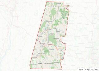
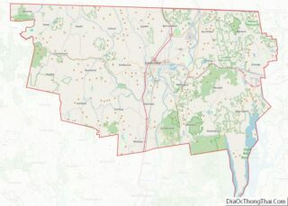
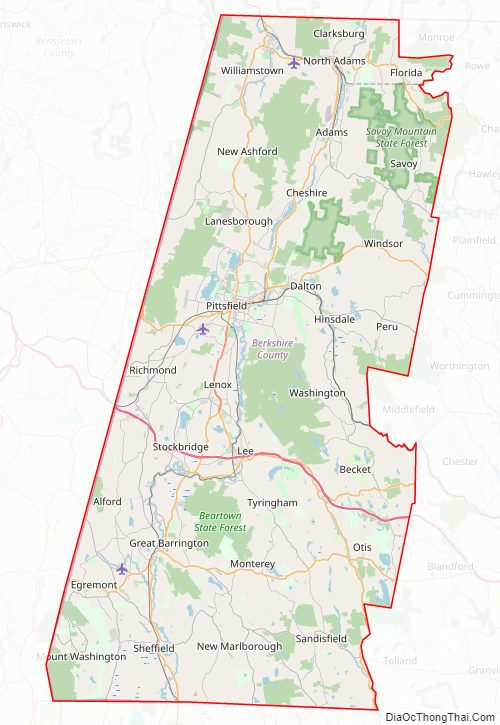
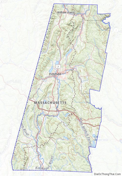
Berkshire County Road Map
Geography
According to the U.S. Census Bureau, the county has a total area of 946 square miles (2,450 km) of which 927 square miles (2,400 km) is land and 20 square miles (52 km) (2.1%) is water. It is the second-largest county in Massachusetts by land area. The highest natural point in Massachusetts, Mount Greylock at 3,492 feet (1,064 m), is in Berkshire County.
Berkshire County is one of two Massachusetts counties that borders three neighboring states (Vermont, New York and Connecticut); the other is Worcester County. The two counties are also the only ones to touch both the northern and southern state lines.
Running north-south through the county are the Hoosac Range of the Berkshire Hills in the eastern part of the county and the Taconic Mountains in the western part of the county. Due to their elevation, the Berkshires attract tourists and summer residents eager to escape the heat of the lowlands.
Adjacent counties
- Bennington County, Vermont (north)
- Franklin County (northeast)
- Hampshire County (east)
- Hampden County (southeast)
- Litchfield County, Connecticut (south)
- Dutchess County, New York (southwest)
- Columbia County, New York (west)
- Rensselaer County, New York (northwest)
Berkshire County Topographic Map
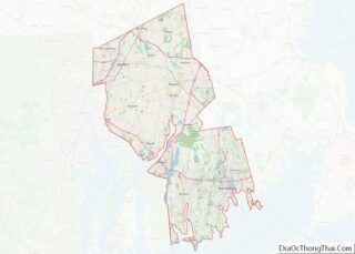
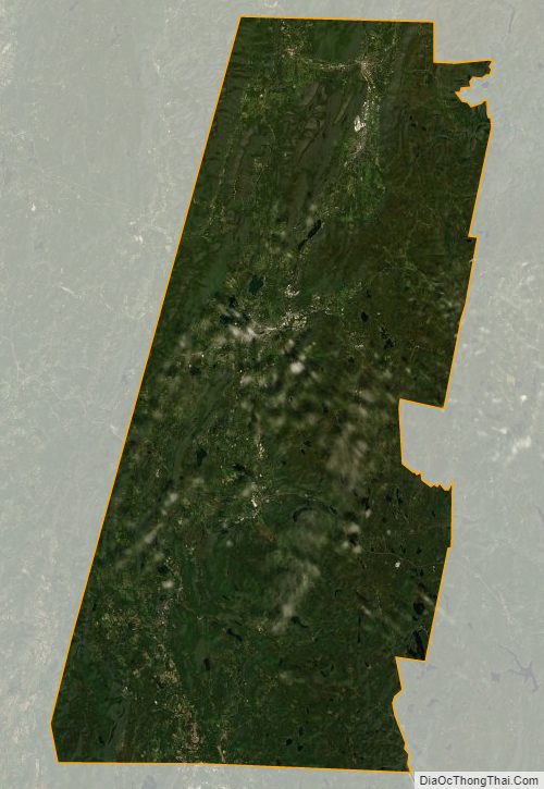
Berkshire County Satellite Map
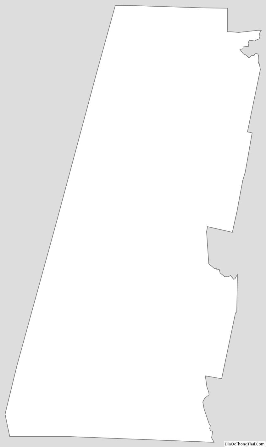
Berkshire County Outline Map