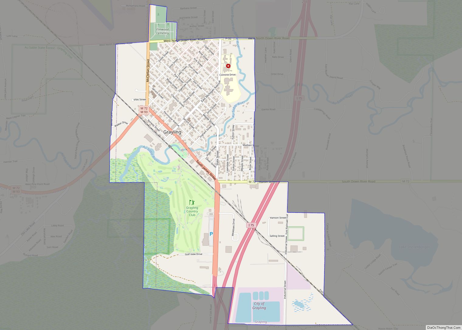
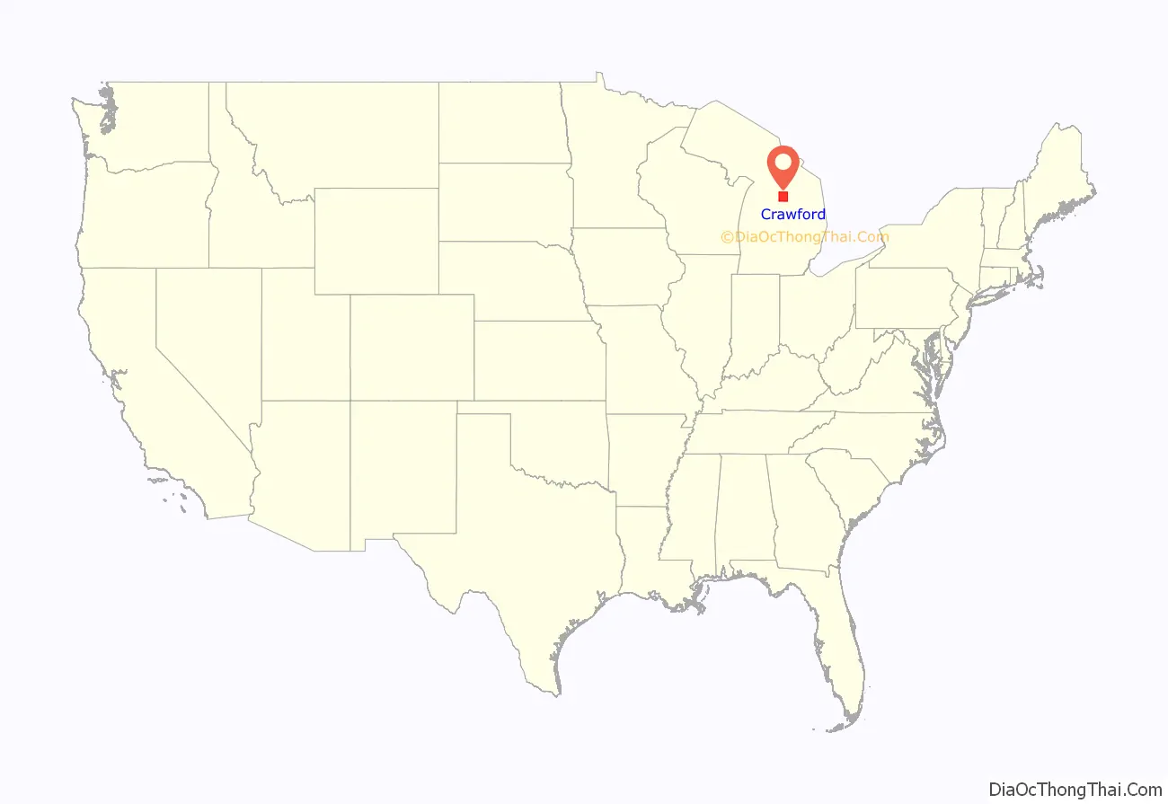
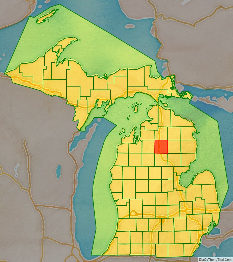
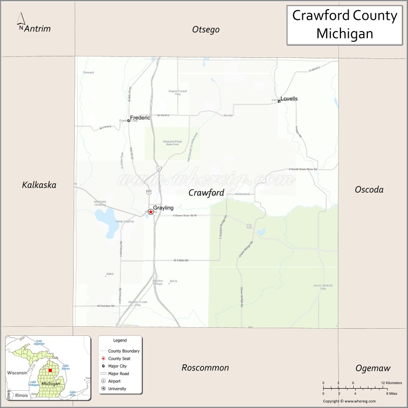
Crawford County is a county in the U.S. state of Michigan. Its population was 12,988 as of the 2020 census. The county seat of Crawford County is Grayling, the county’s only incorporated community.
Crawford County is located in the Northern Lower Peninsula of Michigan. It contains land within three of Michigan’s largest watersheds, belonging to the Au Sable, Manistee, and Muskegon rivers.
| Name: | Crawford County |
|---|---|
| FIPS code: | 26-039 |
| State: | Michigan |
| Founded: | 1840 |
| Named for: | William Crawford |
| Seat: | Grayling |
| Largest city: | Grayling |
| Total Area: | 563 sq mi (1,460 km²) |
| Land Area: | 556 sq mi (1,440 km²) |
| Total Population: | 12,988 |
| Population Density: | 25/sq mi (10/km²) |
| Time zone: | UTC−5 (Eastern) |
| Summer Time Zone (DST): | UTC−4 (EDT) |
| Website: | www.crawfordco.org |
Crawford County location map. Where is Crawford County?
History
The county is named for Col. William Crawford, a Revolutionary War soldier killed in 1782 while fighting Native Americans in Ohio. It was created by the Michigan Legislature in 1840 as Shawono County, then renamed Crawford County in 1843. “Shawono” was derived from an Ojibwe word, zhaawanong, meaning “from the south”. The county was administered by a succession of other Michigan counties prior to the organization of county government in 1879.
Crawford County Road Map
Geography
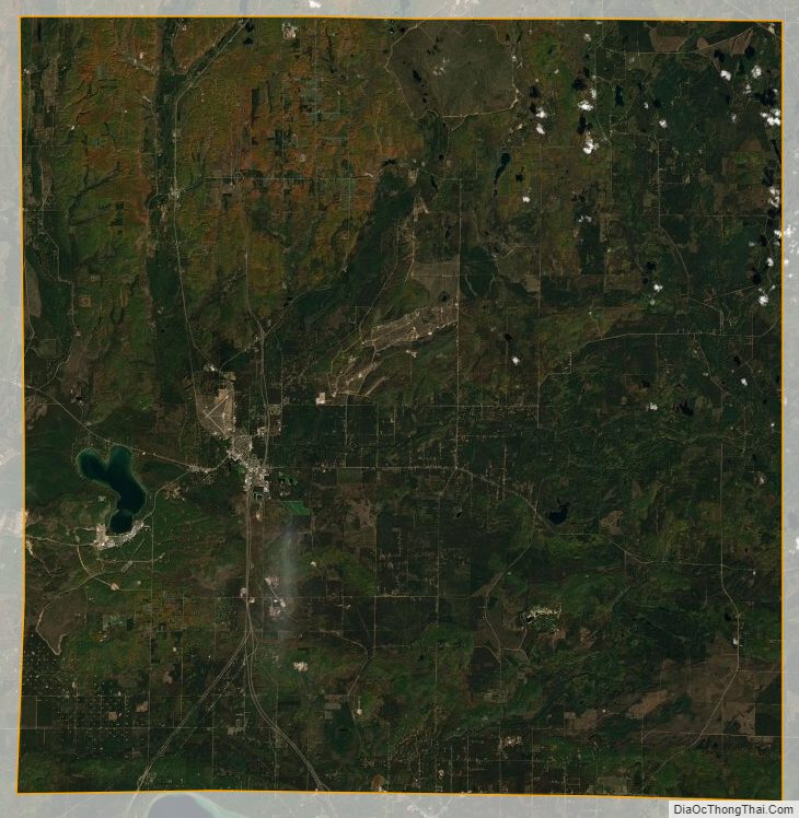
According to the U.S. Census Bureau, the county has a total area of 563 square miles (1,460 km), of which 556 square miles (1,440 km) is land and 7.0 square miles (18 km) (1.2%) is water. The county is part of Northern Michigan.
The county is part of the Au Sable State Forest, specifically the Grayling FMU (Alcona, Crawford, Oscoda, and northern Iosco counties). Glaciers shaped the area, creating a unique regional ecosystem. A large portion of the area is the so-called Grayling outwash plain, which consists of broad outwash plain including sandy ice-disintegration ridges; jack pine barrens, some white pine-red pine forest, and northern hardwood forest. Large lakes were created by glacial action.
Major highways
- I-75
- BL I-75
- BL I-75
- US 127
- M-18
- M-72
- M-93
- F-32
- F-97
- County Highway 612
Adjacent counties
- Otsego County – north
- Montmorency County – northeast
- Oscoda County – east
- Ogemaw County – southeast
- Roscommon County – south
- Missaukee County – southwest
- Kalkaska County – west
- Antrim County – northwest
National protected area
- Huron National Forest (part)
Crawford County Topographic Map
Crawford County Satellite Map
Crawford County Outline Map