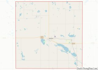
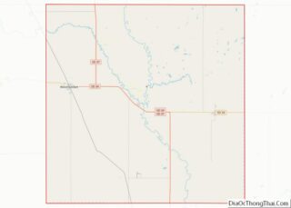
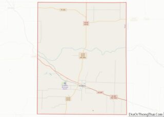
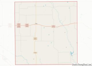
Map of Blaine County, Oklahoma
Blaine County is a county located in the U.S. state of Oklahoma. As of the 2020 census, the population was 8,735. Its county seat is Watonga. Part of the Cheyenne-Arapaho land opening in 1892, the county had gained rail lines by the early 1900s and highways by the 1930s. The county was named for James ... Read more
Map of Blaine County, Oklahoma
Map of Dewey County, Oklahoma
Dewey County is a county in the western part of the U.S. state of Oklahoma. As of the 2010 census, the population was 4,810. Its county seat is Taloga. The county was created in 1891 as “County D”. In an 1898 election, county voters chose the name Dewey, honoring Admiral George Dewey. Dewey County overview: ... Read more
Map of Dewey County, Oklahoma
Map of Kiowa County, Oklahoma
Kiowa County is a county located in the southwestern part of the U.S. state of Oklahoma. As of the 2010 census, the population was 9,446. Its county seat is Hobart. The county was created in 1901 as part of Oklahoma Territory. It was named for the Kiowa people. Kiowa County overview: Name: Kiowa County FIPS ... Read more
Map of Kiowa County, Oklahoma
Map of Okfuskee County, Oklahoma
Okfuskee County is a county located in the U.S. state of Oklahoma. As of the 2010 census, its population was 12,191. Its county seat is Okemah. The county is named for a former Muscogee town in present Cleburne County, Alabama, that in turn was named for the Okfuskee, a Muscogee tribe. Okfuskee County overview: Name: ... Read more
Map of Okfuskee County, Oklahoma
Map of Texas County, Oklahoma
Texas County is a county located in the panhandle of the U.S. state of Oklahoma. Its county seat is Guymon. As of the 2010 census, the population was 20,640. It is the second largest county in Oklahoma, based on land area, and is named for Texas, the state that adjoins the county to its south. ... Read more
Map of Texas County, Oklahoma
Map of Deschutes County, Oregon
Deschutes County (/dəˈʃuːts/ də-SHOOTS) is one of the 36 counties in the U.S. state of Oregon. As of the 2020 census, the population was 198,253. The county seat is Bend. The county was created in 1916 out of part of Crook County and was named for the Deschutes River, which itself was named by French-Canadian ... Read more
Map of Deschutes County, Oregon
Map of Morrow County, Oregon
Morrow County is one of the 36 counties in the U.S. state of Oregon. As of the 2020 census, the population was 12,186. The county seat is Heppner. The county is named for one of its first settlers, Jackson L. Morrow, who was a member of the state legislature when the county was created. Half ... Read more
Map of Morrow County, Oregon
Map of Bedford County, Pennsylvania
Bedford County is a county in the Commonwealth of Pennsylvania. As of the 2020 census, the population was 47,577. The county seat is Bedford. Bedford County overview: Name: Bedford County FIPS code: 42-009 State: Pennsylvania Founded: March 9, 1771 Named for: Fort Bedford Seat: Bedford Total Area: 1,017 sq mi (2,630 km²) Land Area: 1,012 sq mi (2,620 km²) Total Population: ... Read more
Map of Bedford County, Pennsylvania
Map of Cumberland County, Pennsylvania
Cumberland County is a county in the Commonwealth of Pennsylvania. As of the 2020 census, the population was 259,469. Its county seat is Carlisle. Cumberland County is included in the Harrisburg–Carlisle metropolitan statistical area. Cumberland County overview: Name: Cumberland County FIPS code: 42-041 State: Pennsylvania Founded: January 27, 1750 Named for: Cumberland Seat: Carlisle Total ... Read more
Map of Cumberland County, Pennsylvania
Map of Lawrence County, Pennsylvania
Lawrence County is a county in the Commonwealth of Pennsylvania. As of the 2020 census, the population was 86,070. The county seat is New Castle. Lawrence County comprises the entire New Castle, PA Micropolitan Statistical Area, which is also included in the larger Pittsburgh-New Castle-Weirton, PA-WV-OH Combined Statistical Area. Lawrence County overview: Name: Lawrence County ... Read more
Map of Lawrence County, Pennsylvania
Map of Potter County, Pennsylvania
Potter County is a county in the Commonwealth of Pennsylvania. As of the 2020 census, its population was 16,396, making it the fifth-least populous county in Pennsylvania. Its county seat is Coudersport. The county was created in 1804 and later organized in 1836. It is named after James Potter, who was a general from Pennsylvania ... Read more
Map of Potter County, Pennsylvania
Map of Kent County, Rhode Island
Kent County is a county located in the U.S. state of Rhode Island. As of the 2020 census, the population was 170,363, making it the second-most populous county in Rhode Island. The county was formed in 1750 from the southern third of Providence County. It was named after the county of Kent, England. Kent County, ... Read more
Map of Kent County, Rhode Island