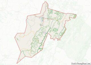
Randolph County is a county located in the U.S. state of West Virginia. As of the 2020 census, the population was 27,932. Its county seat is Elkins. The county was founded in 1787 and is named for Edmund Jennings Randolph. Randolph County comprises the Elkins, West Virginia, Micropolitan Statistical Area. Randolph County overview: Name: Randolph ... Read more
Barron County is a county located in the U.S. state of Wisconsin. As of the 2020 census, the population was 46,711. Its county seat is Barron. The county was created in 1859 and later organized in 1874. Barron County overview: Name: Barron County FIPS code: 55-005 State: Wisconsin Founded: 1874 Named for: Henry D. Barron ... Read more
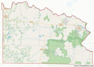
Florence County is a county located in the U.S. state of Wisconsin. As of the 2020 census, the population was 4,558, making it the second-least populous county in Wisconsin after Menominee County. Its county seat is Florence. Florence County is part of the Iron Mountain, MI–WI Micropolitan Statistical Area. Florence County overview: Name: Florence County ... Read more
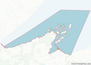
Lake Superior Water body overview: Name: Lake Superior Water body State: Wisconsin Lake Superior Water body location map. Where is Lake Superior Water body? Lake Superior Water body Road Map Lake Superior Water body Topographic Map Lake Superior Water body Satellite Map Lake Superior Water body Outline Map
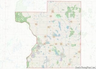
Polk County is a county in the U.S. state of Wisconsin. As of the 2020 census, the population was 44,977. Its county seat is Balsam Lake. The county was created in 1853. Polk County overview: Name: Polk County FIPS code: 55-095 State: Wisconsin Founded: 1853 Named for: James K. Polk Seat: Balsam Lake Largest city: ... Read more
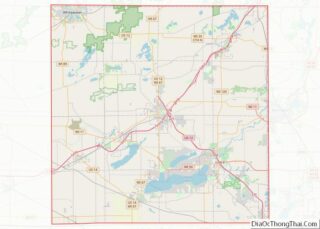
Walworth County is a county located in the U.S. state of Wisconsin. As of the 2020 census, the population was 106,478. Its county seat is Elkhorn. The county was created in 1836 from Wisconsin Territory and organized in 1839. It is named for Reuben H. Walworth. Walworth County comprises the Whitewater-Elkhorn, WI Micropolitan Statistical Area ... Read more
Hot Springs County is a county in the U.S. state of Wyoming. As of the 2020 United States Census, the population was 4,696, making it the second-least populous county in Wyoming. Its county seat is Thermopolis. The county is named for the hot springs located in Hot Springs State Park. Hot Springs County overview: Name: ... Read more
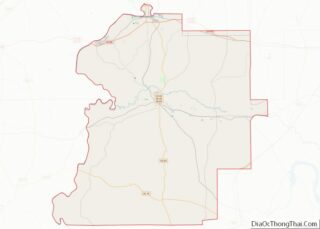
Clay County is a county in the east central part of the U.S. state of Alabama. As of the 2020 census the population was 14,236. Its county seat is Ashland. Its name is in honor of Henry Clay, famous American statesman, member of the United States Senate from Kentucky and United States Secretary of State ... Read more
Franklin County is a county located in the U.S. state of Alabama. As of the 2020 census, the population was 32,113. Its county seat is Russellville. Its name is in honor of Benjamin Franklin, famous statesman, scientist, and printer. It is a dry county, although the city of Russellville is wet. Franklin County overview: Name: ... Read more
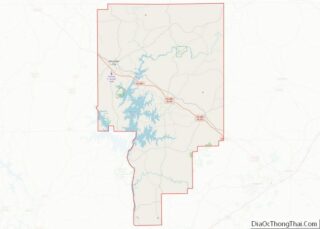
Marengo County is a county located in the west central portion of the U.S. state of Alabama. As of the 2020 census, the population was 19,323. The largest city is Demopolis, and the county seat is Linden. It is named in honor of the Battle of Marengo near Turin, Italy, where French leader Napoleon Bonaparte ... Read more
Tallapoosa County is located in the east-central portion of the U.S. state of Alabama. As of the 2020 census, the population was 41,311. Its county seat is Dadeville. Its largest city is Alexander City. Tallapoosa County overview: Name: Tallapoosa County FIPS code: 01-123 State: Alabama Founded: December 18, 1832 Named for: Tallapoosa River Seat: Dadeville ... Read more
Kenai Peninsula Borough is a borough of the U.S. state of Alaska. As of the 2020 census, the population was 58,799, up from 55,400 in 2010. The borough seat is Soldotna, the largest city is Kenai, and the most populated community is the census-designated place of Kalifornsky. The borough includes most of the Kenai Peninsula ... Read more