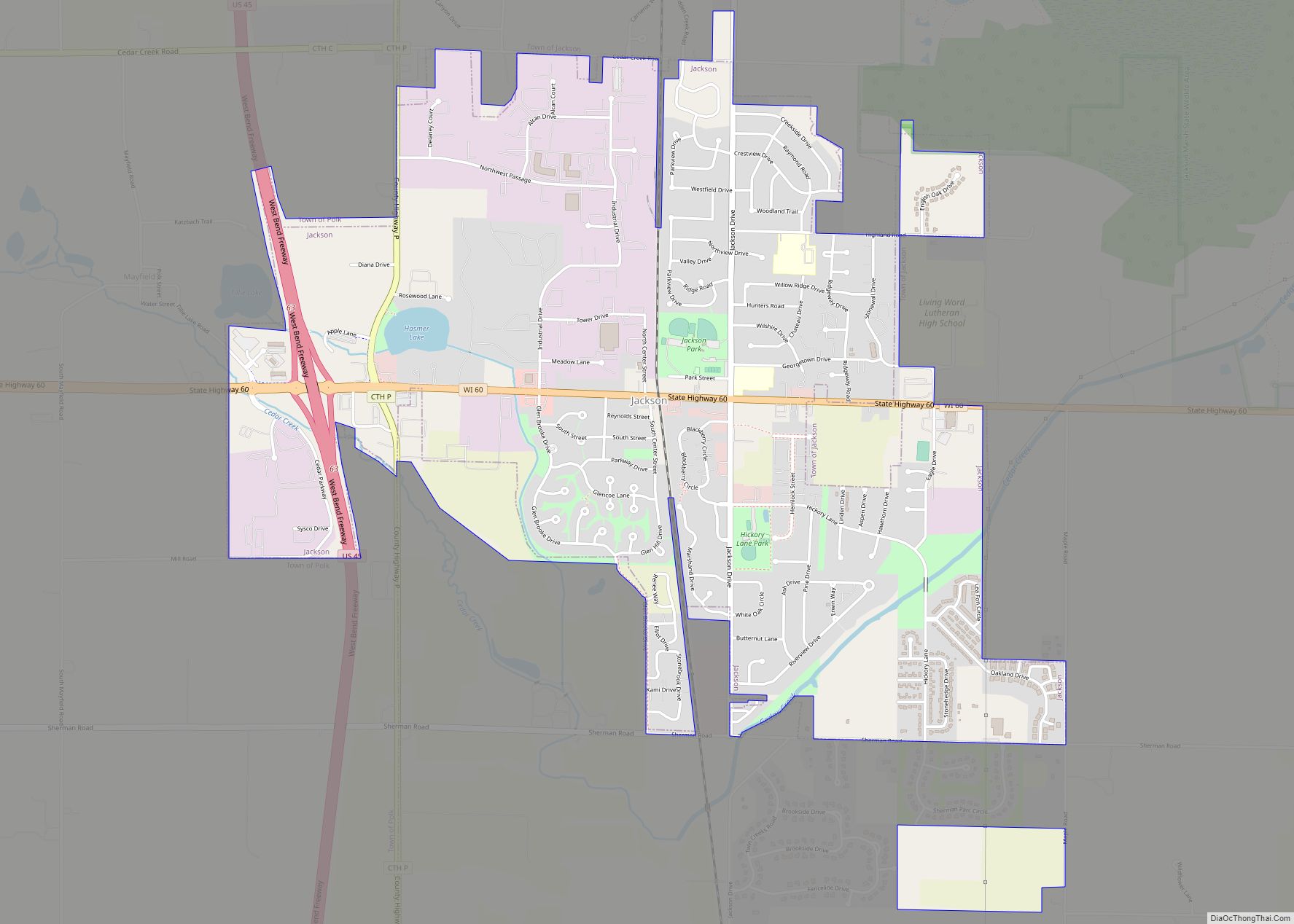
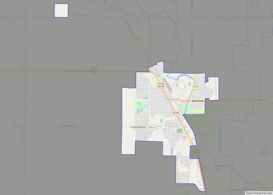
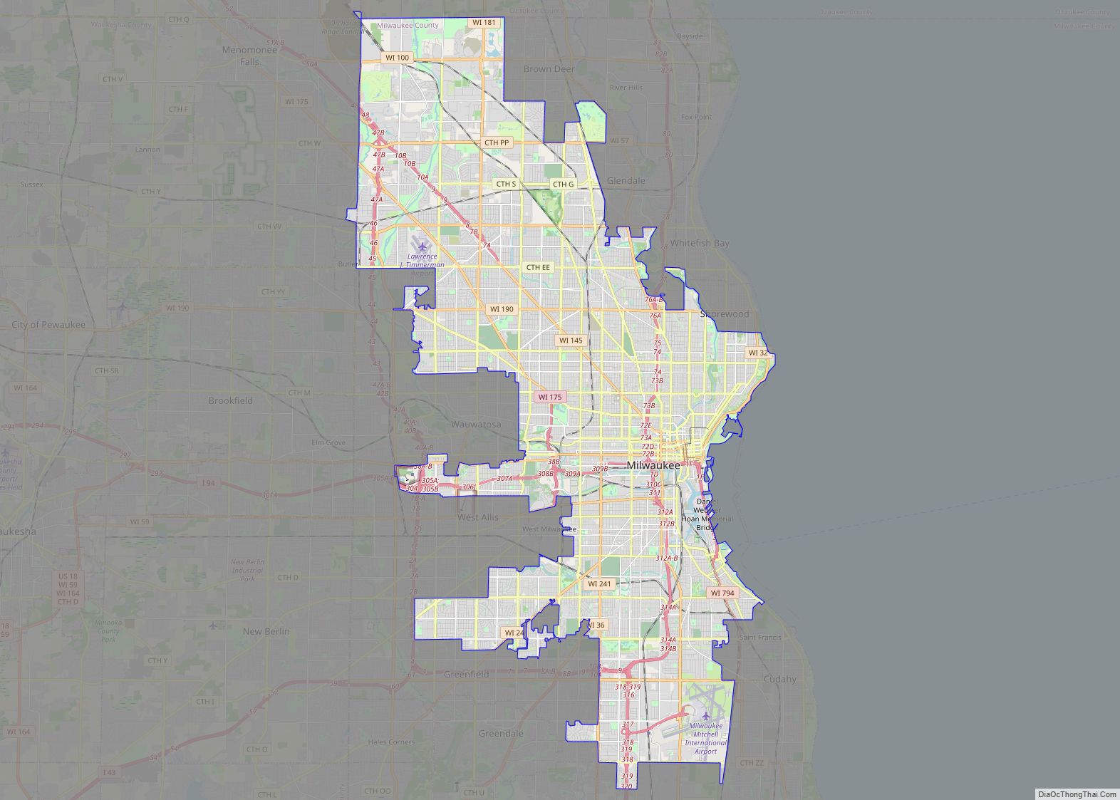
Washington County is a county in the U.S. state of Wisconsin. As of the 2020 census, the population was 136,761. Its county seat is West Bend. The county was created from Wisconsin Territory in 1836 and organized in 1845. It was named after President George Washington.
Washington County is part of the Milwaukee–Waukesha–West Allis, WI Metropolitan Statistical Area.
| Name: | Washington County |
|---|---|
| FIPS code: | 55-131 |
| State: | Wisconsin |
| Founded: | 1836 |
| Named for: | George Washington |
| Seat: | West Bend |
| Largest city: | West Bend |
| Total Area: | 436 sq mi (1,130 km²) |
| Land Area: | 431 sq mi (1,120 km²) |
| Total Population: | 136,761 |
| Population Density: | 317.6/sq mi (122.6/km²) |
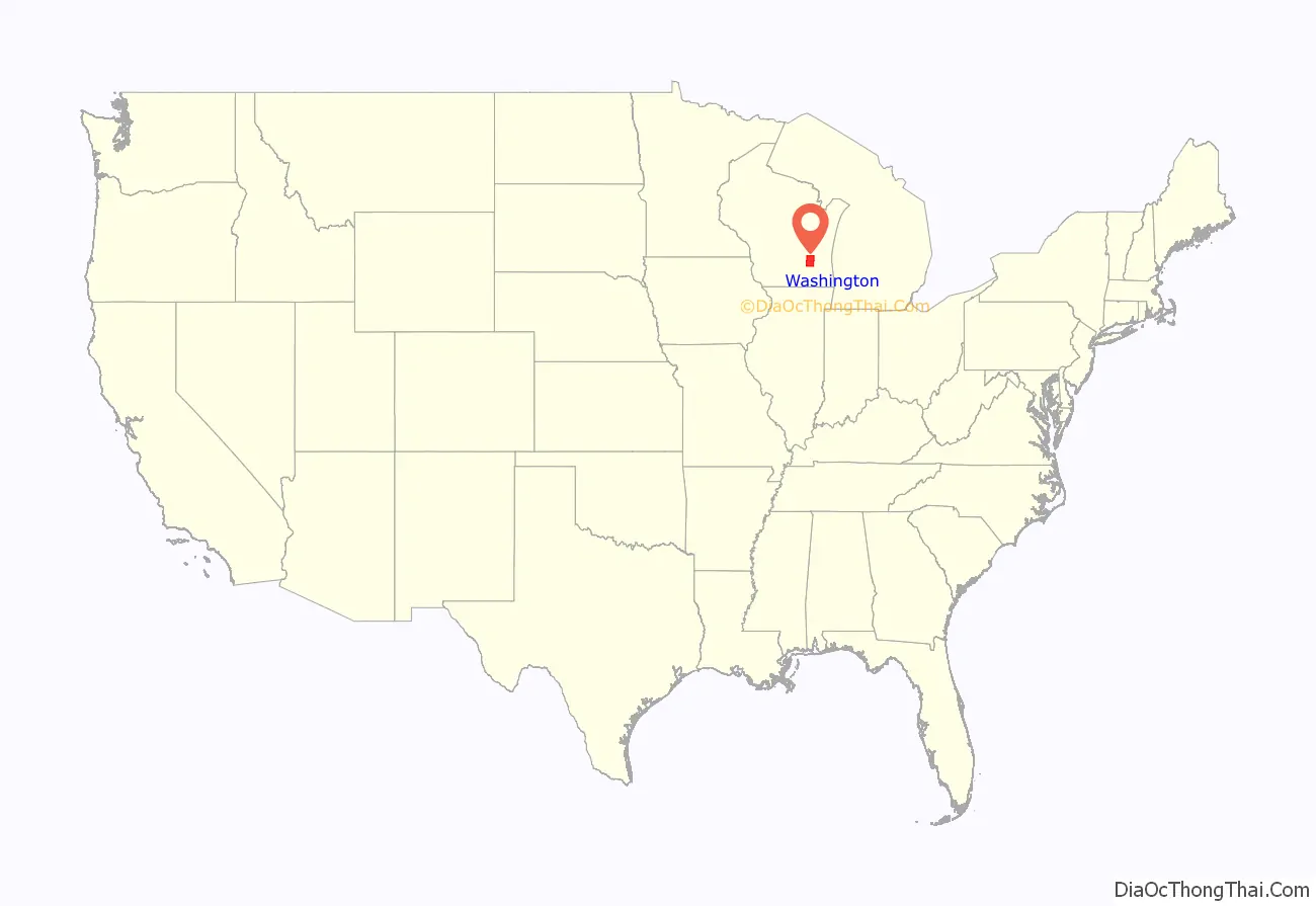
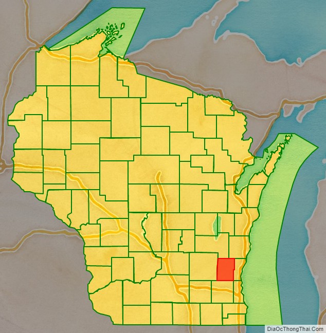
Washington County location map. Where is Washington County?
History
Washington County was created on December 7, 1836, by the Wisconsin Territory Legislature, with Port Washington designated as the county seat. It was run administratively from Milwaukee County until 1840, when an Act of Organization allowed the county self-governance, and the county seat was moved to Grafton, then called Hamburg. This solution was not satisfactory, as at that time four cities were vying to become the county seat: Port Washington, Grafton, Cedarburg, and West Bend. At least four inconclusive elections were held between 1848 and 1852, but the results were unusable due to accusations of foul play and serious irregularities.
In 1852, the state Legislature attempted to split the county into a northern and southern half, with the northern half retaining the name and the southern half becoming Tuskola County. Voters refused this decision, so in 1853 the Legislature again split the county, this time into a western and eastern portion. The western portion remained Washington County, with West Bend as its county seat, while the eastern portion became Ozaukee County, with Port Washington as its county seat.
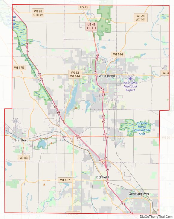
Washington County Road Map
Geography
According to the U.S. Census Bureau, the county has a total area of 436 square miles (1,130 km), of which 431 square miles (1,120 km) is land and 5.0 square miles (13 km) (1.2%) is water. It is the fifth-smallest county in Wisconsin by total area.
Major highways
- Interstate 41
- U.S. Highway 41
- U.S. Highway 45
- Highway 28 (Wisconsin)
- Highway 33 (Wisconsin)
- Highway 60 (Wisconsin)
- Highway 83 (Wisconsin)
- Highway 144 (Wisconsin)
- Highway 145 (Wisconsin)
- Highway 164 (Wisconsin)
- Highway 167 (Wisconsin)
- Highway 175 (Wisconsin)
Railroads
- Canadian National
- Wisconsin and Southern Railroad
Buses
- Washington County Commuter Express
- List of intercity bus stops in Wisconsin
Airports
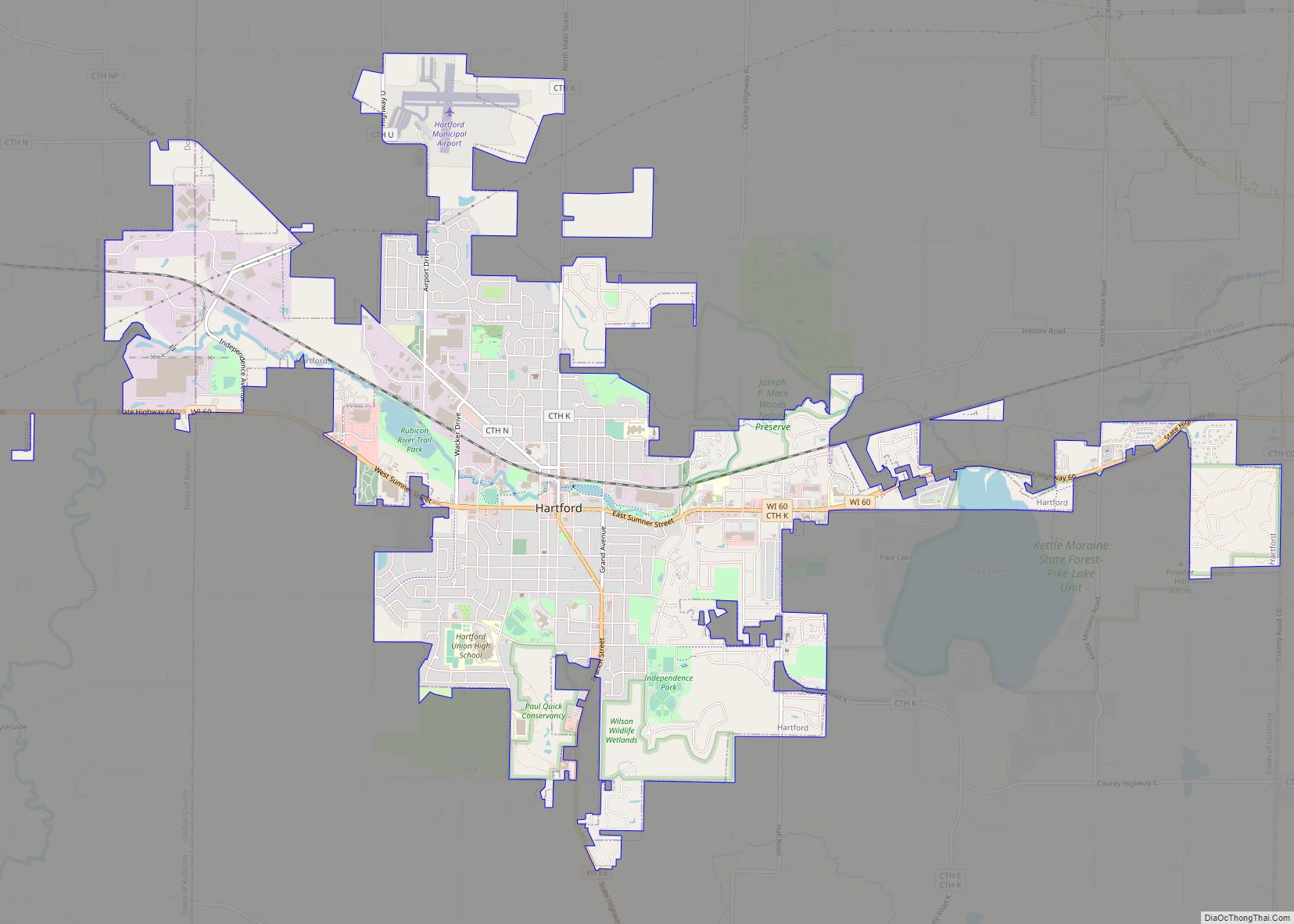
Hartford Municipal Airport (KHXF) and West Bend Municipal Airport (KETB) serve the county and surrounding communities.
Adjacent counties
- Fond du Lac County – northwest
- Sheboygan County – northeast
- Ozaukee County – east
- Milwaukee County – southeast
- Waukesha County – south
- Dodge County – west
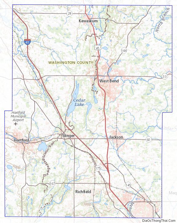
Protected areas
- Ackerman’s Grove County Park
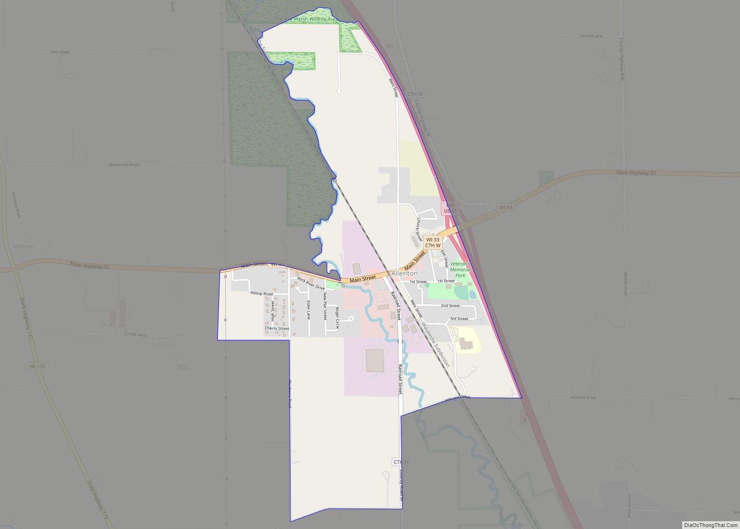
- Allenton Marsh State Wildlife Area
- Goeden County Park
- Heritage Trails County Park
- Isadore and Lorraine Spaeth County Park
- Jackson Marsh State Wildlife Area
- Kettle Moraine State Forest (part)
- Leonard J. Yahr County Park
- Lizard Mound State Park
- Pike Lake State Park
- Sandy Knoll County Park
- Theresa Marsh State Wildlife Area (part)
Washington County Topographic Map
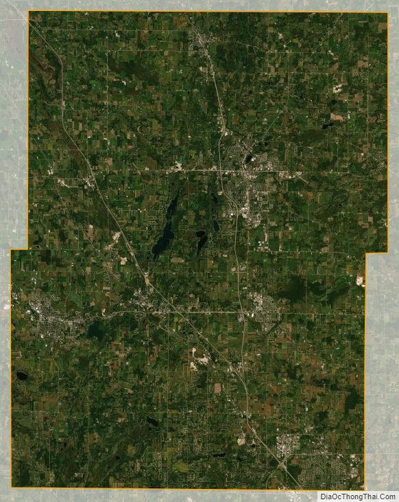
Washington County Satellite Map
Washington County Outline Map