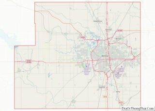
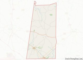
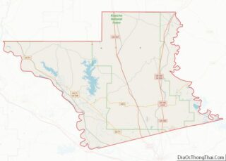
Map of Andrew County

Map of Andrew County, Missouri

Andrew County is a county located in the northwestern part of the U.S. state of Missouri. As of the 2020 census, the county had a population of 18,135. Its county seat is Savannah. The county was organized January 29, 1841, and named for Andrew Jackson Davis, a lawyer and prominent citizen of St. Louis. Andrew … Read more

Map of Carter County

Map of Carter County, Missouri

Carter County is a county in the Ozarks of Missouri. At the 2020 census, it had a population of 5,202. The largest city and county seat is Van Buren. The county was officially organized on March 10, 1859, and is named after Zimri A. Carter, a pioneer settler who came to Missouri from South Carolina … Read more

Map of Douglas County

Map of Douglas County, Missouri

Douglas County is a county located in the south-central portion of the U.S. state of Missouri. As of the 2020 census, the population was 11,578. The county seat and only incorporated community is Ava. The county was officially organized on October 19, 1857, and is named after U.S. Senator Stephen A. Douglas (D-Illinois) and later … Read more

Map of Jefferson County

Map of Jefferson County, Missouri

Jefferson County is located in the eastern portion of the state of Missouri. It is a part of the St. Louis Metropolitan Area. As of the 2020 census, the population was 226,739, making it the sixth-most populous county in Missouri. Its county seat is Hillsboro. The county was organized in 1818 and named in honor … Read more

Map of Miller County

Map of Miller County, Missouri

Miller County overview: Name: Miller County FIPS code: 29-131 State: Missouri Founded: February 6, 1837 Named for: John Miller Seat: Tuscumbia Largest city: Eldon Total Area: 600 sq mi (2,000 km²) Land Area: 593 sq mi (1,540 km²) Total Population: 24,722 Population Density: 41/sq mi (16/km²) Time zone: UTC−6 (Central) Summer Time Zone (DST): UTC−5 (CDT) Website: www.millercountymissouri.org Miller County location map. … Read more

Map of Pike County

Map of Pike County, Missouri

Pike County is a county on the eastern border of the U.S. state of Missouri, bounded by the Mississippi River. As of the 2010 census, the population was 18,516. Its county seat is Bowling Green. Its namesake was a city in middle Kentucky, a region from where many early migrants came. The county was organized … Read more

Map of Schuyler County

Map of Schuyler County, Missouri

Schuyler County overview: Name: Schuyler County FIPS code: 29-197 State: Missouri Founded: February 14, 1845 Named for: Philip Schuyler Seat: Lancaster Largest city: Lancaster Total Area: 308 sq mi (800 km²) Land Area: 307 sq mi (800 km²) Total Population: 4,032 Population Density: 13/sq mi (5.1/km²) Time zone: UTC−6 (Central) Summer Time Zone (DST): UTC−5 (CDT) Schuyler County location map. Where is … Read more

Map of Wright County

Map of Wright County, Missouri

Wright County is a county located in the southern portion of the U.S. state of Missouri. As of the 2010 census, the population was 18,815. Its county seat is Hartville. The county was officially organized on January 29, 1841, and is named after Silas Wright (D-New York), a former Congressman, U.S. Senator and Governor of … Read more

Map of Gallatin County

Map of Gallatin County, Montana

Gallatin County is located in the U.S. state of Montana. With its county seat in Bozeman, it is the second-most populous county in Montana, with a population of 118,960 in the 2020 Census. The county’s prominent geographical features are the Bridger mountains in the north, and the Gallatin mountains and Gallatin River in the south, … Read more

Map of Missoula County

Map of Missoula County, Montana

Missoula County /mɪˈzuːlə/ (listen) is located in the State of Montana. As of the 2020 census, the population was 117,922, making it Montana’s third-most populous county. Its county seat and largest city is Missoula. The county was founded in 1860. Missoula County comprises the Missoula, MT Metropolitan Statistical Area. Missoula County overview: Name: Missoula County … Read more

Map of Stillwater County

Map of Stillwater County, Montana

Stillwater County overview: Name: Stillwater County FIPS code: 30-095 State: Montana Founded: 1913 Named for: Stillwater River Seat: Columbus Largest town: Columbus Total Area: 1,805 sq mi (4,670 km²) Land Area: 1,795 sq mi (4,650 km²) Total Population: 8,963 Population Density: 5.0/sq mi (1.9/km²) Time zone: UTC−7 (Mountain) Summer Time Zone (DST): UTC−6 (MDT) Website: www.stillwater.mt.gov Stillwater County location map. Where is … Read more

Map of Boyd County

Map of Boyd County, Nebraska

Boyd County is a county in the U.S. state of Nebraska. As of the 2010 United States Census, the population was 2,099. Its county seat is Butte. The county was formed in 1891 and named after James E. Boyd, the governor of Nebraska at the time. In the Nebraska license plate system, Boyd County is … Read more