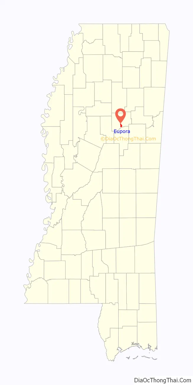
Eupora is the largest city in Webster County, central Mississippi. The population was 2,197 at the 2010 census.
| Name: | Eupora city |
|---|---|
| LSAD Code: | 25 |
| LSAD Description: | city (suffix) |
| State: | Mississippi |
| County: | Webster County |
| Elevation: | 384 ft (117 m) |
| Total Area: | 3.68 sq mi (9.54 km²) |
| Land Area: | 3.36 sq mi (8.69 km²) |
| Water Area: | 0.33 sq mi (0.85 km²) |
| Total Population: | 2,018 |
| Population Density: | 601.31/sq mi (232.15/km²) |
| ZIP code: | 39744 |
| Area code: | 662 |
| FIPS code: | 2823420 |
| GNISfeature ID: | 0669823 |
| Website: | www.cityofeupora.com |
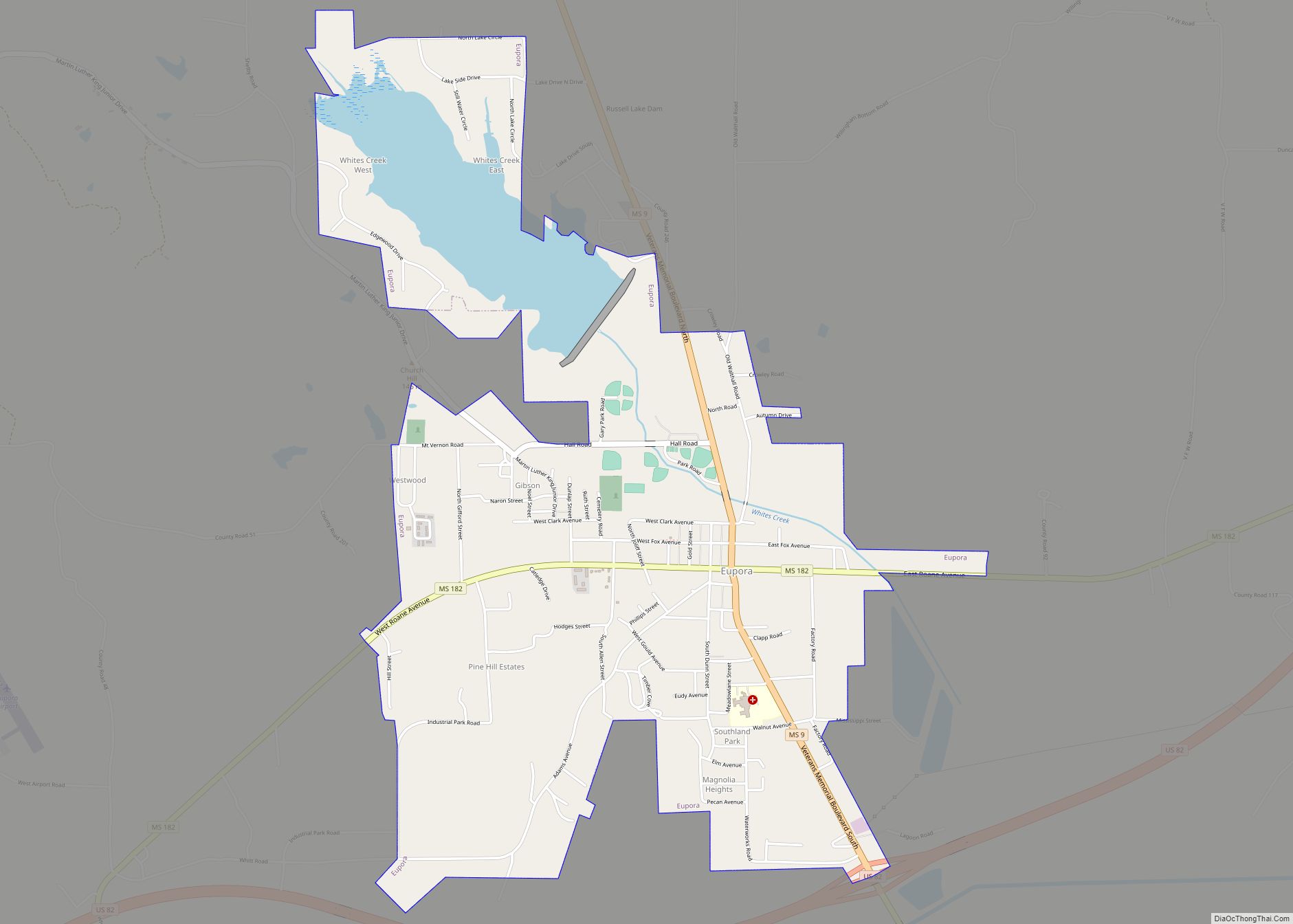
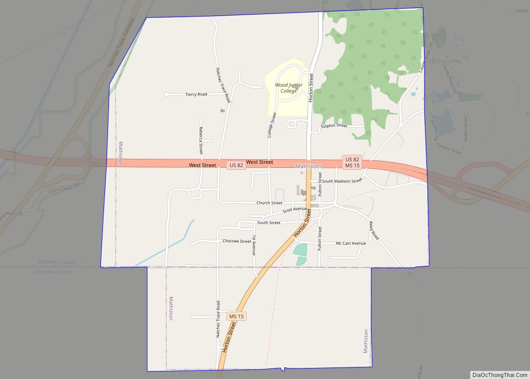
Online Interactive Map
Click on ![]() to view map in "full screen" mode.
to view map in "full screen" mode.
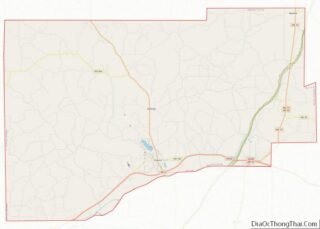
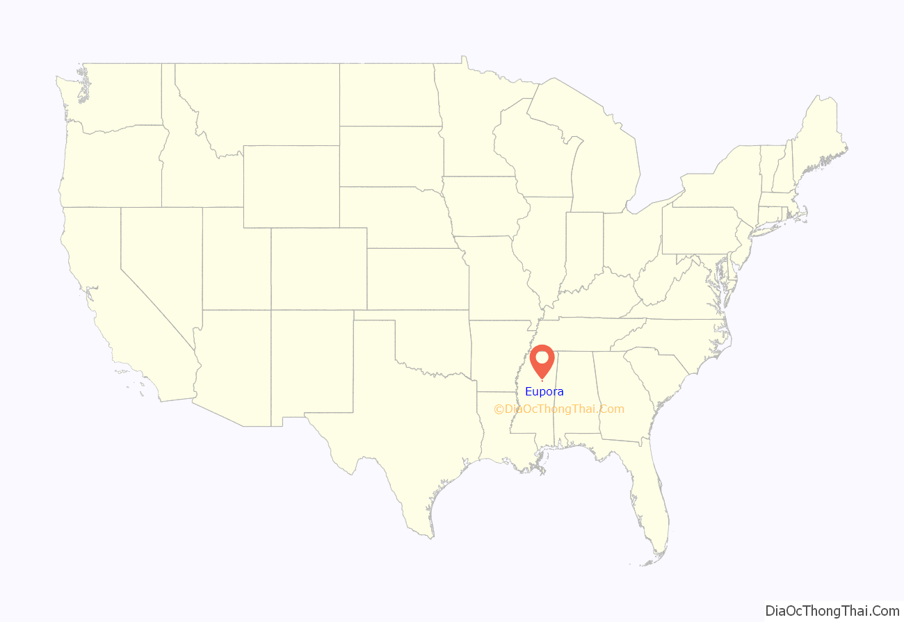
Eupora location map. Where is Eupora city?
History
Eupora was established in 1889 by European Americans on a spur track of the Georgia Pacific Railway. While there had been agricultural development prior to this in the county, the railroad stimulated trade and businesses. Today this is the largest city in the county.
Near here was a site in 1770 of armed conflict among some Native American tribes. The Chakchiuma were destroyed by the allied Choctaw and Chickasaw, who were traditional enemies in the region. They dominated territories in what became Mississippi and Alabama.
In 1904 Bud Simpson, an African-American man also known as Sterling (or Starling) Dunham, was accused of raping some white girls. Not given a trial, he was lynched – hanged from a tree by a mob of 200 cheering white people. They riddled his body with bullets.
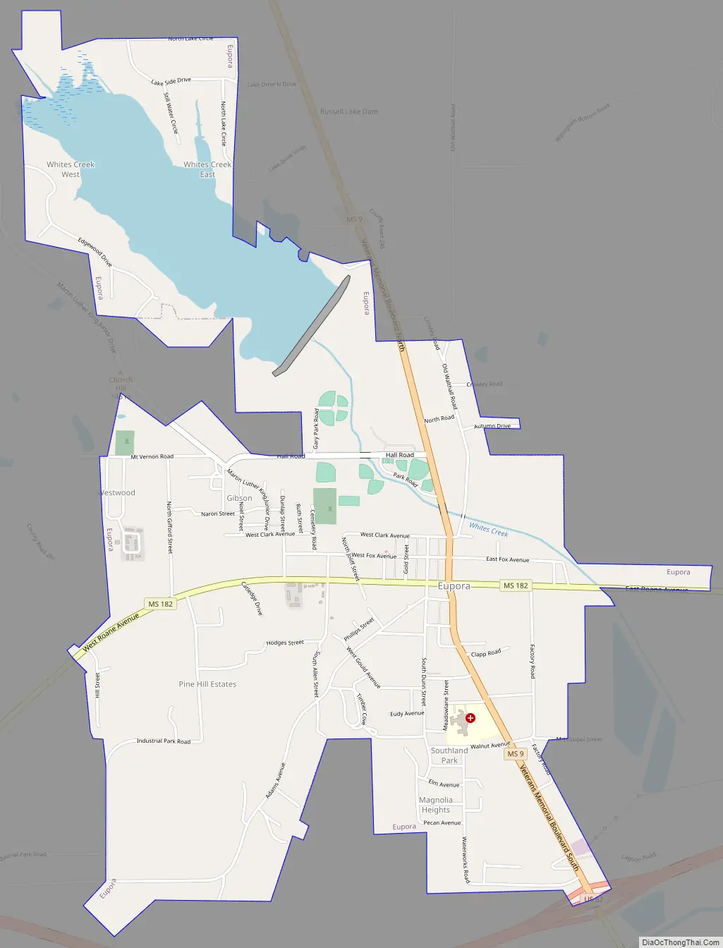
Eupora Road Map
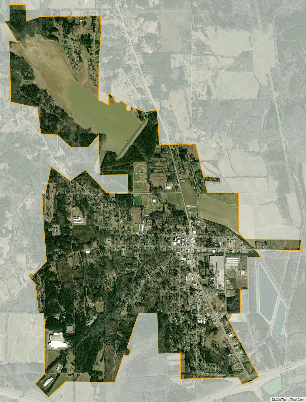
Eupora city Satellite Map
Geography
According to the United States Census Bureau, the city has a total area of 3.6 square miles (9.3 km), of which 3.3 square miles (8.4 km) is land and 0.3 square mile (0.8 km) (8.94%) is water.
See also
Map of Mississippi State and its subdivision:- Adams
- Alcorn
- Amite
- Attala
- Benton
- Bolivar
- Calhoun
- Carroll
- Chickasaw
- Choctaw
- Claiborne
- Clarke
- Clay
- Coahoma
- Copiah
- Covington
- Desoto
- Forrest
- Franklin
- George
- Greene
- Grenada
- Hancock
- Harrison
- Hinds
- Holmes
- Humphreys
- Issaquena
- Itawamba
- Jackson
- Jasper
- Jefferson
- Jefferson Davis
- Jones
- Kemper
- Lafayette
- Lamar
- Lauderdale
- Lawrence
- Leake
- Lee
- Leflore
- Lincoln
- Lowndes
- Madison
- Marion
- Marshall
- Monroe
- Montgomery
- Neshoba
- Newton
- Noxubee
- Oktibbeha
- Panola
- Pearl River
- Perry
- Pike
- Pontotoc
- Prentiss
- Quitman
- Rankin
- Scott
- Sharkey
- Simpson
- Smith
- Stone
- Sunflower
- Tallahatchie
- Tate
- Tippah
- Tishomingo
- Tunica
- Union
- Walthall
- Warren
- Washington
- Wayne
- Webster
- Wilkinson
- Winston
- Yalobusha
- Yazoo
- Alabama
- Alaska
- Arizona
- Arkansas
- California
- Colorado
- Connecticut
- Delaware
- District of Columbia
- Florida
- Georgia
- Hawaii
- Idaho
- Illinois
- Indiana
- Iowa
- Kansas
- Kentucky
- Louisiana
- Maine
- Maryland
- Massachusetts
- Michigan
- Minnesota
- Mississippi
- Missouri
- Montana
- Nebraska
- Nevada
- New Hampshire
- New Jersey
- New Mexico
- New York
- North Carolina
- North Dakota
- Ohio
- Oklahoma
- Oregon
- Pennsylvania
- Rhode Island
- South Carolina
- South Dakota
- Tennessee
- Texas
- Utah
- Vermont
- Virginia
- Washington
- West Virginia
- Wisconsin
- Wyoming