Gonzales is a city in Gonzales County, Texas, United States. It is the county seat. The population was 7,165 at the 2020 census. The “Come and Take It” flag in the War for Texas Independence from Mexico originated in Gonzales.
Its economy is enhanced through lodging oil field workers from the nearby Eagle Ford Shale. It was the site of the first battle of the Texas Revolution.
| Name: | Gonzales city |
|---|---|
| LSAD Code: | 25 |
| LSAD Description: | city (suffix) |
| State: | Texas |
| County: | Gonzales County |
| Elevation: | 285 ft (87 m) |
| Total Area: | 6.08 sq mi (15.75 km²) |
| Land Area: | 6.08 sq mi (15.75 km²) |
| Water Area: | 0.00 sq mi (0.00 km²) |
| Total Population: | 7,165 |
| Population Density: | 1,238.98/sq mi (478.34/km²) |
| ZIP code: | 78629 |
| Area code: | 830 |
| FIPS code: | 4830116 |
| GNISfeature ID: | 1336672 |
| Website: | www.cityofgonzales.org |
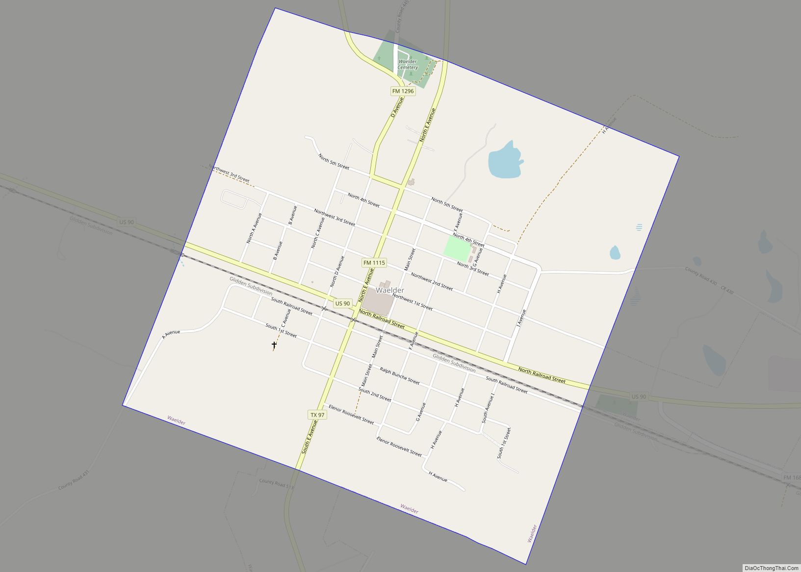
Online Interactive Map
Click on ![]() to view map in "full screen" mode.
to view map in "full screen" mode.
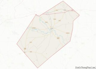
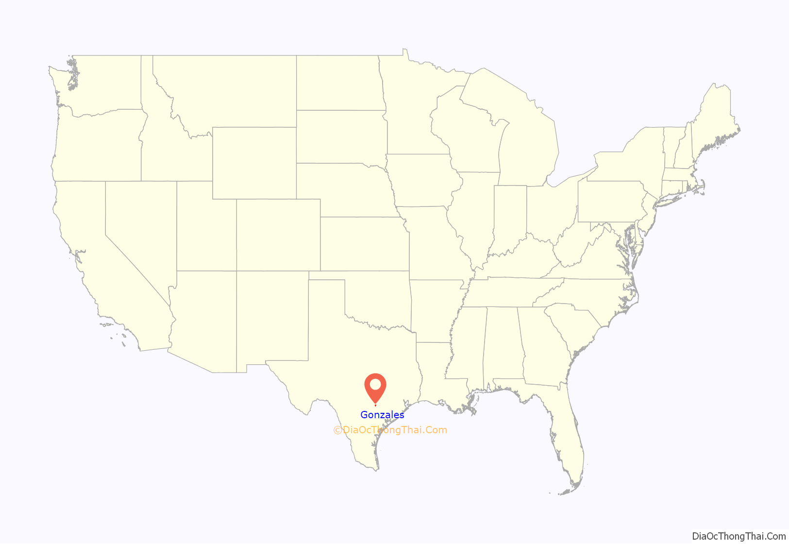
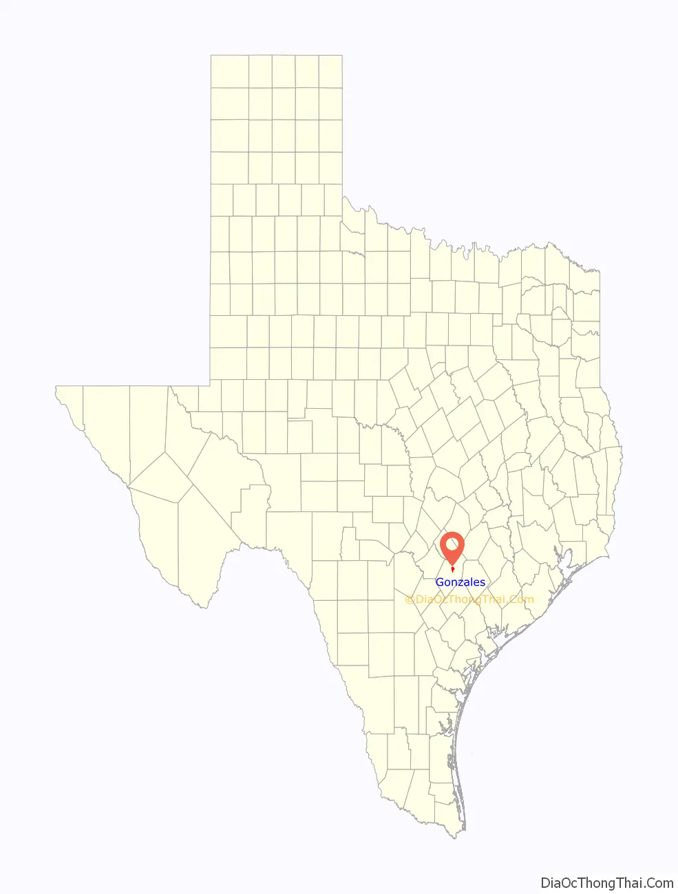
Gonzales location map. Where is Gonzales city?
History
Gonzales is one of the earliest Anglo-American settlements in Texas, the first west of the Colorado River. It was established by Empresario Green DeWitt as the capital of his colony in August 1825. DeWitt named the community for Rafael Gonzáles, governor of Coahuila y Tejas. Informally, the community was known as the DeWitt Colony.
The original settlement (located where Highway 90-A crosses Kerr Creek) was abandoned in 1826 after two Indian attacks. It was rebuilt nearby in 1827. The town remains today as it was originally surveyed.
Gonzales is referred to as the “Lexington of Texas” because it was the site of the first skirmish of the Texas Revolution. In 1831, the Mexican government had granted Green DeWitt’s request for a small cannon for protection against Indian attacks. At the outbreak of disputes between the Anglo settlers and the Mexican authorities in 1835, a contingent of more than 100 Mexican soldiers was sent from San Antonio to retrieve the cannon.
When the soldiers arrived, only 18 men were in Gonzales, but they refused to return the cannon, and men from the surrounding area soon joined them. Texians under the command of John Henry Moore confronted them. Sarah DeWitt and her daughter sewed a flag bearing the likeness of the cannon and the words “Come and Take It”, which was flown when the first shots of Texian independence were fired on October 2, 1835. The Texians successfully resisted the Mexican troops in what became known as the Battle of Gonzales.
Gonzales later contributed 32 men from the Gonzales Ranging Company to the defense of the Alamo. It was the only city to send aid to the Alamo, and all 32 men lost their lives defending the site. Susanna Dickinson, widow of one of the Alamo defenders, and Joe, the slave of William B. Travis, fled to Gonzales with news of the Alamo massacre. General Sam Houston was there organizing the Texas forces. He anticipated the town would be the next target of General Antonio López de Santa Anna’s Mexican army. Gathering the Texians at Peach Creek east of town, under the Sam Houston Oak, Houston ordered Gonzales burned, to deny it to the enemy. He began a retreat toward the U.S. border. The widows and orphans of Gonzales and their neighbors were forced to flee, thus precipitating the Runaway Scrape.
The town was derelict immediately after the Texas Revolution, but was eventually rebuilt on the original site in the early 1840s. By 1850, the town had a population of 300. The population rose to 1,703 by time of the 1860 census, 2,900 by the mid-1880s, and 4,297 in 1900. Part of the growth of the late 19th century can be attributed to the arrival of various immigrants, among them Jews, many of whom became peddlers and merchants.
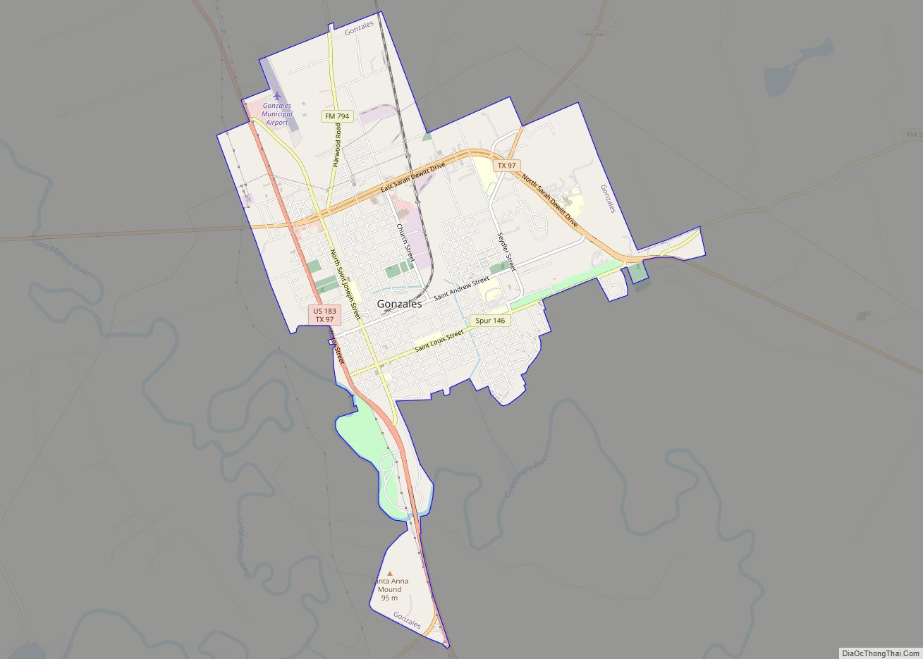
Gonzales Road Map
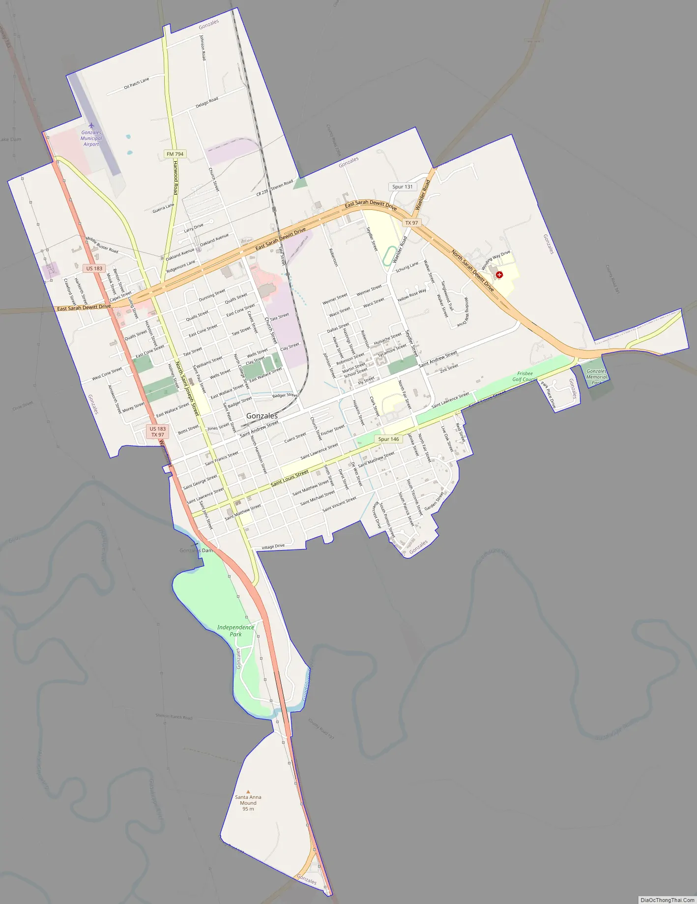
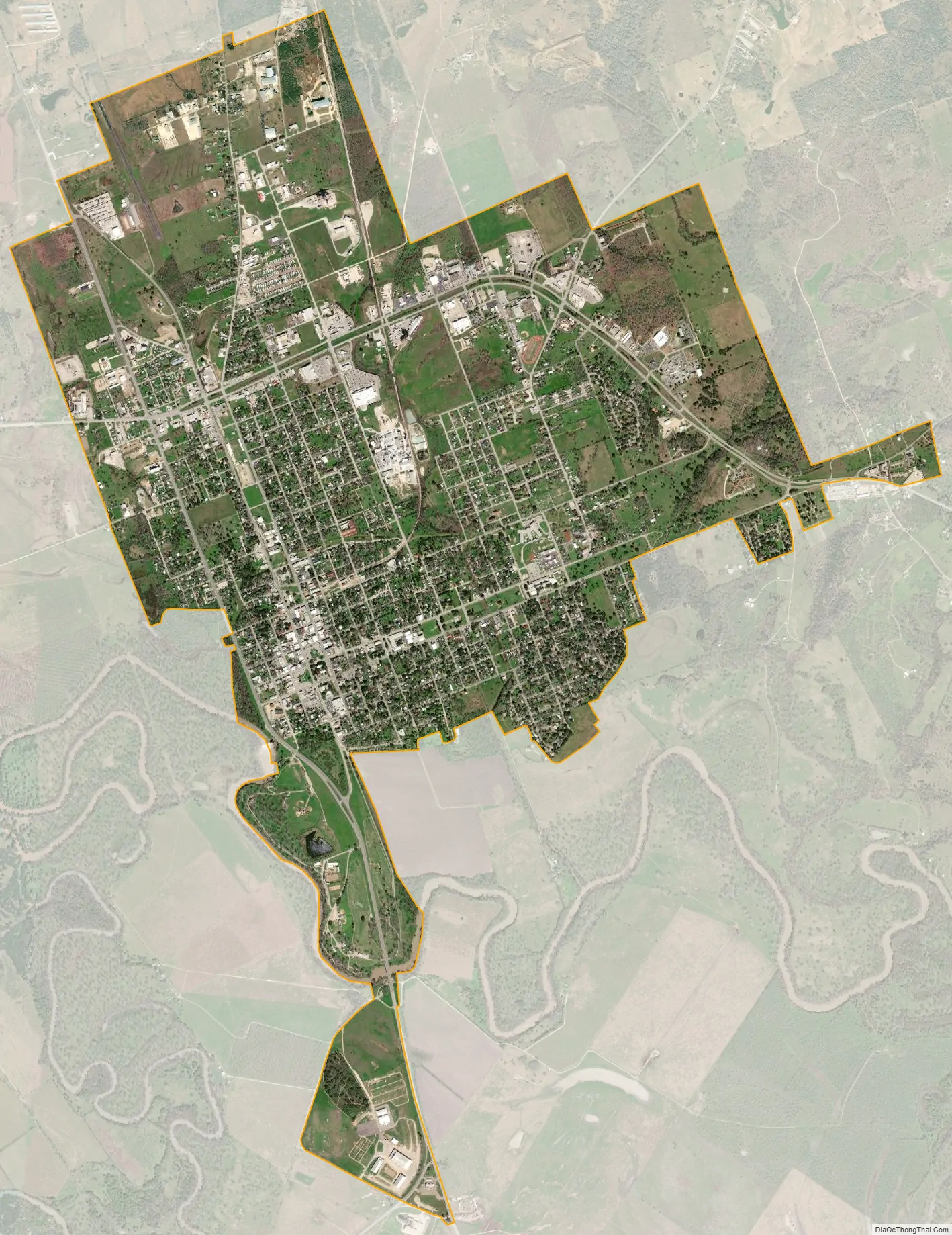
Gonzales city Satellite Map
Geography
Gonzales is located in central Gonzales County, on the northeast side of the Guadalupe River, just east of the mouth of the San Marcos River. U.S. Route 183 passes through the west side of the city, and U.S. Route 90 Alternate passes through the north of the city.
According to the United States Census Bureau, Gonzales has a total area of 6.1 square miles (15.7 km), all of it land.
Climate
The climate in this area is characterized by hot, humid summers and generally mild to cool winters. According to the Köppen Climate Classification system, Gonzales has a humid subtropical climate, abbreviated “Cfa” on climate maps.
See also
Map of Texas State and its subdivision:- Anderson
- Andrews
- Angelina
- Aransas
- Archer
- Armstrong
- Atascosa
- Austin
- Bailey
- Bandera
- Bastrop
- Baylor
- Bee
- Bell
- Bexar
- Blanco
- Borden
- Bosque
- Bowie
- Brazoria
- Brazos
- Brewster
- Briscoe
- Brooks
- Brown
- Burleson
- Burnet
- Caldwell
- Calhoun
- Callahan
- Cameron
- Camp
- Carson
- Cass
- Castro
- Chambers
- Cherokee
- Childress
- Clay
- Cochran
- Coke
- Coleman
- Collin
- Collingsworth
- Colorado
- Comal
- Comanche
- Concho
- Cooke
- Coryell
- Cottle
- Crane
- Crockett
- Crosby
- Culberson
- Dallam
- Dallas
- Dawson
- Deaf Smith
- Delta
- Denton
- Dewitt
- Dickens
- Dimmit
- Donley
- Duval
- Eastland
- Ector
- Edwards
- El Paso
- Ellis
- Erath
- Falls
- Fannin
- Fayette
- Fisher
- Floyd
- Foard
- Fort Bend
- Franklin
- Freestone
- Frio
- Gaines
- Galveston
- Garza
- Gillespie
- Glasscock
- Goliad
- Gonzales
- Gray
- Grayson
- Gregg
- Grimes
- Guadalupe
- Hale
- Hall
- Hamilton
- Hansford
- Hardeman
- Hardin
- Harris
- Harrison
- Hartley
- Haskell
- Hays
- Hemphill
- Henderson
- Hidalgo
- Hill
- Hockley
- Hood
- Hopkins
- Houston
- Howard
- Hudspeth
- Hunt
- Hutchinson
- Irion
- Jack
- Jackson
- Jasper
- Jeff Davis
- Jefferson
- Jim Hogg
- Jim Wells
- Johnson
- Jones
- Karnes
- Kaufman
- Kendall
- Kenedy
- Kent
- Kerr
- Kimble
- King
- Kinney
- Kleberg
- Knox
- La Salle
- Lamar
- Lamb
- Lampasas
- Lavaca
- Lee
- Leon
- Liberty
- Limestone
- Lipscomb
- Live Oak
- Llano
- Loving
- Lubbock
- Lynn
- Madison
- Marion
- Martin
- Mason
- Matagorda
- Maverick
- McCulloch
- McLennan
- McMullen
- Medina
- Menard
- Midland
- Milam
- Mills
- Mitchell
- Montague
- Montgomery
- Moore
- Morris
- Motley
- Nacogdoches
- Navarro
- Newton
- Nolan
- Nueces
- Ochiltree
- Oldham
- Orange
- Palo Pinto
- Panola
- Parker
- Parmer
- Pecos
- Polk
- Potter
- Presidio
- Rains
- Randall
- Reagan
- Real
- Red River
- Reeves
- Refugio
- Roberts
- Robertson
- Rockwall
- Runnels
- Rusk
- Sabine
- San Augustine
- San Jacinto
- San Patricio
- San Saba
- Schleicher
- Scurry
- Shackelford
- Shelby
- Sherman
- Smith
- Somervell
- Starr
- Stephens
- Sterling
- Stonewall
- Sutton
- Swisher
- Tarrant
- Taylor
- Terrell
- Terry
- Throckmorton
- Titus
- Tom Green
- Travis
- Trinity
- Tyler
- Upshur
- Upton
- Uvalde
- Val Verde
- Van Zandt
- Victoria
- Walker
- Waller
- Ward
- Washington
- Webb
- Wharton
- Wheeler
- Wichita
- Wilbarger
- Willacy
- Williamson
- Wilson
- Winkler
- Wise
- Wood
- Yoakum
- Young
- Zapata
- Zavala
- Alabama
- Alaska
- Arizona
- Arkansas
- California
- Colorado
- Connecticut
- Delaware
- District of Columbia
- Florida
- Georgia
- Hawaii
- Idaho
- Illinois
- Indiana
- Iowa
- Kansas
- Kentucky
- Louisiana
- Maine
- Maryland
- Massachusetts
- Michigan
- Minnesota
- Mississippi
- Missouri
- Montana
- Nebraska
- Nevada
- New Hampshire
- New Jersey
- New Mexico
- New York
- North Carolina
- North Dakota
- Ohio
- Oklahoma
- Oregon
- Pennsylvania
- Rhode Island
- South Carolina
- South Dakota
- Tennessee
- Texas
- Utah
- Vermont
- Virginia
- Washington
- West Virginia
- Wisconsin
- Wyoming