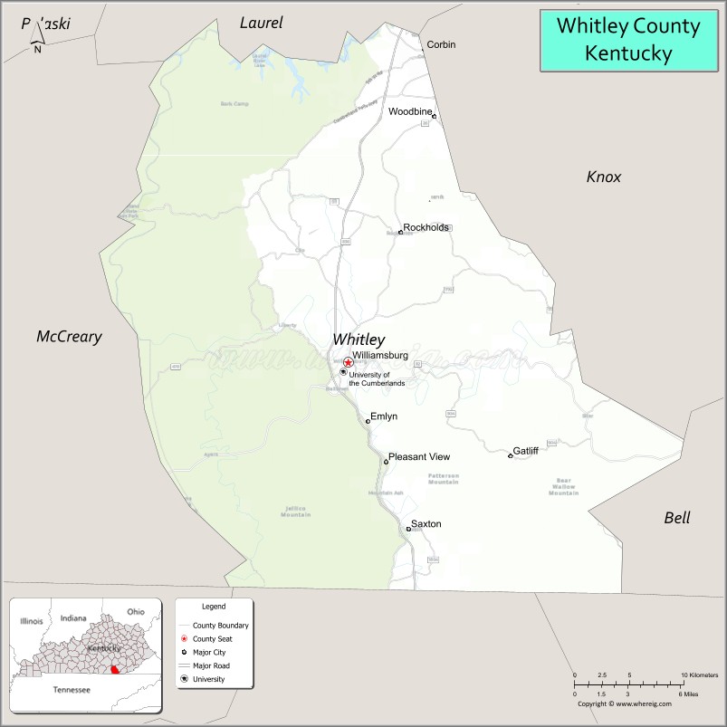
Whitley County is a county located in the southeastern part of the U.S. state of Kentucky. As of the 2020 census, the population was 36,712. Its county seat is at Williamsburg, though the largest city is Corbin, and the county’s District Court (a trial court of limited jurisdiction) sits in both cities. Whitley County is included in the London, KY Micropolitan Statistical Area.
| Name: | Whitley County |
|---|---|
| FIPS code: | 21-235 |
| State: | Kentucky |
| Founded: | January 17, 1818 |
| Named for: | William Whitley |
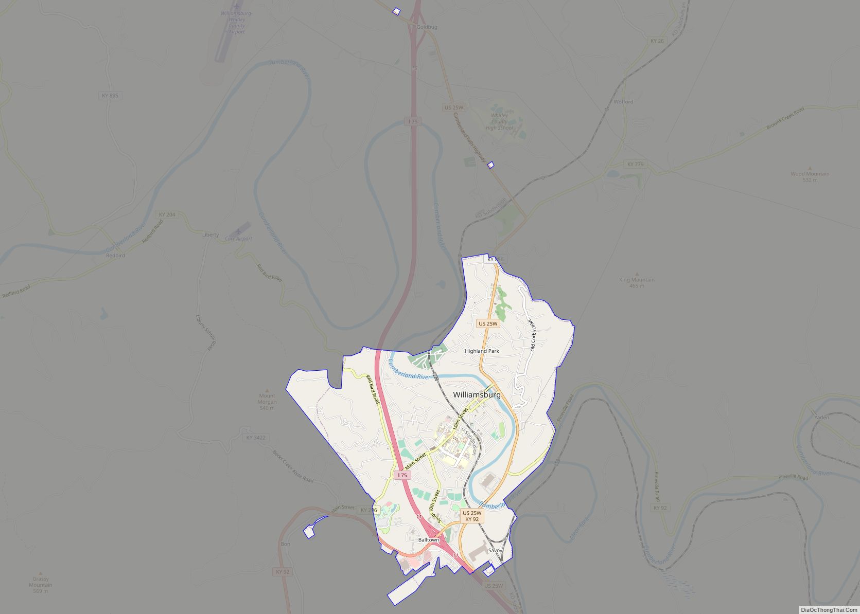
| Seat: | Williamsburg |
| Largest city: | Corbin |
| Total Area: | 445 sq mi (1,150 km²) |
| Land Area: | 438 sq mi (1,130 km²) |
| Total Population: | 36,712 |
| Population Density: | 82/sq mi (32/km²) |
| Time zone: | UTC−5 (Eastern) |
| Summer Time Zone (DST): | UTC−4 (EDT) |
| Website: | www.whitleycountyfiscalcourt.com |
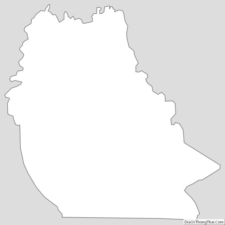
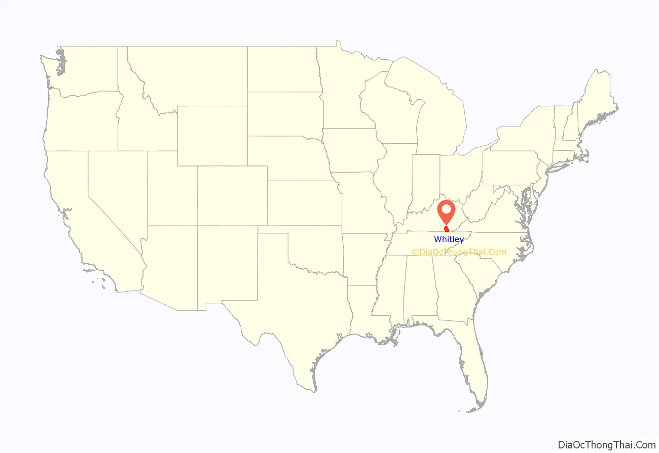
Whitley County location map. Where is Whitley County?
History
The area now encompassed by Kentucky’s Whitley County was first bounded in 1772, when all of what is now the state of Kentucky was in the frontier county of Fincastle County, Virginia. Fincastle was divided in 1776, with the western portion named Kentucky County, Virginia. In 1780, Virginia set aside all land in Kentucky County for soldiers who had served in the Revolutionary War. Kentucky County was divided into 3 counties, Jefferson, Fayette, and Lincoln. Lincoln County was divided in 1799, with part of becoming Knox County. On January 17, 1818, the Legislature removed the southwest portion of Knox to create a separate subdivision, named Whitley County. In 1912, some of the previous Whitley area was partitioned off to create McCreary County.
The new county was given the name of Whitley in honor of William Whitley, noted pioneer and Indian fighter. In the years prior to 1818, many skirmishes were fought between Indians and hunters and trappers in the area. Colonel William Whitley, is famous locally for fighting many of these battles within the area, safeguarding the Wilderness Road, as well as for his service in the War of 1812, where he was killed at the Battle of the Thames. The county seat, Williamsburg, is also named for Colonel Whitley, with the first court held at the home of the town’s earliest resident, Samuel Cox.
Thomas Walker was the first known white man to see Whitley County. His expedition began in 1750. During his passage he named the Cumberland River, after the Duke of Cumberland. The estimated population of Whitley County in 1818 was 500. It had increased to 7,522 by 1860; that number includes 186 slaves. Extension of a railroad spur into Whitley County (1883) provided significant impetus to its continued growth. Industry began to flourish – primarily lumber mills and coal mines. The Whitley County courthouse burned in 1931. It was replaced with federal funding.
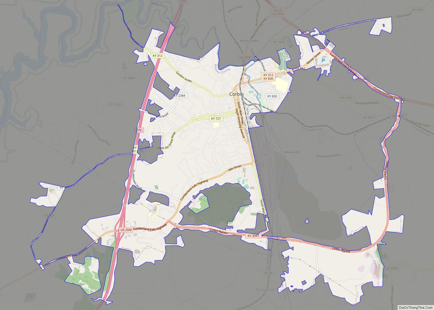
Its rugged terrain, densely forested woodlands, and a history of conflict with local Indian tribes all combined to make for a very slow rate of growth in Whitley County. The development of the coal mining industry in the area towards the late 1800s spurred on population growth as poor families from neighboring states rushed into the county and led to the formation of Corbin, still the largest city in Whitley County.
North Corbin, just north of Whitley County is home to Sanders Cafe, which is the birthplace of Kentucky Fried Chicken. It was founded there by Harland David Sanders, better known as Colonel Sanders, in 1930.
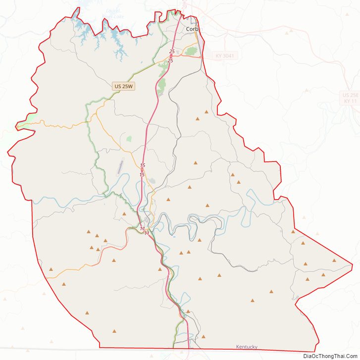
Whitley County Road Map
Geography
According to the United States Census Bureau, the county has a total area of 445 square miles (1,150 km), of which 438 square miles (1,130 km) is land and 7.3 square miles (19 km) (1.6%) is water.
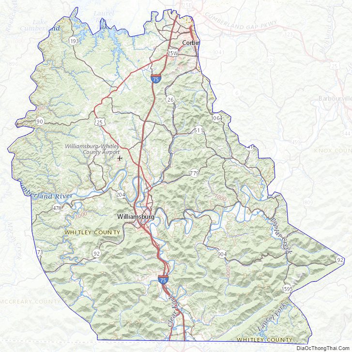
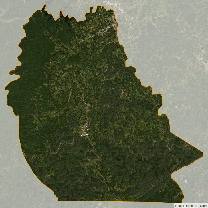
Whitley County is located within the Cumberland Plateau of southeastern Kentucky, which is greatly overlapped by the broad Eastern Coal Field region of the state. Because of its location in the midst of Cumberland Mountains, elevations in the county range from 723 feet (220 m) to 2,220 feet (680 m) above sea level. 38,000 acres (150 km) of western Whitley County are preserved within the Daniel Boone National Forest. Cumberland Falls, in Cumberland Falls State Resort Park, is the largest waterfall in Kentucky. Both Daniel Boone Forest and Cumberland Falls State Park are operated by the Kentucky State Parks system, also located in the county. The county contains two regionally significant waterways, the Laurel and Cumberland rivers.
Geographic features
- Cumberland Falls
- Cumberland Plateau
- Cumberland River
- Jellico Mountain
- Laurel River
- Laurel River Lake
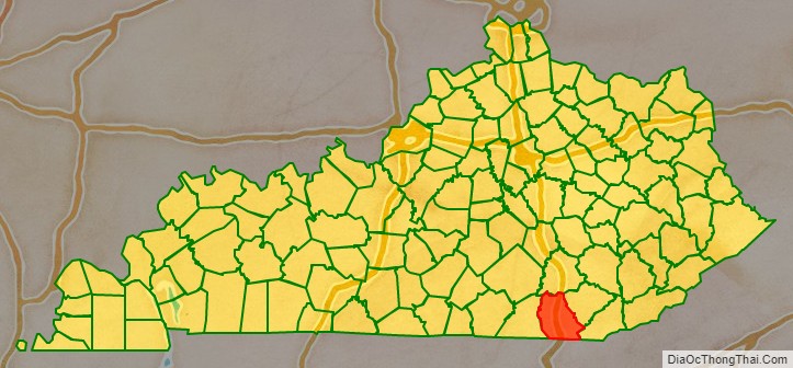
Adjacent counties
- Laurel County – north
- Knox County – northeast
- Bell County – east
- Claiborne County, Tennessee – southeast
- Campbell County, Tennessee – south
- McCreary County – west
National protected area
- Daniel Boone National Forest (part)
Whitley County Topographic Map
Whitley County Satellite Map
Whitley County Outline Map