Winnebago County is a county in the U.S. state of Wisconsin. As of the 2020 census, the population was 171,730. Its county seat is Oshkosh. It was named for the historic Winnebago people, a federally recognized Native American tribe now known as the Ho-Chunk Nation. Chief Oshkosh was a Menominee leader in the area. Winnebago County comprises the Oshkosh-Neenah, WI Metropolitan Statistical Area, which is included in the Appleton-Oshkosh-Neenah, WI Combined Statistical Area.
| Name: | Winnebago County |
|---|---|
| FIPS code: | 55-139 |
| State: | Wisconsin |
| Founded: | 1848 |
| Named for: | Winnebago people |
| Seat: | Oshkosh |
| Largest city: | Oshkosh |
| Total Area: | 579 sq mi (1,500 km²) |
| Land Area: | 434 sq mi (1,120 km²) |
| Total Population: | 171,730 |
| Population Density: | 395.1/sq mi (152.5/km²) |
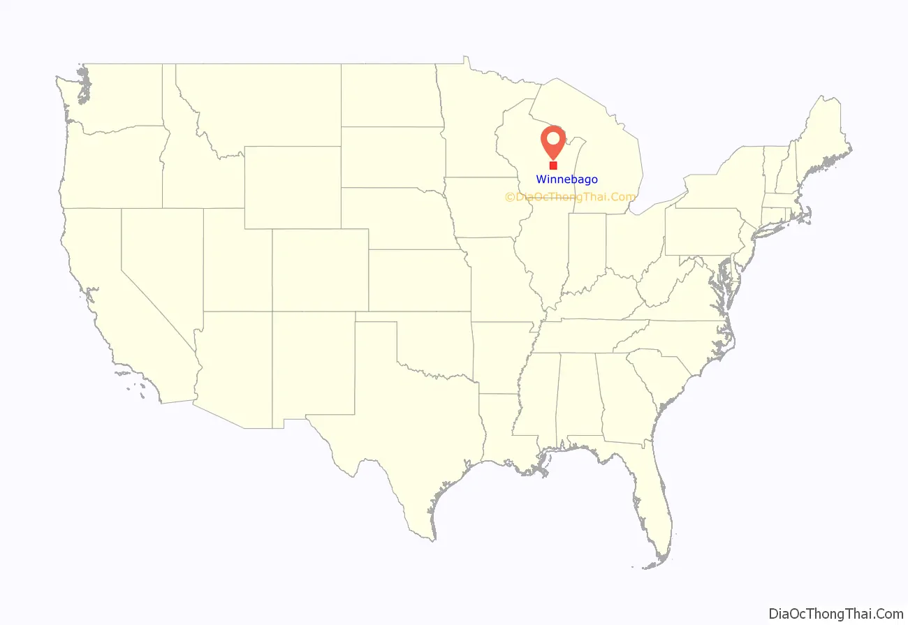
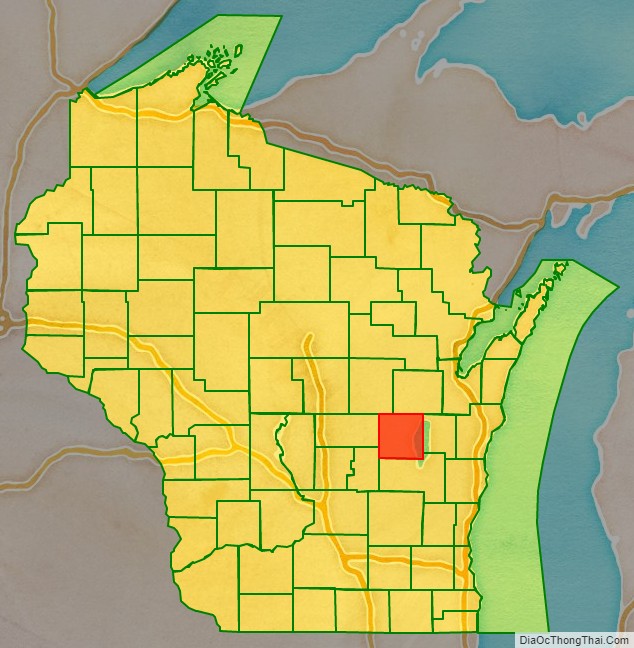
Winnebago County location map. Where is Winnebago County?
History
The region was occupied by several Native American tribes in the period of European encounter, including the Sauk, Fox, Menominee, and Ojibwa (known as Chippewa in the US). French traders from what is now Canada had early interaction with them, as did French Jesuit missionaries, who sought to convert them to Catholicism. European and American settlement encroached on their traditional territories, and the United States negotiated treaties in the mid-19th century to keep pushing the Indians to the west.
Winnebago County was created in 1840 by European Americans and organized in 1848. The name Winnebago is of Algonquin origin, with variations used by the Fox and Potowatomi to refer to the Fox River below Lake Winnebago, which sometimes got muddy and full of fish. It means ‘people dwelling by the fetid or ill-smelling water’, which may also refer to a sulfur spring. The county seat, Oshkosh, was incorporated as a city in 1853, when it already had a population of nearly 2,800.
Chief Oshkosh was the namesake for the county seat. A leader of the Menominee in the region, he was successful in gaining authorization from the federal government for 2500 of his people to remain in Wisconsin, at a time when the government was pushing for their removal west of the Mississippi River.
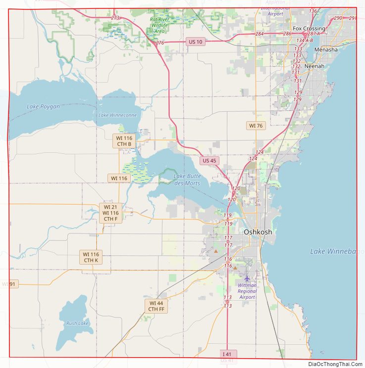
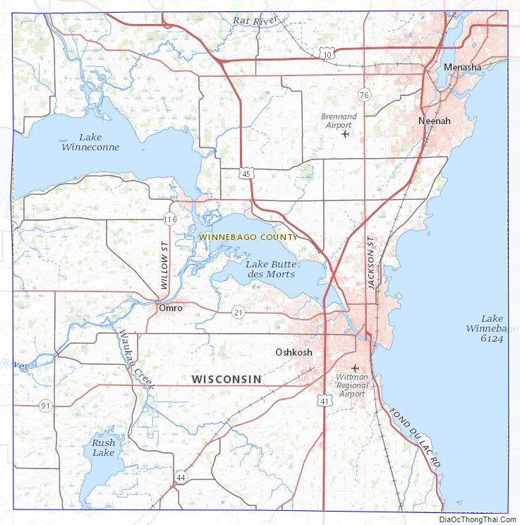
Winnebago County Road Map
Geography
According to the U.S. Census Bureau, the county has a total area of 579 square miles (1,500 km), of which 434 square miles (1,120 km) is land and 144 square miles (370 km) (25%) is water.
Adjacent counties
- Waupaca County – northwest
- Outagamie County – northeast
- Calumet County – east
- Fond du Lac County – south
- Green Lake County – southwest
- Waushara County – west
Major highways
- Interstate 41
- U.S. Highway 10
- U.S. Highway 41
- U.S. Highway 45
- Wisconsin Highway 21
- Wisconsin Highway 26
- Wisconsin Highway 44
- Wisconsin Highway 47
- Wisconsin Highway 76
- Wisconsin Highway 91
- Wisconsin Highway 114
- Wisconsin Highway 116
- Wisconsin Highway 441
Railroads
- Canadian National
- Wisconsin and Southern Railroad
Buses
- GO Transit (Wisconsin)
- Valley Transit (Wisconsin)
- List of intercity bus stops in Wisconsin
Airports
Wittman Regional Airport (KOSH) serves the county and surrounding communities.
Brennand Airport (79C) in the Town of Clayton is a major recreational aircraft hub year-round.
Commercial airline service for Winnebago County is provided by Appleton International Airport in the neighboring Outagamie County.
Winnebago County Topographic Map
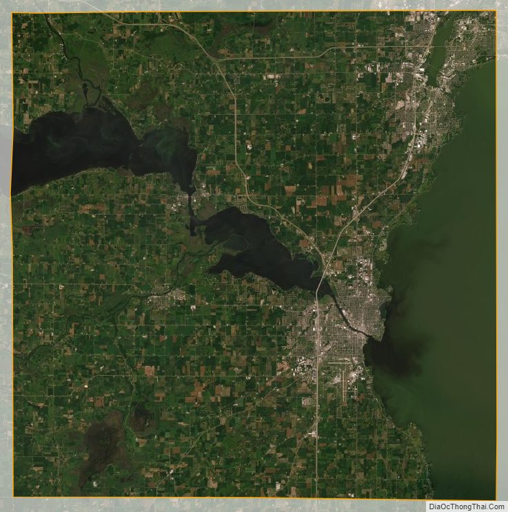
Winnebago County Satellite Map
Winnebago County Outline Map