Adair County is a county in the U.S. state of Iowa. As of the 2020 census, the population was 7,496. Its county seat is Greenfield.
| Name: | Adair County |
|---|---|
| FIPS code: | 19-001 |
| State: | Iowa |
| Founded: | 1851 |
| Named for: | John Adair |
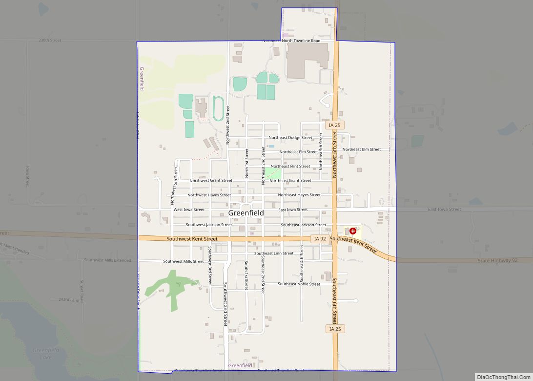
| Seat: | Greenfield |
| Largest city: | Greenfield |
| Total Area: | 570 sq mi (1,500 km²) |
| Land Area: | 569 sq mi (1,470 km²) |
| Total Population: | 7,496 |
| Population Density: | 13/sq mi (5.1/km²) |
| Time zone: | UTC−6 (Central) |
| Summer Time Zone (DST): | UTC−5 (CDT) |
| Website: | www.adaircountyiowa.org |
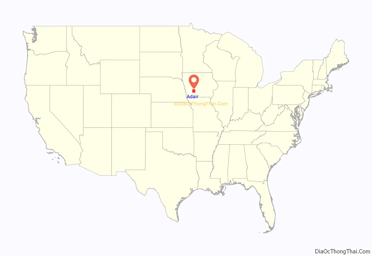
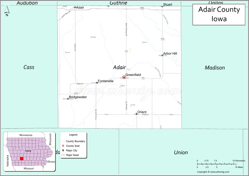
Adair County location map. Where is Adair County?
History
Adair County was formed in 1851 from sections of Pottawattamie County. It was named for John Adair, a general in the War of 1812, and the eighth Governor of Kentucky.
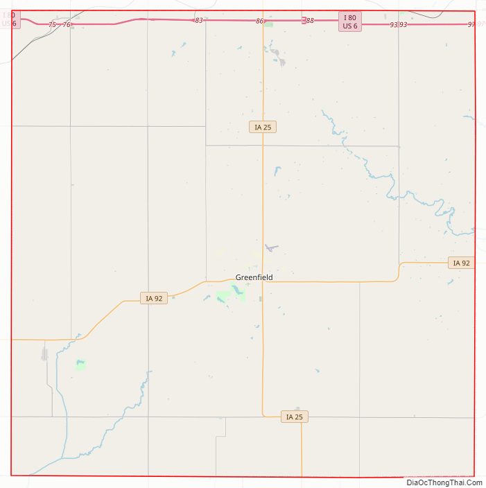
Adair County Road Map
Geography
According to the U.S. Census Bureau, the county has a total area of 570 square miles (1,500 km), of which 569 square miles (1,470 km) is land and 1.0 square mile (2.6 km) (0.2%) is water.
Major highways
- Interstate 80
- U.S. Highway 6
- Iowa Highway 25
- Iowa Highway 92
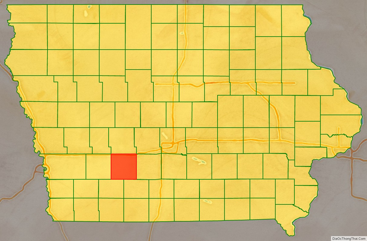
Adjacent counties
- Guthrie County (north)
- Madison County (east)
- Union County (southeast)
- Adams County (southwest)
- Cass County (west)
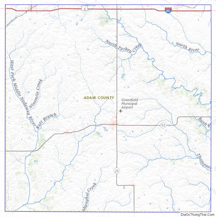
Adair County Topographic Map
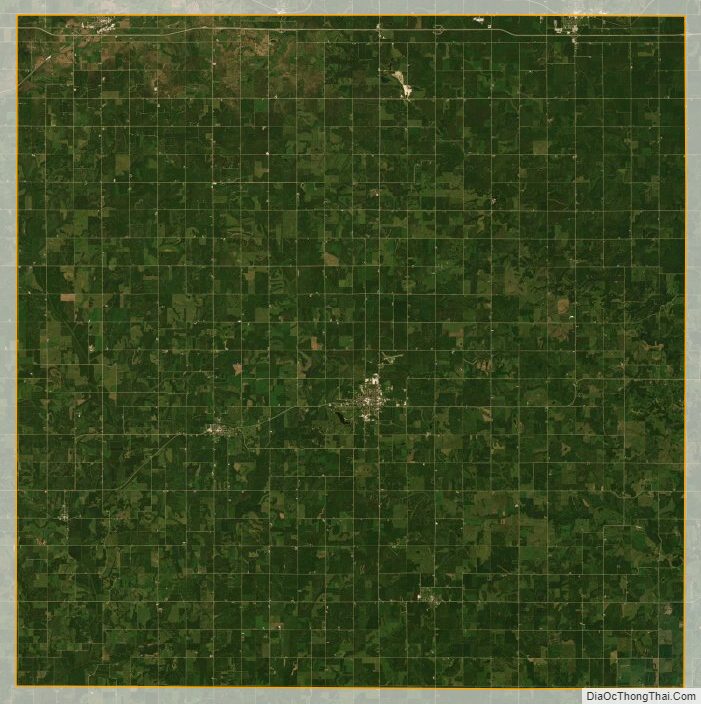
Adair County Satellite Map
Adair County Outline Map