Appanoose County is a county in the U.S. state of Iowa. As of the 2020 census, the population was 12,317. Its county seat is Centerville.
| Name: | Appanoose County |
|---|---|
| FIPS code: | 19-007 |
| State: | Iowa |
| Founded: | 1843 |
| Named for: | Chief Appanoose |
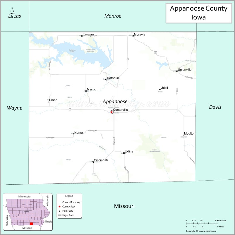
| Seat: | Centerville |
| Largest city: | Centerville |
| Total Area: | 516 sq mi (1,340 km²) |
| Land Area: | 497 sq mi (1,290 km²) |
| Total Population: | 12,317 |
| Population Density: | 24/sq mi (9.2/km²) |
| Time zone: | UTC−6 (Central) |
| Summer Time Zone (DST): | UTC−5 (CDT) |
| Website: | appanoosecounty.iowa.gov |
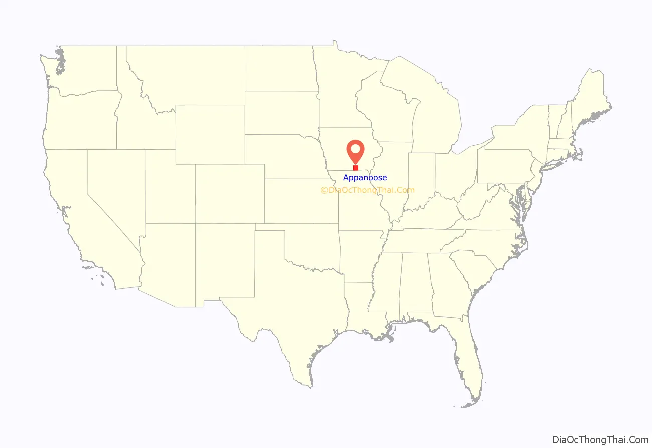
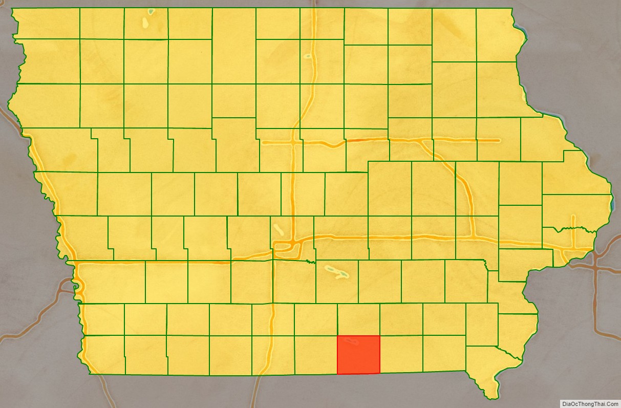
Appanoose County location map. Where is Appanoose County?
History
Appanoose County was formed on February 17, 1843, from open territory. It was named for the Meskwaki Chief Appanoose, who did not engage in war against Black Hawk, advocating peace. The present county seat was formerly called Chaldea, and was later renamed to Senterville in honor of Congressman William Tandy Senter of Tennessee. In April 1848, the courthouse, constructed at the expense of $160, was put into use and served as such until 1857. The second courthouse was opened in 1864, and was burned down to the first floor during an explosive Fourth of July fireworks demonstration. The third courthouse was dedicated on May 21, 1903, and remains in use.
In the summer of 1832 a company of cavalry set out from Davenport on a reconnaissance which extended as far west as Fort Leavenworth. They passed through what would become Appanoose County in a nearly southwest direction, passing near the present city of Moulton, camping overnight at a spring southwest of Cincinnati, and leaving the area and crossing into Missouri near the southwest corner of Pleasant Township. Early settlers in search of claims found two trails. The route taken by the cavalrymen and another with a general north–south direction, passing through Washington Township, and known as the bee trace and used in the summer by honey collectors. A post office in Washington Township was called Beetrace. The Beetrace post office was discontinued on March 1, 1886. This may have been originally an Indian trail. The first settlers say that it was a tolerably well-defined wagon road as far north as the Beetrace post office and that it could be followed easily into Taylor Township. Another “bee-trace” ran from Missouri diagonally through Davis County and terminated near Unionville.
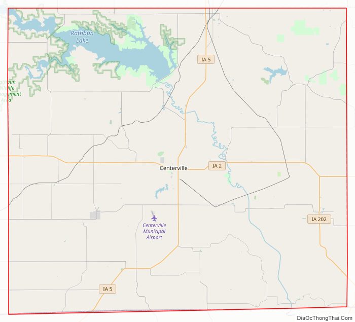
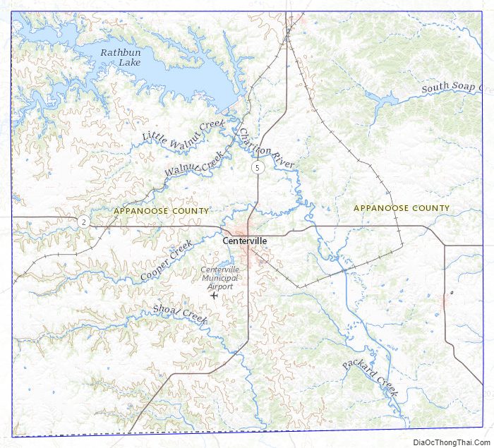
Appanoose County Road Map
Geography
According to the U.S. Census Bureau, the county has a total area of 516 square miles (1,340 km), of which 497 square miles (1,290 km) is land and 19 square miles (49 km) (3.7%) is water. Rathbun Reservoir, created by damming the Chariton River, is its main physical feature.
Major highways
- Iowa Highway 2
- Iowa Highway 5
- Iowa Highway 202
Adjacent counties
- Monroe County (north)
- Wapello County (northeast)
- Lucas County (northwest)
- Davis County (east)
- Schuyler County, Missouri (southeast)
- Putnam County, Missouri (southwest)
- Wayne County (west)
Appanoose County Topographic Map
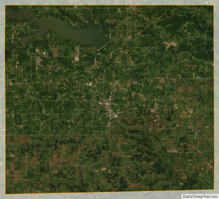
Appanoose County Satellite Map
Appanoose County Outline Map