Burleigh County is a county in the U.S. state of North Dakota. As of the 2020 census, the population was 98,458, making it the second-most populous county in North Dakota. Its county seat is Bismarck, the state capital. The county was named for Dakota Territory political figure Walter A. Burleigh.
| Name: | Burleigh County |
|---|---|
| FIPS code: | 38-015 |
| State: | North Dakota |
| Founded: | 1873 |
| Named for: | Walter A. Burleigh |
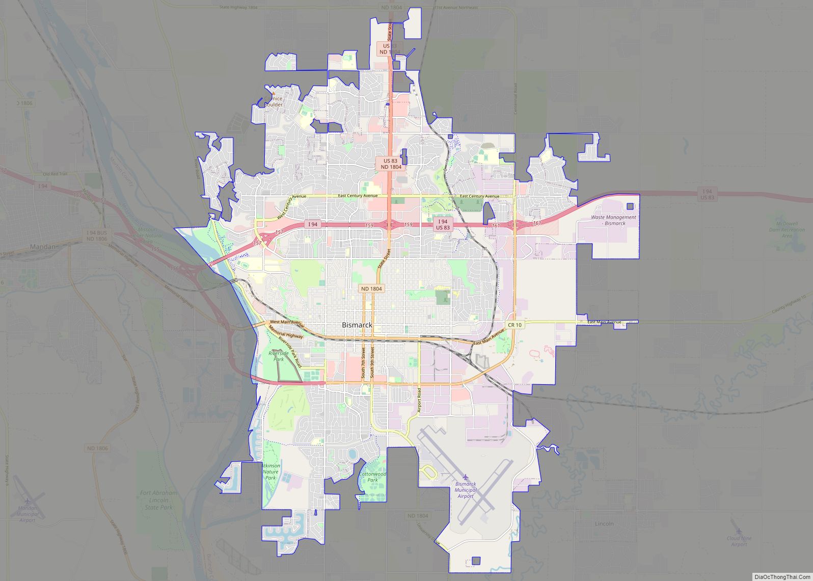
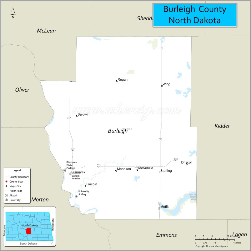
| Seat: | Bismarck |
| Largest city: | Bismarck |
| Total Area: | 1,668 sq mi (4,320 km²) |
| Land Area: | 1,633 sq mi (4,230 km²) |
| Total Population: | 98,458 |
| Population Density: | 59/sq mi (23/km²) |
| Time zone: | UTC−6 (Central) |
| Summer Time Zone (DST): | UTC−5 (CDT) |
| Website: | www.co.burleigh.nd.us |
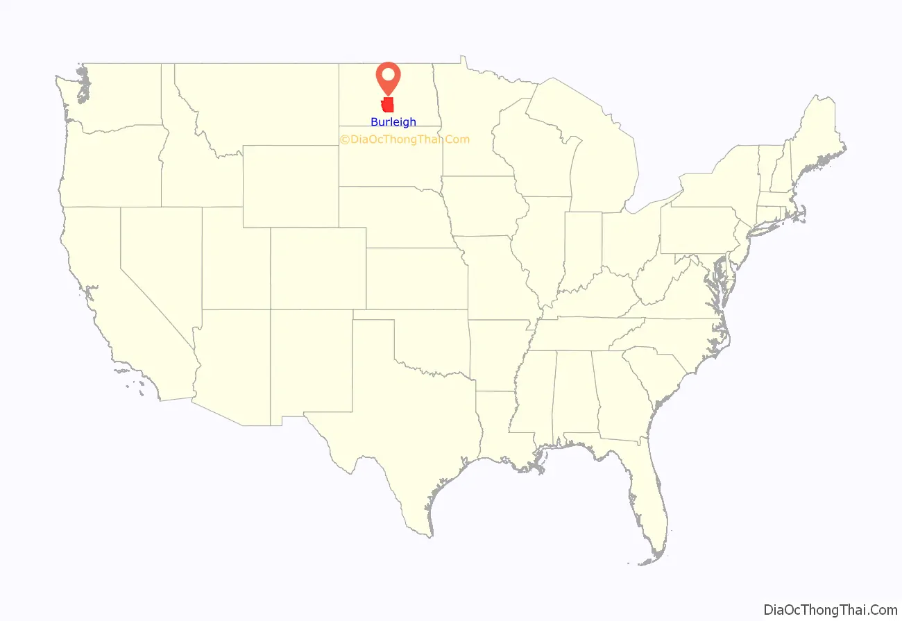
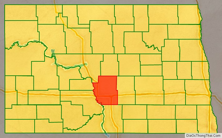
Burleigh County location map. Where is Burleigh County?
History
The territorial legislature created Burleigh County on January 4, 1873, annexing territory from Buffalo County. Burleigh was not organized at that time, but the organization was effected on July 16, 1873. Its boundaries were altered in 1879, 1881, 1883, and twice in 1885.
Burleigh County is included in the Bismarck, ND Metropolitan Statistical Area, commonly called “Bismarck–Mandan”.
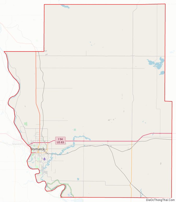
Burleigh County Road Map
Geography
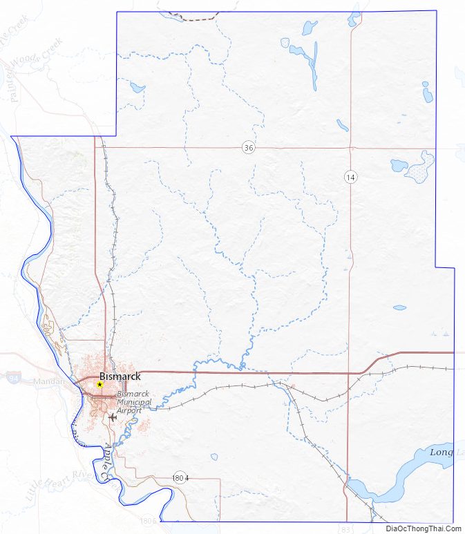
The Missouri River flows south-southeasterly along the lower west boundary line of Burleigh County. The central part of the county is drained by south-flowing creeks. The county terrain consists of semi-arid low rolling hills, partially devoted to agriculture. The terrain slopes to the south, and its western portion also slopes to the river valley. The terrain’s highest point is on the upper portion of the east boundary line, at 2,060′ (628m) ASL. The county has a total area of 1,668 square miles (4,320 km), of which 1,633 square miles (4,230 km) is land and 36 square miles (93 km) (2.1%) is water.
Major highways
- I-94
- US 83
- ND 14
- ND 36
- ND 41
- ND 1804
Adjacent counties
- Sheridan County – north
- Kidder County – east
- Emmons County – south
- Morton County – southwest
- Oliver County – west
- McLean County – northwest
Protected areas
- Arena State Game Management Area
- Bunker Lake State Game Management Area
- Canfield Lake National Wildlife Refuge
- Florence Lake National Wildlife Refuge
- Long Lake National Wildlife Refuge (part)
- Sibley Nature Park
- Wilton Mine State Game Management Area (part)
Lakes
- Bunce Lake
- Bunker Lake
- Clear Lake
- Florence Lake
- Grass Lake
- Harriet Lake
- Horseshoe Lake
- Lonetree Lake
- Long Lake
- Mitchell Lake
- New Johns Lake (part)
- O’Brien Lake
- Pelican Lake
- Rice Lake
Burleigh County Topographic Map
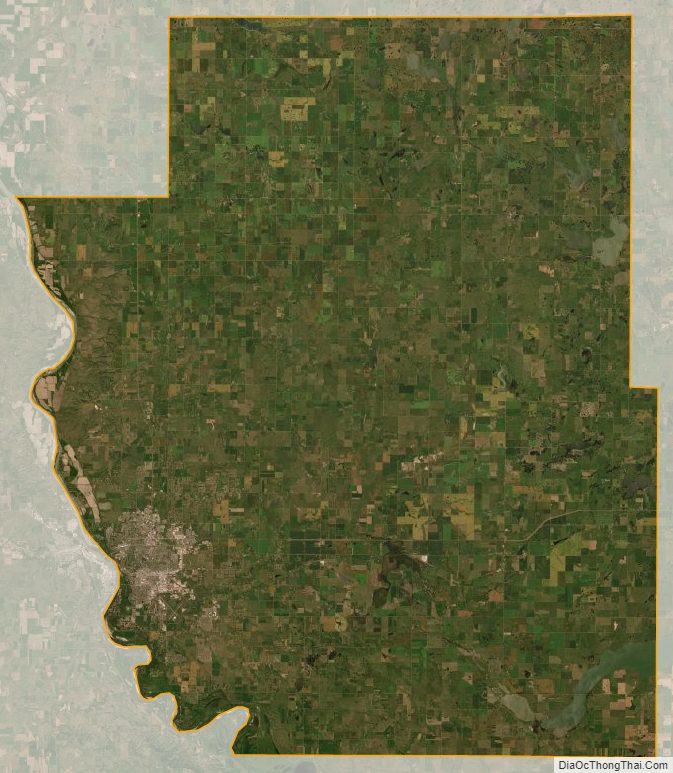
Burleigh County Satellite Map
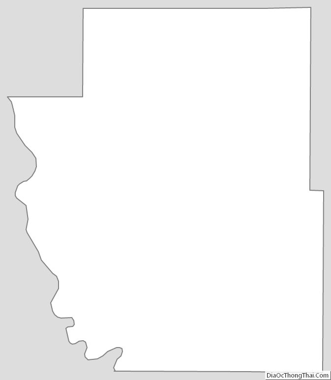
Burleigh County Outline Map