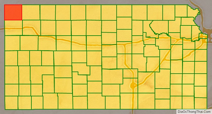
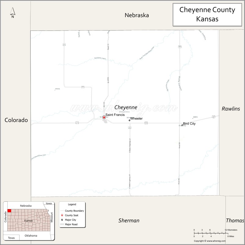
Cheyenne County (county code CN) is a county located in the northwest corner of the U.S. state of Kansas. As of the 2020 census, the county population was 2,616. Its county seat and most populous city is St. Francis.
| Name: | Cheyenne County |
|---|---|
| FIPS code: | 20-023 |
| State: | Kansas |
| Founded: | March 20, 1873 |
| Named for: | Cheyenne Native Americans |
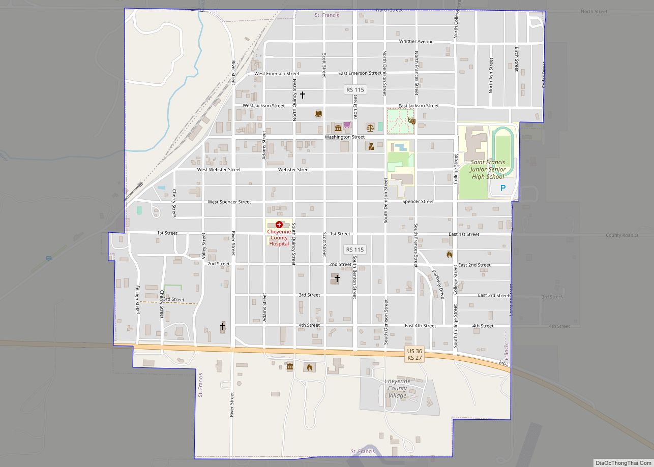
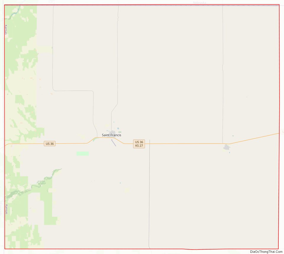
| Seat: | St. Francis |
| Largest city: | St. Francis |
| Total Area: | 1,021 sq mi (2,640 km²) |
| Land Area: | 1,020 sq mi (2,600 km²) |
| Total Population: | 2,616 |
| Population Density: | 2.6/sq mi (1.0/km²) |
| Time zone: | UTC−6 (Central) |
| Summer Time Zone (DST): | UTC−5 (CDT) |
| Website: | cncoks.us |
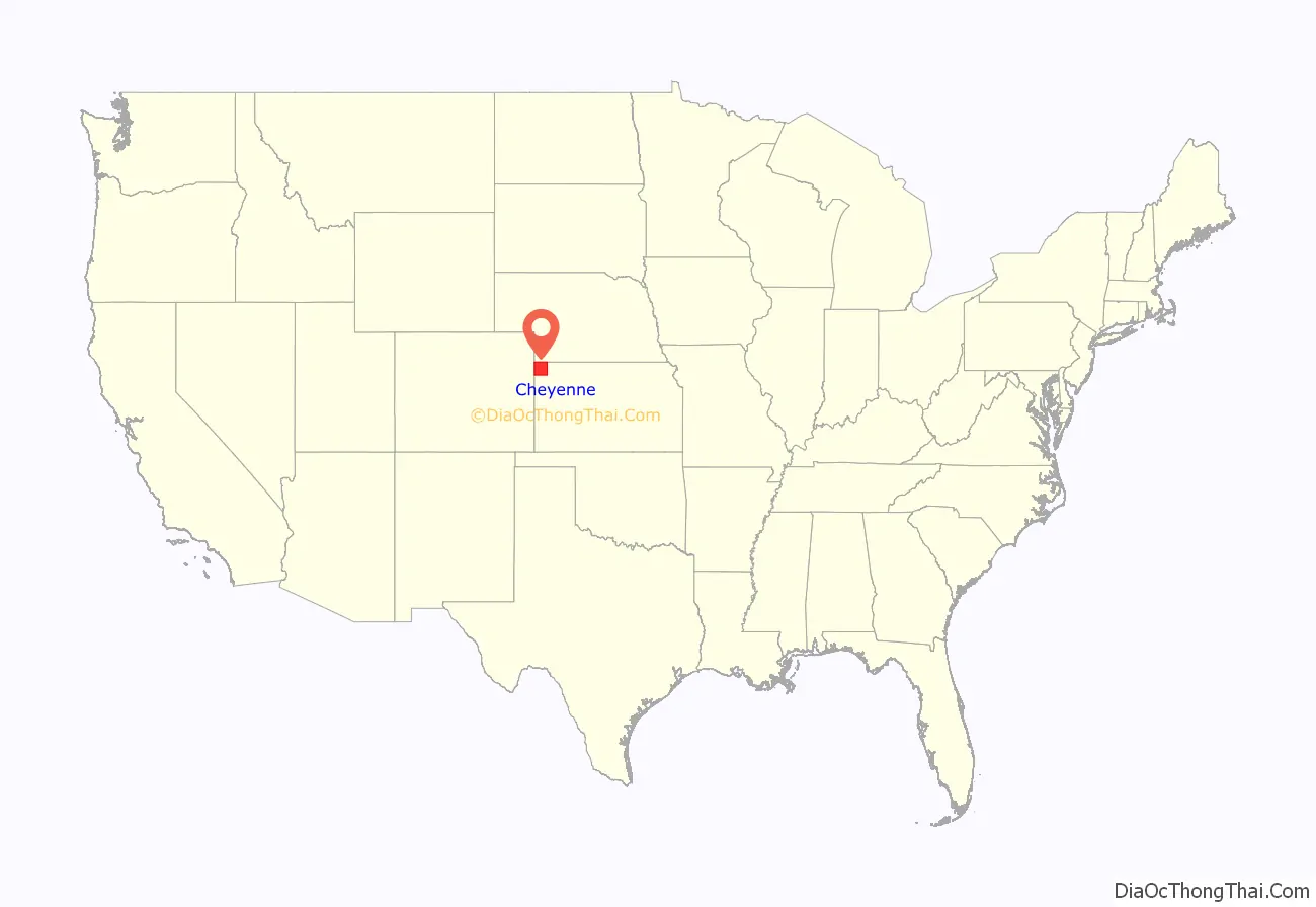
Cheyenne County location map. Where is Cheyenne County?
History
Early history
For many millennia, the Great Plains of North America was inhabited by nomadic Native Americans. From the 16th century to 18th century, the Kingdom of France claimed ownership of large parts of North America. In 1762, after the French and Indian War, France secretly ceded New France to Spain, per the Treaty of Fontainebleau.
19th century
In 1802, Spain returned most of the land to France, but keeping title to about 7,500 square miles. In 1803, most of the land for modern day Kansas was acquired by the United States from France as part of the 828,000 square mile Louisiana Purchase for 2.83 cents per acre.
In 1854, the Kansas Territory was organized, then in 1861 Kansas became the 34th U.S. state. In 1873, Cheyenne County was established.
Cheyenne County Road Map
Geography
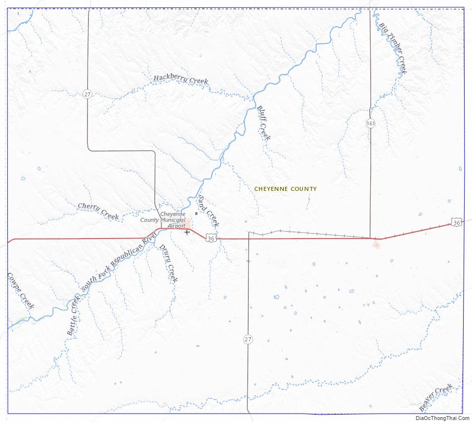
According to the U.S. Census Bureau, the county has a total area of 1,021 square miles (2,640 km), of which 1,020 square miles (2,600 km) is land and 1.1 square miles (2.8 km) (0.1%) is water.
Adjacent counties
- Dundy County, Nebraska (north/Mountain Time border)
- Rawlins County (east)
- Sherman County (south/Mountain Time border)
- Kit Carson County, Colorado (southwest/Mountain Time border)
- Yuma County, Colorado (west/Mountain Time border)
Major highways
Sources: National Atlas, U.S. Census Bureau
- U.S. Route 36
- Kansas Highway 27
- Kansas Highway 161
Time Zones
The county is in the Central Time zone, but is bordered by the Mountain Time Zone in three directions; it is the only county in the United States to have this characteristic. Dundy County, Nebraska to the north, Yuma County, Colorado and Kit Carson County, Colorado to the west, and Sherman County to the south are all located in the Mountain Time Zone. As a result, Rawlins County is Cheyenne County’s only neighbor to also observe Central Time.
Cheyenne County Topographic Map
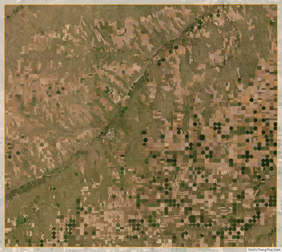
Cheyenne County Satellite Map
Cheyenne County Outline Map