Clinton County is a county located in the U.S. state of Iowa. As of the 2020 census, the population was 46,460. Its county seat is Clinton. Its name is in honor of the seventh Governor of New York State, DeWitt Clinton.
Clinton County comprises the Clinton, IA Micropolitan Statistical Area, which is also included in the Davenport–Moline–Rock Island Metropolitan Statistical Area.
| Name: | Clinton County |
|---|---|
| FIPS code: | 19-045 |
| State: | Iowa |
| Founded: | 1837 |
| Named for: | DeWitt Clinton |
| Seat: | Clinton |
| Largest city: | Clinton |
| Total Area: | 710 sq mi (1,800 km²) |
| Land Area: | 695 sq mi (1,800 km²) |
| Total Population: | 46,460 |
| Population Density: | 65/sq mi (25/km²) |
| Time zone: | UTC−6 (Central) |
| Summer Time Zone (DST): | UTC−5 (CDT) |
| Website: | www.clintoncounty-ia.gov |
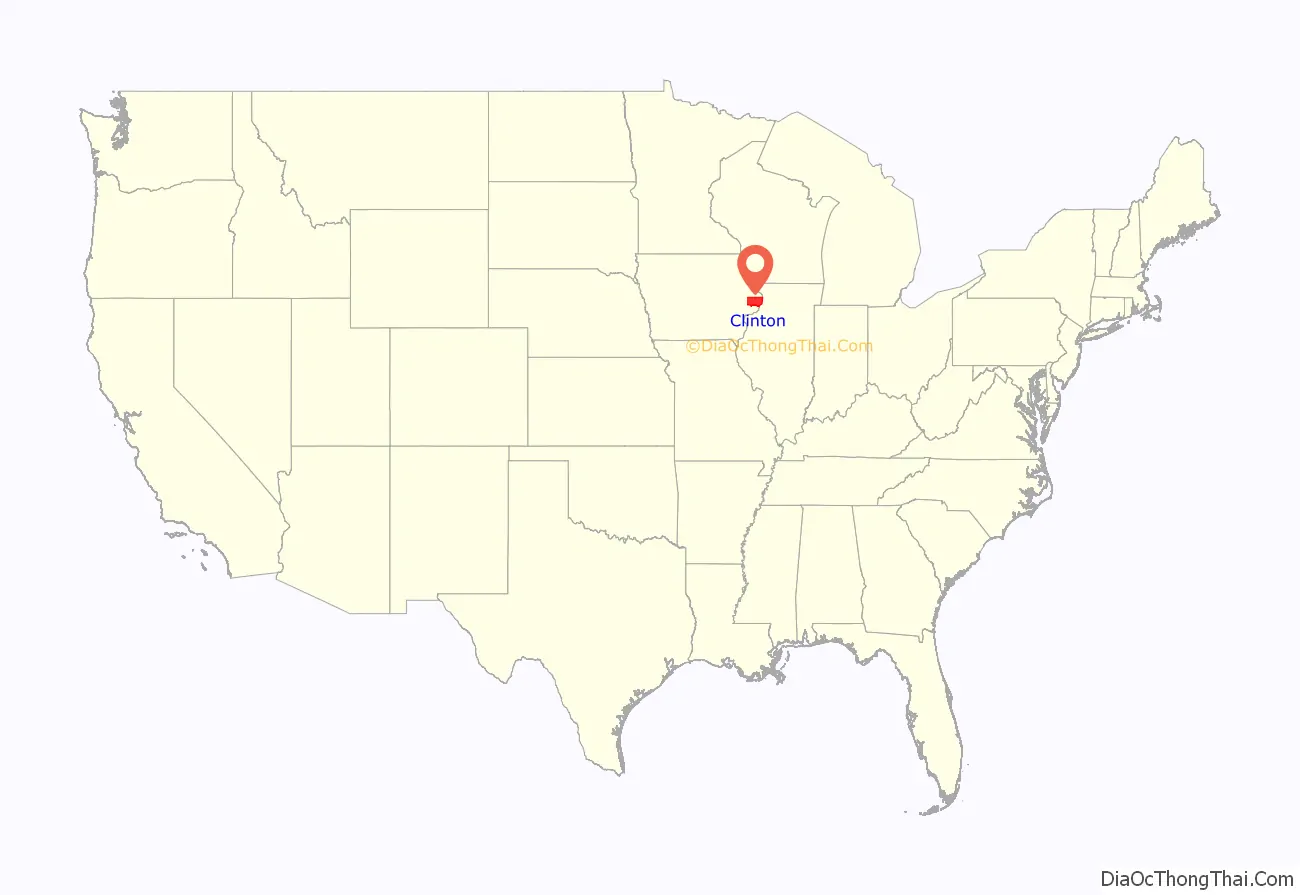
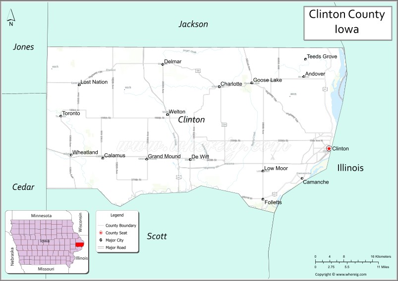
Clinton County location map. Where is Clinton County?
History
Clinton County was formed on December 21, 1837. It was named for DeWitt Clinton, a Governor of New York and most ardent advocate for the construction of the Erie Canal. The cities of DeWitt and Clinton were also named after him.
In 1835, Elijah Buell built a log cabin for himself and his family and was thus the first settler of the region. In 1854, the first newspaper was issued and in 1858, the Lyons Female College for girls opened its doors. The tuition was set at $175 per student.
The county has used three courthouses in its history. The structure currently in use was constructed in Romanesque style and opened in 1897.
Early settlement
Clinton county was first settled in 1836, by Mr. Bourne, who located upon Sec. 1, T. 80, R. 4, East. The county was surveyed in 1837, by the Messrs. Burtz. The Surveyor General’s office was then at Cincinnati, Ohio. In 1840, the county was organized by Sheriff Bourne. In 1841, R. R. Bed ford and others formed a little settlement at De Witt, and during the same year Messrs. Wheeler and Evans erected a log court-house. In stepping from the past to the present, we quote the language of one of the “oldest inhabitants.” He says: “Clinton County was originally settled by the poorest class of people on God’s earth; and it is with great pleasure that I have witnessed their progress, slow but sure, and now find the most of them very comfortably situated.”
The population of this County in 1840, was 821; in 1850, 2822; in 1854, 7000; and in 1856, 11,000. The population of Lyons in 1850, was 453. In 1856 the population increased to 2700.
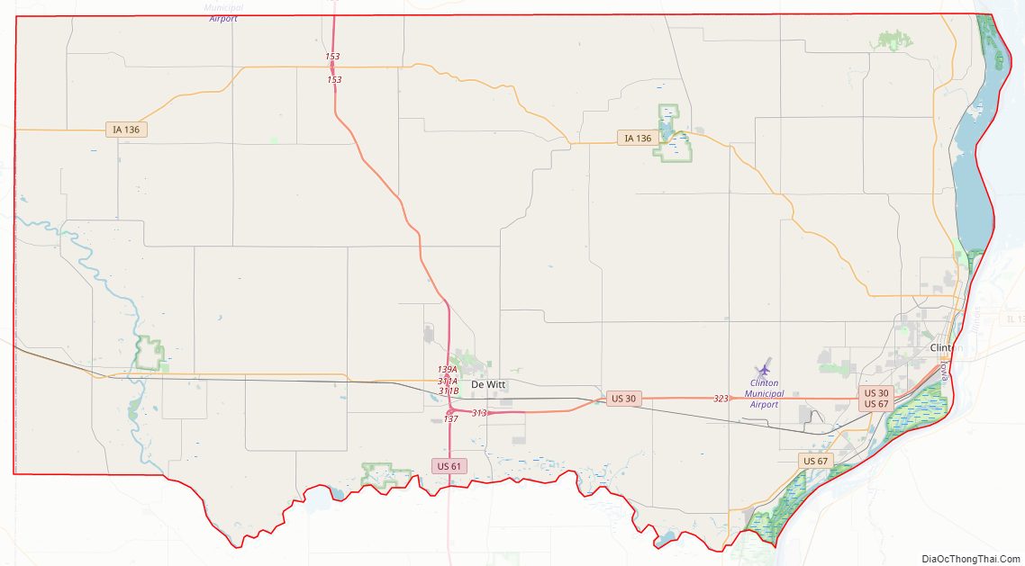
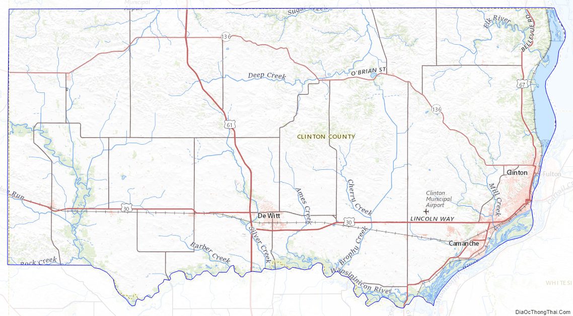
Clinton County Road Map
Geography
According to the U.S. Census Bureau, the county has a total area of 710 square miles (1,800 km), of which 695 square miles (1,800 km) is land and 15 square miles (39 km) (2.1%) is water. It includes the easternmost point in the state of Iowa, on the Mississippi River in Elk River township in the northeast section of the county.
Major highways
- US 30
- US 61
- US 67
- Iowa 136
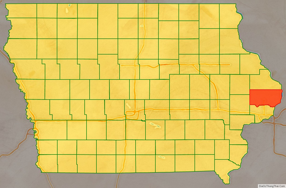
Adjacent counties
- Jackson County (north)
- Carroll County, Illinois (northeast)
- Whiteside County, Illinois (east)
- Rock Island County, Illinois (southeast)
- Scott County (south)
- Cedar County (southwest)
- Jones County (northwest)
National protected area
- Upper Mississippi River National Wildlife and Fish Refuge (part)
Clinton County Topographic Map
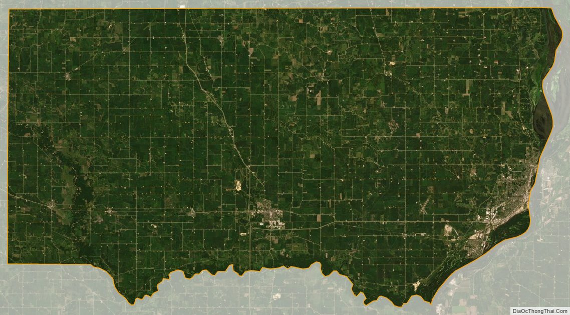
Clinton County Satellite Map
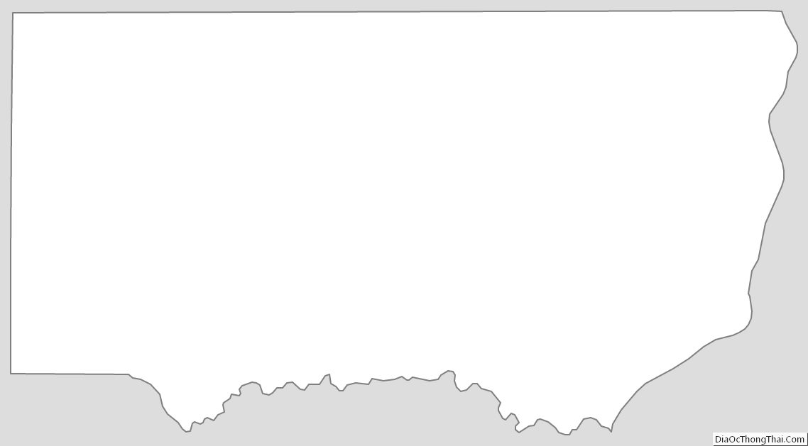
Clinton County Outline Map