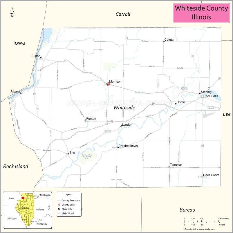
Whiteside County is a county located in the U.S. state of Illinois. According to the 2010 census, it had a population of 58,498. Its county seat is Morrison. The county is bounded on the west by the Mississippi River. Whiteside County comprises the Sterling, IL Micropolitan Statistical Area, which is also included in the Dixon-Sterling, IL Combined Statistical Area. U.S. President Ronald Reagan was born in 1911 in the Whiteside County community of Tampico.
| Name: | Whiteside County |
|---|---|
| FIPS code: | 17-195 |
| State: | Illinois |
| Founded: | 1836 |
| Named for: | Samuel Whiteside |
| Seat: | Morrison |
| Largest city: | Sterling |
| Total Area: | 697 sq mi (1,810 km²) |
| Land Area: | 684 sq mi (1,770 km²) |
| Total Population: | 58,498 |
| Population Density: | 84/sq mi (32/km²) |
| Time zone: | UTC−6 (Central) |
| Summer Time Zone (DST): | UTC−5 (CDT) |
| Website: | www.whiteside.org |
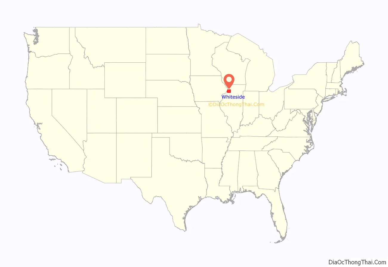
Whiteside County location map. Where is Whiteside County?
History
This area was long occupied by varying cultures of Native Americans.
Whiteside County was organized by European Americans in 1836 from parts of Jo Daviess and Henry counties. It was named for General Samuel Whiteside, an Illinois officer in the War of 1812 and Black Hawk War.
Whiteside County’s boundaries have remained unchanged since its creation in 1836.
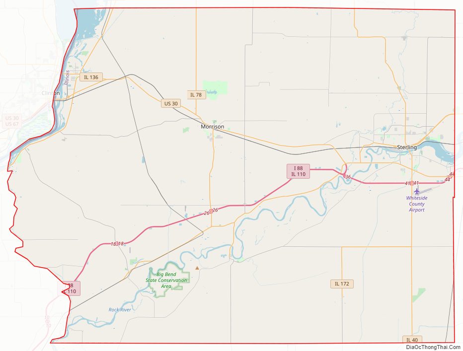
Whiteside County Road Map
Geography
According to the U.S. Census Bureau, the county has a total area of 697 square miles (1,810 km), of which 684 square miles (1,770 km) is land and 12 square miles (31 km) (1.8%) is water.
Climate and weather
In recent years, average temperatures in the county seat of Morrison have ranged from a low of 10 °F (−12 °C) in January to a high of 85 °F (29 °C) in July, although a record low of −30 °F (−34 °C) was recorded in February 1905 and a record high of 112 °F (44 °C) was recorded in July 1936. Average monthly precipitation ranged from 1.51 inches (38 mm) in February to 4.69 inches (119 mm) in August.
Major highways
- Interstate 88
- U.S. Highway 30
- Illinois Route 2
- Illinois Route 40
- Illinois Route 78
- Illinois Route 84
- Illinois Route 110
- Illinois Route 136
- Illinois Route 172
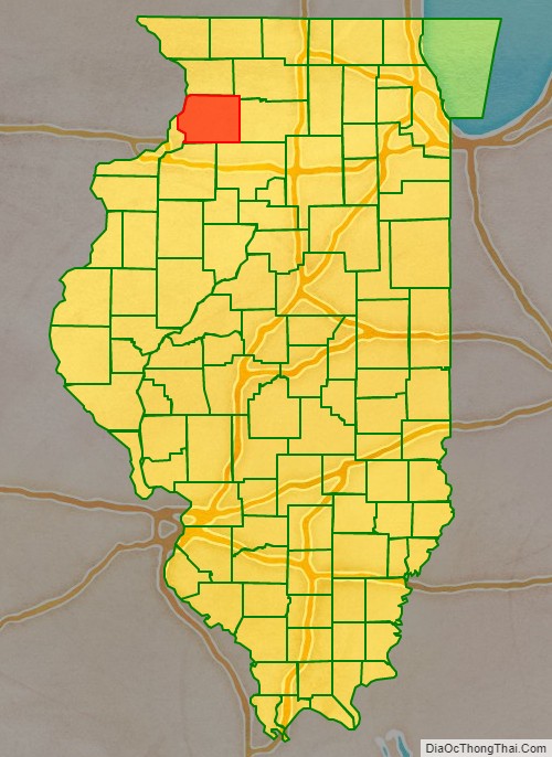
Adjacent counties
- Carroll County (north)
- Ogle County (northeast)
- Lee County (east)
- Bureau County (southeast)
- Henry County (south)
- Rock Island County (southwest)
- Clinton County, Iowa (west)
National protected area
- Upper Mississippi River National Wildlife and Fish Refuge (part)
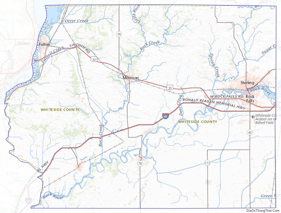
Whiteside County Topographic Map
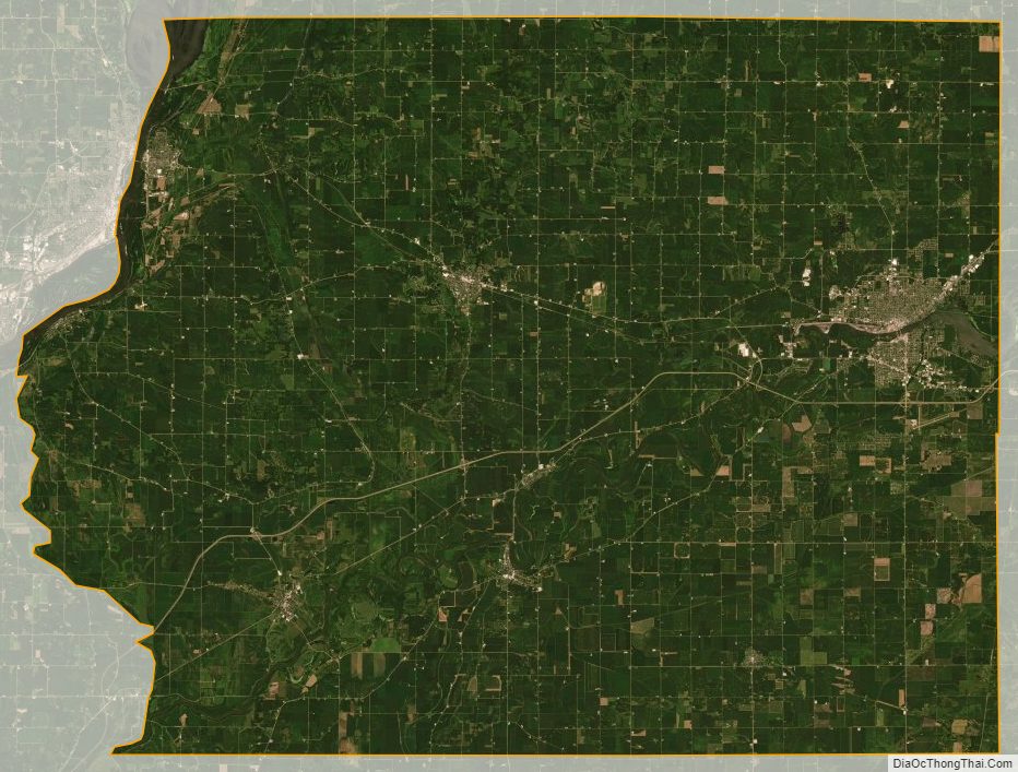
Whiteside County Satellite Map
Whiteside County Outline Map