Clinton County is a county located in the U.S. state of Kentucky in the Pennyrile Region along the southern border with Tennessee. As of the 2020 census, the population was 9,253. Its county seat is Albany. The county was formed in 1835 and named for DeWitt Clinton, the seventh Governor of New York. It is a prohibition or dry county.
| Name: | Clinton County |
|---|---|
| FIPS code: | 21-053 |
| State: | Kentucky |
| Founded: | February 20, 1835 |
| Named for: | DeWitt Clinton |
| Seat: | Albany |
| Largest city: | Albany |
| Total Area: | 205 sq mi (530 km²) |
| Land Area: | 197 sq mi (510 km²) |
| Total Population: | 9,253 |
| Population Density: | 45/sq mi (17/km²) |
| Time zone: | UTC−6 (Central) |
| Summer Time Zone (DST): | UTC−5 (CDT) |
| Website: | clintoncounty.ky.gov |
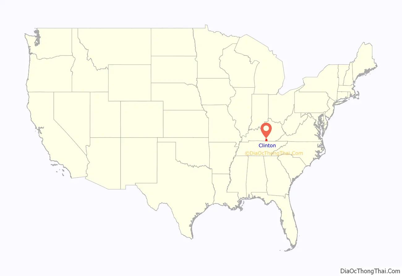
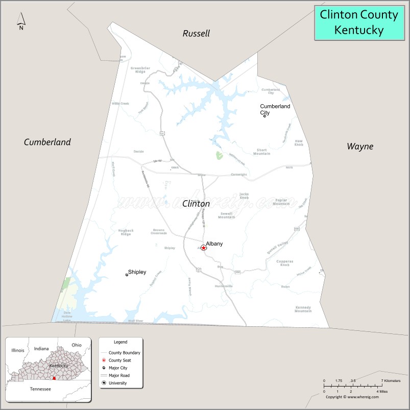
Clinton County location map. Where is Clinton County?
History
Clinton County was formed on February 20, 1835, from portions of Cumberland and Wayne counties. It was named for DeWitt Clinton, governor of New York and driving force behind the Erie Canal.
Courthouse fires in 1864 (Civil War guerrillas) and 1980 resulted in the destruction of county records, but in the latter case, local volunteers’ assistance successfully preserved almost all records.
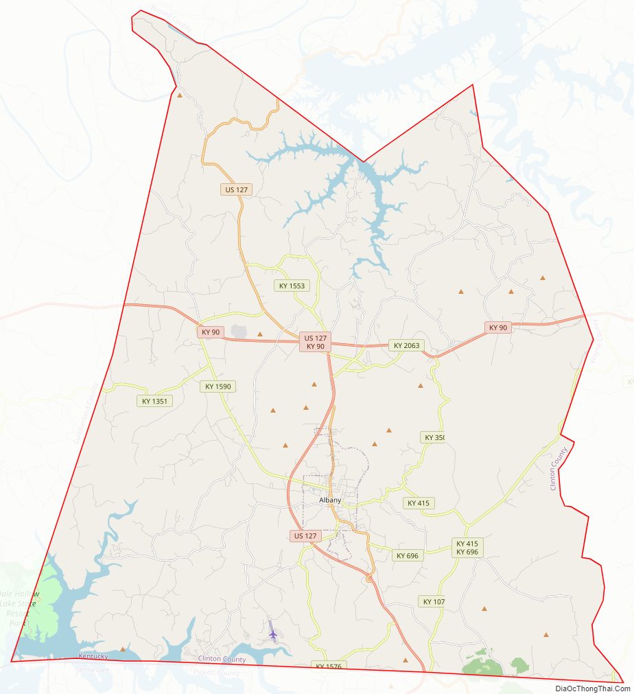
Clinton County Road Map
Geography
According to the U.S. Census Bureau, the county has a total area of 205 square miles (530 km), of which 197 square miles (510 km) is land and 8.2 square miles (21 km) (4.0%) is water.
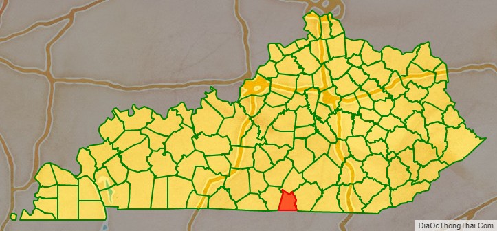
Adjacent counties
- Russell County (north)
- Wayne County (east/EST border)
- Pickett County, Tennessee (south)
- Clay County, Tennessee (southwest)
- Cumberland County (west)
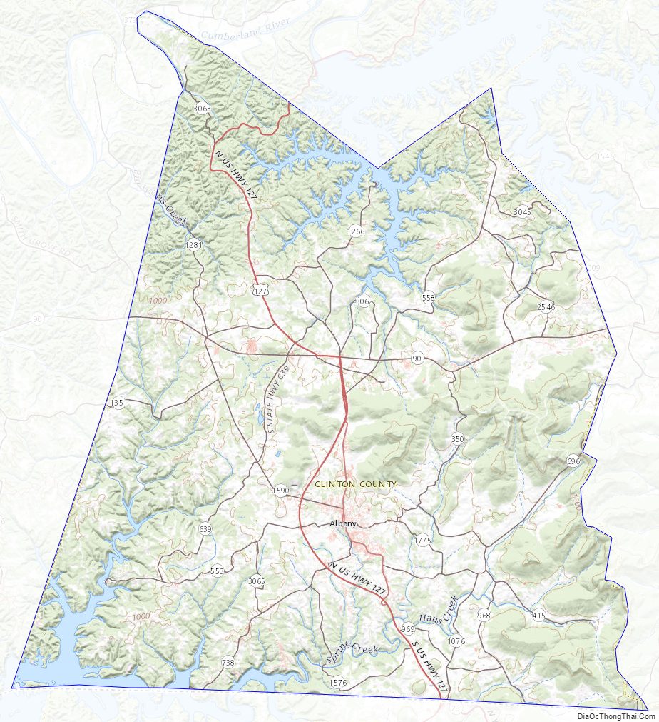
Clinton County Topographic Map
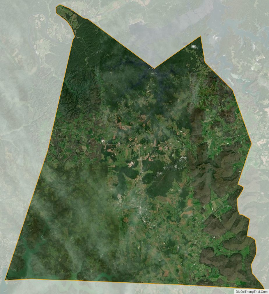
Clinton County Satellite Map
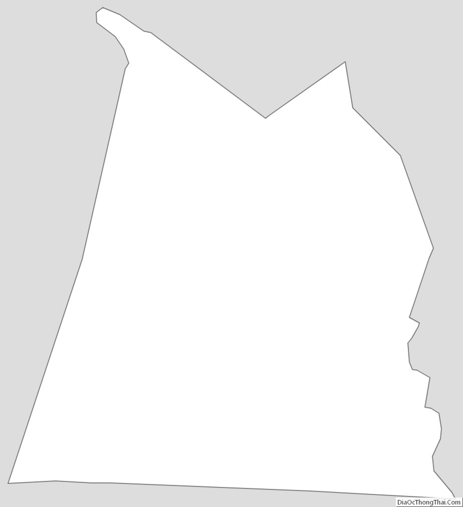
Clinton County Outline Map