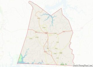
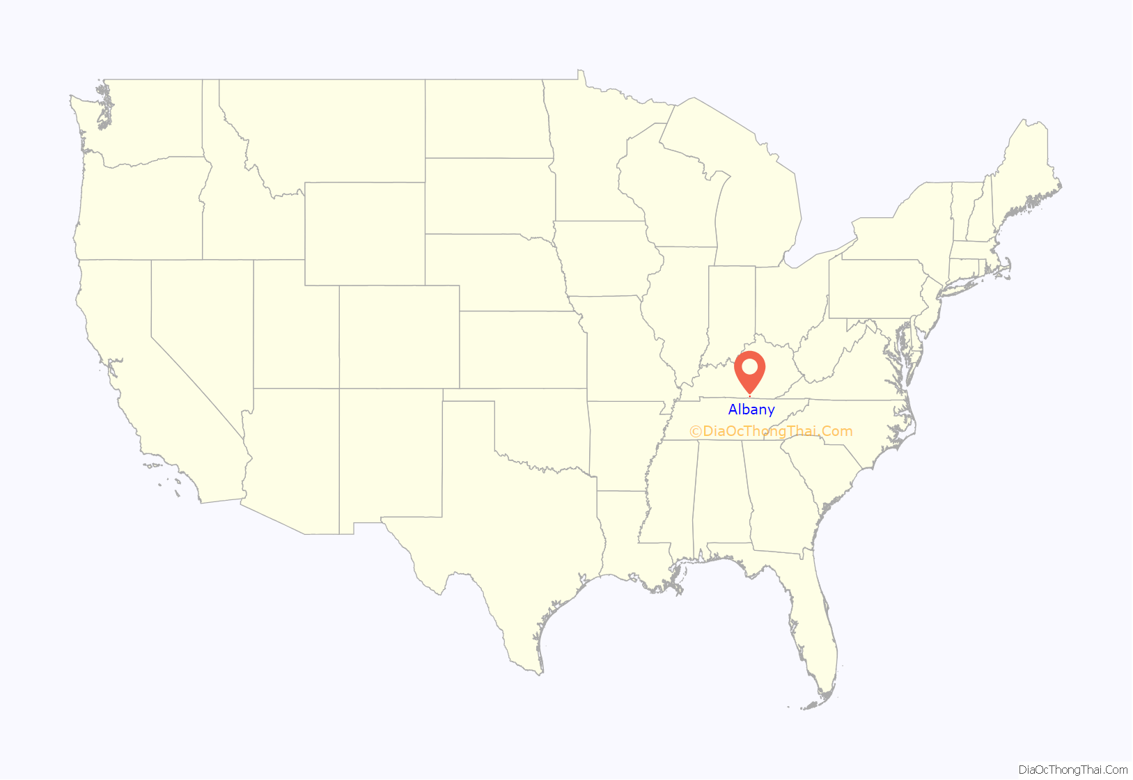
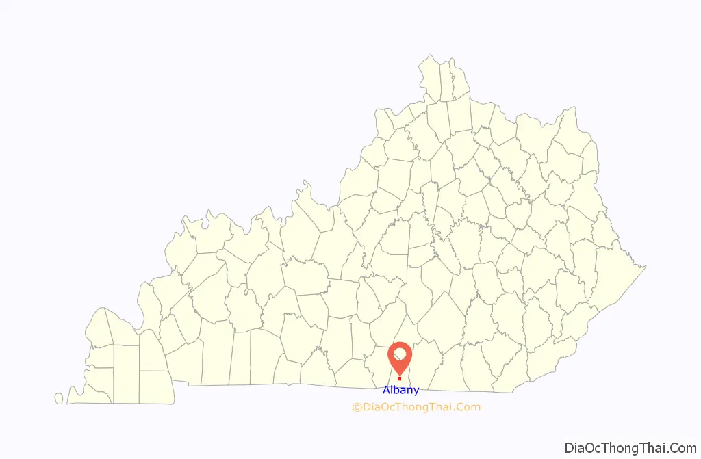
Albany is a home rule-class city in Clinton County, Kentucky, in the United States. The population was 2,033 at the 2010 census. It is the county seat of Clinton County. It is located on U.S. Route 127, about 6 miles (10 km) north of the Tennessee border.
| Name: | Albany city |
|---|---|
| LSAD Code: | 25 |
| LSAD Description: | city (suffix) |
| State: | Kentucky |
| County: | Clinton County |
| Elevation: | 961 ft (293 m) |
| Total Area: | 2.28 sq mi (5.90 km²) |
| Land Area: | 2.27 sq mi (5.89 km²) |
| Water Area: | 0.01 sq mi (0.01 km²) |
| Total Population: | 1,760 |
| Population Density: | 773.97/sq mi (298.82/km²) |
| ZIP code: | 42602 |
| Area code: | 606 |
| FIPS code: | 2100694 |
| GNISfeature ID: | 0485813 |
Online Interactive Map
Click on ![]() to view map in "full screen" mode.
to view map in "full screen" mode.
Albany location map. Where is Albany city?
History
The community of Albany grew up around a tavern established by Benjamin Dowell in the early 19th century. In 1837, residents voted to make the location the seat of county government. It is generally accepted that the town, formally incorporated on January 27, 1838, was named after Albany, New York, but a local legend holds that, during the vote to determine the location of the county seat, patrons of Dowell’s tavern shouted “All for Benny!”, then “all Benny,” which led to the town being called Albany.
During the Civil War, Albany was attacked by Confederate forces, and many buildings, including the courthouse, were burned. A marker in the courthouse square notes that Clinton was the native county of Civil War terrorist Champ Ferguson, hanged after the war for atrocities.
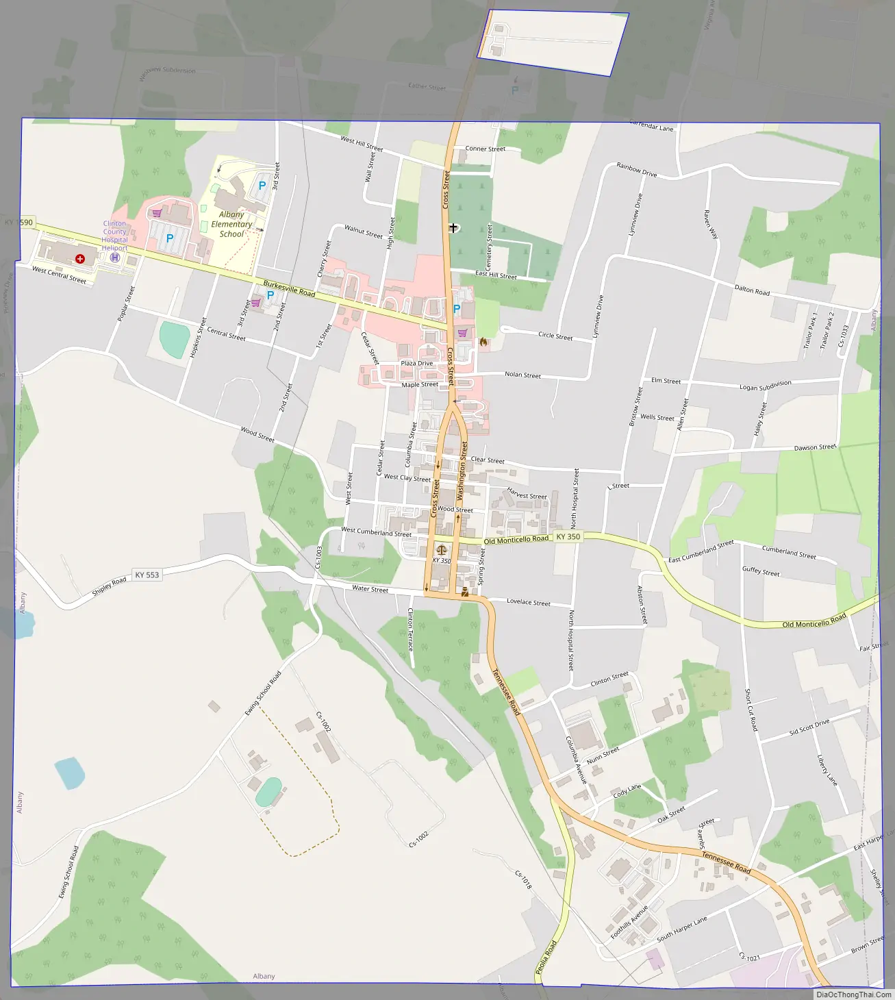
Albany Road Map
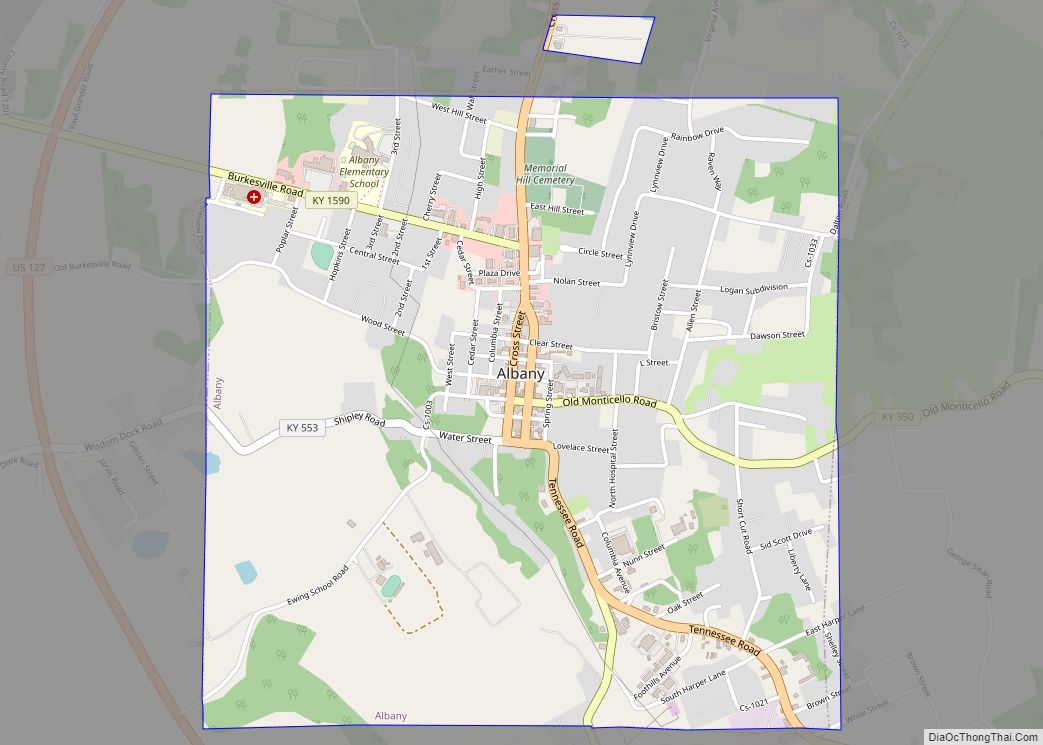
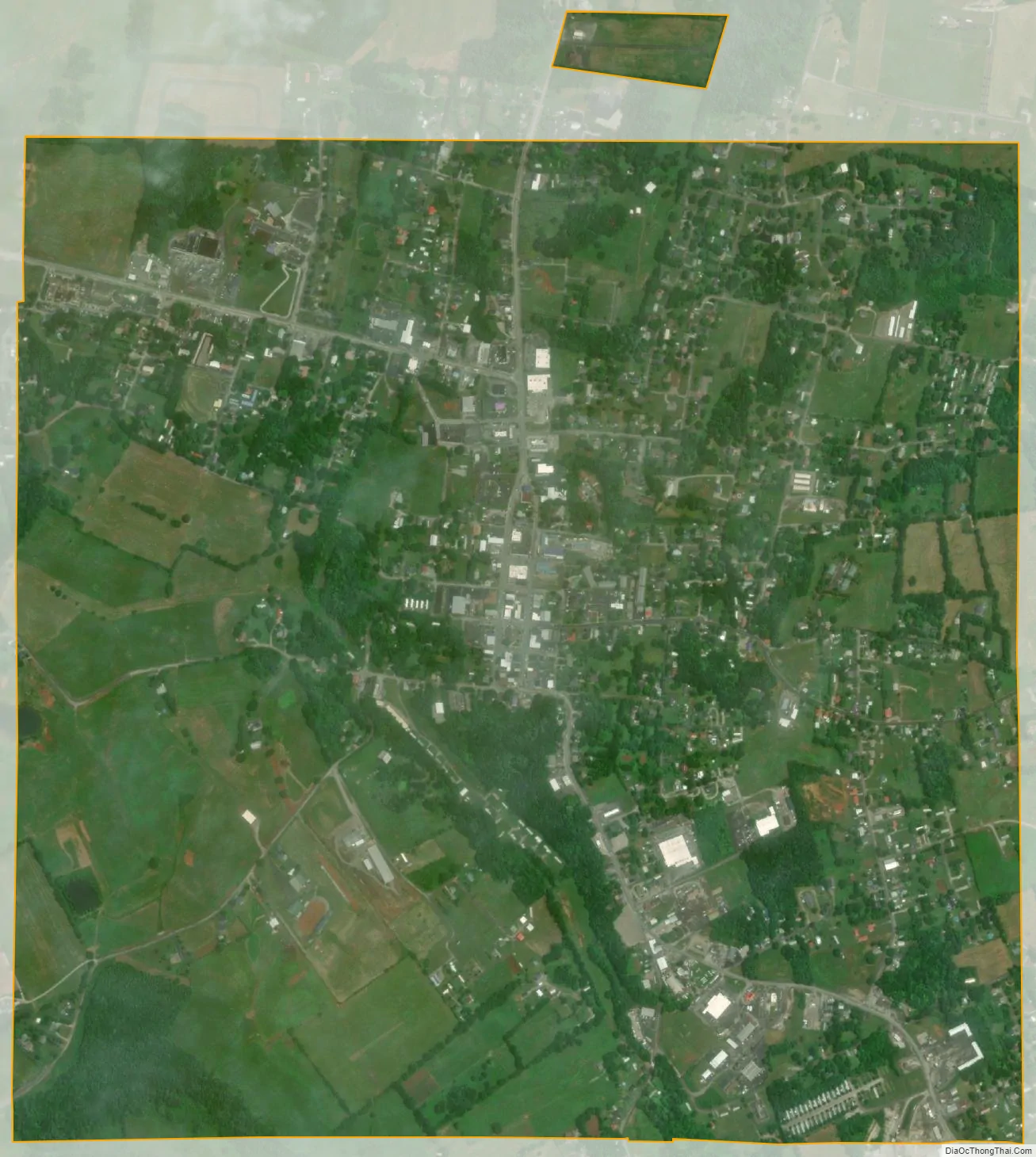
Albany city Satellite Map
Geography
Albany is located in south-central Clinton County at 36°41′36″N 85°8′7″W / 36.69333°N 85.13528°W / 36.69333; -85.13528 (36.693280, -85.135286). The city lies at an elevation of 960 feet (290 m) at the foot of the western edge of the Cumberland Plateau. Albany Rock, a western spur of the plateau, rises northeast of the city to an elevation of 1,700 feet (520 m).
According to the United States Census Bureau, the city has a total area of 2.2 square miles (5.8 km), of which 0.004 square miles (0.01 km), or 0.23%, is water.
Climate
The climate in this area is characterized by hot, humid summers and generally mild to cool winters. According to the Köppen Climate Classification system, Albany has a humid subtropical climate, abbreviated “Cfa” on climate maps.
See also
Map of Kentucky State and its subdivision:- Adair
- Allen
- Anderson
- Ballard
- Barren
- Bath
- Bell
- Boone
- Bourbon
- Boyd
- Boyle
- Bracken
- Breathitt
- Breckinridge
- Bullitt
- Butler
- Caldwell
- Calloway
- Campbell
- Carlisle
- Carroll
- Carter
- Casey
- Christian
- Clark
- Clay
- Clinton
- Crittenden
- Cumberland
- Daviess
- Edmonson
- Elliott
- Estill
- Fayette
- Fleming
- Floyd
- Franklin
- Fulton
- Gallatin
- Garrard
- Grant
- Graves
- Grayson
- Green
- Greenup
- Hancock
- Hardin
- Harlan
- Harrison
- Hart
- Henderson
- Henry
- Hickman
- Hopkins
- Jackson
- Jefferson
- Jessamine
- Johnson
- Kenton
- Knott
- Knox
- Larue
- Laurel
- Lawrence
- Lee
- Leslie
- Letcher
- Lewis
- Lincoln
- Livingston
- Logan
- Lyon
- Madison
- Magoffin
- Marion
- Marshall
- Martin
- Mason
- McCracken
- McCreary
- McLean
- Meade
- Menifee
- Mercer
- Metcalfe
- Monroe
- Montgomery
- Morgan
- Muhlenberg
- Nelson
- Nicholas
- Ohio
- Oldham
- Owen
- Owsley
- Pendleton
- Perry
- Pike
- Powell
- Pulaski
- Robertson
- Rockcastle
- Rowan
- Russell
- Scott
- Shelby
- Simpson
- Spencer
- Taylor
- Todd
- Trigg
- Trimble
- Union
- Warren
- Washington
- Wayne
- Webster
- Whitley
- Wolfe
- Woodford
- Alabama
- Alaska
- Arizona
- Arkansas
- California
- Colorado
- Connecticut
- Delaware
- District of Columbia
- Florida
- Georgia
- Hawaii
- Idaho
- Illinois
- Indiana
- Iowa
- Kansas
- Kentucky
- Louisiana
- Maine
- Maryland
- Massachusetts
- Michigan
- Minnesota
- Mississippi
- Missouri
- Montana
- Nebraska
- Nevada
- New Hampshire
- New Jersey
- New Mexico
- New York
- North Carolina
- North Dakota
- Ohio
- Oklahoma
- Oregon
- Pennsylvania
- Rhode Island
- South Carolina
- South Dakota
- Tennessee
- Texas
- Utah
- Vermont
- Virginia
- Washington
- West Virginia
- Wisconsin
- Wyoming