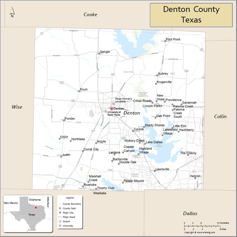
Denton County is located in the U.S. state of Texas. As of the 2020 census, its population was 906,422, making it the 7th-most populous county in Texas. The county seat is Denton. The county, which was named for John B. Denton, was established in 1846. Denton County constitutes part of the Dallas–Fort Worth metroplex. In 2007, it was one of the fastest-growing counties in the United States.
| Name: | Denton County |
|---|---|
| FIPS code: | 48-121 |
| State: | Texas |
| Founded: | April 11, 1846 |
| Named for: | John B. Denton |
| Seat: | Denton |
| Largest city: | Denton |
| Total Area: | 953 sq mi (2,470 km²) |
| Land Area: | 878 sq mi (2,270 km²) |
| Total Population: | 906,422 |
| Population Density: | 950/sq mi (370/km²) |
| Time zone: | UTC−6 (Central) |
| Summer Time Zone (DST): | UTC−5 (CDT) |
| Website: | dentoncounty.gov |
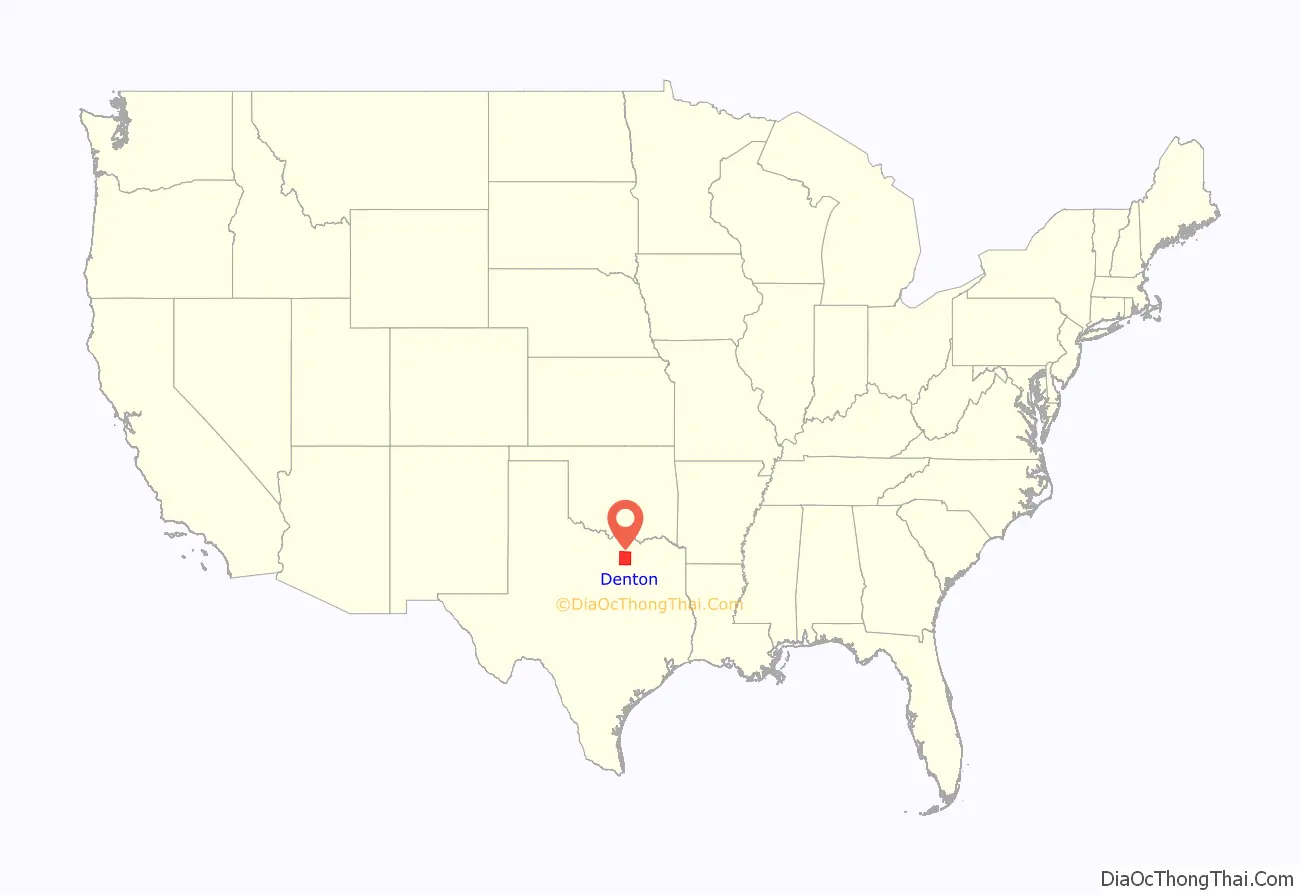
Denton County location map. Where is Denton County?
History
Before the arrival of settlers, various Native American peoples, including the Kichai and the Lenape, infrequently populated the area. The area was settled by Peters Colony landowners in the early 1840s. Until the annexation of Texas, the area was considered part of Fannin County. On April 11, 1846, the First Texas Legislature established Denton County. The county was named for John B. Denton, who was killed while raiding a Native American village in Tarrant County in 1841. Originally, the county seat was set at Pickneyville. This was later changed to Alton, where the Old Alton Bridge currently stands, and then moved finally to Denton.
By 1860, the population of the county had increased to 5,031. On March 4, 1861, residents of the county narrowly voted for secession from the Union, with 331 votes cast for and 264 against. The Missouri–Kansas–Texas Railroad reached Lewisville, located in the southern portion of the county, by the early 1880s. The Denton County Courthouse-on-the-Square was built in 1896, and currently houses various government offices, as well as a museum.
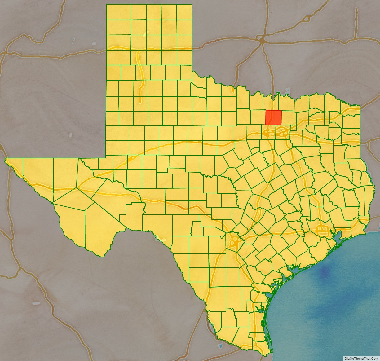
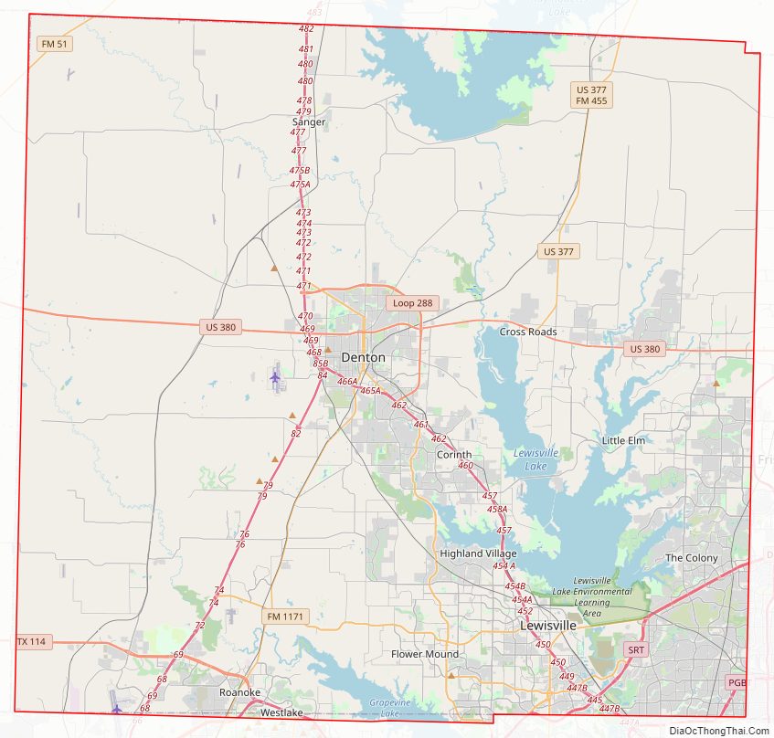
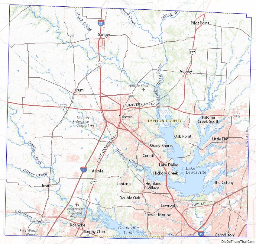
Denton County Road Map
Geography
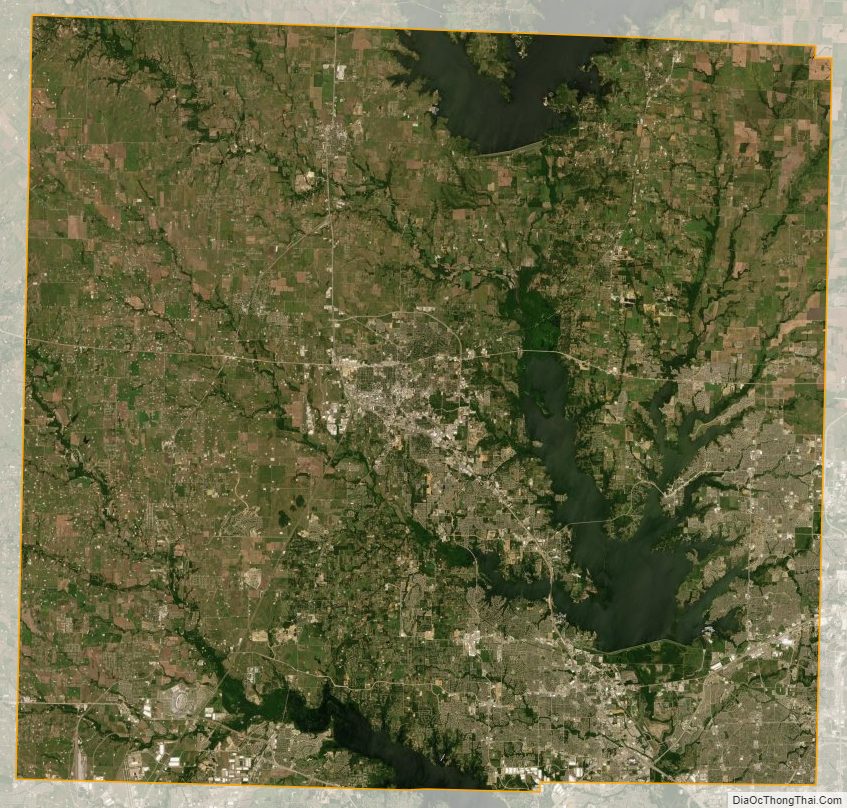
According to the U.S. Census Bureau, the county has a total area of 953 square miles (2,470 km), of which 878 square miles (2,270 km) are land and 75 square miles (190 km) (7.8%) are covered by water. Denton County is located in the northern part of the Dallas–Fort Worth metroplex, about 35 miles south of the border between Texas and Oklahoma. It is drained by two forks of the Trinity River. The largest body of water in Denton County is Lewisville Lake, which was formed in 1954 when the Garza–Little Elm Reservoir was merged with Lake Dallas. The county is on the western edge of the eastern Cross Timbers and also encompasses parts of the Grand Prairie portion of the Texas blackland prairies. Portions of Denton County sit atop the Barnett shale, a geological formation believed to contain large quantities of natural shale gas. Between 1995 and 2007, the number of natural gas wells in the county increased from 156 to 1,820, which has led to some controversy over the pollution associated with hydraulic fracturing.
Lakes
- Lewisville Lake
- Lake Ray Roberts
Adjacent counties
- Cooke County (north)
- Grayson County (northeast)
- Collin County (east)
- Dallas County (southeast)
- Tarrant County (south)
- Wise County (west)
Denton County Topographic Map
Denton County Satellite Map
Denton County Outline Map