Lewisville (/ˈluːɪsvɪl/ LOO-iss-vil) is a city in the U.S. state of Texas, predominantly within Denton County with a small part lying within Dallas County. As a suburban community within the Dallas–Fort Worth metroplex, the 2020 census tabulated a population of 111,822.
Originally called Holford’s Prairie, Lewisville dates back to the early 1840s. The arrival of the town’s first railroad in 1881 engendered its initial growth, and the expansion of the area’s transportation infrastructure spurred further development in the early part of the 20th century. Lewisville incorporated in 1925, and when construction of Lewisville Lake was completed in the 1950s, the city began to expand rapidly.
Lewisville’s proximity to Lewisville Lake has made it a recreational hub of the Dallas–Fort Worth metroplex. The area’s transportation infrastructure has evolved around the I-35 Corridor along Interstate 35E. The diversity of its population and industry has created a stable economic climate. Lewisville Independent School District provides most of the area’s public education programs.
| Name: | Lewisville city |
|---|---|
| LSAD Code: | 25 |
| LSAD Description: | city (suffix) |
| State: | Texas |
| County: | Dallas County, Denton County |
| Incorporated: | January 15, 1925 (1925-01-15) |
| Elevation: | 469 ft (143 m) |
| Total Area: | 43.22 sq mi (111.94 km²) |
| Land Area: | 37.01 sq mi (95.85 km²) |
| Water Area: | 6.21 sq mi (16.09 km²) |
| Total Population: | 113,760 |
| Population Density: | 2,951.04/sq mi (1,139.39/km²) |
| ZIP code: | 75029, 75057, 75067, 75077 |
| Area code: | 214, 469, 972 |
| FIPS code: | 4842508 |
| GNISfeature ID: | 2410829 |
| Website: | www.cityoflewisville.com |
Online Interactive Map
Click on ![]() to view map in "full screen" mode.
to view map in "full screen" mode.
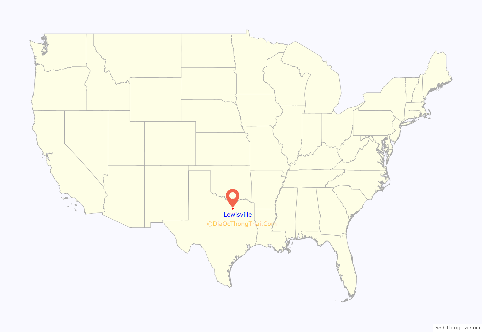
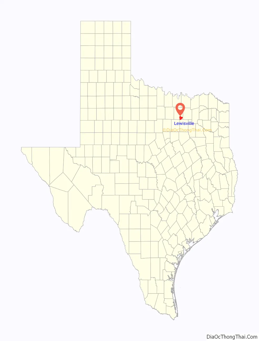
Lewisville location map. Where is Lewisville city?
History
Settlement
In 1841, the Republic of Texas chartered the Peters Colony Land Grant Company (named for William Smalling Peters, publisher of the song “Oh! Susanna”) to settle the North Texas area. In 1844, John W. King and his wife settled on the east side of the prairie, where the city now lies. Baptist settlers from Platte County, Missouri, settled on the west side; among them were John and James Holford, who named the area Holford’s Prairie. Further south, Presbyterians established a church and called it Flower Mound. In the confusion over land ownership after the Hedgcoxe War, Basdeal Lewis purchased Holford’s Prairie in 1853 and renamed it after himself.
In 1845, the Fox family, which owned about a dozen slaves, buried a slave child called Melinda on the family farm, which eventually became the town’s cemetery for black residents. Named Fox–Hembry Cemetery, the plot still exists today. After it had fallen into disrepair, local residents and businesses gathered to restore it in 2011. Though Abraham Lincoln was not on the ballot in the area for the 1860 Presidential election, residents of Lewisville (listed as “Hollforts” on election results) still gave John C. Breckinridge only a 44–31 majority over an electoral fusion option.
During Reconstruction, Lewisville became home to Denton County’s first cotton gin. Built in 1867, it could produce up to three bales per day. The Thirteenth Texas Legislature chartered the Dallas and Wichita Railroad (later the Missouri–Kansas–Texas) on terms requiring 20 miles of track to be in running order by July 1, 1875. Lewisville paid the company $15,000 to come to the city, with a promise of another $5,000 on completion. The company fulfilled the deal by completing the railroad tracks to a point just south of Lewisville on the morning of the deadline, and the line began running full-time in 1881. Republicans in the Fourteenth Texas Legislature passed a law on April 30, 1874, prohibiting alcohol within two miles of the town. Many residents ignored the law, however, and the city retained as many as 17 saloons at one point. The population of the unincorporated town was 500 in 1888.
Progress
On January 15, 1925, residents voted by a margin of 17 votes to incorporate Lewisville, which established its official boundaries as a city. By 1930, Lewisville’s population had increased to 853, making it the fourth-most populous municipality in Denton County (behind Denton, Sanger, and Pilot Point).
Because the city’s economy had become diversified before the Wall Street Crash of 1929, Lewisville was relatively well insulated from the Great Depression. Many residents, including business leaders, nevertheless supported the New Deal programs of Franklin D. Roosevelt. By 1936, the Works Progress Administration operated a cannery in the city to provide temporary jobs for unemployed residents. As an extension of the Good Roads Movement, which had been prominent in Denton County since the early 1910s, residents formed the Good Roads Committee of Lewisville to lobby state and federal officials for funding to create better streets. Lewisville celebrated the paving of the U.S. Route 77 between Denton and Dallas in 1931 with a “Coming Out of the Mud” ceremony. The new pavement closed the “Lewisville Gap” between the two cities, a stretch of dirt road through the city that often became too muddy for travel.
The new road also led indirectly to the downfall of the area’s public transportation system. Between 1925 and 1932, the Texas Interurban Railway, an electric commuter rail service that ran from Dallas to Denton, operated a station in Lewisville. Business leaders in the Lewisville Chamber of Commerce welcomed the service at the time, proudly citing the city’s progressive citizenship. The area’s low population density could not sustain the venture, however, and in 1932, the line went out of business and immediately halted service.
On April 25, 1934, Raymond Hamilton of the Barrow gang robbed the First National Bank of Lewisville. Residents chased him to Howe, Texas, where he was captured at a roadblock and transferred to Dallas County Jail.
Growth
Lewisville’s rapid growth began when construction of the Garza–Little Elm Dam finished in 1954, expanding the Garza–Little Elm Reservoir into what is now Lewisville Lake. The city adopted a home-rule charter for a council–manager style of municipal government in 1963, becoming one of only a few home-rule cities in Texas with a population less than 5,000. In September 1969, 13 days after Woodstock, the city hosted the Texas International Pop Festival, which drew over 150,000 spectators and featured performances by Janis Joplin, B.B. King, and Led Zeppelin. In 2011, the Texas Historical Commission dedicated a historical event marker at the Hebron A-train station in Lewisville to commemorate the event.
When Dallas/Fort Worth International Airport opened to the south of the city in 1974 and Vista Ridge Mall opened at the intersection of Interstate 35E and Round Grove Road in 1989, Lewisville began to undergo rapid suburban growth. Its population increased from 24,273 in 1980 to 46,521 in 1990, making it the 40th-most populous city in Texas. In the early 1990s, the Lewisville Chamber of Commerce marketed the city with the slogan “City of Expanding Horizons”. Its population reached 77,737 in 2000 and 95,290 in 2010.
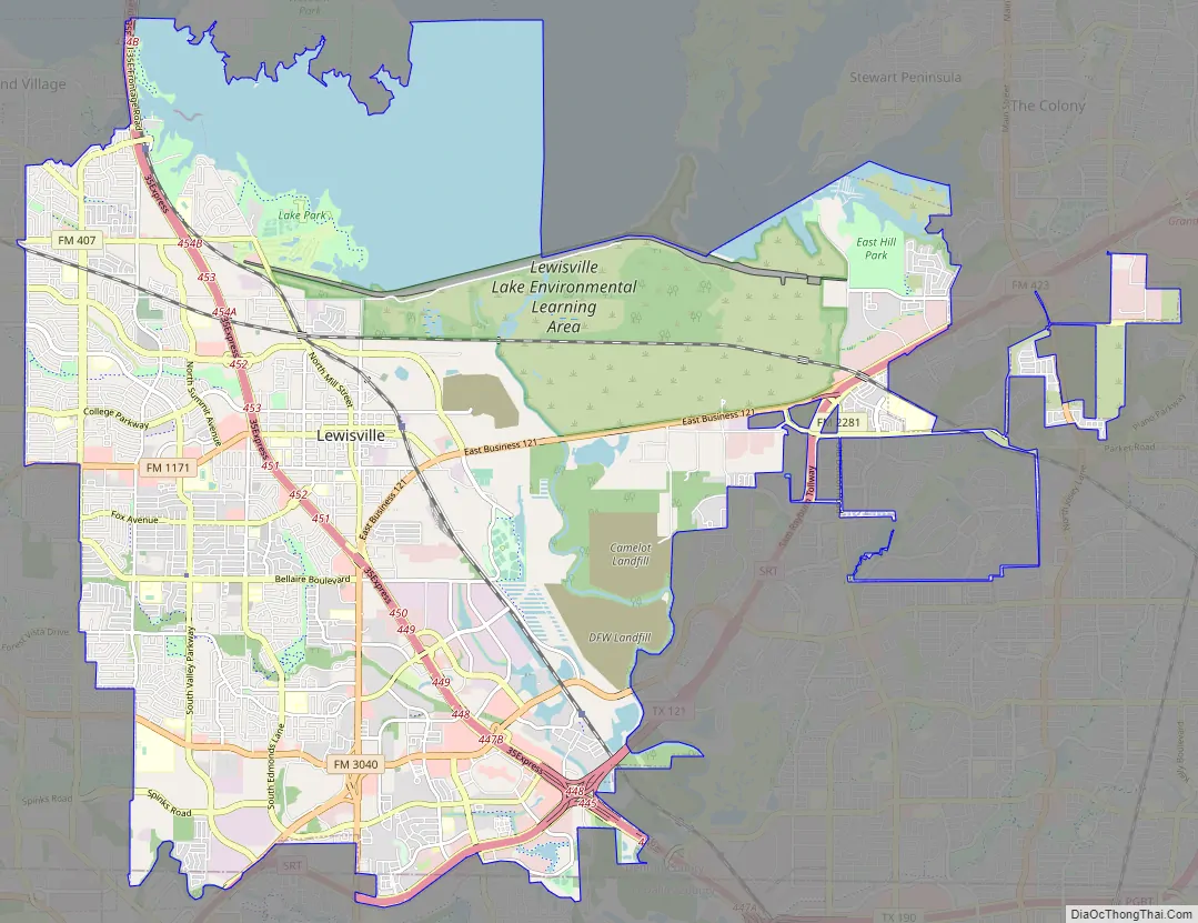
Lewisville Road Map
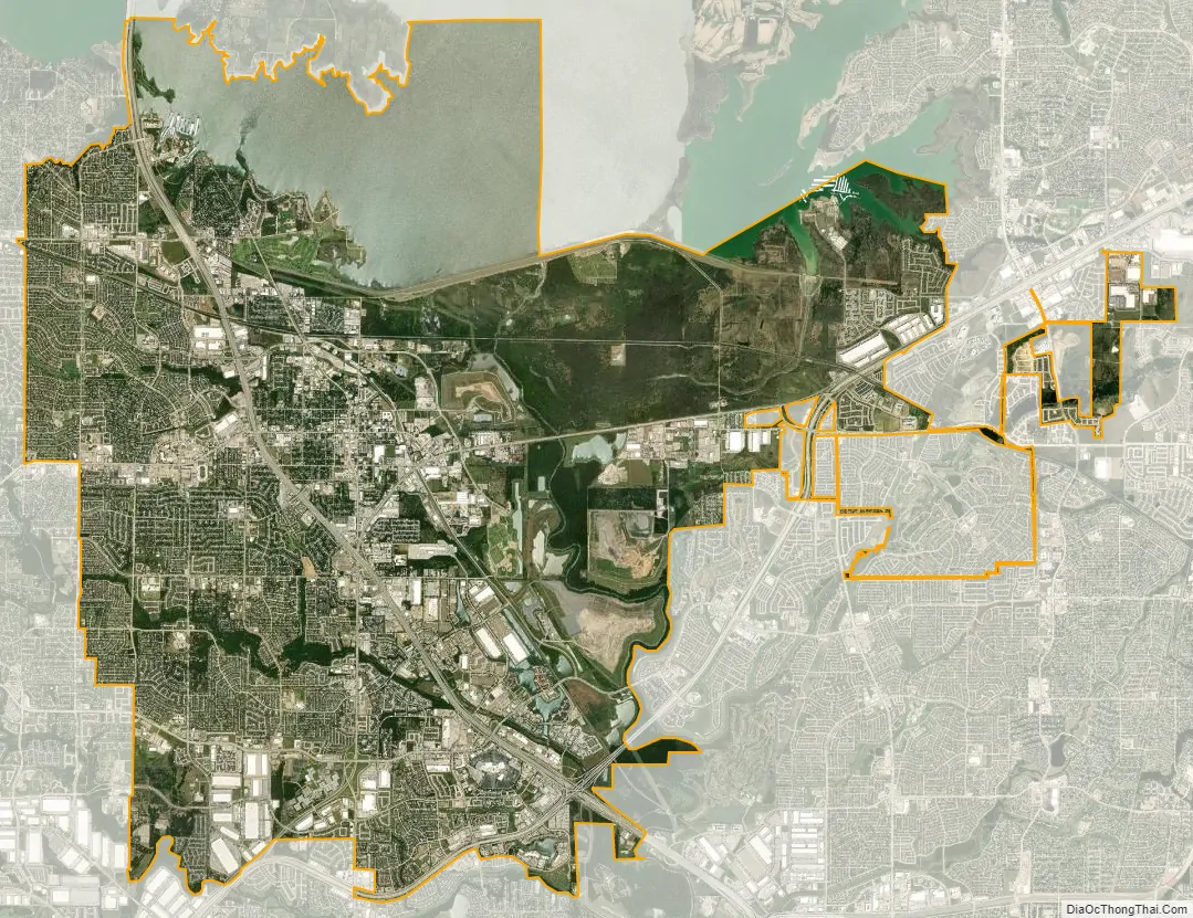
Lewisville city Satellite Map
Geography
Lewisville is at 33°2′18″N 97°0′22″W / 33.03833°N 97.00611°W / 33.03833; -97.00611 (33.038316, −97.006232) at an elevation of about 550 feet (170 m). It has a total area of 42.5 square miles (110 km), of which 6.1 sq mi (16 km) is covered by water. It lies at the southern end of Denton County and the northern end of the Dallas–Fort Worth metroplex, in the eastern part of the Cross Timbers region of Texas between the Texas Blackland Prairies and the Grand Prairie. Vista Ridge, a small plateau, is in the southeast corner of Lewisville, and the lowest part of Denton County, at 484 feet (148 m), is found in the city. Lewisville sits above the Barnett Shale, a geological formation containing a large quantity of natural shale gas.
Water constitutes about 14% of the city’s total area, including Lewisville Lake, the Elm Fork of the Trinity River, and two local tributaries of the Elm Fork – Prairie Creek and Timber Creek. A riparian zone encompasses a portion of the city in the southeast. The intersection of the Elm Fork and Lake Lewisville has given rise to a delta at the southern end of the lake, extending 6.9 miles (11.1 km) south. The Federal Emergency Management Agency has labeled much of the area surrounding the delta as “Zone AE”, meaning the area is subject to 100-year flood precautions.
Climate
Lewisville’s climate is classified as humid subtropical. Its Köppen climate classification is Cfa, which means it has a temperate climate, does not have a dry season, and has a hot summer. According to the United States Department of Agriculture, Lewisville is in a hardiness zone of 8a. The city is seldom affected by extreme weather, but Hurricane Carla in 1961 brought 86-mile-per-hour (138 km/h) winds and caused 6-foot (1.8 m) swells on Lewisville Lake. During heavy rains, Timber Creek can overflow its banks, and on rare occasions, flood some of the surrounding homes. The National Weather Service defines no official borders for Tornado Alley, but Lewisville is considered to be in it.
See also
Map of Texas State and its subdivision:- Anderson
- Andrews
- Angelina
- Aransas
- Archer
- Armstrong
- Atascosa
- Austin
- Bailey
- Bandera
- Bastrop
- Baylor
- Bee
- Bell
- Bexar
- Blanco
- Borden
- Bosque
- Bowie
- Brazoria
- Brazos
- Brewster
- Briscoe
- Brooks
- Brown
- Burleson
- Burnet
- Caldwell
- Calhoun
- Callahan
- Cameron
- Camp
- Carson
- Cass
- Castro
- Chambers
- Cherokee
- Childress
- Clay
- Cochran
- Coke
- Coleman
- Collin
- Collingsworth
- Colorado
- Comal
- Comanche
- Concho
- Cooke
- Coryell
- Cottle
- Crane
- Crockett
- Crosby
- Culberson
- Dallam
- Dallas
- Dawson
- Deaf Smith
- Delta
- Denton
- Dewitt
- Dickens
- Dimmit
- Donley
- Duval
- Eastland
- Ector
- Edwards
- El Paso
- Ellis
- Erath
- Falls
- Fannin
- Fayette
- Fisher
- Floyd
- Foard
- Fort Bend
- Franklin
- Freestone
- Frio
- Gaines
- Galveston
- Garza
- Gillespie
- Glasscock
- Goliad
- Gonzales
- Gray
- Grayson
- Gregg
- Grimes
- Guadalupe
- Hale
- Hall
- Hamilton
- Hansford
- Hardeman
- Hardin
- Harris
- Harrison
- Hartley
- Haskell
- Hays
- Hemphill
- Henderson
- Hidalgo
- Hill
- Hockley
- Hood
- Hopkins
- Houston
- Howard
- Hudspeth
- Hunt
- Hutchinson
- Irion
- Jack
- Jackson
- Jasper
- Jeff Davis
- Jefferson
- Jim Hogg
- Jim Wells
- Johnson
- Jones
- Karnes
- Kaufman
- Kendall
- Kenedy
- Kent
- Kerr
- Kimble
- King
- Kinney
- Kleberg
- Knox
- La Salle
- Lamar
- Lamb
- Lampasas
- Lavaca
- Lee
- Leon
- Liberty
- Limestone
- Lipscomb
- Live Oak
- Llano
- Loving
- Lubbock
- Lynn
- Madison
- Marion
- Martin
- Mason
- Matagorda
- Maverick
- McCulloch
- McLennan
- McMullen
- Medina
- Menard
- Midland
- Milam
- Mills
- Mitchell
- Montague
- Montgomery
- Moore
- Morris
- Motley
- Nacogdoches
- Navarro
- Newton
- Nolan
- Nueces
- Ochiltree
- Oldham
- Orange
- Palo Pinto
- Panola
- Parker
- Parmer
- Pecos
- Polk
- Potter
- Presidio
- Rains
- Randall
- Reagan
- Real
- Red River
- Reeves
- Refugio
- Roberts
- Robertson
- Rockwall
- Runnels
- Rusk
- Sabine
- San Augustine
- San Jacinto
- San Patricio
- San Saba
- Schleicher
- Scurry
- Shackelford
- Shelby
- Sherman
- Smith
- Somervell
- Starr
- Stephens
- Sterling
- Stonewall
- Sutton
- Swisher
- Tarrant
- Taylor
- Terrell
- Terry
- Throckmorton
- Titus
- Tom Green
- Travis
- Trinity
- Tyler
- Upshur
- Upton
- Uvalde
- Val Verde
- Van Zandt
- Victoria
- Walker
- Waller
- Ward
- Washington
- Webb
- Wharton
- Wheeler
- Wichita
- Wilbarger
- Willacy
- Williamson
- Wilson
- Winkler
- Wise
- Wood
- Yoakum
- Young
- Zapata
- Zavala
- Alabama
- Alaska
- Arizona
- Arkansas
- California
- Colorado
- Connecticut
- Delaware
- District of Columbia
- Florida
- Georgia
- Hawaii
- Idaho
- Illinois
- Indiana
- Iowa
- Kansas
- Kentucky
- Louisiana
- Maine
- Maryland
- Massachusetts
- Michigan
- Minnesota
- Mississippi
- Missouri
- Montana
- Nebraska
- Nevada
- New Hampshire
- New Jersey
- New Mexico
- New York
- North Carolina
- North Dakota
- Ohio
- Oklahoma
- Oregon
- Pennsylvania
- Rhode Island
- South Carolina
- South Dakota
- Tennessee
- Texas
- Utah
- Vermont
- Virginia
- Washington
- West Virginia
- Wisconsin
- Wyoming


