Denton is a city in and the county seat of Denton County, Texas, United States. With a population of 139,869 as of 2020, it is the 27th-most populous city in Texas, the 197th-most populous city in the United States, and the 12th-most populous city in the Dallas–Fort Worth metroplex.
A Texas land grant led to the formation of Denton County in 1846, and the city was incorporated in 1866. Both were named after pioneer and Texas militia captain John B. Denton. The arrival of a railroad line in the city in 1881 spurred population, and the establishment of the University of North Texas in 1890 and Texas Woman’s University in 1901 distinguished the city from neighboring regions. After the construction of Dallas/Fort Worth International Airport finished in 1974, the city had more rapid growth; as of 2011, Denton was the seventh-fastest growing city with a population of over 100,000 in the country.
Located on the far north end of the Dallas–Fort Worth metroplex in North Texas on Interstate 35, Denton is known for its active music scene; the North Texas State Fair and Rodeo, Denton Arts and Jazz Festival, and Thin Line Fest attract over 300,000 people to the city each year. The city has hot, humid summers and few extreme weather events. Its diverse citizenry is represented by a nonpartisan city council, and numerous county and state departments have offices in the city. With over 45,000 students enrolled at the two universities within its city limits, Denton is often characterized as a college town. As a result of the universities’ growth, educational services play a large role in the city’s economy. Residents are served by the Denton County Transportation Authority, which provides commuter rail and bus service to the area.
| Name: | Denton city |
|---|---|
| LSAD Code: | 25 |
| LSAD Description: | city (suffix) |
| State: | Texas |
| County: | Denton County |
| Incorporated: | 1866 |
| Elevation: | 659 ft (201 m) |
| Land Area: | 96.35 sq mi (249.55 km²) |
| Water Area: | 1.60 sq mi (4.14 km²) 1.527% |
| Population Density: | 1,451.68/sq mi (560.49/km²) |
| Area code: | 940, 682,817 |
| FIPS code: | 4819972 |
| GNISfeature ID: | 2410323 |
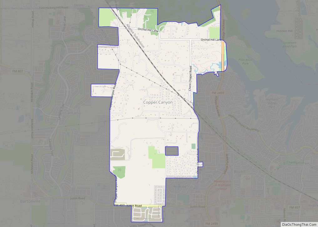
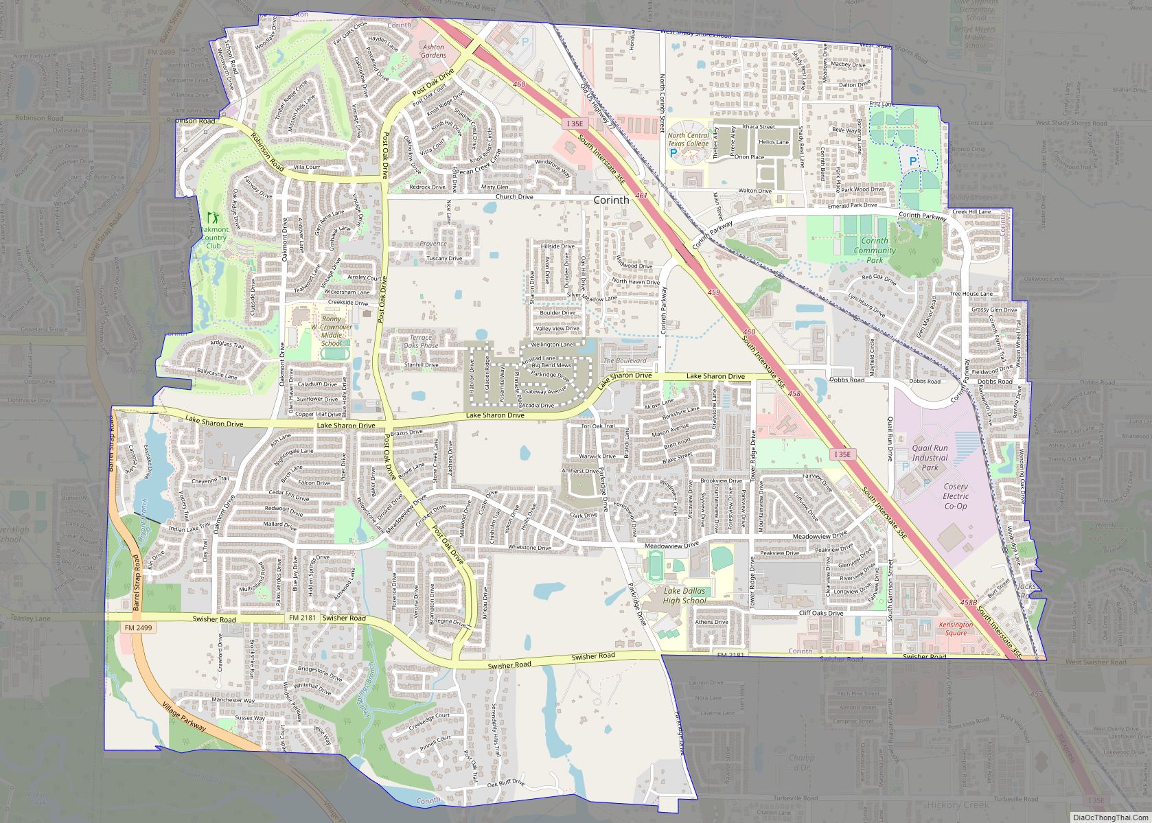
Online Interactive Map
Click on ![]() to view map in "full screen" mode.
to view map in "full screen" mode.
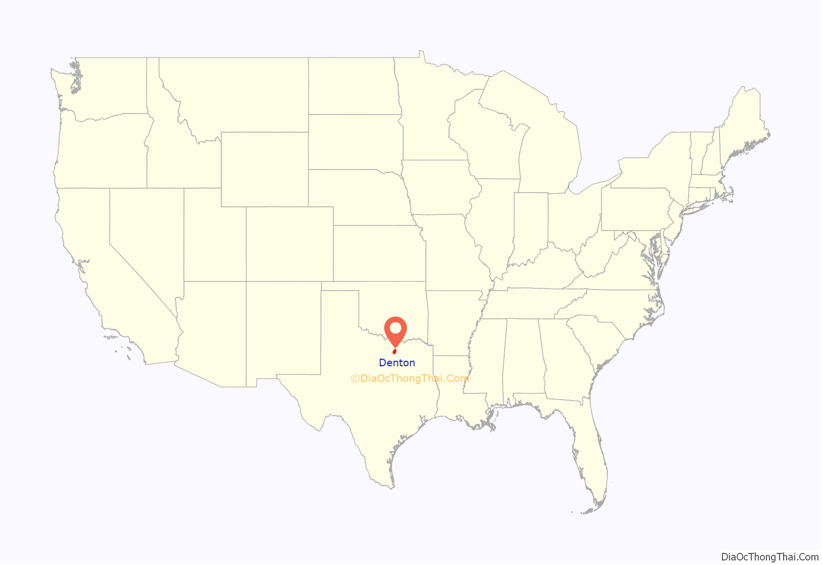
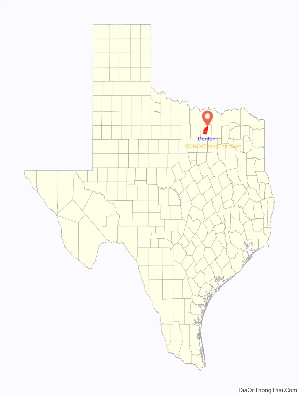
Denton location map. Where is Denton city?
History
Denton’s formation is closely tied to that of Denton County. White settlement of the area began in the mid-1800s when William S. Peters of Kentucky obtained a land grant from the Texas Congress and named it Peters Colony. After initial settlement in the southeast part of the county in 1843, the Texas Legislature voted to form Denton County in 1846. Both the county and the town were named for John B. Denton, a preacher and lawyer who was killed in 1841 during a skirmish with the Kichai people in what is now Tarrant County. Pickneyville and Alton were selected as the county seat before Denton was named the seat in 1857. That year, a commission laid out the city and named the first streets.
On July 8, 1860, approximately half of the downtown Square burned down in what was later called the “Texas Troubles”. Fires occurred in ten Texas communities that day, including Dallas and Pilot Point, and were quickly attributed to a slave insurrection. By the end of July, vigilante justice took hold and “[r]egularly constituted law-enforcement agencies stepped aside to allow the vigilantes to do their work. Although no hard evidence was ever adduced to prove the guilt of a single alleged black arsonist or white abolitionist, many unfortunates of both classes were nevertheless hanged for their alleged crimes.”
In February 1861, a statewide referendum was held and Texans voted to join the Confederate States of America.
Post–Civil War
Denton incorporated in 1866; its first mayor was J.B. Sawyer. As the city expanded beyond its original boundaries (which extended half a mile in every direction from center of the public square), it became an agricultural trade center for the mill and cottage industries. The arrival of the Texas and Pacific Railway in 1881 gave Denton its first rail connection and brought an influx of people to the area. North Texas Normal College, now the University of North Texas, was established in 1890, and the Girls’ Industrial College, now Texas Woman’s University, was founded in 1901. As the universities increased in size, their impact on Denton’s economy and culture increased. Electricity came to Denton in 1905 with the creation of Denton Municipal Electric.
Segregation and Jim Crow era
After the Civil War, “Freedmen Settlements” were started throughout the South. One Freedman Settlement, Quakertown, thrived just south of what is now Texas Woman’s University until around 1920, when the city government forcibly removed the residents to make way for a park. Quakertown’s Black children were served separately from white children by the Frederick Douglass School. Originally scheduled to open in September 1913, it was mysteriously burned down the night before its scheduled opening. It was rebuilt and in 1949 renamed the “Fred Moore School”.
Postwar growth
Denton’s population grew from 26,844 in 1960 to 48,063 in 1980. Its connection to the Dallas–Fort Worth metroplex via I-35E and I-35W played a major role in the growth, and the opening of Dallas/Fort Worth International Airport in 1974 led to a population increase. In the 1980s, heavy manufacturing companies like Victor Equipment Company and Peterbilt joined older manufacturing firms such as Moore Business Forms and Morrison Milling Company in Denton. The population rose from 66,270 in 1990 to 80,537 in 2000. In May 2006, Houston-based real estate company United Equities purchased the 100-block of Fry Street and announced that several of the historic buildings would be demolished and the businesses displaced to accommodate a new mixed-use commercial center. Some residents, who sought to preserve the area as a historic and cultural icon, opposed the proposal. The Denton City Council approved a new proposal for the area from Dinerstein Cos in 2010.
- 1857
- Seat of Denton County relocated to Denton from Alton
- First Methodist Church founded.
- County Courthouse built.
- 1858 – Union Baptist Church founded
- 1866 – Town of Denton incorporated
- 1868 – Denton Monitor newspaper began publication
- 1869 – J.B. Sawyer became mayor.
- 1870 – Denton (and Texas) readmitted to the Union after the American Civil War, per Reconstruction Acts
- 1880 – Population: 1,194
- 1881 – Railroad began operating
- 1882
- Denton Chronicle newspaper began publication
- Fire station built
- 1890 – North Texas Normal College opened
- 1894 – City Hall built
- 1896
- Streetcar began operating
- Denton County Courthouse rebuilt.
- 1899 – Denton Record and Chronicle newspaper in publication
- 1900 – Population: 4,187
- 1903 – Girls’ Industrial College established
- 1907
- Trolley began operating
- Rector Road Bridge built.
- 1914 – City of Denton incorporated
- 1916 – College’s Campus Chat newspaper begins publication
- 1920 – City police department and Rotary Club established
- 1921 – Denton County League of Women Voters formed
- 1923 – Public park created in Quakertown
- 1927 – Denton City Hall built
- 1930 – Population: 9,587
- 1933 – Public library opened
- 1939 – KDNT radio began broadcasting
- 1941 – Little Chapel in the Woods built
- 1947 – Denton Municipal Airport began operating
- 1950 – Population: 21,372
- 1954 – Federal Civil Defense Administration regional office relocated to Denton from Dallas.
- 1959 – Council-manager form of government adopted
- 1960 – Denton State School established
- 1961 – North Texas State University active
- 1966
- Civic Center built
- Denton joined the North Central Texas Council of Governments (approximate date)
- 1969 – Denton Community Theatre active
- 1974 – Dallas–Fort Worth Regional Airport operating in vicinity of Denton
- 1979 – Courthouse-on-the-Square Museum opened
- 1980
- Golden Triangle Mall in business
- Population: 48,063.
- 1987 – North Texas State University Press headquartered in Denton
- 1988 – North Texas State University renamed University of North Texas
- 1996 – City website online (approximate date)
- 2000 – Population: 80,537
- 2003
- Public swimming pool opened
- Michael C. Burgess became U.S. representative for Texas’s 26th congressional district
- 2010 – Population: 113,383
- 2011 – Downtown Denton Transit Center and University of North Texas’ Apogee Stadium opened
- 2014 – Chris Watts became mayor
- 2015 – Friendship City relationship formalized with Santa Rosa de Múzquiz, Mexico.
- 2020 – Gerard Hudspeth became Denton’s first African-American mayor.
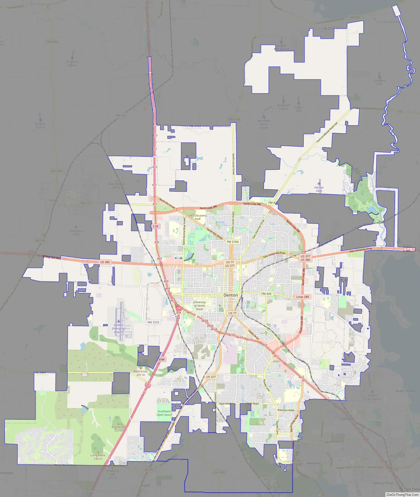
Denton Road Map
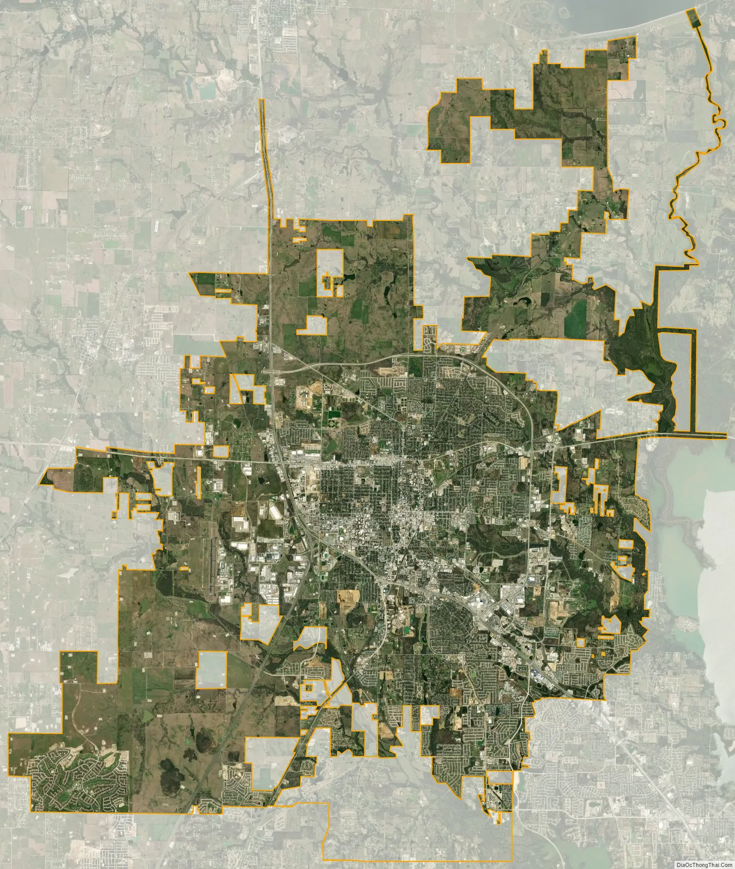
Denton city Satellite Map
Geography
Denton is on the northern edge of the Dallas–Fort Worth metropolitan area. These three cities form the area known as the “Golden Triangle of North Texas”. According to the United States Census Bureau, the city has an area of 89.316 square miles (231.33 km), of which 87.952 square miles (227.79 km) is land and 1.364 square miles (3.53 km) is covered by water. The city lies in the northeast edge of the Bend Arch–Fort Worth Basin, which is characterized by flat terrain. Elevation ranges from 500 to 900 feet (150 to 270 m). Part of the city is atop the Barnett Shale, a geological formation believed to contain large quantities of natural gas. Lewisville Lake, a man-made reservoir, is 15 miles (24 km) south of the city.
Climate
With its hot, humid summers and cool winters, Denton’s climate is characterized as humid subtropical and is within USDA hardiness zone 8a. The city’s all-time high temperature is 113 °F (45 °C), recorded in 1954. Dry winds affect the area in the summer and can bring temperatures of over 100 °F (38 °C), although the average summer temperature highs range from 91 to 96 °F (33 to 36 °C) between June and August. The all-time recorded low is −6 °F (−21 °C), set on February 16, 2021, and the coolest month is January, with daily low temperatures averaging 33 °F (1 °C). Denton lies on the southern end of what is commonly referred to as “Tornado Alley”; the National Weather Service occasionally issues tornado watches, but tornadoes rarely form in the city. The city receives about 37.7 inches (96 cm) of rain per year. Flash floods and severe thunderstorms are frequent in the spring. Average snowfall is similar to the Dallas–Fort Worth average of 2.4 inches (6.1 cm) per year.
See also
Map of Texas State and its subdivision:- Anderson
- Andrews
- Angelina
- Aransas
- Archer
- Armstrong
- Atascosa
- Austin
- Bailey
- Bandera
- Bastrop
- Baylor
- Bee
- Bell
- Bexar
- Blanco
- Borden
- Bosque
- Bowie
- Brazoria
- Brazos
- Brewster
- Briscoe
- Brooks
- Brown
- Burleson
- Burnet
- Caldwell
- Calhoun
- Callahan
- Cameron
- Camp
- Carson
- Cass
- Castro
- Chambers
- Cherokee
- Childress
- Clay
- Cochran
- Coke
- Coleman
- Collin
- Collingsworth
- Colorado
- Comal
- Comanche
- Concho
- Cooke
- Coryell
- Cottle
- Crane
- Crockett
- Crosby
- Culberson
- Dallam
- Dallas
- Dawson
- Deaf Smith
- Delta
- Denton
- Dewitt
- Dickens
- Dimmit
- Donley
- Duval
- Eastland
- Ector
- Edwards
- El Paso
- Ellis
- Erath
- Falls
- Fannin
- Fayette
- Fisher
- Floyd
- Foard
- Fort Bend
- Franklin
- Freestone
- Frio
- Gaines
- Galveston
- Garza
- Gillespie
- Glasscock
- Goliad
- Gonzales
- Gray
- Grayson
- Gregg
- Grimes
- Guadalupe
- Hale
- Hall
- Hamilton
- Hansford
- Hardeman
- Hardin
- Harris
- Harrison
- Hartley
- Haskell
- Hays
- Hemphill
- Henderson
- Hidalgo
- Hill
- Hockley
- Hood
- Hopkins
- Houston
- Howard
- Hudspeth
- Hunt
- Hutchinson
- Irion
- Jack
- Jackson
- Jasper
- Jeff Davis
- Jefferson
- Jim Hogg
- Jim Wells
- Johnson
- Jones
- Karnes
- Kaufman
- Kendall
- Kenedy
- Kent
- Kerr
- Kimble
- King
- Kinney
- Kleberg
- Knox
- La Salle
- Lamar
- Lamb
- Lampasas
- Lavaca
- Lee
- Leon
- Liberty
- Limestone
- Lipscomb
- Live Oak
- Llano
- Loving
- Lubbock
- Lynn
- Madison
- Marion
- Martin
- Mason
- Matagorda
- Maverick
- McCulloch
- McLennan
- McMullen
- Medina
- Menard
- Midland
- Milam
- Mills
- Mitchell
- Montague
- Montgomery
- Moore
- Morris
- Motley
- Nacogdoches
- Navarro
- Newton
- Nolan
- Nueces
- Ochiltree
- Oldham
- Orange
- Palo Pinto
- Panola
- Parker
- Parmer
- Pecos
- Polk
- Potter
- Presidio
- Rains
- Randall
- Reagan
- Real
- Red River
- Reeves
- Refugio
- Roberts
- Robertson
- Rockwall
- Runnels
- Rusk
- Sabine
- San Augustine
- San Jacinto
- San Patricio
- San Saba
- Schleicher
- Scurry
- Shackelford
- Shelby
- Sherman
- Smith
- Somervell
- Starr
- Stephens
- Sterling
- Stonewall
- Sutton
- Swisher
- Tarrant
- Taylor
- Terrell
- Terry
- Throckmorton
- Titus
- Tom Green
- Travis
- Trinity
- Tyler
- Upshur
- Upton
- Uvalde
- Val Verde
- Van Zandt
- Victoria
- Walker
- Waller
- Ward
- Washington
- Webb
- Wharton
- Wheeler
- Wichita
- Wilbarger
- Willacy
- Williamson
- Wilson
- Winkler
- Wise
- Wood
- Yoakum
- Young
- Zapata
- Zavala
- Alabama
- Alaska
- Arizona
- Arkansas
- California
- Colorado
- Connecticut
- Delaware
- District of Columbia
- Florida
- Georgia
- Hawaii
- Idaho
- Illinois
- Indiana
- Iowa
- Kansas
- Kentucky
- Louisiana
- Maine
- Maryland
- Massachusetts
- Michigan
- Minnesota
- Mississippi
- Missouri
- Montana
- Nebraska
- Nevada
- New Hampshire
- New Jersey
- New Mexico
- New York
- North Carolina
- North Dakota
- Ohio
- Oklahoma
- Oregon
- Pennsylvania
- Rhode Island
- South Carolina
- South Dakota
- Tennessee
- Texas
- Utah
- Vermont
- Virginia
- Washington
- West Virginia
- Wisconsin
- Wyoming