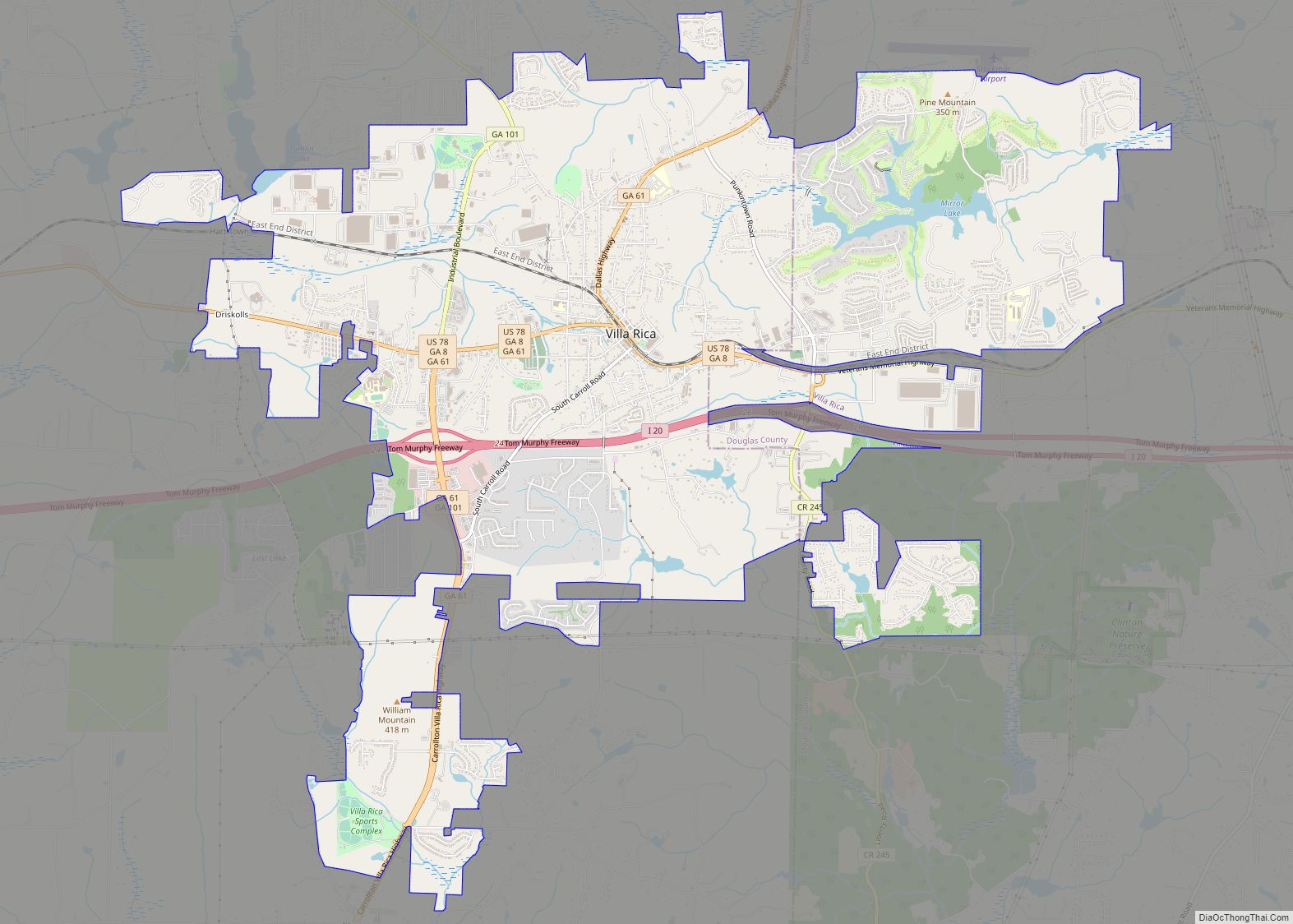
Douglas County is a county located in the north central portion of the U.S. state of Georgia. As of the 2020 U.S. Census, the population was 144,237, having more than doubled since 1990. The county seat is Douglasville. Douglas County is included in the Atlanta-Sandy Springs-Roswell, GA Metropolitan Statistical Area. It has attracted new residents as jobs have increased in the Atlanta area.
| Name: | Douglas County |
|---|---|
| FIPS code: | 13-097 |
| State: | Georgia |
| Founded: | 1870 |
| Named for: | Stephen A. Douglas |
| Seat: | Douglasville |
| Largest city: | Douglasville |
| Total Area: | 201 sq mi (520 km²) |
| Land Area: | 200 sq mi (500 km²) |
| Total Population: | 144,237 |
| Population Density: | 721/sq mi (278/km²) |
| Time zone: | UTC−5 (Eastern) |
| Summer Time Zone (DST): | UTC−4 (EDT) |
| Website: | www.douglascountygeorgia.com |
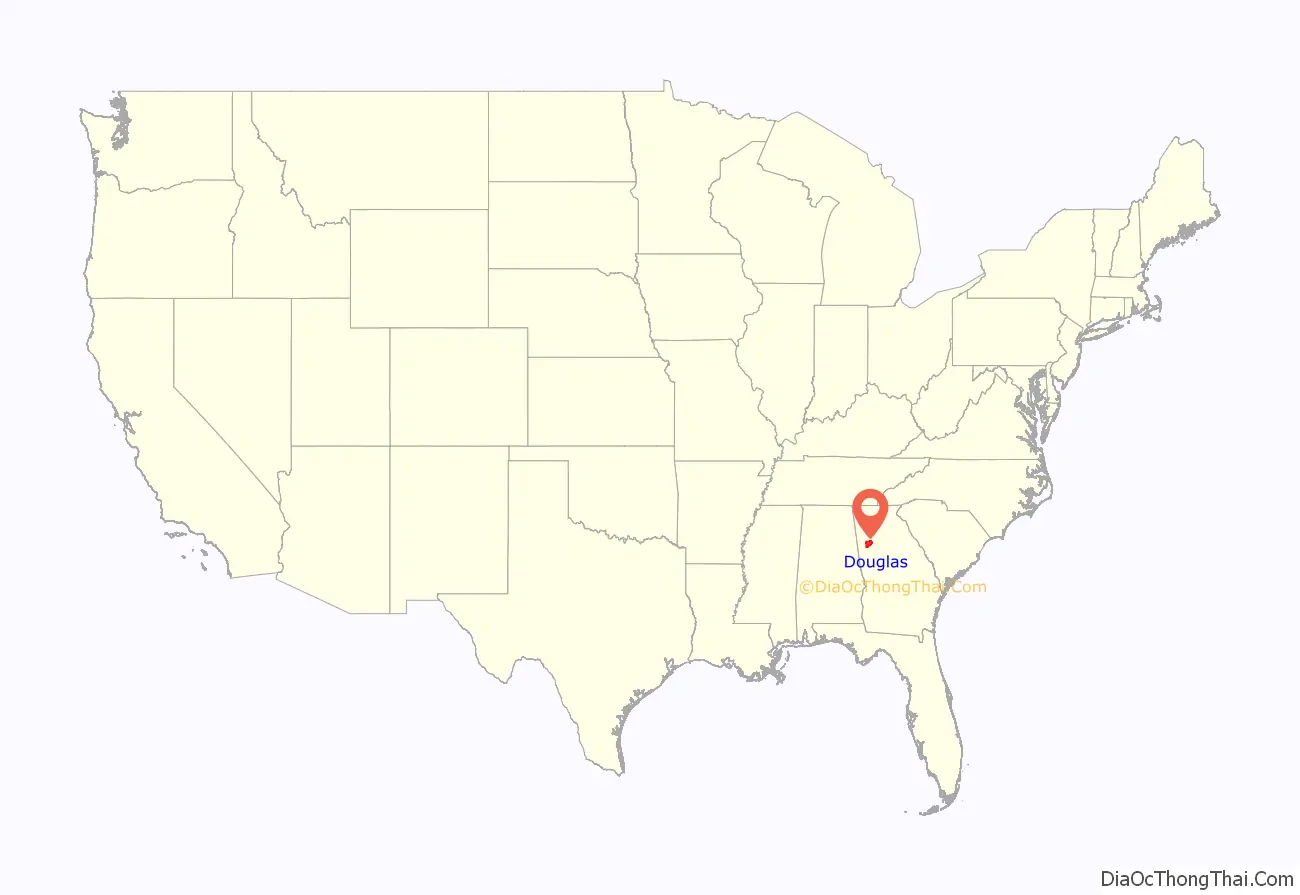
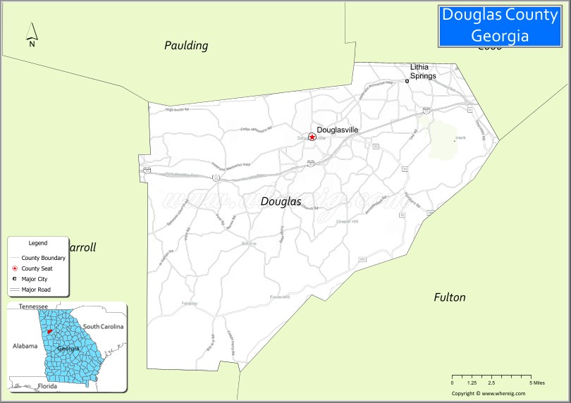
Douglas County location map. Where is Douglas County?
History
The county was created during Reconstruction after the American Civil War. The Georgia General Assembly named it after Stephen A. Douglas, an Illinois senator and the Democratic opponent of Abraham Lincoln in the presidential election of 1860. The existing historical marker says:
Historical Marker:
The act creating Douglas County provided that in November 1870, voters of the new county would elect county officers, and vote to select the site of the county seat. In the election, some voters chose a site near the center of the county, but a larger number voted for the settlement known as “Skinned Chestnut” or “Skin(t) Chestnut,” based on a Creek Indian landmark tree. The courthouse commissioners chose this site as county seat and proceeded to sell lots and build a courthouse. It later changed its name to Douglasville.
A group of citizens filed suit against the commissioners. The case ultimately went to the Supreme Court of Georgia, which ruled against the commissioners. Both sides agreed to postpone further action until the route of the Georgia Western Railroad through Douglas County was determined. The General Assembly enacted legislation on Feb. 28, 1874, directing that an election be held on Apr. 7, 1874, to determine the location of the county seat—but with the provision that the site be located on the Georgia Western Railroad. In the election, voters confirmed Douglasville as the county seat. On Feb. 25, 1875, the General Assembly incorporated Douglasville.
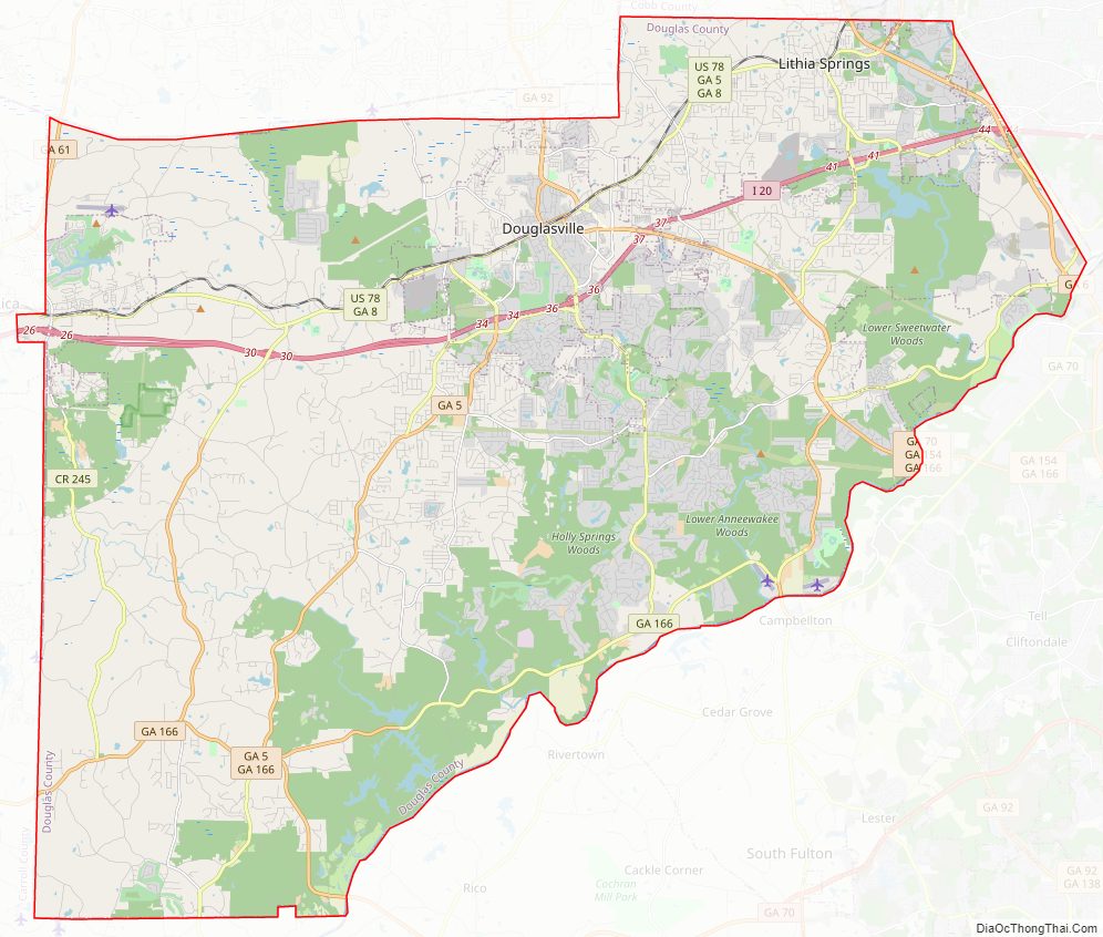
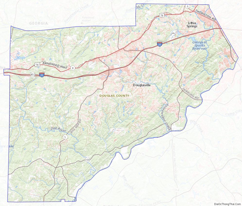
Douglas County Road Map
Geography
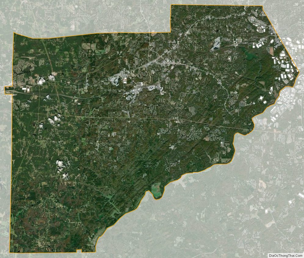
According to the U.S. Census Bureau, the county has a total area of 201 square miles (520 km), of which 200 square miles (520 km) is land and 1.0 square mile (2.6 km) (0.5%) is water.
Douglas County’s elevation above sea level ranges as low as 740 feet (230 m) at the Chattahoochee River to as high as 1,340 feet (410 m); one of the county’s highest elevation points lies inside the city of Douglasville. Andy Mountain, between Villa Rica and Winston – west of Douglasville along Bankhead Highway, has the highest elevation in Douglas County. Two other elevated summits are located in the county, known as Cedar Mountain at 1,257 feet (383 m), and Pine Mountain at 1,180 feet (360 m).
Douglas County sits in Georgia’s Piedmont region, which makes its elevation vary due to many rolling hills that Douglas County sits on near the tail end of the Appalachian Mountains. There are no high mountain peaks in Douglas County, just a range of ridges, hills and valleys.
The entirety of Douglas County is located in the Middle Chattahoochee River-Lake Harding sub-basin of the ACF River Basin (Apalachicola-Chattahoochee-Flint River Basin).
Bodies of water
- The Chattahoochee River borders the county to the east and southeast.
- Sweetwater Creek runs in the eastern side of the county in the Lithia Springs area. The USGS stream gauge (NWS identifier AUSG1) at Lithia Springs is considered to be “near Austell” by the National Weather Service, however, even though that city is further away and in Cobb and not Douglas.
- George Sparks Reservoir makes its home at Sweetwater Creek State Park.
- The Dog River is a small, almost creek like river in the western side of Douglas county and travels south and eastward until it ends at the Dog River Reservoir in the southern part of the county.
- The Dog River Reservoir is Douglas County’s main source of drinking water, and also serves as a recreational lake for residents of the county.
All of these had massive flooding during the 2009 Atlanta floods.
Climate
Douglas County has been experiencing numerous natural disasters over the most recent decades. Being located in the South Eastern United States the county experiences strong storms and tornadoes often because of its location in Dixie Alley.
A tornado touched down in the city of Douglasville on March 7, 2008, damaging many homes and ripping one home in half in the Brookmont subdivision on Chapel Hill Road. Arbor Place Mall also reported broken windows from the storm. The tornado also damaged the Chapel Hill Kroger grocery store and threw a heavy air conditioning unit onto cars below. There was only one injury reported from the storm.
Another tornado touched down in Douglas County on May 11, 2008, known as the “Mother’s Day Tornado”. The EF2 tornado caused damage all over the county. The tornado touched down in the Fairplay area and moved through the rest of the county. The tornado packing wind speeds up to 110 mph (180 km/h) downed many trees and damaged many homes in the county. A gas station in Douglasville was destroyed by the storm, with the large roof being thrown onto the street. No injuries or deaths were reported. The governor of Georgia declared a state of emergency for Douglas County and many other counties in the state on May 12, 2008. This is the first time in history that two tornados have touched down in Douglas County in the same year.
The county has suffered through numerous ice storms throughout the years. The ice storms bring everything to a stand still in the area due to the lack of equipment to deal with the problem and drastic amounts of power outages. Some of the worst ice storms were in 1938, 1994, 1998, 2000, 2005, and 2010.
In 2007 the county suffered one of the worst droughts in the area’s history, causing a complete watering ban and resulting in the largest wildfire in Georgia history. The fire was located in south east Georgia, but it still affected the county with smoke often through the life of the fire.
In 2005 Hurricane Katrina’s remnants tore through the area spawning tornadoes, causing wind damage, and flooding rains. Katrina killed 2 people in Georgia
Sunday night on January 9, 2011, right after Douglasville’s first white Christmas in decades, a snowstorm developed over Douglas County and caused as much as 8 inches of snow in the area. The storm closed grocery stores, the courthouse, and Arbor Place Mall until that Wednesday January 12. Schools were closed the entire second week of January.
The “Storm of the Century” (1993) in March 1993 brought 17 inches (43 cm) to Douglasville, with drifts measuring several feet.
On September 21, 2009, Douglas County was devastated by the worst flood in Georgia history. Over 18 inches (460 mm) of rain fell in one night causing many roads to be destroyed and many homes a total loss. The county was later declared a disaster area, and the governor of Georgia declared a state of emergency. The floodings worst affected areas were in the areas of Douglasville, Villa Rica, Austell, Lithia Springs, and Chapel Hill. The disaster killed more than eight people in the county, most of them in the Douglasville area. The Austell death toll was also high but it was reported in the Cobb County losses.
Adjacent counties
- Cobb County– northeast
- Fulton County – southeast
- Carroll County – west
- Paulding County – northwest
Douglas County Topographic Map
Douglas County Satellite Map
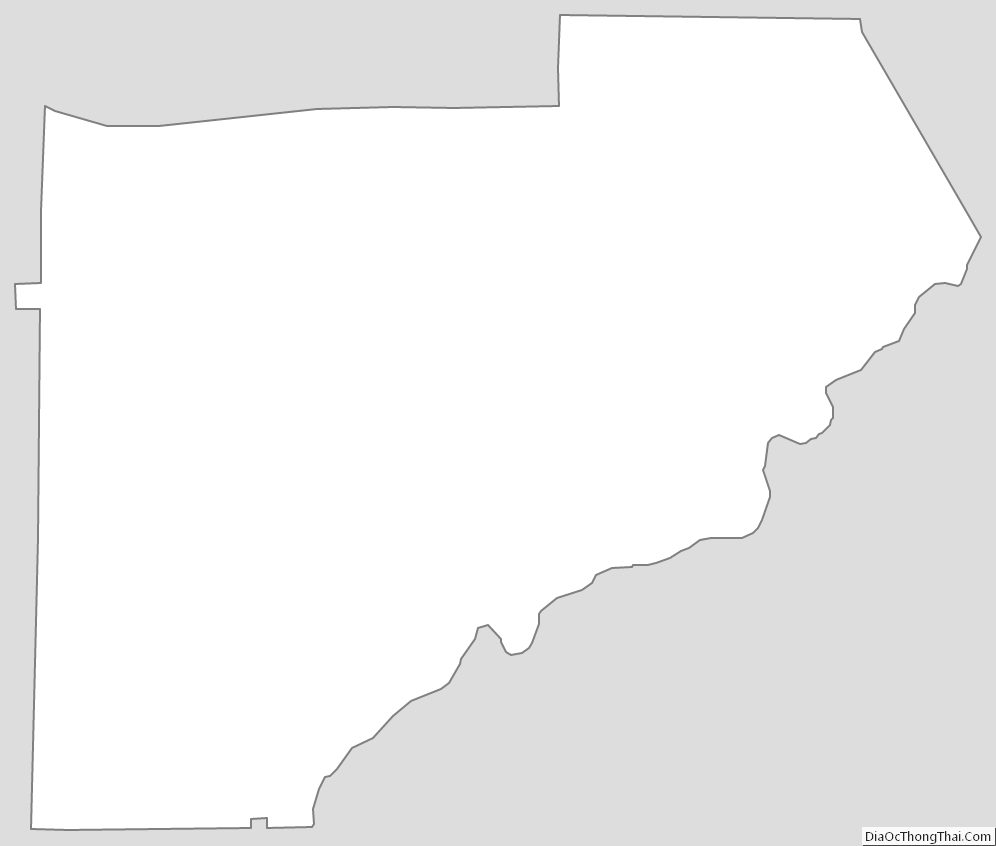
Douglas County Outline Map