The city of Douglasville is the county seat of Douglas County, Georgia, United States. As of the 2020 census, the city had a population of 34,650, up from 30,961 in 2010 and 20,065 in 2000.
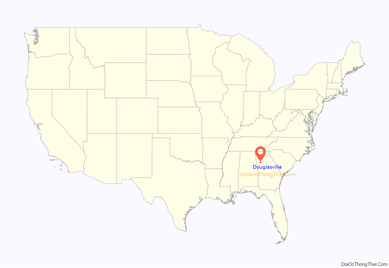
Douglasville is located approximately 20 miles (32 km) west of Atlanta and is part of the Atlanta Metro Area. Highway access can be obtained via three interchanges along Interstate 20.
| Name: | Douglasville city |
|---|---|
| LSAD Code: | 25 |
| LSAD Description: | city (suffix) |
| State: | Georgia |
| County: | Douglas County |
| Elevation: | 1,201 ft (366 m) |
| Total Area: | 23.04 sq mi (59.66 km²) |
| Land Area: | 22.93 sq mi (59.39 km²) |
| Water Area: | 0.11 sq mi (0.28 km²) |
| Total Population: | 34,650 |
| Population Density: | 1,511.19/sq mi (583.47/km²) |
| ZIP code: | 30122, 30133-30135. 30154 |
| Area code: | 770/678/470 |
| FIPS code: | 1323900 |
| GNISfeature ID: | 0355535 |
| Website: | www.douglasvillega.gov |
Online Interactive Map
Click on ![]() to view map in "full screen" mode.
to view map in "full screen" mode.
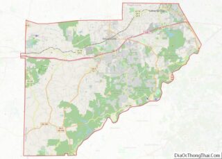
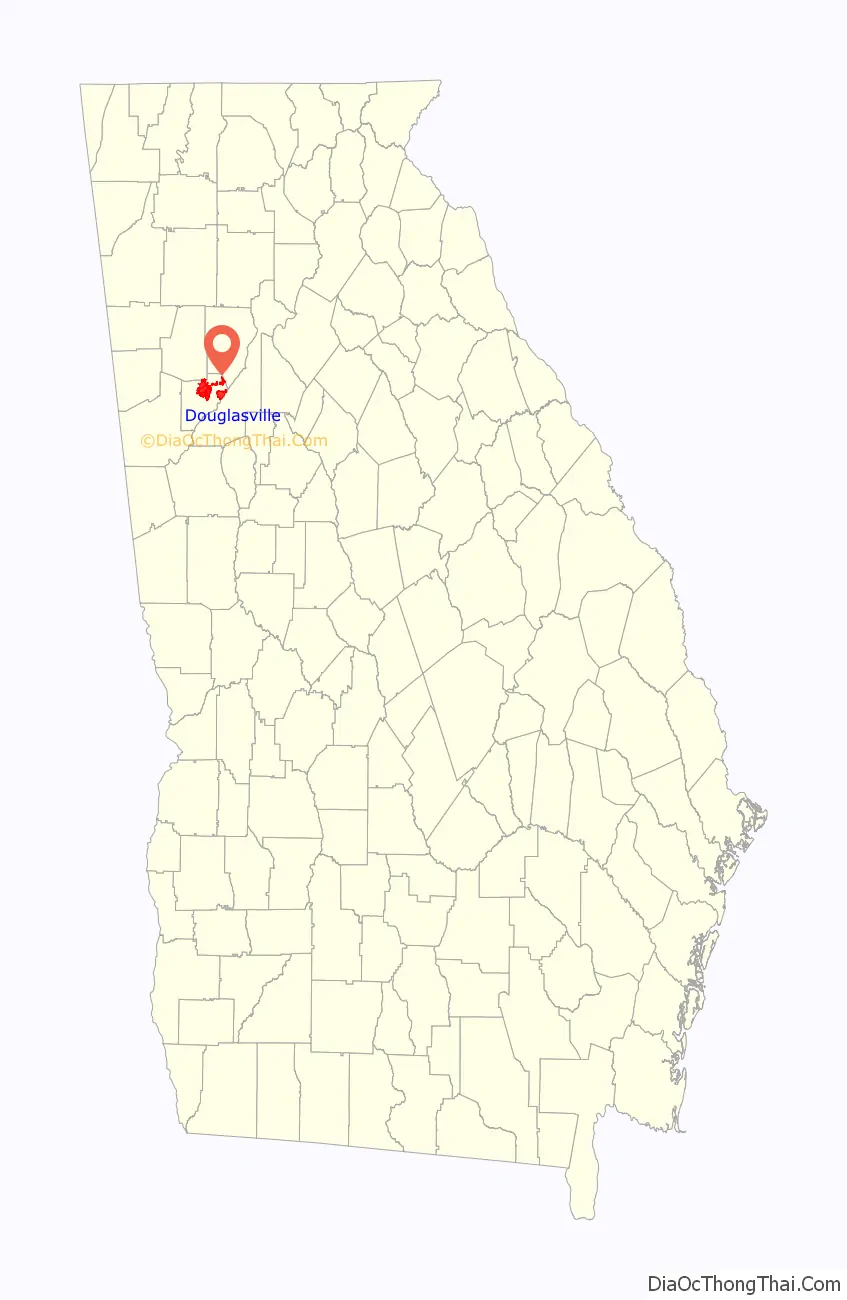
Douglasville location map. Where is Douglasville city?
History
Located along a natural rise in the topography, Douglasville was originally known as “Skint Chestnut.” The name was derived from a large tree used by Native Americans as a landmark; it was stripped of its bark so as to be more conspicuous.
Douglasville was founded in 1874 as the railroad was constructed in the area. That same year, Douglasville was designated as the county seat of the recently formed Douglas County. The community was named for Senator Stephen A. Douglas of Illinois.
Georgia General Assembly first incorporated Douglasville in 1875.
On September 21, 2009, Douglas County was devastated by the worst flood in Georgia history. Over 18 inches (457 mm) of rain fell in one night, destroying many roads and homes. The county was later declared a disaster area, and the governor of Georgia declared a state of emergency. The flooding most affected the areas of Douglasville, Villa Rica, Austell, Lithia Springs, and Chapel Hill. The disaster killed more than eight people in the county, most of them in the Douglasville area.
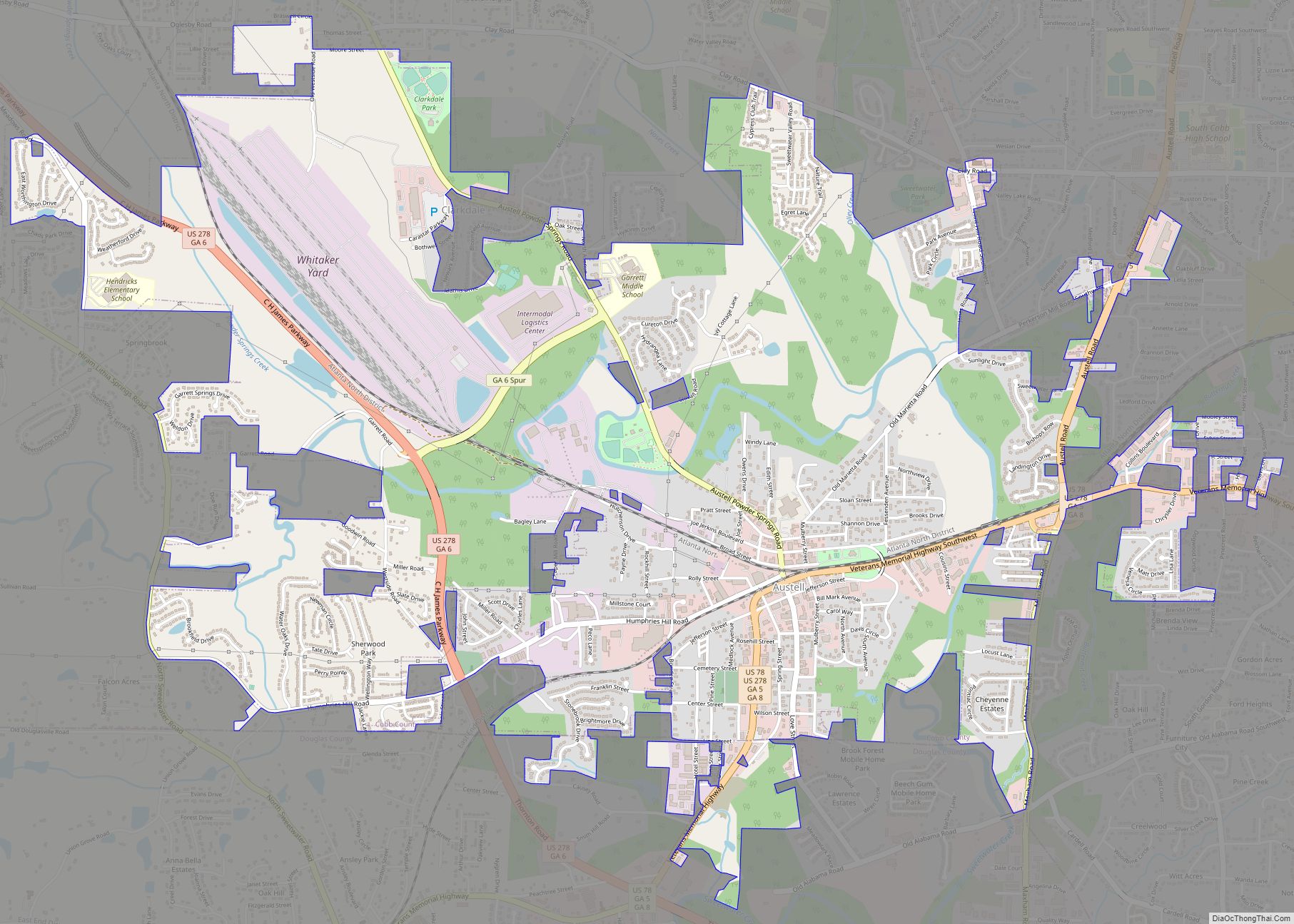
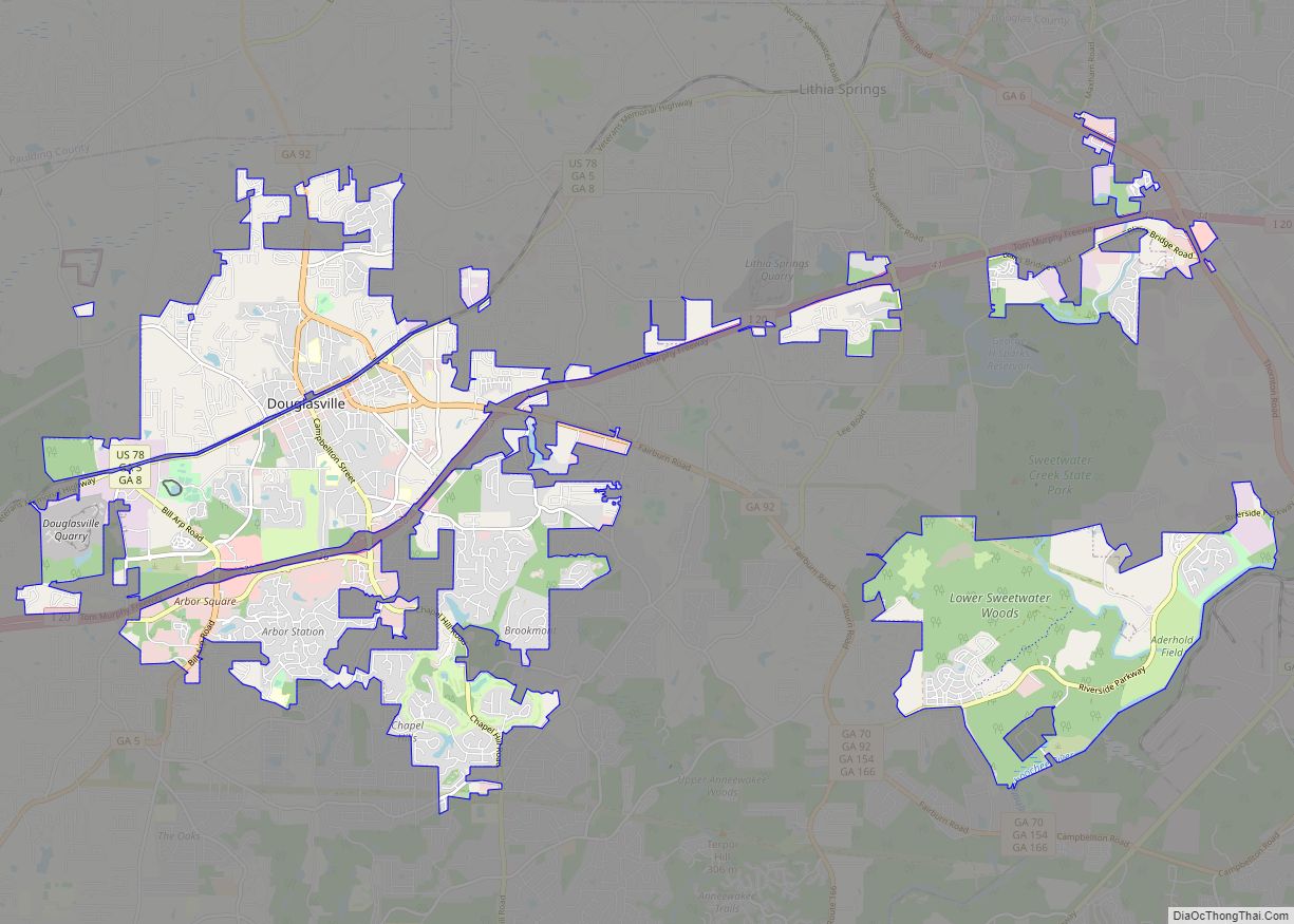
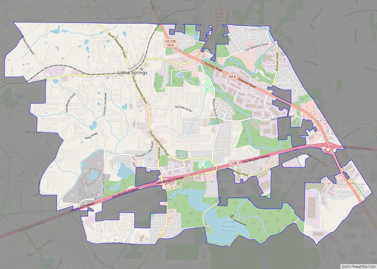
Douglasville Road Map
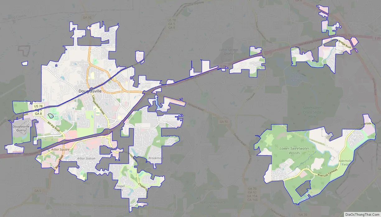
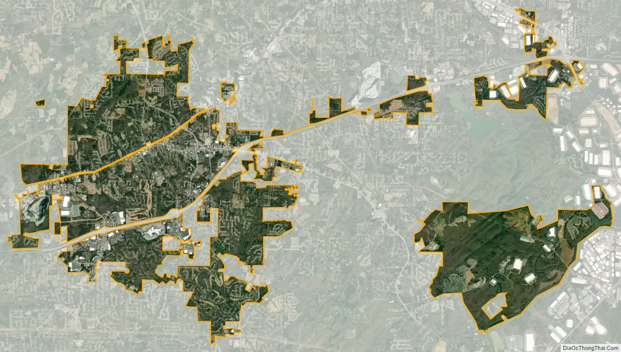
Douglasville city Satellite Map
Geography
Douglasville is located in north-central Douglas County at 33°44′59″N 84°43′23″W / 33.74972°N 84.72306°W / 33.74972; -84.72306Coordinates: 33°44′59″N 84°43′23″W / 33.74972°N 84.72306°W / 33.74972; -84.72306 (33.749824, −84.723190). Lithia Springs is 6 miles (10 km) to the northeast along U.S. Route 78, and Villa Rica is 10 miles (16 km) to the west. Hiram is 9 miles (14 km) to the north via SR 92. Interstate 20 passes south of downtown, leading east 22 miles (35 km) to downtown Atlanta and west 125 miles (201 km) to Birmingham, Alabama. I-20 provides access to the city from exits 34, 36, and 37.
According to the United States Census Bureau, Douglasville has a total area of 22.6 square miles (58.5 km), of which 22.5 square miles (58.2 km) is land and 0.1 square miles (0.3 km), or 0.58%, is water.
Douglasville has an elevation of 1,209 ft (369 m) above sea level.
See also
Map of Georgia State and its subdivision:- Appling
- Atkinson
- Bacon
- Baker
- Baldwin
- Banks
- Barrow
- Bartow
- Ben Hill
- Berrien
- Bibb
- Bleckley
- Brantley
- Brooks
- Bryan
- Bulloch
- Burke
- Butts
- Calhoun
- Camden
- Candler
- Carroll
- Catoosa
- Charlton
- Chatham
- Chattahoochee
- Chattooga
- Cherokee
- Clarke
- Clay
- Clayton
- Clinch
- Cobb
- Coffee
- Colquitt
- Columbia
- Cook
- Coweta
- Crawford
- Crisp
- Dade
- Dawson
- Decatur
- DeKalb
- Dodge
- Dooly
- Dougherty
- Douglas
- Early
- Echols
- Effingham
- Elbert
- Emanuel
- Evans
- Fannin
- Fayette
- Floyd
- Forsyth
- Franklin
- Fulton
- Gilmer
- Glascock
- Glynn
- Gordon
- Grady
- Greene
- Gwinnett
- Habersham
- Hall
- Hancock
- Haralson
- Harris
- Hart
- Heard
- Henry
- Houston
- Irwin
- Jackson
- Jasper
- Jeff Davis
- Jefferson
- Jenkins
- Johnson
- Jones
- Lamar
- Lanier
- Laurens
- Lee
- Liberty
- Lincoln
- Long
- Lowndes
- Lumpkin
- Macon
- Madison
- Marion
- McDuffie
- McIntosh
- Meriwether
- Miller
- Mitchell
- Monroe
- Montgomery
- Morgan
- Murray
- Muscogee
- Newton
- Oconee
- Oglethorpe
- Paulding
- Peach
- Pickens
- Pierce
- Pike
- Polk
- Pulaski
- Putnam
- Quitman
- Rabun
- Randolph
- Richmond
- Rockdale
- Schley
- Screven
- Seminole
- Spalding
- Stephens
- Stewart
- Sumter
- Talbot
- Taliaferro
- Tattnall
- Taylor
- Telfair
- Terrell
- Thomas
- Tift
- Toombs
- Towns
- Treutlen
- Troup
- Turner
- Twiggs
- Union
- Upson
- Walker
- Walton
- Ware
- Warren
- Washington
- Wayne
- Webster
- Wheeler
- White
- Whitfield
- Wilcox
- Wilkes
- Wilkinson
- Worth
- Alabama
- Alaska
- Arizona
- Arkansas
- California
- Colorado
- Connecticut
- Delaware
- District of Columbia
- Florida
- Georgia
- Hawaii
- Idaho
- Illinois
- Indiana
- Iowa
- Kansas
- Kentucky
- Louisiana
- Maine
- Maryland
- Massachusetts
- Michigan
- Minnesota
- Mississippi
- Missouri
- Montana
- Nebraska
- Nevada
- New Hampshire
- New Jersey
- New Mexico
- New York
- North Carolina
- North Dakota
- Ohio
- Oklahoma
- Oregon
- Pennsylvania
- Rhode Island
- South Carolina
- South Dakota
- Tennessee
- Texas
- Utah
- Vermont
- Virginia
- Washington
- West Virginia
- Wisconsin
- Wyoming