Lithia Springs (/ˈlɪθiːə/) is a census-designated place and unincorporated area, formerly incorporated as a city, located in northeastern Douglas County, Georgia, United States. As of the 2020 census, the community had a population of 16,644. The area is named for its historic lithia mineral water springs.
Incorporated in 1882, Lithia Springs was dissolved the first time in 1933. Lithia Springs became incorporated again in 1994, to be Douglas County’s second completely internal municipality, but disincorporated again in 2000.
In 2000, the citizens voted (80% yea, 20% nay) on December 20 to dissolve the city charter and de-incorporate the city, transferring all assets to the county. The referendum that ended the town was part of the settlement in a lawsuit brought by city residents charging the city should be dissolved because it did not deliver enough services to justify its existence under state law. During its incorporation until 2000, the former city had five mayors.
Lithia Springs is assigned the United States Postal Service ZIP code of 30122.
| Name: | Lithia Springs CDP |
|---|---|
| LSAD Code: | 57 |
| LSAD Description: | CDP (suffix) |
| State: | Georgia |
| County: | Douglas County |
| Elevation: | 1,043 ft (318 m) |
| Total Area: | 13.49 sq mi (34.95 km²) |
| Land Area: | 13.44 sq mi (34.81 km²) |
| Water Area: | 0.05 sq mi (0.13 km²) |
| Total Population: | 16,644 |
| Population Density: | 1,238.21/sq mi (478.09/km²) |
| ZIP code: | 30122 |
| Area code: | 770/678/470 |
| FIPS code: | 1346832 |
| GNISfeature ID: | 0356358 |
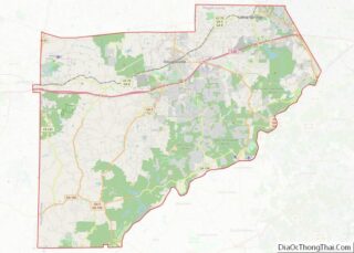
Online Interactive Map
Click on ![]() to view map in "full screen" mode.
to view map in "full screen" mode.
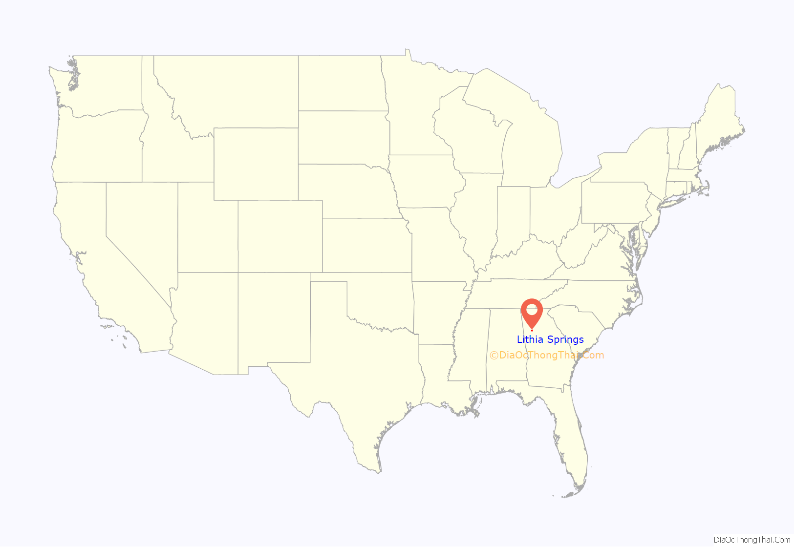
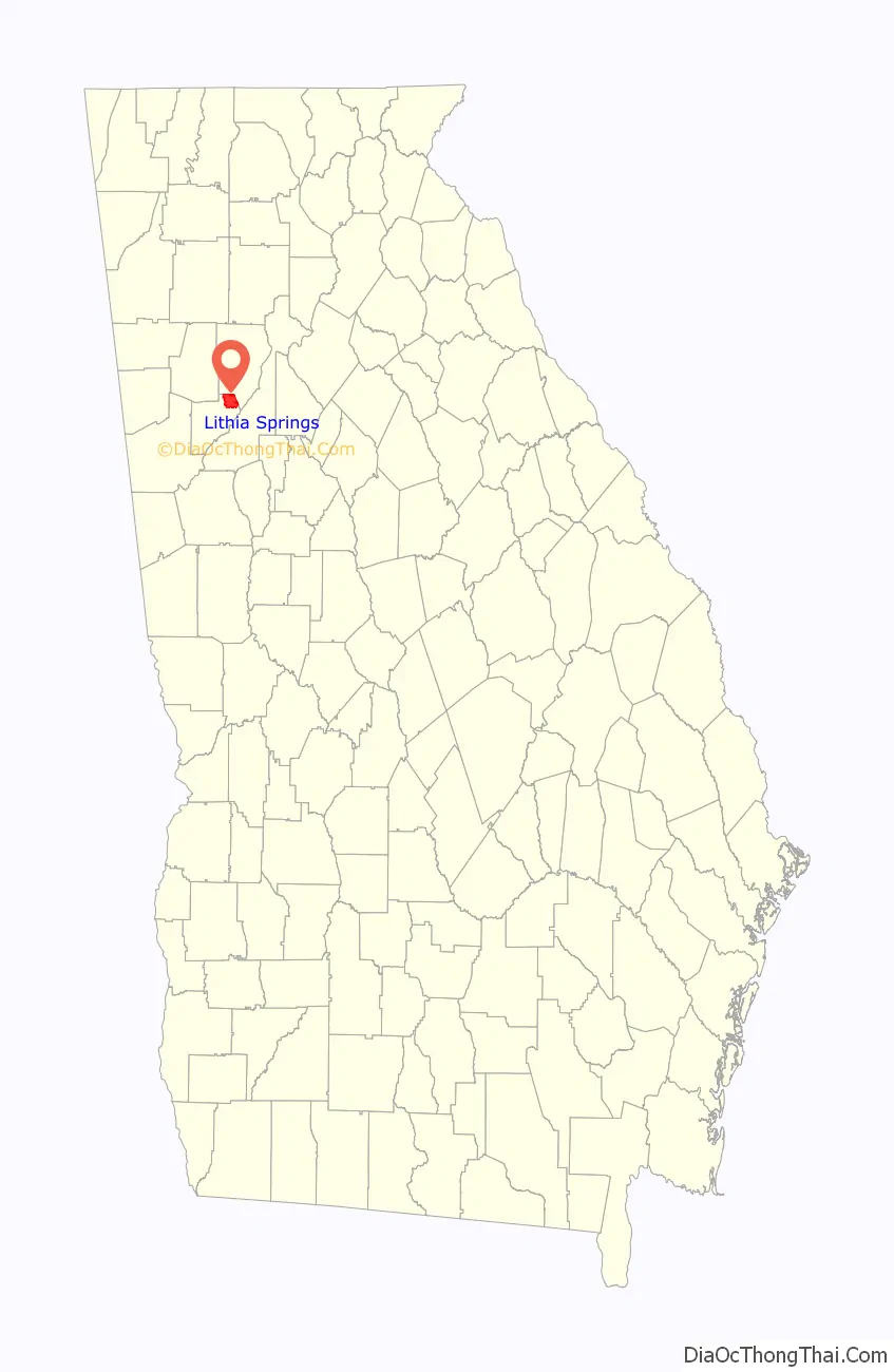
Lithia Springs location map. Where is Lithia Springs CDP?
History
The history of the community begins with Lithia Springs, a natural lithia water spring. So popular were the curative waters that flowed from Lithia Springs that people came for miles to drink it. The neighboring city of Austell was also founded due to the spring’s popularity.
In 1887 Judge Bowden bought the springs with a group of investors and started bottling and selling Bowden lithia spring water. That same year the Sweet Water Hotel, a 300-room luxury health resort, opened in Lithia Springs. The Sweet Water Hotel and its famous lithia spring water were so popular that Mark Twain, members of the Vanderbilt family, and Presidents Cleveland, Taft, McKinley and Theodore Roosevelt all enjoyed the many amenities of the resort which included the world-famous Lithia Vapor Baths.
In 1888, the Piedmont Chautauqua Institute opened in Lithia Springs. Henry W. Grady, editor of the Atlanta Constitution, was the founder and gave the institute the motto “Enlightenment of the People”. In 1888, over 30,000 tourists, sightseers, and health-seekers visited Lithia Springs GA.
The only remnants of this time that have survived are the natural springs and its historic lithia water under the name brand Lithia, which is still bottled and sold in restaurants and health food stores.
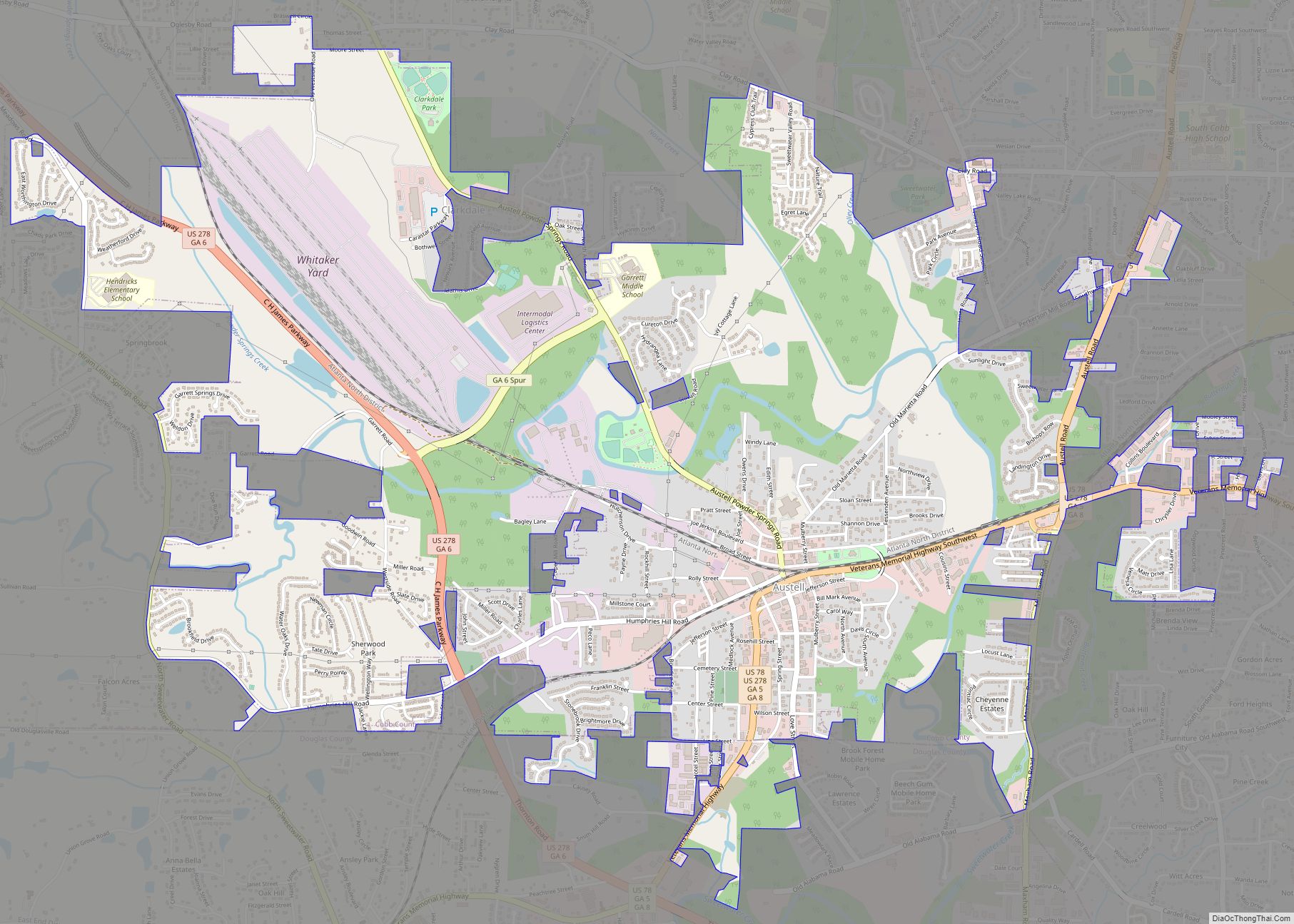
Lithia Springs Road Map

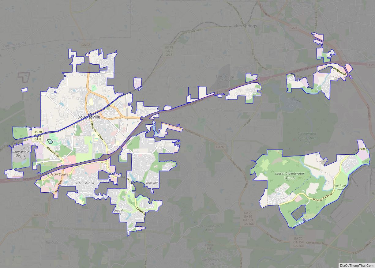
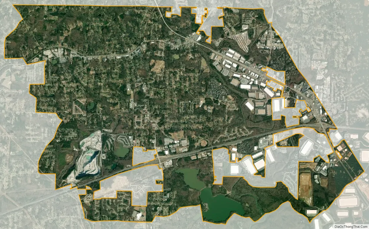
Lithia Springs city Satellite Map
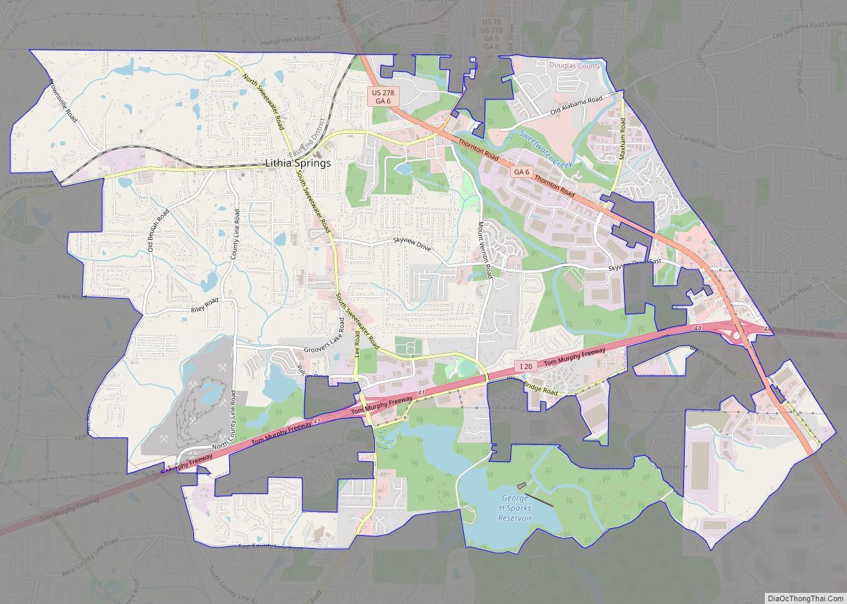
Geography
Lithia Springs is located in the northeastern corner of Douglas County, bordered to the north and east by the Cobb County line and to the south by East County Line Road, Cedar Terrace Road, and Factory Shoals Road. Sweetwater Creek, a tributary of the Chattahoochee River, flows through the eastern part of the community, and Sweetwater Creek State Park is along its southern edge.
Some of the incorporated limits of Douglasville occupy some of the territory within Lithia Springs, along Interstate 20, Blair Bridge Road, Lee Road and Thornton Road.
According to the U.S. Census Bureau, the Lithia Springs CDP has a total area of 13.7 square miles (35.4 km), of which 13.6 square miles (35.2 km) is land and 0.050 square miles (0.13 km), or 0.37%, is water.
See also
Map of Georgia State and its subdivision:- Appling
- Atkinson
- Bacon
- Baker
- Baldwin
- Banks
- Barrow
- Bartow
- Ben Hill
- Berrien
- Bibb
- Bleckley
- Brantley
- Brooks
- Bryan
- Bulloch
- Burke
- Butts
- Calhoun
- Camden
- Candler
- Carroll
- Catoosa
- Charlton
- Chatham
- Chattahoochee
- Chattooga
- Cherokee
- Clarke
- Clay
- Clayton
- Clinch
- Cobb
- Coffee
- Colquitt
- Columbia
- Cook
- Coweta
- Crawford
- Crisp
- Dade
- Dawson
- Decatur
- DeKalb
- Dodge
- Dooly
- Dougherty
- Douglas
- Early
- Echols
- Effingham
- Elbert
- Emanuel
- Evans
- Fannin
- Fayette
- Floyd
- Forsyth
- Franklin
- Fulton
- Gilmer
- Glascock
- Glynn
- Gordon
- Grady
- Greene
- Gwinnett
- Habersham
- Hall
- Hancock
- Haralson
- Harris
- Hart
- Heard
- Henry
- Houston
- Irwin
- Jackson
- Jasper
- Jeff Davis
- Jefferson
- Jenkins
- Johnson
- Jones
- Lamar
- Lanier
- Laurens
- Lee
- Liberty
- Lincoln
- Long
- Lowndes
- Lumpkin
- Macon
- Madison
- Marion
- McDuffie
- McIntosh
- Meriwether
- Miller
- Mitchell
- Monroe
- Montgomery
- Morgan
- Murray
- Muscogee
- Newton
- Oconee
- Oglethorpe
- Paulding
- Peach
- Pickens
- Pierce
- Pike
- Polk
- Pulaski
- Putnam
- Quitman
- Rabun
- Randolph
- Richmond
- Rockdale
- Schley
- Screven
- Seminole
- Spalding
- Stephens
- Stewart
- Sumter
- Talbot
- Taliaferro
- Tattnall
- Taylor
- Telfair
- Terrell
- Thomas
- Tift
- Toombs
- Towns
- Treutlen
- Troup
- Turner
- Twiggs
- Union
- Upson
- Walker
- Walton
- Ware
- Warren
- Washington
- Wayne
- Webster
- Wheeler
- White
- Whitfield
- Wilcox
- Wilkes
- Wilkinson
- Worth
- Alabama
- Alaska
- Arizona
- Arkansas
- California
- Colorado
- Connecticut
- Delaware
- District of Columbia
- Florida
- Georgia
- Hawaii
- Idaho
- Illinois
- Indiana
- Iowa
- Kansas
- Kentucky
- Louisiana
- Maine
- Maryland
- Massachusetts
- Michigan
- Minnesota
- Mississippi
- Missouri
- Montana
- Nebraska
- Nevada
- New Hampshire
- New Jersey
- New Mexico
- New York
- North Carolina
- North Dakota
- Ohio
- Oklahoma
- Oregon
- Pennsylvania
- Rhode Island
- South Carolina
- South Dakota
- Tennessee
- Texas
- Utah
- Vermont
- Virginia
- Washington
- West Virginia
- Wisconsin
- Wyoming