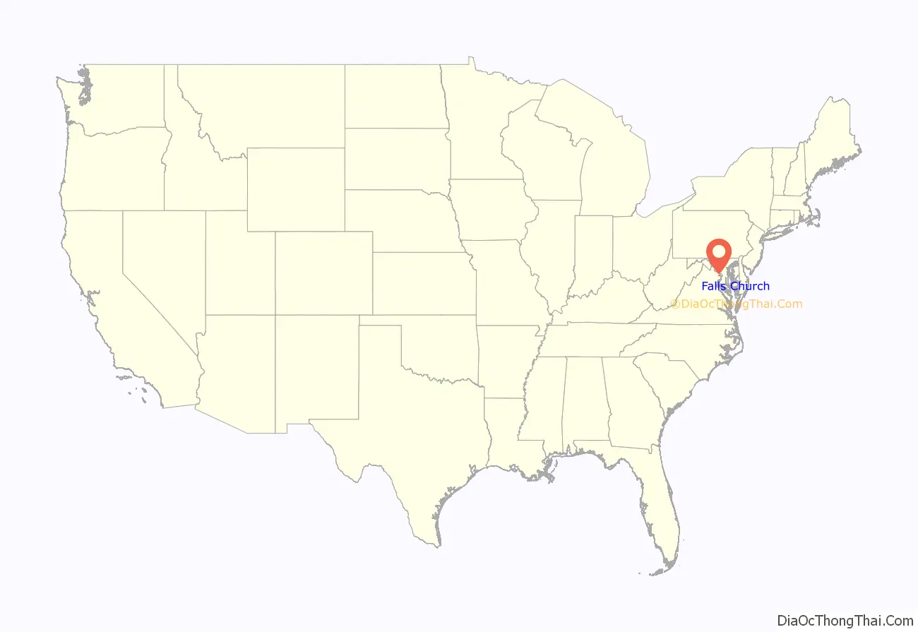
Falls Church is an independent city in the Commonwealth of Virginia. As of the 2020 census, the population was 14,658. Falls Church is included in the Washington metropolitan area.
Taking its name from The Falls Church, an 18th-century Church of England (later Episcopal Church) parish, Falls Church gained township status within Fairfax County in 1875. In 1948, it was incorporated as the City of Falls Church, an independent city with county-level governance status although it is not a county.
The city’s corporate boundaries do not include all of the area historically known as Falls Church; these areas include portions of Seven Corners and other portions of the current Falls Church postal districts of Fairfax County, as well as the area of Arlington County known as East Falls Church, which was part of the town of Falls Church from 1875 to 1936. For statistical purposes, the U.S. Department of Commerce’s Bureau of Economic Analysis combines the City of Falls Church with Fairfax City and Fairfax County.
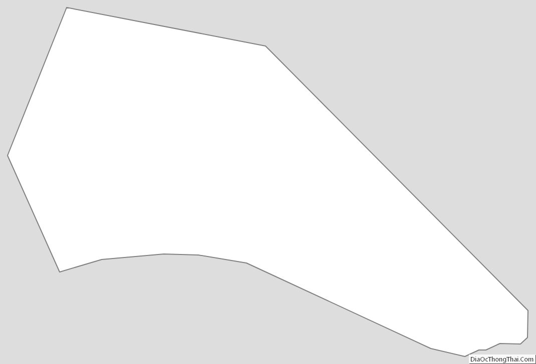
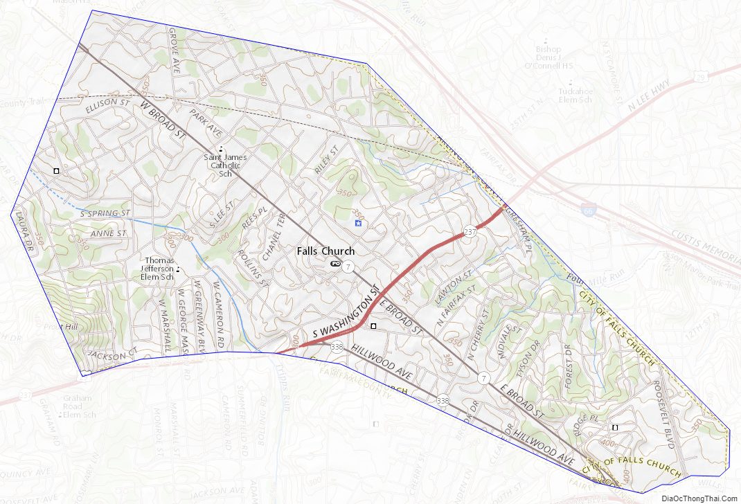
At 2.11 square miles, Falls Church is the smallest incorporated municipality in the Commonwealth of Virginia and the smallest county-equivalent municipality in the United States.
| Name: | Falls Church City |
|---|---|
| FIPS code: | 51-610 |
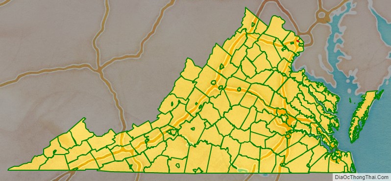
| State: | Virginia |
| Total Area: | 2.05 sq mi (5.30 km²) |
| Land Area: | 2.05 sq mi (5.30 km²) |
| Total Population: | 14,658 |
| Population Density: | 7,200/sq mi (2,800/km²) |
Falls Church City location map. Where is Falls Church City?
History
The first known government in the area was the Iroquois Confederacy. After exploration by Captain John Smith, England began sending colonists to what they called Virginia. While no records have yet been found showing the earliest colony settlement in the area, a cottage demolished between 1908 and 1914, two blocks from the city center, bore a stone engraved with the date “1699” set into one of its two large chimneys.
During the American Revolution the area is most known for The Falls Church vestrymen George Washington and George Mason. A copy of the United States Declaration of Independence was read to citizens from the steps of The Falls Church during the summer of 1776.
During the American Civil War Falls Church voted 44–26 in favor of secession. The Confederate Army occupied the then village of Falls Church as well as Munson’s and Upton’s hills to the East, probably due to their views of Washington, D.C. On September 28, 1861, Confederate troops withdrew from Falls Church and nearby hills, retreating to the heights at Centreville. Union troops took Munson’s and Upton’s hills, yet the village was never entirely brought under Union rule. Mosby’s Raiders made several armed incursions into the heart of Falls Church to kidnap and murder suspected Northern sympathizers in 1864 and 1865.
Historic sites
Cherry Hill Farmhouse and Barn, an 1845 Greek-Revival farmhouse and 1856 barn, owned and managed by the city of Falls Church, are open to the public on select Saturdays in summer. Tinner Hill Arch and Tinner Hill Heritage Foundation represent a locus of early African American history in the area, including the site of the first rural chapter of the NAACP. Two of the District of Columbia’s original 1791 boundary stones (see: Boundary Markers of the Original District of Columbia) are located in public parks on the boundary between Falls Church and Arlington County. The West cornerstone stands in Andrew Ellicott Park at 2824 Meridian Street, Falls Church and N. Arizona Street, Arlington, just south of West Street. Stone number SW9 stands in Benjamin Banneker Park on Van Buren Street, south of 18th Street, near the East Falls Church Metro station. Most of Banneker Park is in Arlington County, across Van Buren Street from Isaac Crossman Park at Four Mile Run.
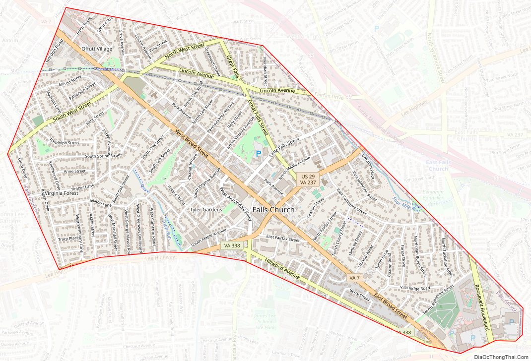
Falls Church City Road Map
Geography
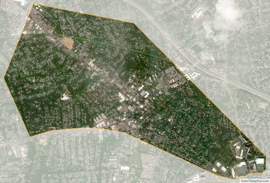
According to the United States Census Bureau, the city has a total area of 2.0 square miles (5.2 km), all of it land and none of it water. Falls Church is the smallest independent city by area in Virginia. Since independent cities in Virginia are considered county-equivalents, it is also the smallest county-equivalent in the United States by area.
The center of the city is the crossroads of Virginia State Route 7 (Broad St./Leesburg Pike) and U.S. Route 29 (Washington St./Lee Highway).
Tripps Run, a tributary of the Cameron Run Watershed, drains two-thirds of Falls Church, while the Four Mile Run watershed drains the other third of the city. Four Mile Run flows at the base of Minor’s Hill, which overlooks Falls Church on its north, and Upton’s Hill, which bounds the area to its east.
Falls Church City Topographic Map
Falls Church City Satellite Map
Falls Church City Outline Map