Seven Corners is a commercial center and census-designated place (CDP) in Fairfax County, Virginia, United States. The population was 9,255 at the 2010 census. Seven Corners has a “Falls Church” mailing address but is not within Falls Church‘s city limits. The area got its name from the intersection of State Route 7 (Leesburg Pike and East Broad Street), U.S. Route 50 (Arlington Boulevard), State Route 613 (Sleepy Hollow Road), State Route 338 (Hillwood Avenue) and Wilson Boulevard (also part of State Route 613). The junction of these four roads once created seven corners.
| Name: | Seven Corners CDP |
|---|---|
| LSAD Code: | 57 |
| LSAD Description: | CDP (suffix) |
| State: | Virginia |
| County: | Fairfax County |
| Elevation: | 384 ft (117 m) |
| Total Area: | 0.7 sq mi (1.8 km²) |
| Land Area: | 0.7 sq mi (1.8 km²) |
| Water Area: | 0.0 sq mi (0.0 km²) |
| Total Population: | 9,255 |
| Population Density: | 13,000/sq mi (5,100/km²) |
| ZIP code: | 22044 |
| Area code: | 571, 703 |
| FIPS code: | 5171216 |
| GNISfeature ID: | 1493537 |
Online Interactive Map
Click on ![]() to view map in "full screen" mode.
to view map in "full screen" mode.
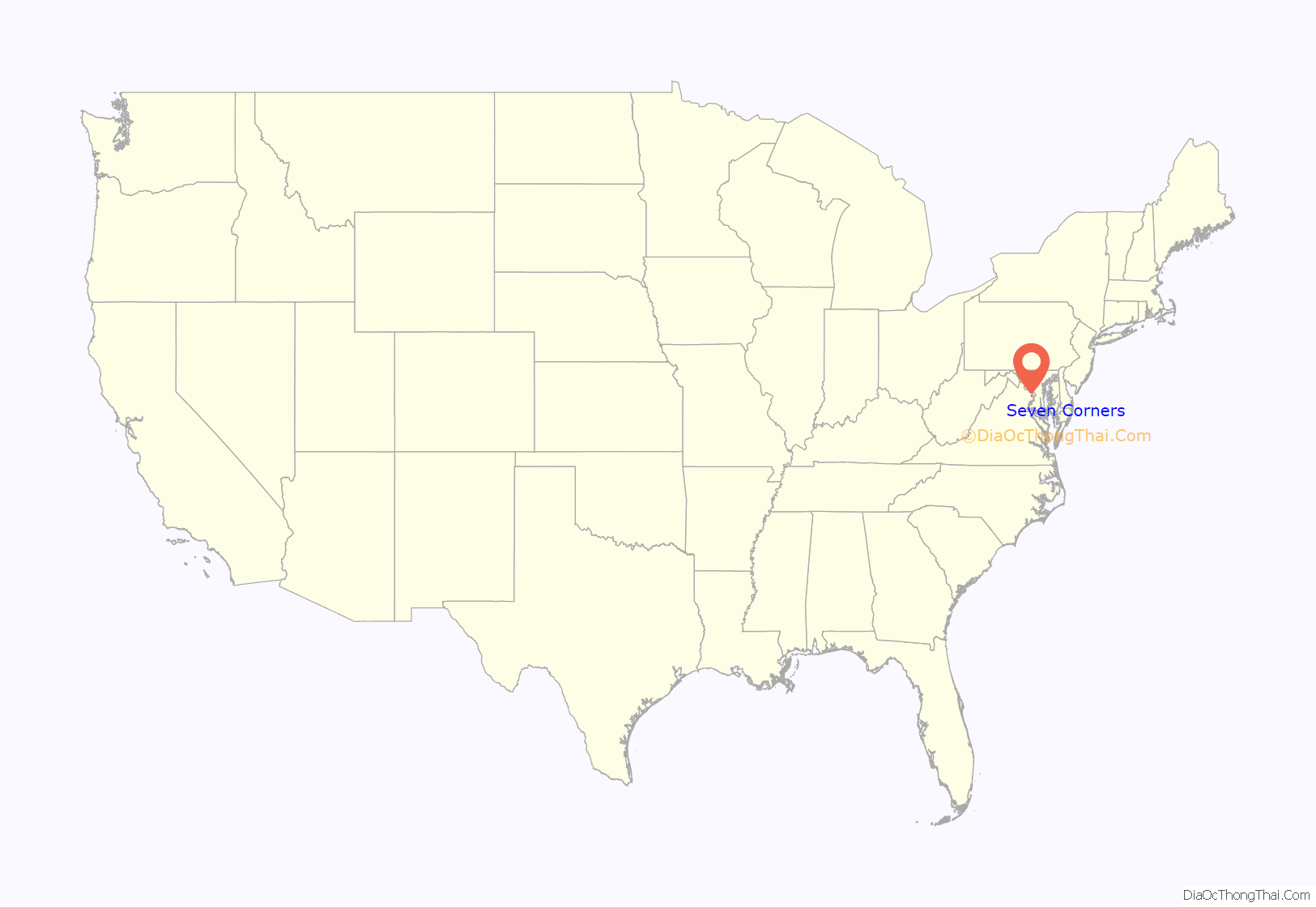
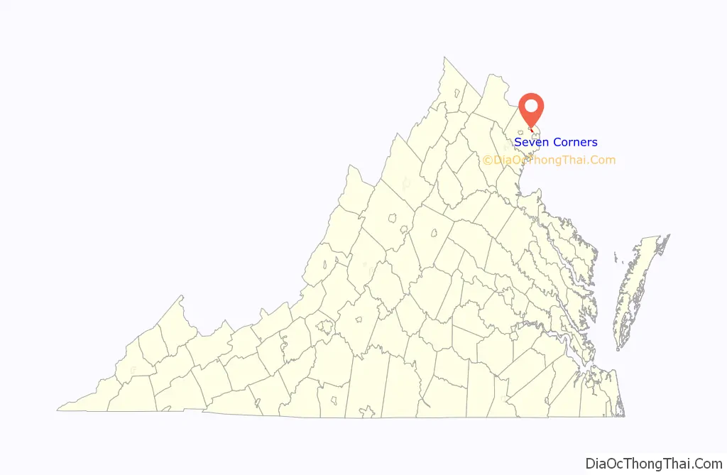
Seven Corners location map. Where is Seven Corners CDP?
History
Seven Corners was known as Fort Buffalo from the American Civil War until the 1950s. The area took its name from a fortification constructed in October 1862 by men of the 21st New York Infantry. Fort Buffalo stood on the southern side of the Leesburg Pike, at its current intersection with Sleepy Hollow Road. The story of the fort is described in a local history of the Civil War entitled A Virginia Village Goes to War–Falls Church During the Civil War. The fort was built at that location to take advantage of the excellent views to the east and south—the direction from which Confederate Army troops were thought to possibly come.
After the war the massive fortification of Fort Buffalo was dismantled but other earthworks remained and were easily visible through the 1930s.
The change of place name in the 1950s came about due to the construction of Lee Memorial Boulevard, now known as Arlington Boulevard (U.S. Route 50). The construction of Route 50 caused the formation of a seven cornered intersection—or did until the mouth of Wilson Boulevard was rerouted slightly to avoid all those roadways converging on a single point.
With the advent of Route 50 the area quickly developed into an important commercial center with the opening in 1956 of Seven Corners Shopping Center, one of the first malls in the Washington region. The original center featured an iconic sign combined with a modernistic entry arch; this was later removed. The original Route 50, envisioned and built as a landscaped parkway linking Washington, D.C., with the Shenandoah Valley, has since evolved into a commercial corridor and its function as a link to the valley has been assumed by Interstate 66.
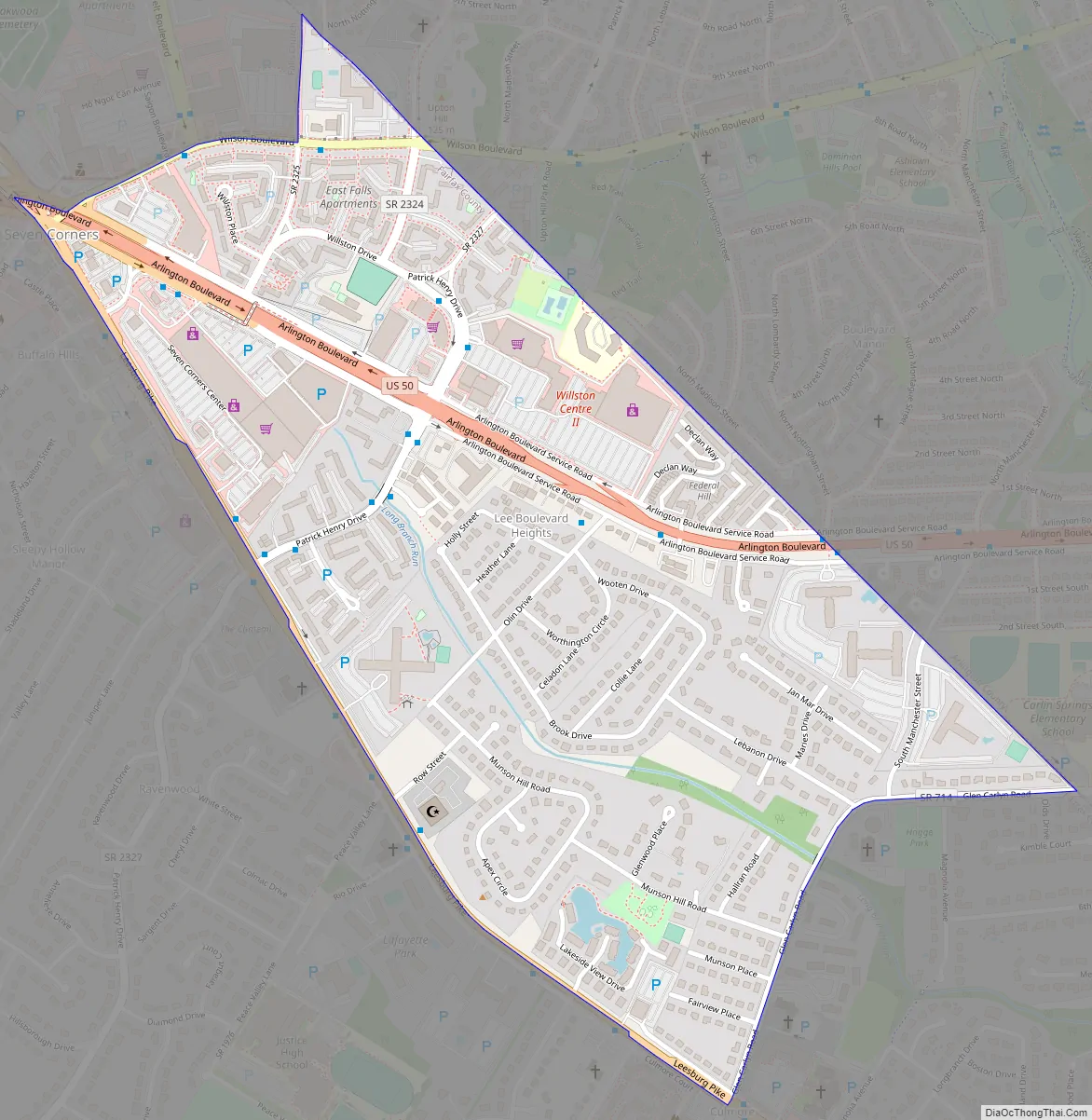
Seven Corners Road Map
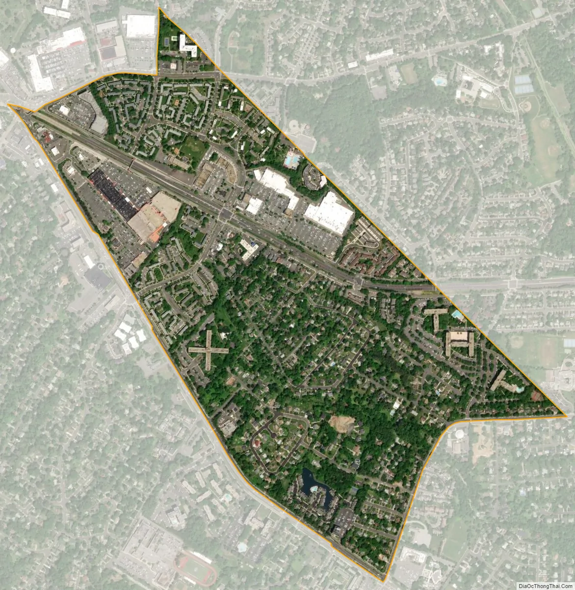
Seven Corners city Satellite Map
Geography
According to the United States Census Bureau, the CDP has a total area of 0.7 square miles (1.8 km), all of it land. The Upper Long Branch of Four Mile Run passes through the northernmost low point of the CDP.
The area is built on Munson’s Hill, and overlooks adjacent Upton’s Hill. The views to the south and west are unbroken, and offer scenic vistas in the directions of Annandale and Fairfax City.
See also
Map of Virginia State and its subdivision:- Accomack
- Albemarle
- Alexandria
- Alleghany
- Amelia
- Amherst
- Appomattox
- Arlington
- Augusta
- Bath
- Bedford
- Bedford City
- Bland
- Botetourt
- Bristol
- Brunswick
- Buchanan
- Buckingham
- Buena Vista
- Campbell
- Caroline
- Carroll
- Charles City
- Charlotte
- Charlottesville
- Chesapeake
- Chesterfield
- Clarke
- Clifton Forge City
- Colonial Heights
- Covington
- Craig
- Culpeper
- Cumberland
- Danville
- Dickenson
- Dinwiddie
- Emporia
- Essex
- Fairfax
- Fairfax City
- Falls Church
- Fauquier
- Floyd
- Fluvanna
- Franklin
- Frederick
- Fredericksburg
- Galax
- Giles
- Gloucester
- Goochland
- Grayson
- Greene
- Greensville
- Halifax
- Hampton
- Hanover
- Harrisonburg
- Henrico
- Henry
- Highland
- Hopewell
- Isle of Wight
- James City
- King and Queen
- King George
- King William
- Lancaster
- Lee
- Lexington
- Loudoun
- Louisa
- Lunenburg
- Lynchburg
- Madison
- Manassas
- Manassas Park
- Martinsville
- Mathews
- Mecklenburg
- Middlesex
- Montgomery
- Nelson
- New Kent
- Newport News
- Norfolk
- Northampton
- Northumberland
- Norton
- Nottoway
- Orange
- Page
- Patrick
- Petersburg
- Pittsylvania
- Poquoson
- Portsmouth
- Powhatan
- Prince Edward
- Prince George
- Prince William
- Pulaski
- Radford
- Rappahannock
- Richmond
- Roanoke
- Roanoke City
- Rockbridge
- Rockingham
- Russell
- Salem
- Scott
- Shenandoah
- Smyth
- Southampton
- Spotsylvania
- Stafford
- Staunton
- Suffolk
- Surry
- Sussex
- Tazewell
- Virginia Beach
- Warren
- Washington
- Waynesboro
- Westmoreland
- Williamsburg
- Winchester
- Wise
- Wythe
- York
- Alabama
- Alaska
- Arizona
- Arkansas
- California
- Colorado
- Connecticut
- Delaware
- District of Columbia
- Florida
- Georgia
- Hawaii
- Idaho
- Illinois
- Indiana
- Iowa
- Kansas
- Kentucky
- Louisiana
- Maine
- Maryland
- Massachusetts
- Michigan
- Minnesota
- Mississippi
- Missouri
- Montana
- Nebraska
- Nevada
- New Hampshire
- New Jersey
- New Mexico
- New York
- North Carolina
- North Dakota
- Ohio
- Oklahoma
- Oregon
- Pennsylvania
- Rhode Island
- South Carolina
- South Dakota
- Tennessee
- Texas
- Utah
- Vermont
- Virginia
- Washington
- West Virginia
- Wisconsin
- Wyoming


