Hot Springs County is a county in the U.S. state of Wyoming. As of the 2020 United States Census, the population was 4,696, making it the second-least populous county in Wyoming. Its county seat is Thermopolis. The county is named for the hot springs located in Hot Springs State Park.
| Name: | Hot Springs County |
|---|---|
| FIPS code: | 56-017 |
| State: | Wyoming |
| Founded: | February 21, 1911 (established) 1913 (organized) |
| Named for: | Hot springs in the area |
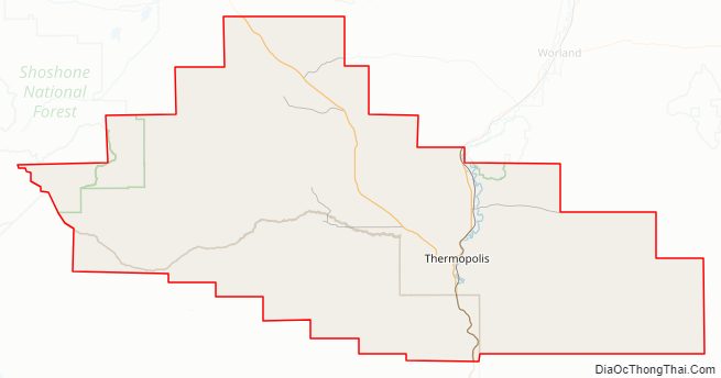
| Seat: | Thermopolis |
| Largest town: | Thermopolis |
| Total Area: | 2,006 sq mi (5,200 km²) |
| Land Area: | 2,004 sq mi (5,190 km²) |
| Total Population: | 4,621 |
| Population Density: | 2.3/sq mi (0.89/km²) |
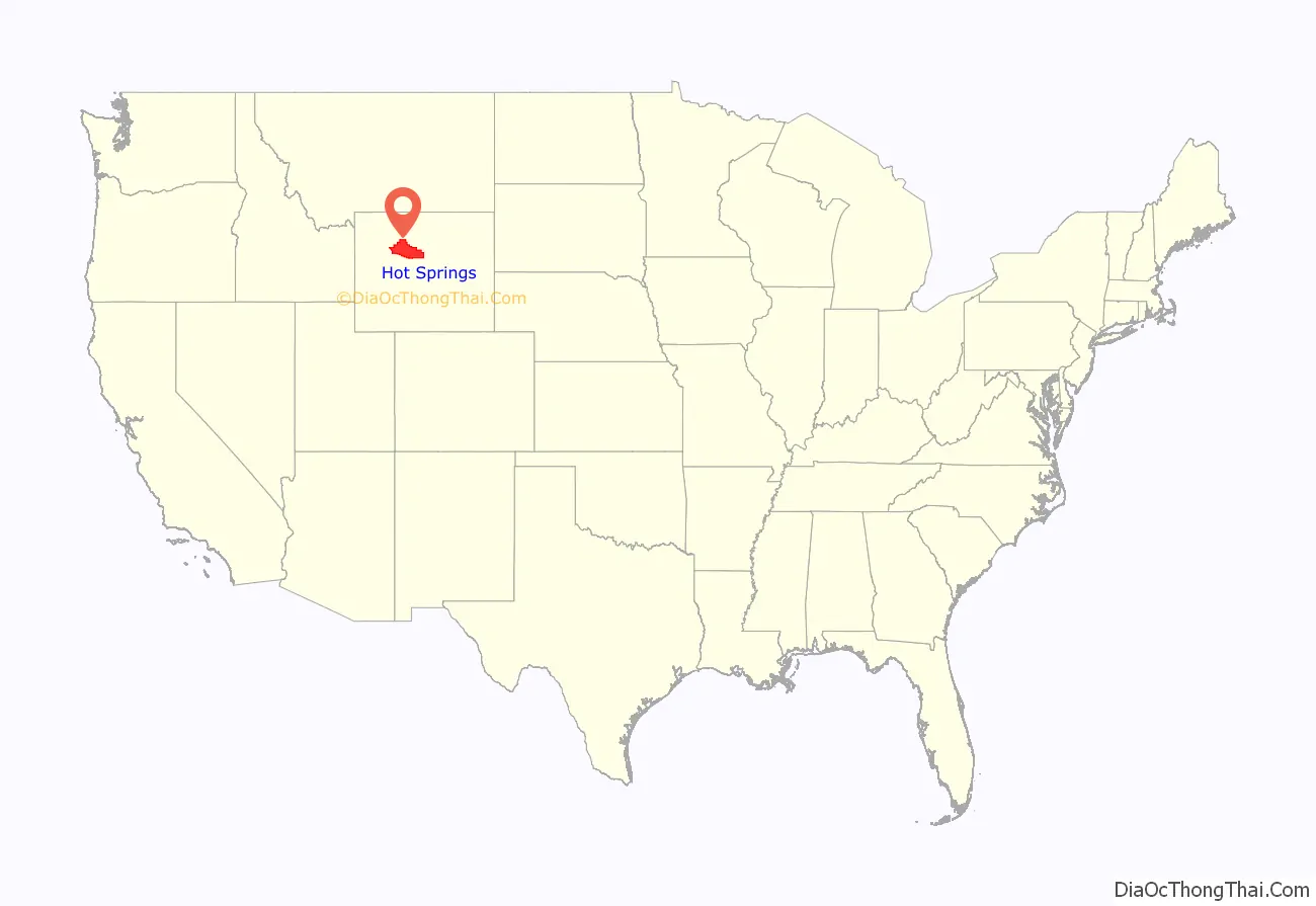
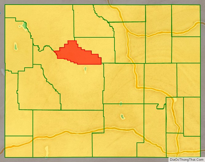
Hot Springs County location map. Where is Hot Springs County?
History
Hot Springs County was created on February 21, 1911, with of areas annexed from Big Horn, Fremont, and Park counties. It was organized in 1913.
Hot Springs County was named for the hot springs located in the county seat of Thermopolis.
In the 2008 United States presidential election, Hot Springs County was the only county in the entire Mountain West outside of Arizona where John McCain beat George W. Bush’s percentage of the county vote from the 2004 election.
Hot Springs County Road Map
Geography
According to the US Census Bureau, the county has a total area of 2,006 square miles (5,200 km), of which 2,004 square miles (5,190 km) is land and 2.3 square miles (6.0 km) (0.1%) is water, which gives it nearly twice the land area of Rhode Island and a slightly larger land area than Delaware. It is the smallest county in Wyoming by area and the largest county in the US that is a state’s smallest county.
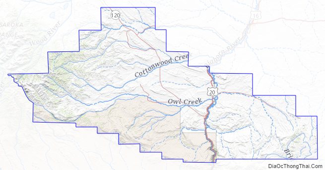
Hot Springs County includes the southern portion of Wyoming’s Big Horn Basin, and is surrounded by mountains. Most of the Wind River Canyon, with the Owl Creek Mountains on the west and Bridger Mountains on the east is in Hot Springs County, while the Bighorn Mountains ring the east portion on the county and the Absaroka Range is to the west. A small portion of the Shoshone National Forest is in the western part of the county.
The Wind River Indian Reservation extends into southern Hot Springs County.
Adjacent counties
- Washakie County – northeast
- Fremont County – south and southwest
- Park County – northwest and north
National protected area
- Shoshone National Forest (part)
Hot Springs County Topographic Map
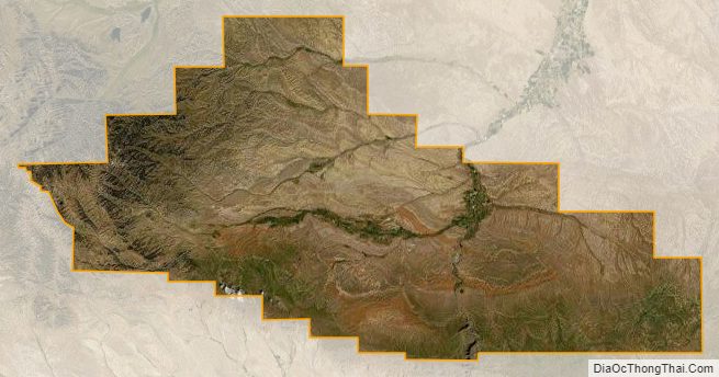
Hot Springs County Satellite Map
Hot Springs County Outline Map

See also
Map of Wyoming State and its subdivision: Map of other states:- Alabama
- Alaska
- Arizona
- Arkansas
- California
- Colorado
- Connecticut
- Delaware
- District of Columbia
- Florida
- Georgia
- Hawaii
- Idaho
- Illinois
- Indiana
- Iowa
- Kansas
- Kentucky
- Louisiana
- Maine
- Maryland
- Massachusetts
- Michigan
- Minnesota
- Mississippi
- Missouri
- Montana
- Nebraska
- Nevada
- New Hampshire
- New Jersey
- New Mexico
- New York
- North Carolina
- North Dakota
- Ohio
- Oklahoma
- Oregon
- Pennsylvania
- Rhode Island
- South Carolina
- South Dakota
- Tennessee
- Texas
- Utah
- Vermont
- Virginia
- Washington
- West Virginia
- Wisconsin
- Wyoming