King County is located in the U.S. state of Washington. The population was 2,269,675 in the 2020 census, making it the most populous county in Washington, and the 13th-most populous in the United States. The county seat is Seattle, also the state’s most populous city.
King County is one of three Washington counties that are included in the Seattle–Tacoma–Bellevue metropolitan statistical area. (The others are Snohomish County to the north, and Pierce County to the south.) About two-thirds of King County’s population lives in Seattle’s suburbs.
| Name: | King County |
|---|---|
| FIPS code: | 53-033 |
| State: | Washington |
| Founded: | December 22, 1852 |
| Named for: |
|
| Seat: | Seattle |
| Largest city: | Seattle |
| Total Area: | 2,307 sq mi (5,980 km²) |
| Land Area: | 2,116 sq mi (5,480 km²) |
| Total Population: | 2,269,675 |
| Population Density: | 980/sq mi (380/km²) |
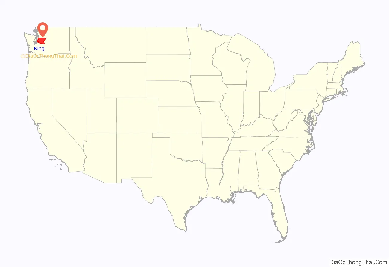
King County location map. Where is King County?
History
When Europeans arrived in the region that would become King County, it was inhabited by several Coast Salish groups. Villages around the site that would become Seattle were primarily populated by the Duwamish people. The Snoqualmie Indian Tribe occupied the area that would become eastern King County. The Green River and White River were home for the Muckleshoot tribal groups. In the first winter after the Denny Party landed at Alki Point, the settlement at the point consisted of a few dozen settlers and over a thousand Native Americans. The local tribes provided the settlers with construction labor, domestic service, and help with subsistence activities.
The county was formed out of territory within Thurston County on December 22, 1852, by the Oregon Territory legislature and was named after Alabamian William R. King, who had just been elected Vice President of the United States under President Franklin Pierce. Seattle was made the county seat on January 11, 1853. The area became part of the Washington Territory when it was created later that year.
King County originally extended to the Olympic Peninsula. According to historian Bill Speidel, when peninsular prohibitionists threatened to shut down Seattle’s saloons, Doc Maynard engineered a peninsular independence movement; King County lost what is now Kitsap County but preserved its entertainment industry.
Coal was discovered in 1853 by Dr. M. Bigelow along the Black River, and in subsequent decades several companies formed to mine coal around Lake Washington and deliver it to Seattle. The Seattle and Walla Walla Railroad started servicing the Renton coal fields in 1877, and the Newcastle fields in 1878. By 1880, King County produced 22% of the coal mined on the West Coast, most of that coal being found within the Renton Formation’s Muldoon coal seam.
Name
On February 24, 1986, the King County Council approved a motion to rename the county to honor civil rights leader Martin Luther King Jr. (no relation to William R. King), preserving the name “King County” while changing its namesake. The motion stated, among other reasons for the change, that “William Rufus DeVane King was a slaveowner” who “earned income and maintained his lifestyle by oppressing and exploiting other human beings,” while Martin Luther King’s “contributions are well-documented and celebrated by millions throughout this nation and the world, and embody the attributes for which the citizens of King County can be proud, and claim as their own.”
Because only the state can charter counties, the change was not made official until April 19, 2005, when Governor Christine Gregoire signed into law Senate Bill 5332, which provided that “King county is renamed in honor of the Reverend Doctor Martin Luther King, Jr.” effective July 24, 2005.
The County Council voted on February 27, 2006, to adopt the proposal sponsored by Councilmember Larry Gossett to change the county’s logo from an imperial crown to an image of Martin Luther King Jr. On March 12, 2007, the new logo was unveiled. The new logo design was developed by the Gable Design Group and the specific image was selected by a committee consisting of King County Executive Ron Sims, Council Chair Larry Gossett, Prosecutor Norm Maleng, Sheriff Sue Rahr, District Court Judge Corrina Harn, and Superior Court Judge Michael Trickey. The same logo is used in the flag.
Martin Luther King Jr. had visited King County once, for three days in November 1961.
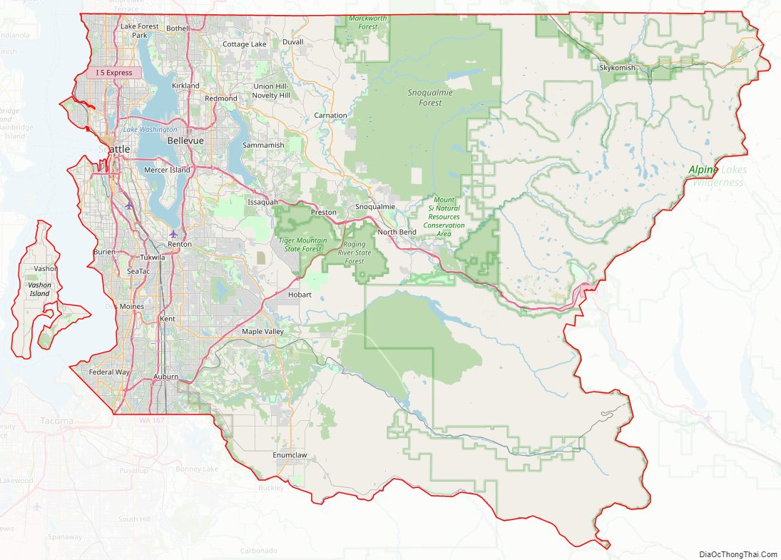
King County Road Map
Geography
According to the United States Census Bureau, the county has a total area of 2,307 square miles (5,980 km), of which 2,116 square miles (5,480 km) is land and 191 square miles (490 km) (8.3%) is water. King County has nearly twice the land area of the state of Rhode Island. The highest point in the county is Mount Daniel at 7,959 feet (2,426 meters) above sea level.
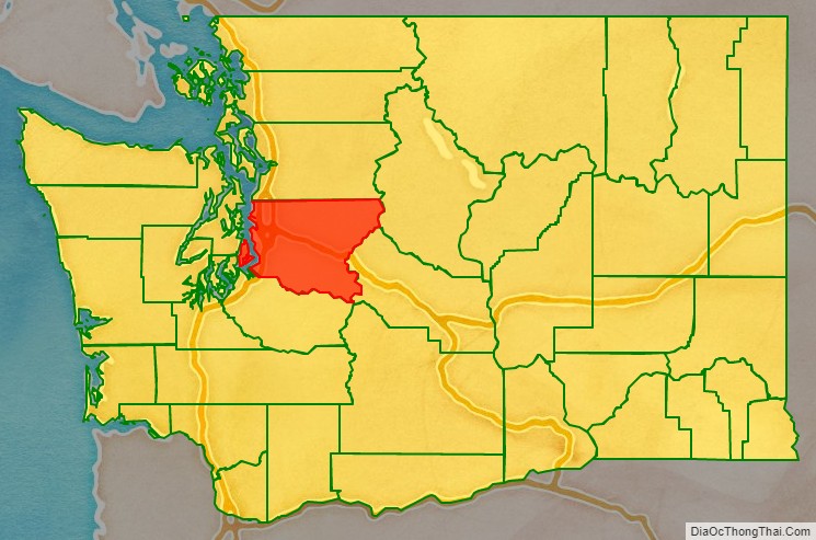
King County borders Snohomish County to the north, Kitsap County to the west, Kittitas County to the east, and Pierce County to the south. It also shares a small border with Chelan County to the northeast. King County includes Vashon Island and Maury Island in Puget Sound.
Geographic features
- Cascade Range
- Issaquah Alps
- Mount Baker-Snoqualmie National Forest
- Mount Daniel, the highest point
- Mount Si
- Harbor Island
- Maury Island
- Mercer Island
- Sammamish Plateau
- Vashon Island
- Cedar River
- Green/Duwamish River
- Elliott Bay
- Greenwater River
- Issaquah Creek
- Lake Sammamish
- Lake Union
- Lake Washington
- Lake Youngs
- Pratt River
- Puget Sound
- Raging River
- Skykomish River
- Snoqualmie Falls
- Snoqualmie River
- Taylor River
- Tolt River
- White River
Major highways
- Interstate 5
- Interstate 90
- Interstate 405
- U.S. Route 2
- State Route 18
- State Route 99
- State Route 167
- State Route 520
- State Route 522
Public transit
King County Metro is the eighth-largest transit bus agency in the United States. Sound Transit manages Link light rail, Sounder commuter rail, and Sound Transit Express buses in King County that provide connections to adjacent counties.
Adjacent counties
- Snohomish County – north
- Pierce County – south
- Chelan County – east/northeast
- Kittitas County – east/southeast
- Kitsap County – west
National protected areas
- Klondike Gold Rush National Historical Park (part, also in Skagway, Alaska)
- Snoqualmie National Forest (part)
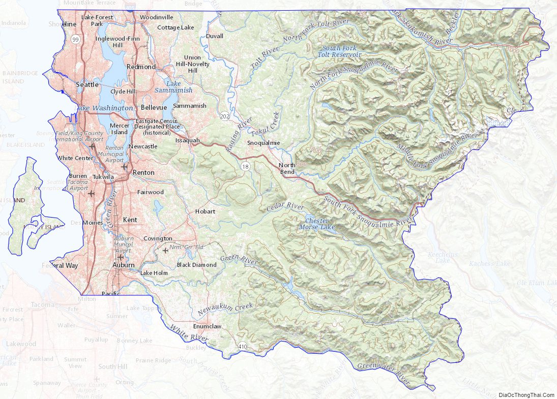
King County Topographic Map
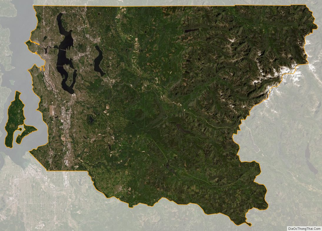
King County Satellite Map
King County Outline Map


