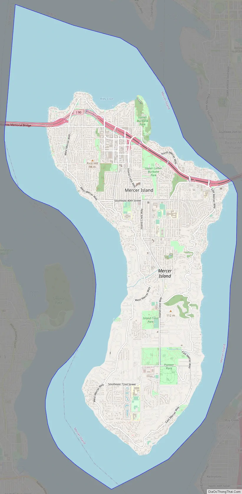
Mercer Island is a city in King County, Washington, United States, located on an island of the same name in the southern portion of Lake Washington. Mercer Island is in the Seattle metropolitan area, with Seattle to its west and Bellevue to its east.
Mercer Island is connected to the mainland on both sides by bridges carrying Interstate 90, with the city of Seattle to the west and the city of Bellevue to the east. The Lacey V. Murrow Memorial Bridge and the parallel Homer M. Hadley Memorial Bridge are floating bridges that span Lake Washington and carry, respectively, eastbound and westbound lanes of Interstate 90 and connect Mercer Island to the northern portion of Seattle’s South End. I-90 traverses the northern portion of Mercer Island and is then carried from the island to Bellevue over the East Channel of Lake Washington by the East Channel Bridge. Mercer Island is located closer to Bellevue than it is to Seattle, and is therefore often considered to be part of King County’s Eastside.
The population was 25,748 at the 2020 census.
The ZIP code 98040 is unique to Mercer Island. Mercer Island has the fifth highest per-capita income in the state of Washington and is one of the 100 richest ZIP codes in the USA according to the IRS figures for Adjusted Gross Income.
| Name: | Mercer Island city |
|---|---|
| LSAD Code: | 25 |
| LSAD Description: | city (suffix) |
| State: | Washington |
| County: | King County |
| Elevation: | 338 ft (103 m) |
| Total Area: | 12.90 sq mi (33.41 km²) |
| Land Area: | 6.38 sq mi (16.53 km²) |
| Water Area: | 6.52 sq mi (16.88 km²) |
| Total Population: | 25,748 |
| Population Density: | 2,000/sq mi (770/km²) |
| ZIP code: | 98040 |
| Area code: | 206 |
| FIPS code: | 5345005 |
| GNISfeature ID: | 1512455 |
| Website: | www.mercerisland.gov |
Online Interactive Map
Click on ![]() to view map in "full screen" mode.
to view map in "full screen" mode.
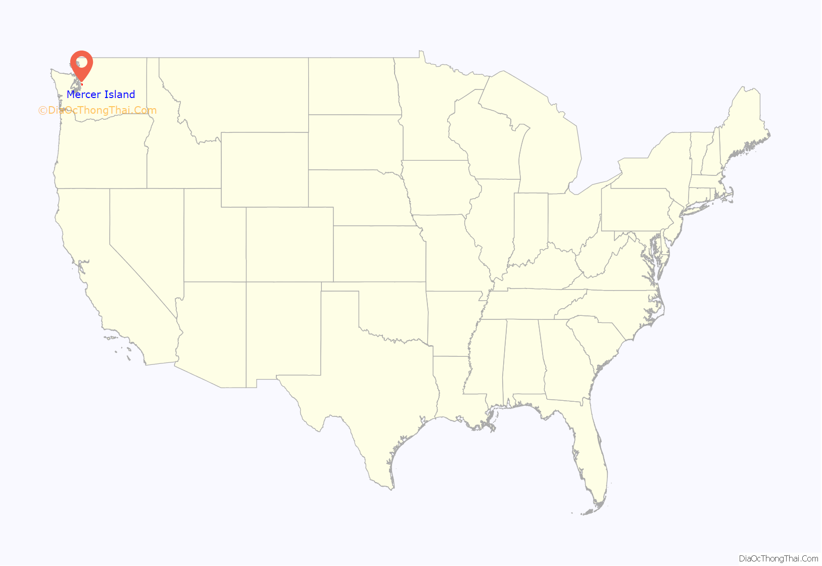
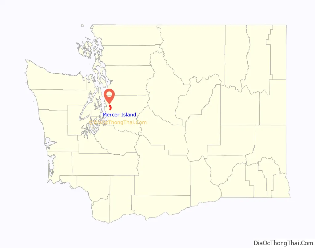
Mercer Island location map. Where is Mercer Island city?
History
The western side of the island was home to two Snoqualmie villages prior to white settlement in the Puget Sound region. Mercer Island, named for the Mercer family of Seattle, was first settled by non-indigenous people between 1870 and 1880. The Mercer brothers often rowed between the island and Seattle to pick berries, hunt, and fish. Those brothers, Thomas Mercer and Asa Mercer, were members of the Mercer family of Virginia. The first large settlement, East Seattle, was toward the northwest side of the island—near the McGilvara neighborhood. During 1889, a C C Calkins built a large and gilded resort, the Calkins Hotel. The hotel was reached via steamboat between Madison Park, Leschi Park, and the Eastside. Guests included President Benjamin Harrison, of 1901, amongst other well-to-do dignitaries from Seattle to the East Coast of the United States. Burned by a mysterious fire, the hotel was razed during 1908.
The Calkins Landing continued service and presumably aided the establishment of a more permanent population. A denser urban community with business district developed toward the central northern island between the McGilvra neighborhood and Luther Burbank Park. This community now composes the majority of the island’s crest through the Middle Island neighborhood.
In 1923, the East Channel Bridge was built to connect the island with Bellevue. In 1930, George W. Lightfoot requested a bridge between Mercer Island and Seattle. The Lacey V. Murrow Memorial Bridge, currently the second longest floating bridge in the world, was built and opened in 1940. In 1989, a second bridge, the Homer M. Hadley Memorial Bridge, was built parallel to the Lacey V. Murrow Memorial Bridge. The East Channel Bridge, Lacey V. Murrow Memorial Bridge, and Homer M. Hadley Memorial Bridge, carry Interstate 90 from Seattle, across Mercer Island, and into Bellevue.
The City of Mercer Island was incorporated from East Seattle on July 5, 1960, and comprised all the island minus the 70-acre (280,000 m) business district. Just over one month later, August 9, the Town of Mercer Island was incorporated from that business district. The two aforementioned municipalities merged as the City of Mercer Island on May 19, 1970.
Mercer Island Road Map
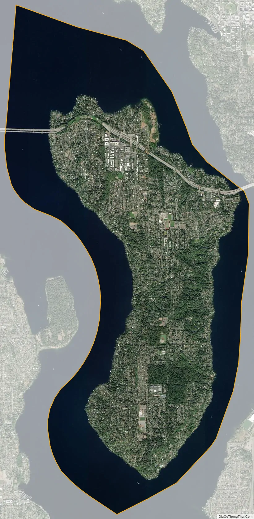
Mercer Island city Satellite Map
Geography
Mercer Island City Hall is located at 47°34′39″N 122°12′43.2″W / 47.57750°N 122.212000°W / 47.57750; -122.212000 (47.5775, -122.212). The peak elevation in the city is about 338 feet (103 m), near the center of the island.
According to the United States Census Bureau, the city has a total area of 13.11 square miles (33.95 km), of which 6.32 square miles (16.37 km) are land and 6.79 square miles (17.59 km) are water.
Mercer Island is the most populated island in a lake in the US.
Climate
This region experiences warm (but not hot) and dry summers, with no average monthly temperatures above 71.6 °F. According to the Köppen Climate Classification system, Mercer Island has a warm-summer Mediterranean climate, abbreviated “Csb” on climate maps.
See also
Map of Washington State and its subdivision:- Adams
- Asotin
- Benton
- Chelan
- Clallam
- Clark
- Columbia
- Cowlitz
- Douglas
- Ferry
- Franklin
- Garfield
- Grant
- Grays Harbor
- Island
- Jefferson
- King
- Kitsap
- Kittitas
- Klickitat
- Lewis
- Lincoln
- Mason
- Okanogan
- Pacific
- Pend Oreille
- Pierce
- San Juan
- Skagit
- Skamania
- Snohomish
- Spokane
- Stevens
- Thurston
- Wahkiakum
- Walla Walla
- Whatcom
- Whitman
- Yakima
- Alabama
- Alaska
- Arizona
- Arkansas
- California
- Colorado
- Connecticut
- Delaware
- District of Columbia
- Florida
- Georgia
- Hawaii
- Idaho
- Illinois
- Indiana
- Iowa
- Kansas
- Kentucky
- Louisiana
- Maine
- Maryland
- Massachusetts
- Michigan
- Minnesota
- Mississippi
- Missouri
- Montana
- Nebraska
- Nevada
- New Hampshire
- New Jersey
- New Mexico
- New York
- North Carolina
- North Dakota
- Ohio
- Oklahoma
- Oregon
- Pennsylvania
- Rhode Island
- South Carolina
- South Dakota
- Tennessee
- Texas
- Utah
- Vermont
- Virginia
- Washington
- West Virginia
- Wisconsin
- Wyoming


