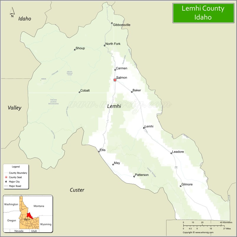
Lemhi County is a county located in the U.S. state of Idaho. As of the 2020 census, the population was 7,974. The largest city and county seat is Salmon. The county was established in 1869, named after Fort Lemhi (or Limhi), a remote Mormon missionary settlement from 1855 to 1858 in Bannock and Shoshone territory.
| Name: | Lemhi County |
|---|---|
| FIPS code: | 16-059 |
| State: | Idaho |
| Founded: | January 9, 1869 |
| Named for: | Fort Lemhi |
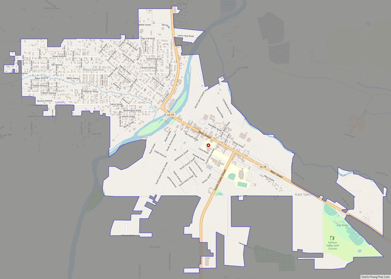
| Seat: | Salmon |
| Largest city: | Salmon |
| Total Area: | 4,569 sq mi (11,830 km²) |
| Land Area: | 4,563 sq mi (11,820 km²) |
| Total Population: | 7,974 |
| Population Density: | 1.7/sq mi (0.67/km²) |
| Time zone: | UTC−7 (Mountain) |
| Summer Time Zone (DST): | UTC−6 (MDT) |
| Website: | www.lemhicountyidaho.org |
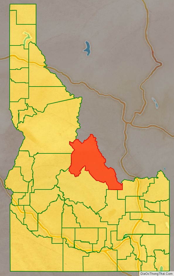
Lemhi County location map. Where is Lemhi County?

History
Native settlement
Habitation of the Lemhi and Salmon Rivers dates back 14,000 years ago. Early natives were spear hunters of big game. The Salmon River was the dividing point among the first cultural split which occurred after 5,000 BC. The Lemhi band of Shoshoni developed culturally in similar fashion to other Shoshoni tribes located south of and east of the Salmon River. The Lemhi band of Shoshoni gained early access to horses and had developed into a migratory culture. They were also known as “Salmon Eaters”. Their migratory pattern consisted of fishing for salmon in the Lemhi Valley in the summer, digging camas on Camas Creek in the spring, and hunting buffalo in the Three Forks area of the Missouri River. They were also known to travel to trade with other tribes. The Lemhi band was forced to a reservation on February 12, 1875, even though the tribe failed to ratify the treaty creating it in 1868. The reservation was disbanded in 1907 and the tribe sent to Fort Hall.
Exploration and early settlement
The Lewis and Clark Expedition entered Idaho on August 12, 1805, at Lemhi Pass in present-day Lemhi County. Meriwether Lewis and three other members of the expedition were the first Americans of European descent to enter what is now Idaho. For Sacajawea, their guide and interpreter, the Lemhi Valley was her birthplace and her brother was the Chief of the Lemhi band. Clark went out to scout the expedition’s route. Within a month, travel down the Salmon and Snake Rivers was ruled out and the expedition headed for Lolo Pass on the Bitterroot Range. Michael Bourdon of the Hudson’s Bay Company established the Lemhi Valley as a base of trapping operations in 1822. The region would support trapping operations for about 20 years. Finnan McDonald, Alexander Ross, David Skene Ogden, Jedediah Smith, and Jim Bridger all spent time in the area. Exploration of the full Salmon River from its source to the Snake River did not occur until 1832. Mormon settlers established Fort Lemhi from 1855 to 1858. The settlement was withdrawn after a native attack on the settlement. The first gold miners ventured into Lemhi County in 1862, with miners working the main Salmon River all the way from Salmon down to Slate Creek.
Mining settlements
F.B. Sharkey and his party struck gold at Leesburg on July 16, 1866. The rush to Leesburg ensued within a month. A stagecoach route was established from Montana in May 1867 to the present location of Salmon City. Additional discovery of gold occurred at Lemhi in 1867 and Shoup in 1868. Salmon City became the county seat of Lemhi County when it was formed in 1869. Additional mining operations occurred at Yellow Jacket in 1869, Gibbonsville in 1877, Gilmore in 1880, Blackbird in 1892, and Leadore in 1904. The Gilmore and Pittsburgh Railroad was completed from Dubois to Salmon on May 18, 1910. The railroad was built to access ore from Gilmore. The railroad ceased operations in 1940.
Development of cities
Salmon City was platted in 1867. While Salmon has gone by the name Salmon City since its inception, it did not have legal status as a city until around 1900.
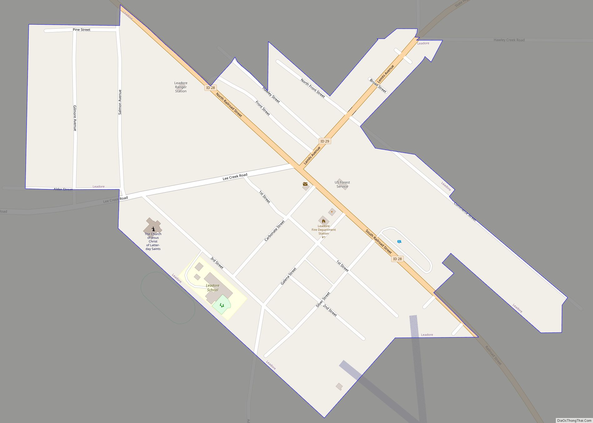
Leadore and Patterson were incorporated as villages in 1947. Patterson was disincorporated by 1980.
County-boundary history
At the start of mining operations in present-day Lemhi County in 1862, the region was fully within Idaho County, Washington Territory. Boise County was created in 1863, with its northern boundary running just north of the ridge dividing Birch Creek) from the Lemhi River. Under Idaho Territory, the southern portion became part of Alturas County on February 2, 1864, and the dividing line between Alturas and Idaho Counties was adjusted to 44° 30′ North latitude. The Idaho territorial legislature actually created Lemhi County twice. The first occasion was on December 21, 1866. A county government was organized at Salmon City, yet the bill approving the county was misplaced and never published in session laws. The following session, the legislature passed the bill again, officially creating Lemhi County on January 9, 1869. The county government was reorganized at Salmon City on February 22, 1870. The western and southern county boundaries for Lemhi were problematic and adjusted frequently. At its creation, Lemhi inherited Idaho County’s southern and eastern boundaries, which effectively created two areas of noncontiguous territory, with one of the sections containing territory along the Salt Lake to Virginia City stagecoach route just north of the present town of Humphrey, Idaho. Finalization of the southern boundary came in several steps from 1885 to 1896. In 1885, the boundary was moved southward, gaining territory in present Clark County, creating a contiguous boundary, and leaving a 6-by-25.5-mile (9.7 by 41.0 km) stretch of the Birch Creek Area in Alturas County. The eastern 6-by-9-mile (9.7 by 14.5 km) portion of that territory was transferred from Alturas to Bingham in 1889. A change in 1891 extended the boundary south to its present location and added territory presently in Clark County. With legislative approval, voters in that territory voted to become part of Fremont County in 1896, finalizing the southern and eastern boundary. At Lemhi’s creation, the western boundary was a line drawn from the Bitterroot Mountains to the southern line of Idaho County. The boundary was moved westward to the divide between the Payette and Salmon Rivers in 1873, moved eastward to a line drawn through the confluence of the Middle Fork and main Salmon rivers in 1885, and then mistakenly extended to the northern line of Idaho County in 1903 before being finalized at its present location in 1911. Custer County was partitioned from Lemhi in 1881 with its initial boundary excluding the Loon Creek area. The Loon Creek area was transferred back to Idaho County in 1885.
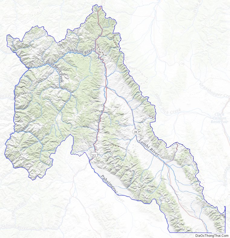
Lemhi County Road Map
Geography
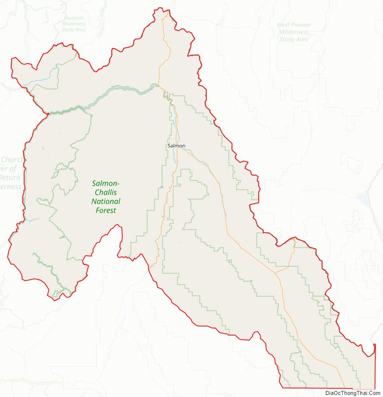
According to the U.S. Census Bureau, the county has a total area of 4,569 square miles (11,830 km), of which 4,563 square miles (11,820 km) is land and 5.4 square miles (14 km) (0.1%) is water. It is the fourth-largest county in Idaho by area. The highest point is Bell Mountain at 11,612 ft (3,539 m) above sea level, and the lowest point is the Salmon River as it exits on the county’s western border with Idaho County at approximately 3,000 feet (910 m). The river cuts through the center of Lemhi County before turning west. The county’s eastern border with Beaverhead County, Montana, is the Continental Divide.
Adjacent counties
- Idaho County, Idaho – northwest/Pacific Time border
- Ravalli County, Montana – north
- Beaverhead County, Montana – northeast
- Clark County, Idaho – east
- Butte County, Idaho – south
- Custer County, Idaho – southwest
- Valley County, Idaho – west
National protected areas
- Challis National Forest (part)
- Salmon National Forest (part)
- Targhee National Forest (part)
- Frank Church—River of No Return Wilderness (part)
Lemhi County Topographic Map
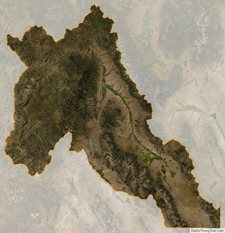
Lemhi County Satellite Map
Lemhi County Outline Map