Loving County is a county in the U.S. state of Texas. With a population of 64 per the 2020 census, it is the least-populous county in the United States. Its county seat and only community is Mentone. The county was originally created in 1887, and after being disorganized in 1897, was reorganized in 1931.
| Name: | Loving County |
|---|---|
| FIPS code: | 48-301 |
| State: | Texas |
| Founded: | 1887 |
| Named for: | Oliver Loving |
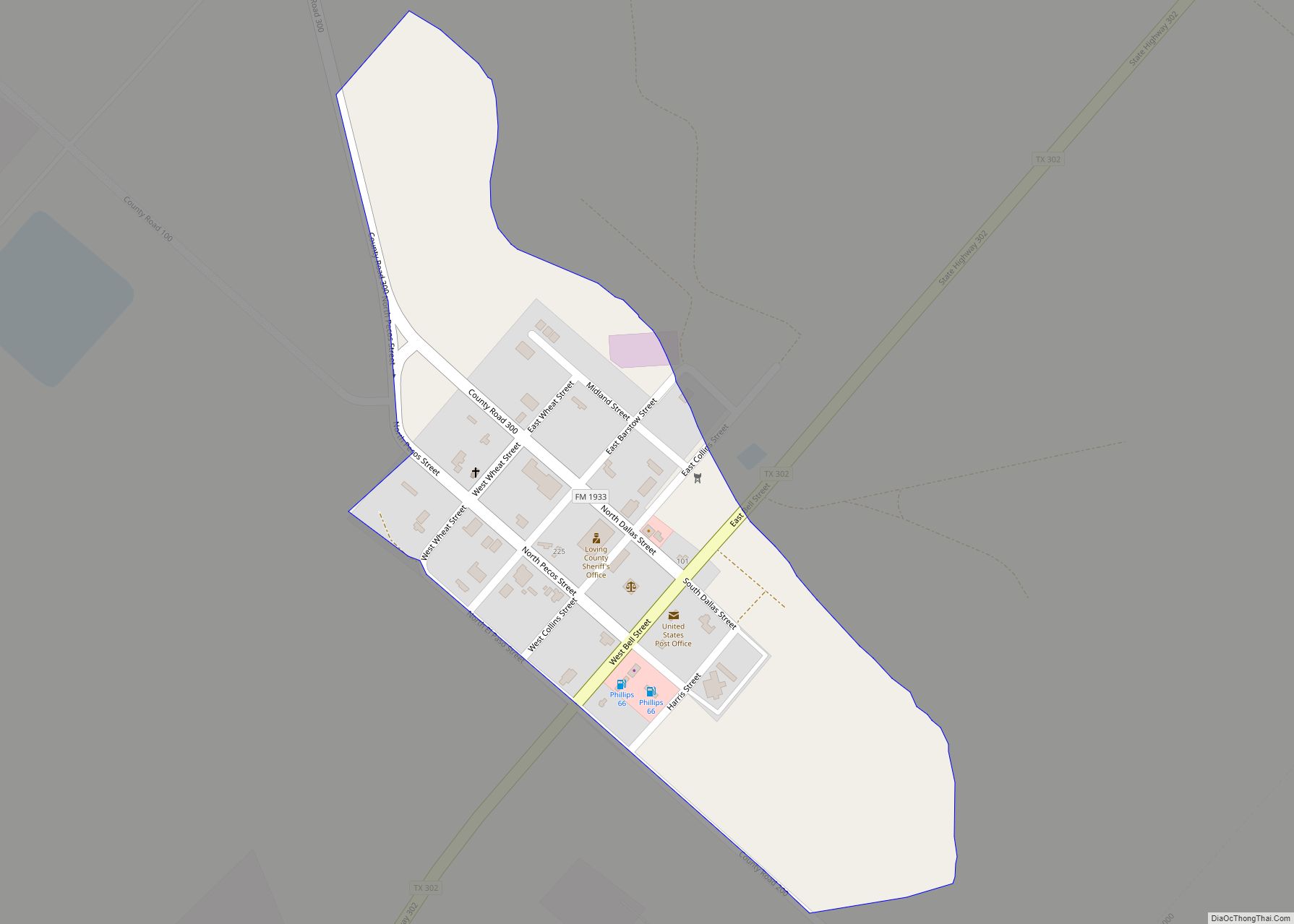
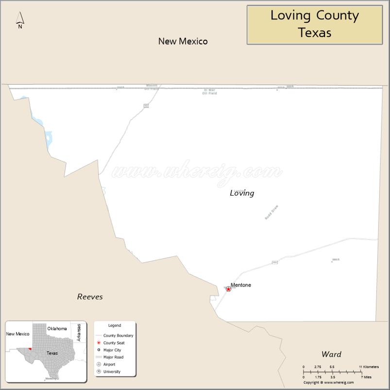
| Seat: | Mentone |
| Total Area: | 677 sq mi (1,750 km²) |
| Land Area: | 669 sq mi (1,730 km²) |
| Total Population: | 64 |
| Population Density: | .095/sq mi (0.037/km²) |
| Time zone: | UTC−6 (Central) |
| Summer Time Zone (DST): | UTC−5 (CDT) |
| Website: | www.co.loving.tx.us |
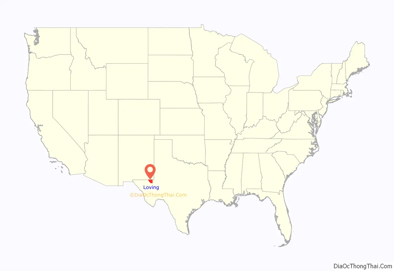
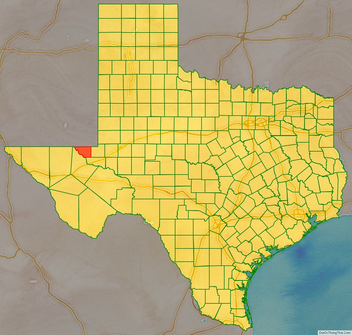
Loving County location map. Where is Loving County?
History
Nomadic hunters inhabited the area during prehistory. Antonio de Espejo traveled in the area in 1583, and crossed the Pecos River. Immigrants used a ford, later named Pope’s Crossing, for travel in the 1840s. John Pope surveyed the area in 1854, for the building of a transcontinental railroad. He created a camp in 1855, and conducted three drilling attempts, but only found water once and was unable to access it. Andrew A. Humphreys ordered Pope to end his drilling and abandon the camp on July 10, 1858. Soldiers were stationed at the camp created by Pope from 1858 to 1861. The route of the Butterfield Overland Mail went through the area.
Oliver Loving, after whom the county was named, and Charles Goodnight drove cattle through the area in 1866, creating the Goodnight–Loving Trail. Loving was shot by a Comanche native in 1867, and died from gangrene. The area was a part of Bexar County from 1837 to 1874, when it became a part of Tom Green County. Eleven people in the area, including Clay Allison, petitioned to the 19th session of the Texas Legislature to become a part of Reeves County. Loving County was created in 1887, by House Bill No. 113, although it was to be attached to Reeves County for purposes, including judicial and surveying.
Six men from Denver came to the county in 1893, and founded the Loving Canal and Irrigation Company and Mentone, which was named by a French surveyor for his home of Menton, France. On June 13, the men filed a petition with 150 signatures to the Reeves County Commissioners Court requesting the organization of the county and it was accepted. The county organization was approved by an election held on July 8, with 83 voters participating, and Mentone became the county seat. Another election was held in 1894, and both elections held in the county are believed to have been fraudulent. The county commission issued bonds worth $6,000 to construct a courthouse in Mentone, but the project was not completed as a flood in August destroyed the work that was done on the irrigation project. Accusations of illegal county organization arose, which were investigated by H. C. Withers and A. H. Randolph. They were informed by W.A. Hunter, the sheriff and tax collector, that R. G. Munn, the county clerk, had taken the tax records to Denver. All of the county officials had left the county by 1897, and the county was dissolved on May 12, 1897, and returned to Reeves County.
In December 1896, Hunter traveled to Pecos, Texas, but went missing with his horses either dying from starvation or being unaccounted for. His sister, Jennie M. Mettler, attempted to receive the $15,000 in life insurance that Hunter took out in November, but the insurance company refused to pay, as Hunter’s body was not discovered. She filed a lawsuit and won in the first case and in the appeal made by the company to the Supreme Court of the United States. Hunter was found living in Birmingham, Alabama, under the name of Al Hunt in 1902. He had abandoned one of his horses, while riding the other one, to take a train from Barstow, Texas. He was sentenced to serve five years in prison, but his conviction was overturned on appeal.
The county has no cemetery, and the only grave in the area is for Shady Davis, a 21-year-old cowboy who was killed by his horse and buried 12 miles from Mentone in the 1920s. The population in the area increased following the discovery of oil, and led to the creation of the town of Ramsey. Loving County was reorganized in 1931, becoming the only county in Texas to be organized twice, and Ramsey was later renamed as Mentone.
On November 17, 2020, during the COVID-19 pandemic, Loving County was the last county in the contiguous United States to confirm at least one case of COVID-19, with three cases confirmed in the area. Earlier in August, a nonresident male at a man camp was confirmed to have contracted the disease. Additionally, at least two residents who had contracted the disease elsewhere returned to Loving County and quarantined, but those cases were not counted in the county’s totals.
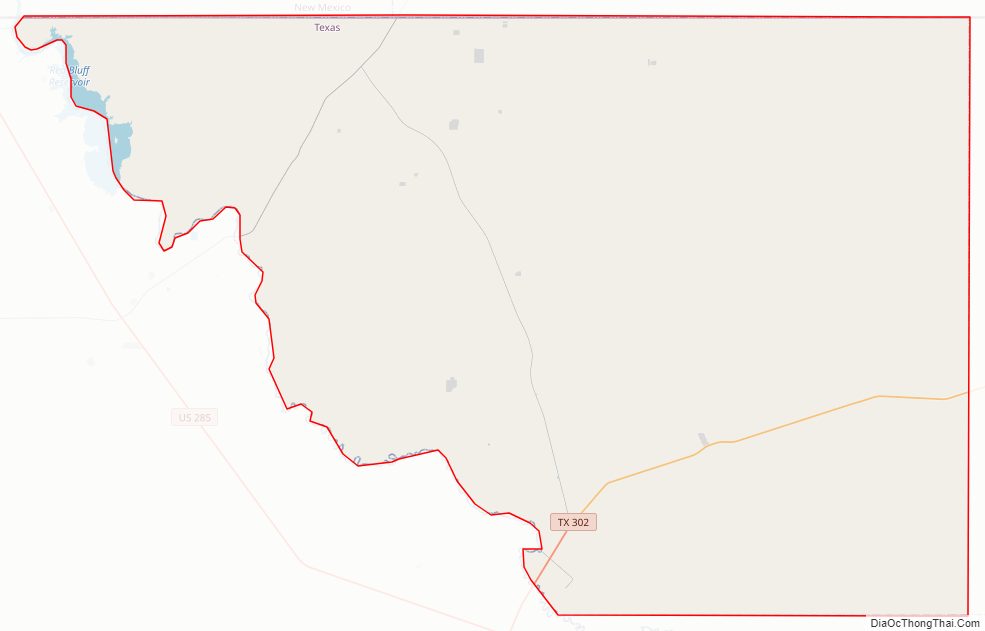
Loving County Road Map
Geography
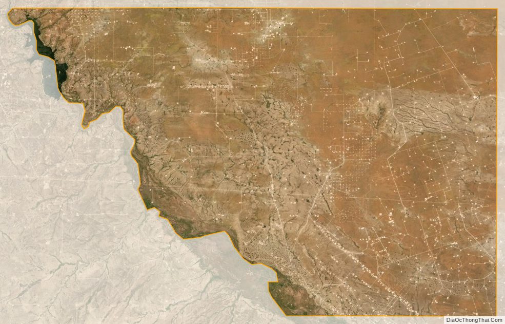
The county is three-fifths the size of Rhode Island. According to the U.S. Census Bureau, the county has a total area of 677 square miles (1,750 km), of which 7.8 square miles (20 km) (1.1%) are covered by water.
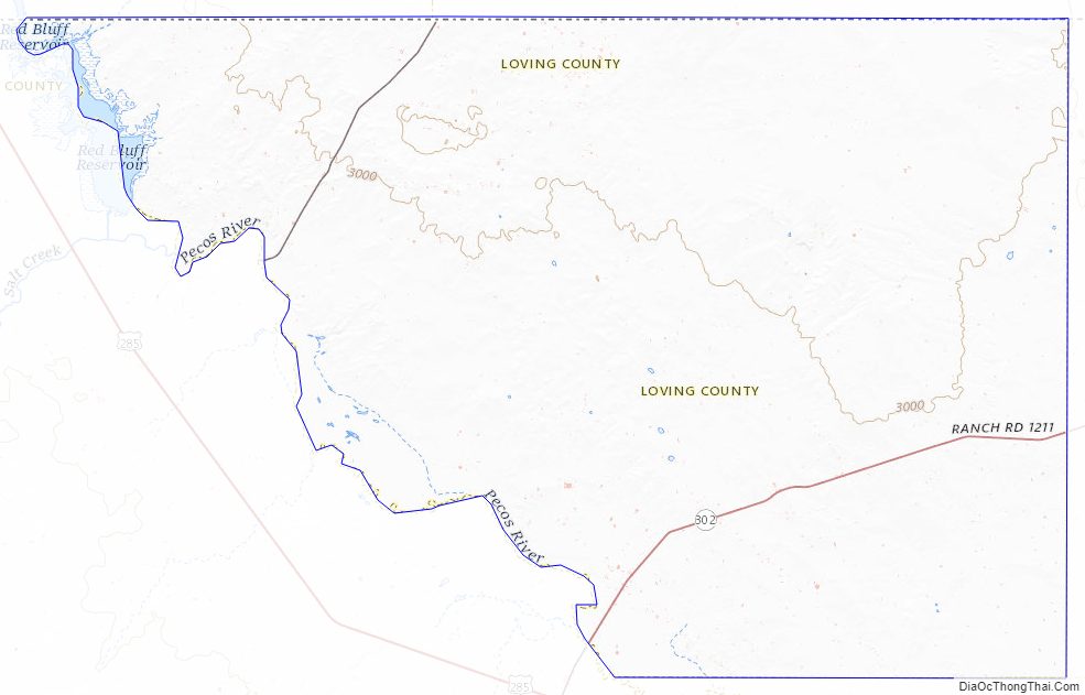
Water in the area has to be imported from Kermit or Pecos, Texas, due to the groundwater in the area containing gypsum; the Pecos River was previously used for water before its salinity became too high. The Pecos River is the county’s western boundary, forming the Red Bluff Reservoir along its northwestern border with Reeves County and Eddy County, New Mexico. The terrain of Loving County is described as flat desert, with a few low hills. Desert shrubs, range grasses, and cacti abound, with salt cedars along the river. Elevations vary from 2,686 to 3,311 feet (819 to 1,009 m) above sea level.
Loving is the smallest county by area in the Permian Basin region.
Major highways
- State Highway 302
- Ranch to Market Road 652
Adjacent counties
- Lea County, New Mexico (north/Mountain Time Zone)
- Winkler County (east)
- Ward County (southeast)
- Reeves County (southwest)
- Eddy County, New Mexico (northwest/Mountain Time Zone)
Loving County Topographic Map
Loving County Satellite Map
Loving County Outline Map