Kermit is a city in and the county seat of Winkler County, Texas, United States. The population was 5,708 at the 2010 census. The city was named after Kermit Roosevelt following a visit by his father, President Theodore Roosevelt, to the county.
| Name: | Kermit city |
|---|---|
| LSAD Code: | 25 |
| LSAD Description: | city (suffix) |
| State: | Texas |
| County: | Winkler County |
| Incorporated: | 1938 |
| Elevation: | 2,861 ft (872 m) |
| Total Area: | 2.52 sq mi (6.52 km²) |
| Land Area: | 2.52 sq mi (6.52 km²) |
| Water Area: | 0.00 sq mi (0.00 km²) |
| Total Population: | 5,708 |
| Population Density: | 2,577.90/sq mi (995.26/km²) |
| ZIP code: | 79745 |
| Area code: | 432 |
| FIPS code: | 4839004 |
| GNISfeature ID: | 1360598 |
| Website: | www.kermittexas.us |
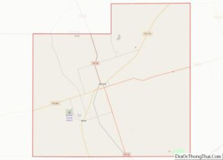
Online Interactive Map
Click on ![]() to view map in "full screen" mode.
to view map in "full screen" mode.
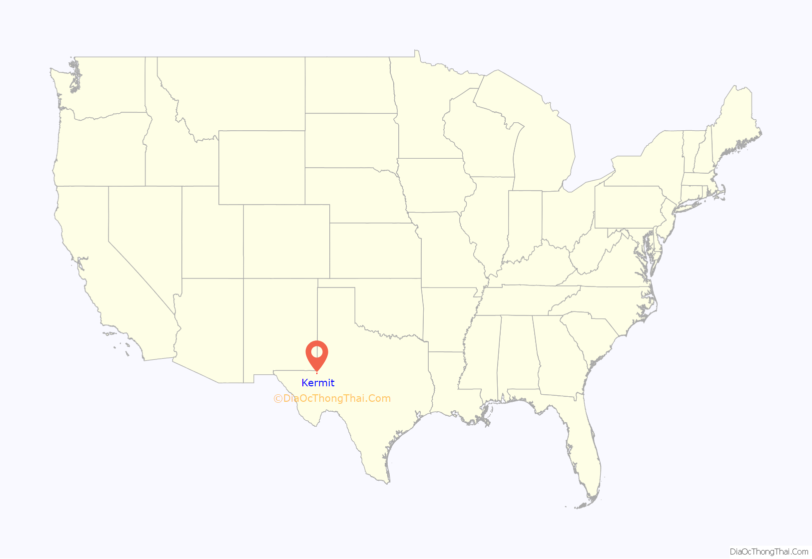
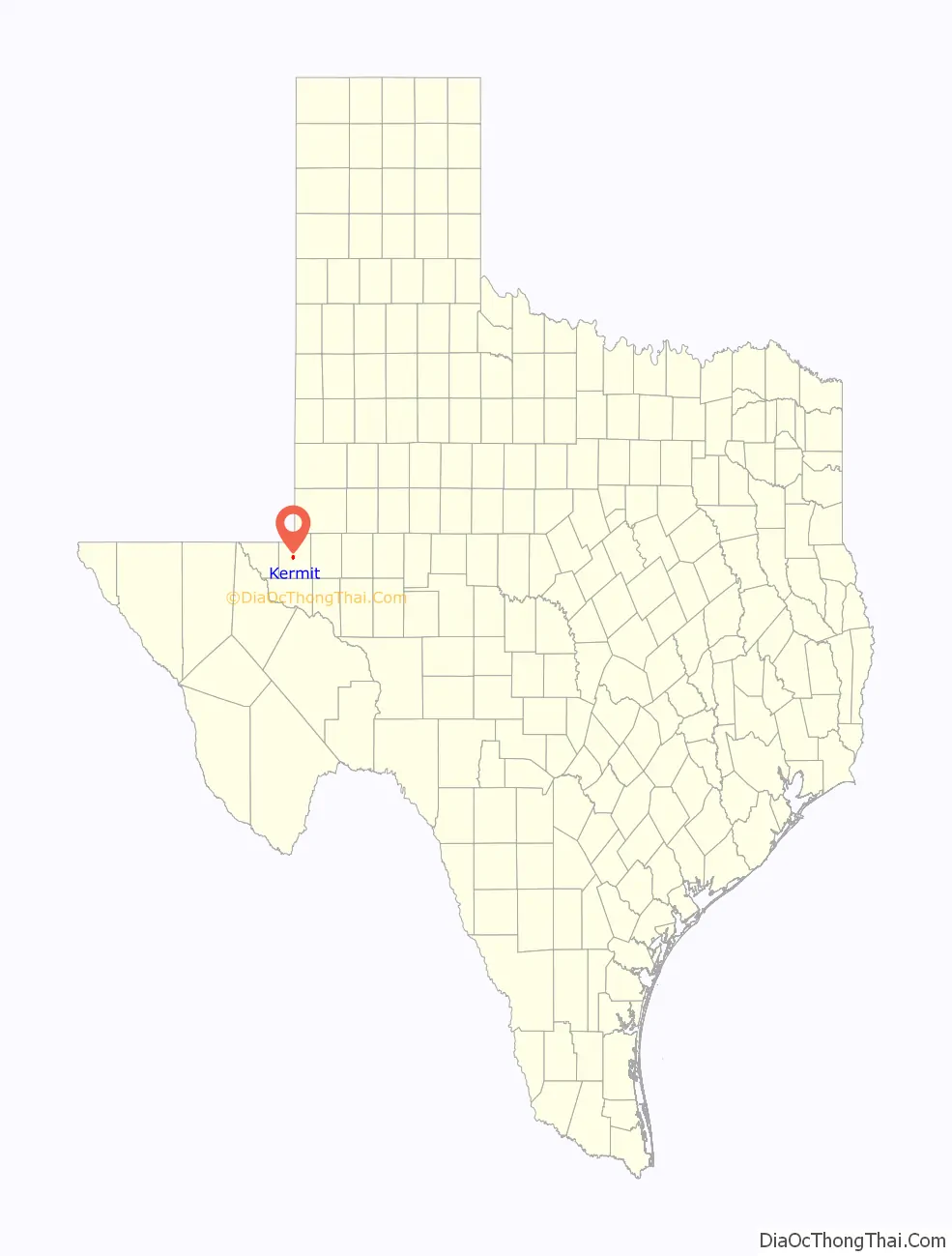
Kermit location map. Where is Kermit city?
History
Establishment
Kermit began as a convenient supply center for the scattered ranches of the area and became the seat of Winkler County when the county was organized in 1910. The first public school and the post office opened the same year. The town’s namesake, Kermit Roosevelt, once visited the T Bar Ranch in northern Winkler County to hunt antelope a few months before the town was named. In 1916, the county suffered a drought. Many homesteaders and ranchers were forced to leave. In 1924, only Ern Baird’s family remained in the town. Only one student attended school in the county for five months of 1924. Only three houses and the courthouse were in use by 1926.
Discovery of oil
On July 16, 1926, however, oil was discovered in Hendrick oilfield, near Kermit, and the town experienced a boom. In 1927, a population of 1,000 was reported; by 1929 that number increased to 1,500. On March 4, 1929, the Texas-New Mexico Railway reached the town.
Great Depression and incorporation
The Great Depression had little effect on the city throughout much of the 1930s, but the population decreased significantly in the early 1930s, and both population and business figures rose at the end of the 1930s, when 2,700 residents and 180 businesses were listed. On February 15, 1938, residents voted to incorporate. During the 1940s, the oil boom caused real estate prices to double. Housing was scarce, and some people lived in tents. A bank was opened by 1945. The grade school had to be enlarged, and a hospital was built.
Oil boom days
In the 1950s, the town continued to grow; housing additions were built. By 1960, the city had a population of 10,465 and 260 businesses, and additional growth estimated to be over 12,000 during the decade. Flooding became a problem because of the flat terrain, so new crown streets were constructed to solve the flooding problem, and more housing additions were built. The town moved the last working wooden derrick in the Permian Basin from Loving County to Pioneer Park in Kermit in 1966 as a symbol of the importance of the oil industry to the economy of Kermit and Winkler County. In the 1970s and 1980s, the population of Kermit bounced between 8,500 and 6,912, and the number of businesses moved between 200 and 116. Improvements were made in city services, and more housing additions were built.
On June 3, 1980, a 9-ft-wide (3 m) sinkhole opened on the property of Atlantic Richfield Company and got progressively larger. Within four days, it had become a tourist attraction, with a crater measuring 400 by 200 ft (122 by 61 m), and as much as 30 ft (9.1 m) deep. The 1990 United States census set the population of Kermit at 6,875.
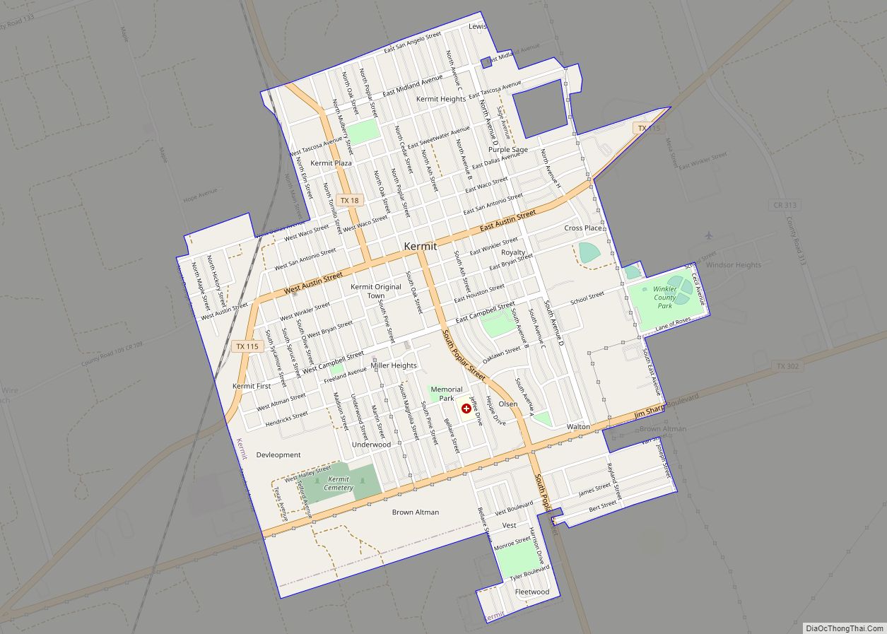
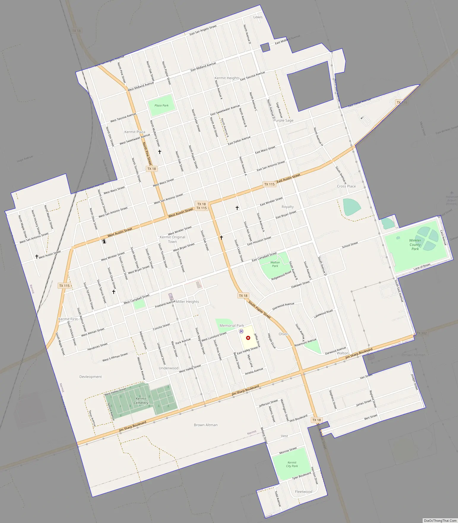
Kermit Road Map
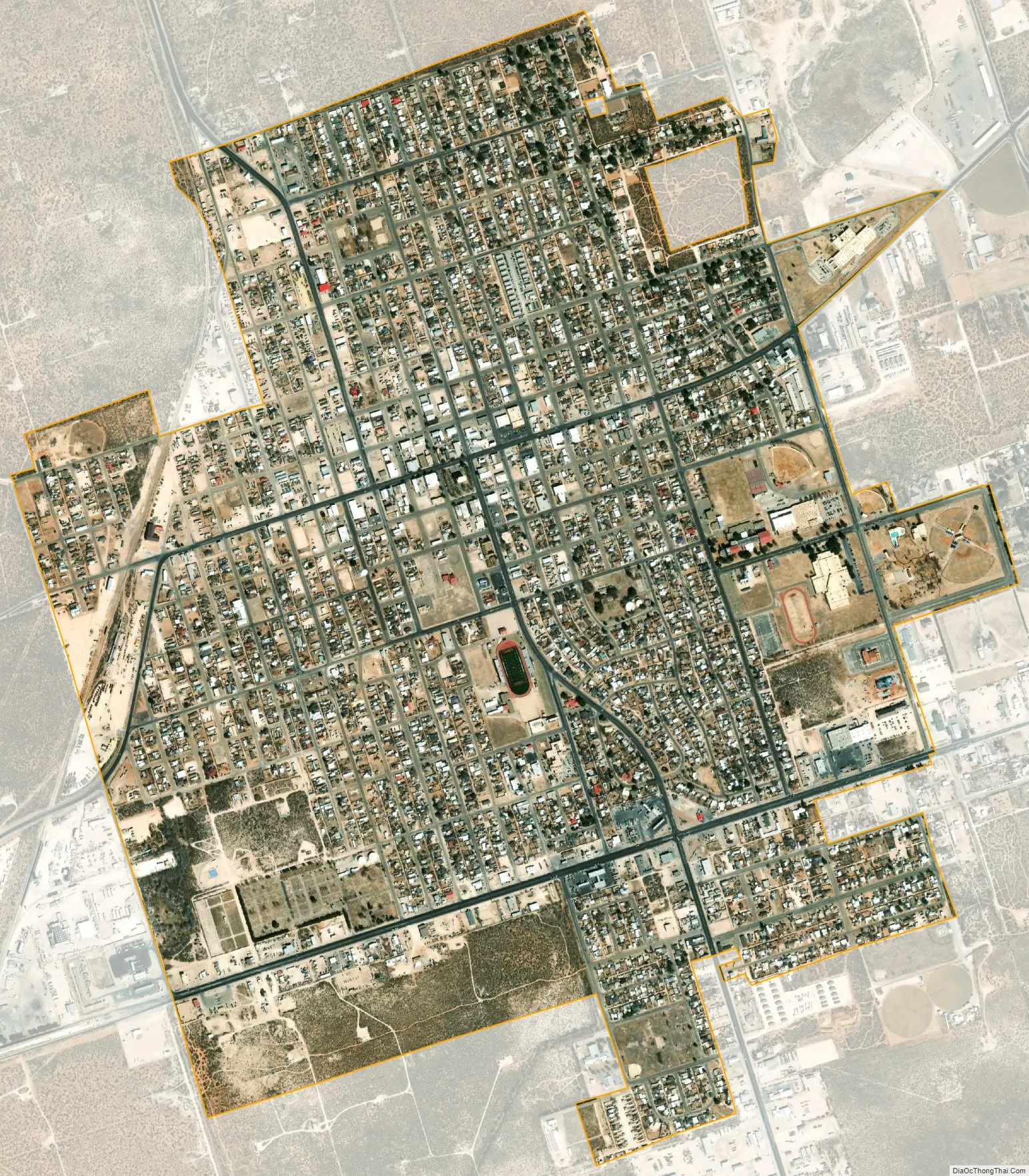
Kermit city Satellite Map
Geography
Kermit is located at 31°51′14″N 103°5′32″W / 31.85389°N 103.09222°W / 31.85389; -103.09222 (31.853995, 103.092336). According to the United States Census Bureau, the city has a total area of 2.5 square miles (6.5 km), all land. The city is located in a semiarid region of the Permian Basin.
Climate
This area has a large amount of sunshine year round due to its stable descending air and high pressure. According to the Köppen climate classification system, Kermit has a hot arid climate, BWh on climate maps, slightly too warm to be a cool arid climate (BWk) and slightly too dry for semi-arid classification.
See also
Map of Texas State and its subdivision:- Anderson
- Andrews
- Angelina
- Aransas
- Archer
- Armstrong
- Atascosa
- Austin
- Bailey
- Bandera
- Bastrop
- Baylor
- Bee
- Bell
- Bexar
- Blanco
- Borden
- Bosque
- Bowie
- Brazoria
- Brazos
- Brewster
- Briscoe
- Brooks
- Brown
- Burleson
- Burnet
- Caldwell
- Calhoun
- Callahan
- Cameron
- Camp
- Carson
- Cass
- Castro
- Chambers
- Cherokee
- Childress
- Clay
- Cochran
- Coke
- Coleman
- Collin
- Collingsworth
- Colorado
- Comal
- Comanche
- Concho
- Cooke
- Coryell
- Cottle
- Crane
- Crockett
- Crosby
- Culberson
- Dallam
- Dallas
- Dawson
- Deaf Smith
- Delta
- Denton
- Dewitt
- Dickens
- Dimmit
- Donley
- Duval
- Eastland
- Ector
- Edwards
- El Paso
- Ellis
- Erath
- Falls
- Fannin
- Fayette
- Fisher
- Floyd
- Foard
- Fort Bend
- Franklin
- Freestone
- Frio
- Gaines
- Galveston
- Garza
- Gillespie
- Glasscock
- Goliad
- Gonzales
- Gray
- Grayson
- Gregg
- Grimes
- Guadalupe
- Hale
- Hall
- Hamilton
- Hansford
- Hardeman
- Hardin
- Harris
- Harrison
- Hartley
- Haskell
- Hays
- Hemphill
- Henderson
- Hidalgo
- Hill
- Hockley
- Hood
- Hopkins
- Houston
- Howard
- Hudspeth
- Hunt
- Hutchinson
- Irion
- Jack
- Jackson
- Jasper
- Jeff Davis
- Jefferson
- Jim Hogg
- Jim Wells
- Johnson
- Jones
- Karnes
- Kaufman
- Kendall
- Kenedy
- Kent
- Kerr
- Kimble
- King
- Kinney
- Kleberg
- Knox
- La Salle
- Lamar
- Lamb
- Lampasas
- Lavaca
- Lee
- Leon
- Liberty
- Limestone
- Lipscomb
- Live Oak
- Llano
- Loving
- Lubbock
- Lynn
- Madison
- Marion
- Martin
- Mason
- Matagorda
- Maverick
- McCulloch
- McLennan
- McMullen
- Medina
- Menard
- Midland
- Milam
- Mills
- Mitchell
- Montague
- Montgomery
- Moore
- Morris
- Motley
- Nacogdoches
- Navarro
- Newton
- Nolan
- Nueces
- Ochiltree
- Oldham
- Orange
- Palo Pinto
- Panola
- Parker
- Parmer
- Pecos
- Polk
- Potter
- Presidio
- Rains
- Randall
- Reagan
- Real
- Red River
- Reeves
- Refugio
- Roberts
- Robertson
- Rockwall
- Runnels
- Rusk
- Sabine
- San Augustine
- San Jacinto
- San Patricio
- San Saba
- Schleicher
- Scurry
- Shackelford
- Shelby
- Sherman
- Smith
- Somervell
- Starr
- Stephens
- Sterling
- Stonewall
- Sutton
- Swisher
- Tarrant
- Taylor
- Terrell
- Terry
- Throckmorton
- Titus
- Tom Green
- Travis
- Trinity
- Tyler
- Upshur
- Upton
- Uvalde
- Val Verde
- Van Zandt
- Victoria
- Walker
- Waller
- Ward
- Washington
- Webb
- Wharton
- Wheeler
- Wichita
- Wilbarger
- Willacy
- Williamson
- Wilson
- Winkler
- Wise
- Wood
- Yoakum
- Young
- Zapata
- Zavala
- Alabama
- Alaska
- Arizona
- Arkansas
- California
- Colorado
- Connecticut
- Delaware
- District of Columbia
- Florida
- Georgia
- Hawaii
- Idaho
- Illinois
- Indiana
- Iowa
- Kansas
- Kentucky
- Louisiana
- Maine
- Maryland
- Massachusetts
- Michigan
- Minnesota
- Mississippi
- Missouri
- Montana
- Nebraska
- Nevada
- New Hampshire
- New Jersey
- New Mexico
- New York
- North Carolina
- North Dakota
- Ohio
- Oklahoma
- Oregon
- Pennsylvania
- Rhode Island
- South Carolina
- South Dakota
- Tennessee
- Texas
- Utah
- Vermont
- Virginia
- Washington
- West Virginia
- Wisconsin
- Wyoming