Oconee County is a county located in the northeastern part of the U.S. state of Georgia. As of the 2020 census, the population was 41,799. The county seat is Watkinsville.
Oconee County is included in the Athens-Clarke County, GA Metropolitan Statistical Area.
| Name: | Oconee County |
|---|---|
| FIPS code: | 13-219 |
| State: | Georgia |
| Founded: | 1875 |
| Named for: | Oconee River |
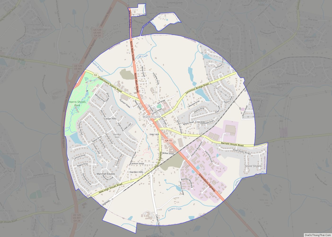
| Seat: | Watkinsville |
| Largest town: | Watkinsville |
| Total Area: | 186 sq mi (480 km²) |
| Land Area: | 184 sq mi (480 km²) |
| Total Population: | 41,799 |
| Population Density: | 227/sq mi (88/km²) |
| Time zone: | UTC−5 (Eastern) |
| Summer Time Zone (DST): | UTC−4 (EDT) |
| Website: | www.oconeecounty.com |
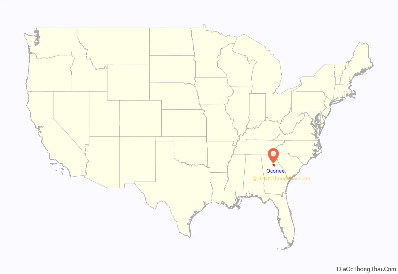
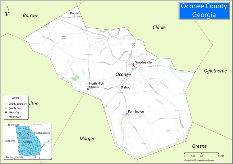
Oconee County location map. Where is Oconee County?
History
The county’s name derives from the Oconee, a Muskogean people of central Georgia. The name exists in several variations, including Ocone, Oconi, Ocony, and Ekwoni. Oconee County was created from the southwestern part of Clarke County in 1875 by the Georgia General Assembly. The new county was created to satisfy southwestern Clarke County residents’ demand for their own county after the county seat was moved from Watkinsville to Athens by the General Assembly in 1872. It is named for the river flowing along part of its eastern border.
The county was ranked as the third-best rural county to live in by Progressive Farmer magazine in 2006.
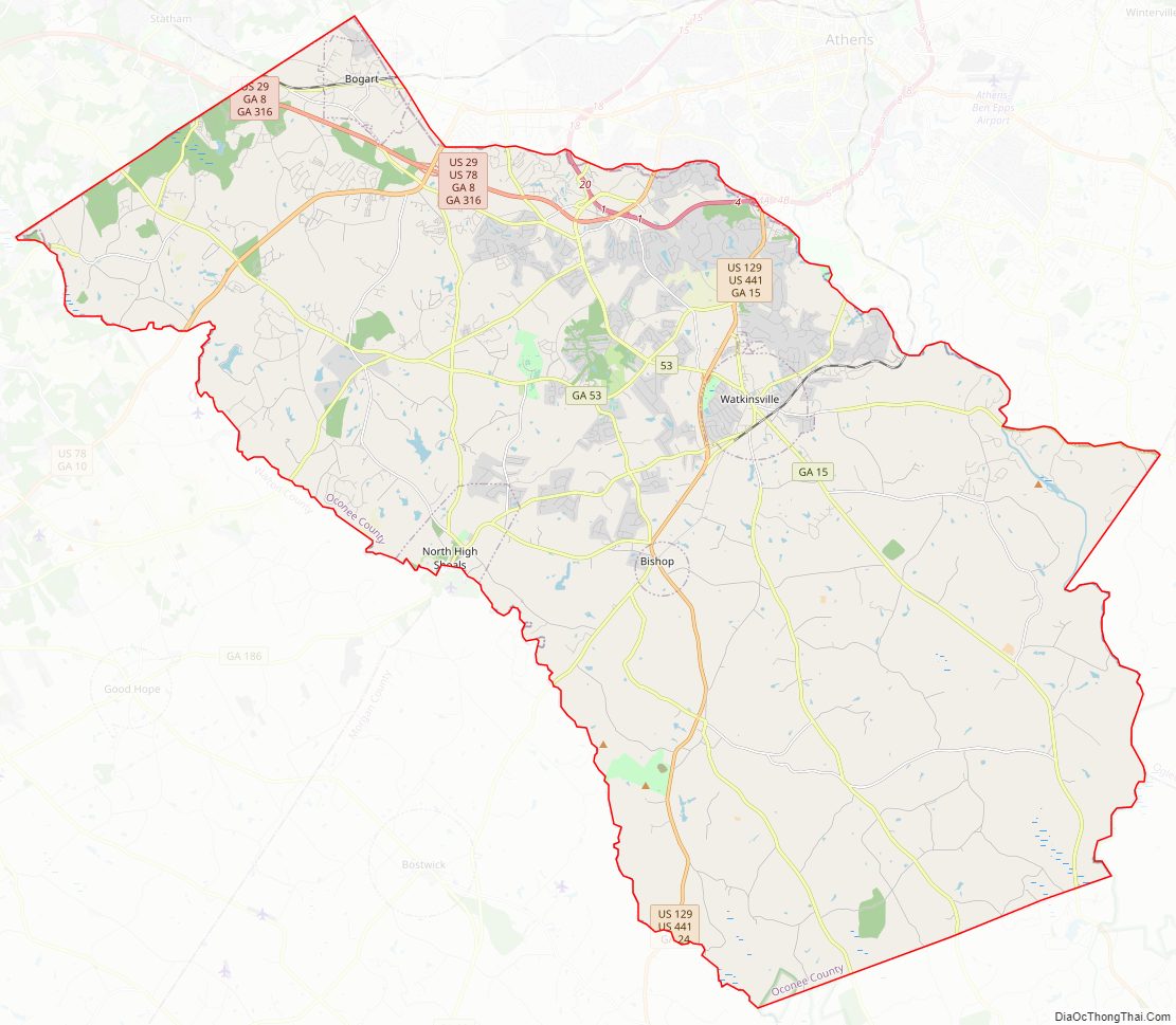
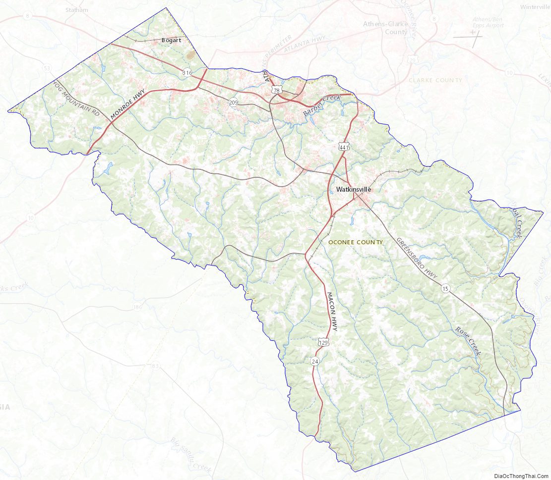
Oconee County Road Map
Geography
According to the U.S. Census Bureau, the county has a total area of 186 square miles (480 km), of which 184 square miles (480 km) is land and 2.1 square miles (5.4 km) (1.1%) is water. The county is located in the Piedmont region of the state.
The entirety of Oconee County is located in the Upper Oconee River sub-basin of the Altamaha River basin.
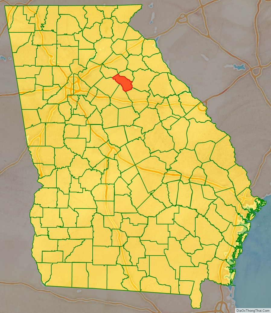
Adjacent counties
- Clarke County (north)
- Oglethorpe County (east)
- Greene County (southeast)
- Morgan County (south)
- Walton County (west)
- Barrow County (northwest)
National protected area
- Oconee National Forest (part)
Oconee County Topographic Map
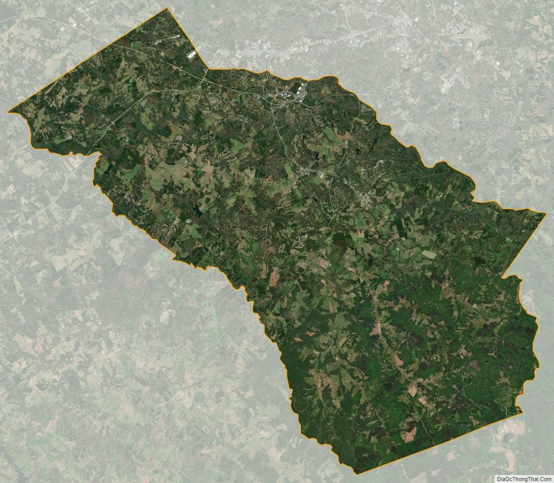
Oconee County Satellite Map
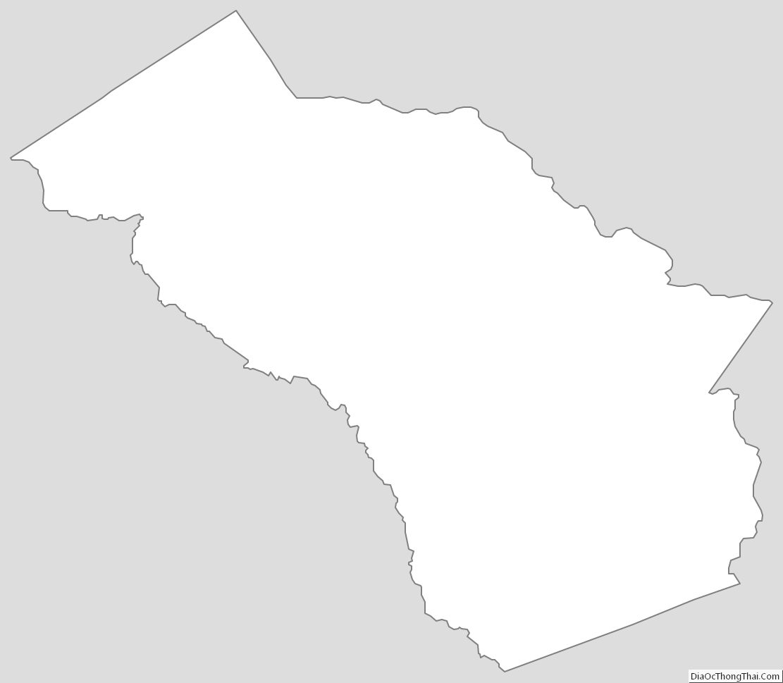
Oconee County Outline Map