Watkinsville is the largest town and county seat of Oconee County, Georgia, United States. As of the 2020 census, the town had a total population of 2,896. It served as the seat of Clarke County until 1872 when the county seat of that county was moved to Athens, a move which ultimately led to the creation of Oconee County in 1875. It is included in the Athens-Clarke County, Georgia Metropolitan Statistical Area.
| Name: | Watkinsville city |
|---|---|
| LSAD Code: | 25 |
| LSAD Description: | city (suffix) |
| State: | Georgia |
| County: | Oconee County |
| Elevation: | 735 ft (224 m) |
| Total Area: | 3.31 sq mi (8.58 km²) |
| Land Area: | 3.28 sq mi (8.48 km²) |
| Water Area: | 0.04 sq mi (0.10 km²) |
| Total Population: | 2,896 |
| Population Density: | 884.00/sq mi (341.36/km²) |
| ZIP code: | 30677 |
| Area code: | 706 |
| FIPS code: | 1380788 |
| GNISfeature ID: | 2405687 |
| Website: | http://cityofwatkinsville.com/ |
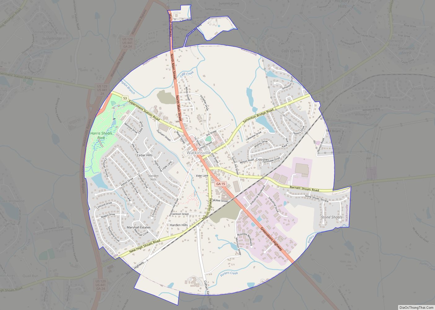
Online Interactive Map
Click on ![]() to view map in "full screen" mode.
to view map in "full screen" mode.
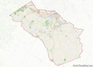
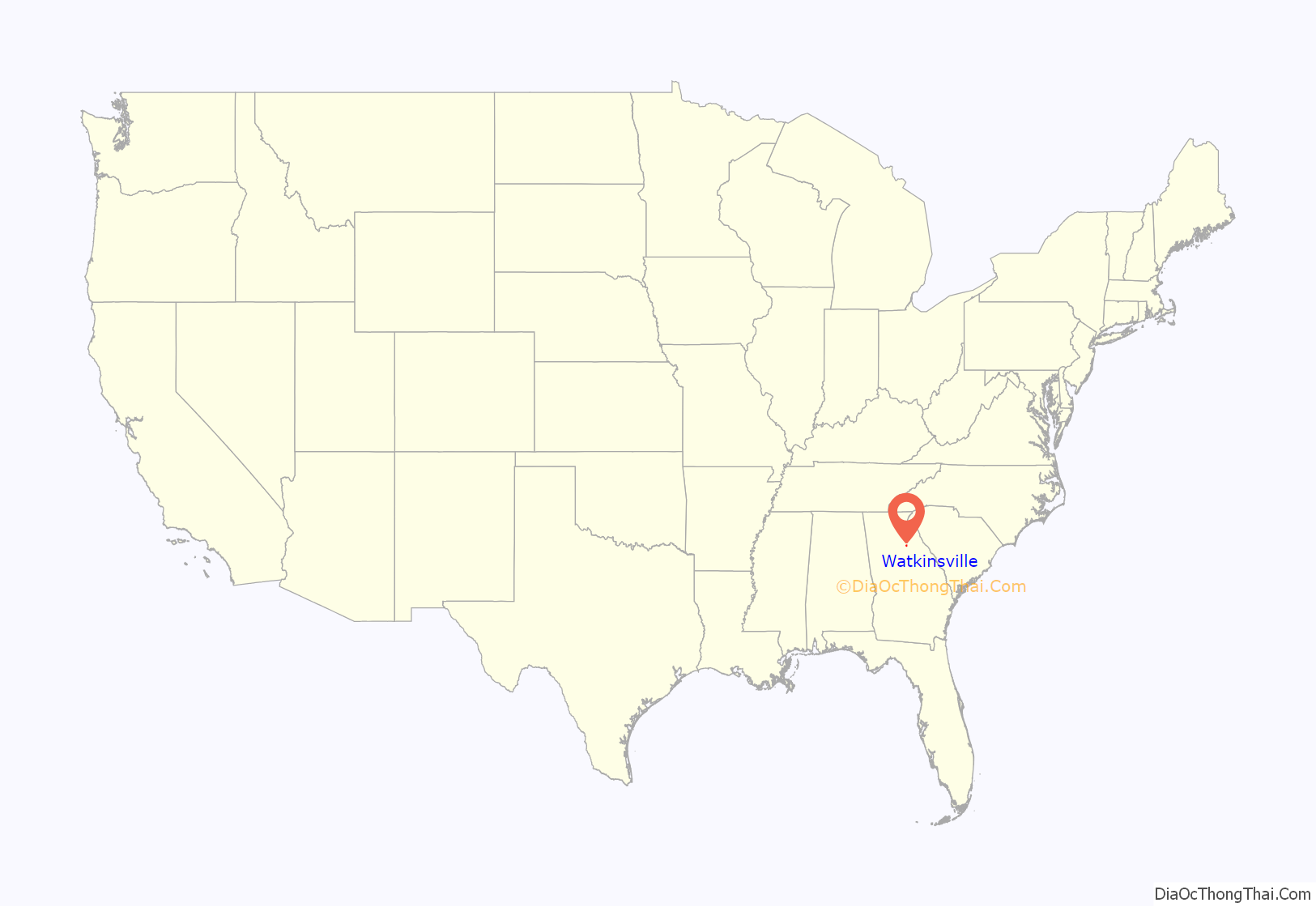
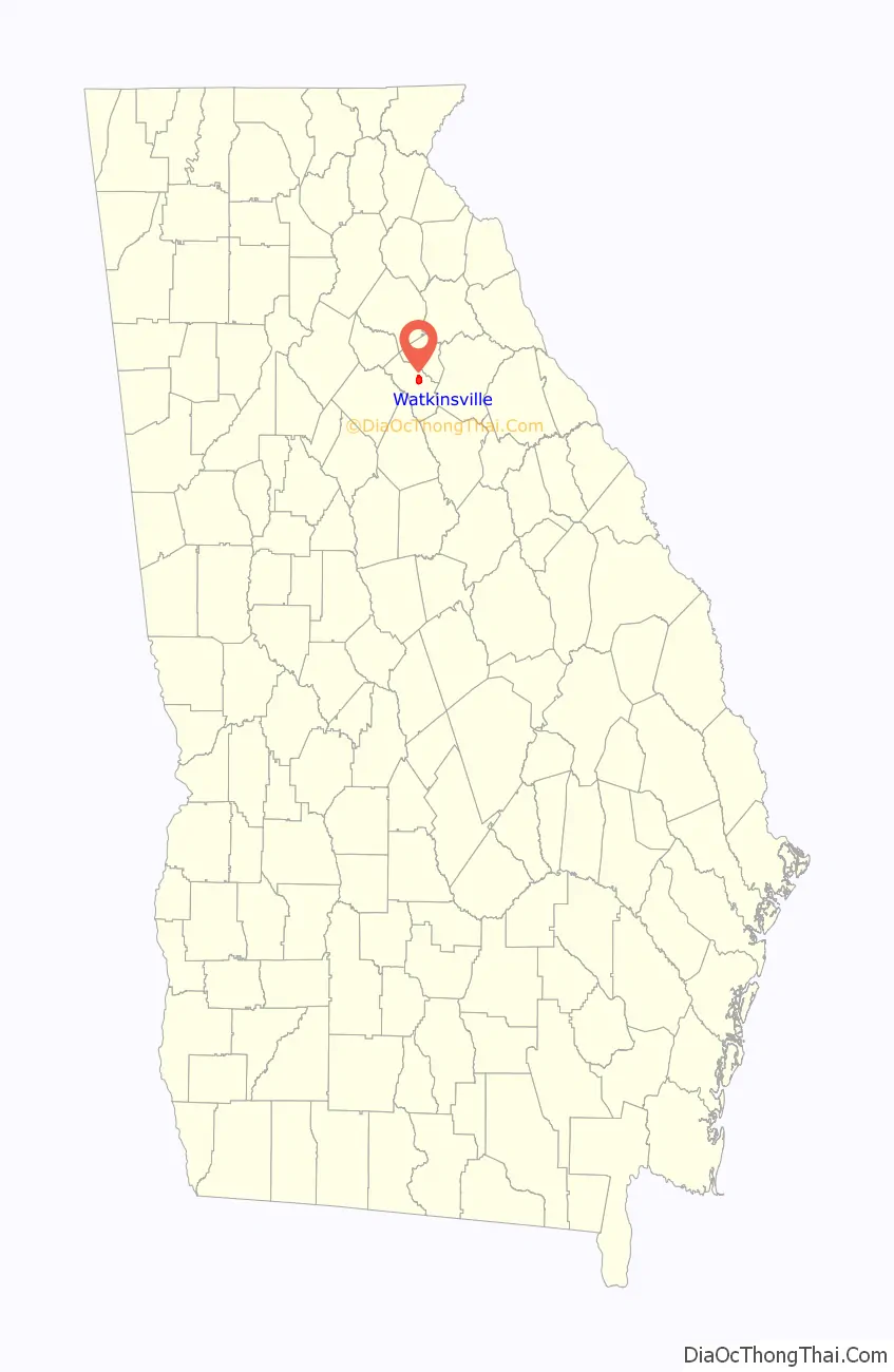
Watkinsville location map. Where is Watkinsville city?
History
Named after colonel Robert Watkins, Watkinsville was first named in records in 1791. It was located on the dangerous western frontier of the new United States. The Methodist Church played a prominent role in the city’s early history. The Georgia General Assembly incorporated Watkinsville in 1815.
Watkinsville had previously been in Clarke County. Oconee County was created from the southwestern part of Clarke County in 1875 by the Georgia General Assembly.
1905 lynching
On June 30, 1905, Watkinsville saw one of the worst outbreaks of racial violence ever in Georgia. In one instance, eight men (seven of whom were black) were pulled from a local jail and lynched. The lynching occurred due to two events. One of which was accusations that Sandy Price, one of the black males, assaulted a white woman named Weldon Dooley at her home in Watkinsville. Secondly, unsupported rumors spread that black males had killed a white couple known as the Holbrooks. This provoked the town people further. Price tried to flee from a crowd of angry locals, who chased and fired at him. He escaped the crowd of people, but was captured by the law and placed in jail. News of Price’s jailing reached the people and they begun planning his killing. People from the surrounding areas gathered together and forcefully retrieved the key to the jail cells from L. H. Alken, the marshal of the local jail. According to two eyewitnesses, the mob tied the African Americans and one white man to posts outside the jail after retrieving them, then shot them multiple times with pistols, rifles, and shotguns. The only survivor of the killings was Joe Patterson, who was shot in the head and torso, but found still breathing by the crowd. One black male inside the jail, Ed Thrasher, was spared from the lynching. Another incident occurred on 1917 that could have been racially motivated.
Watkinsville Road Map
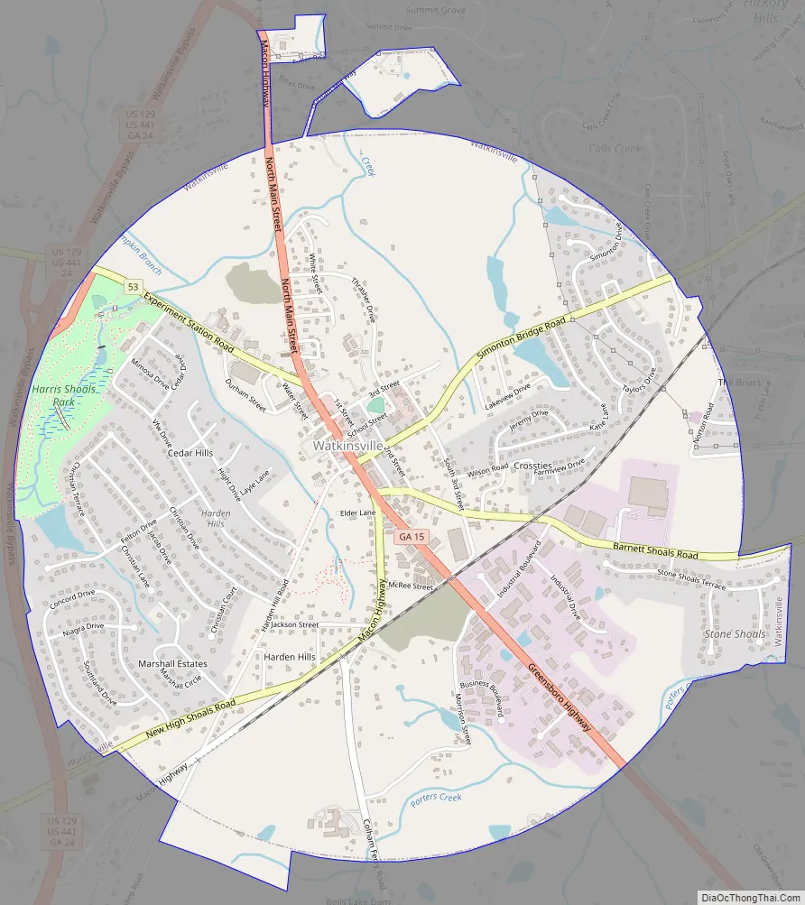
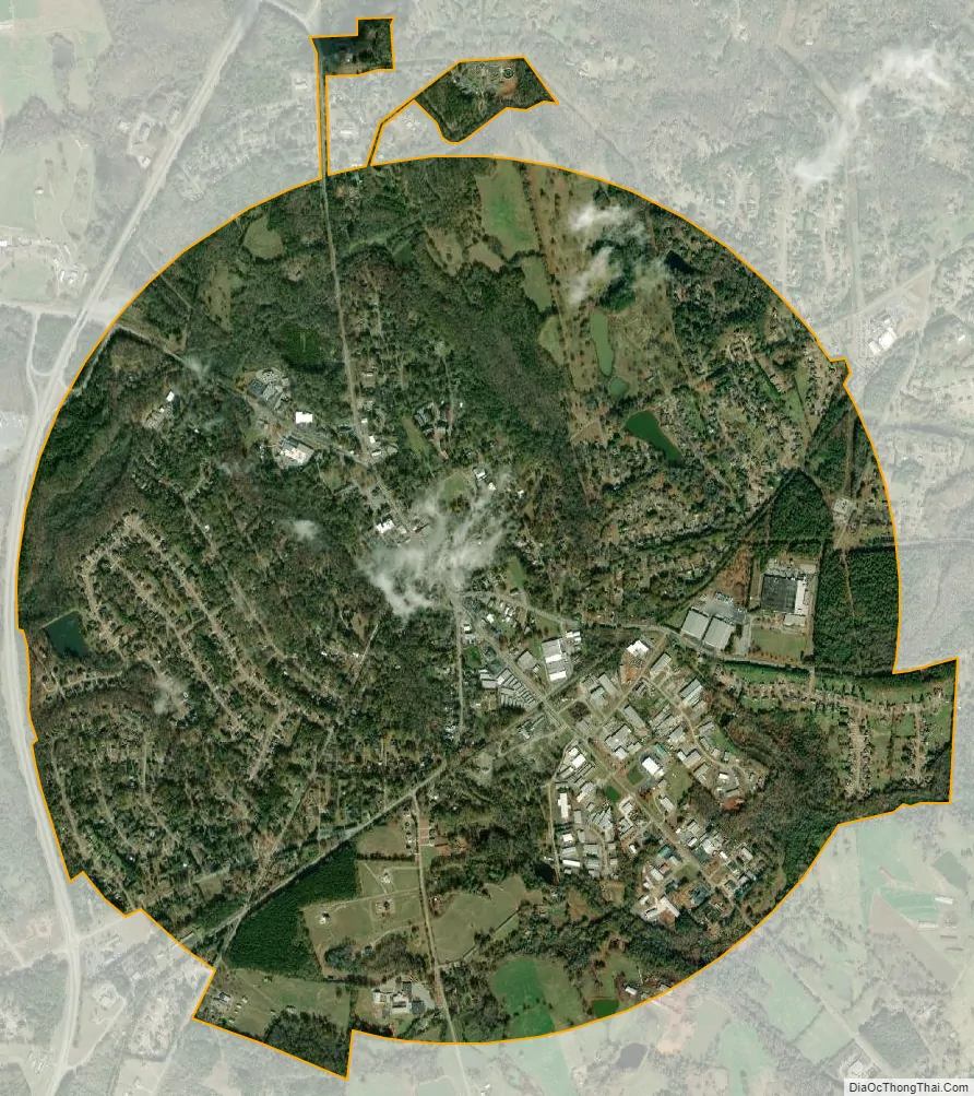
Watkinsville city Satellite Map
Geography
Watkinsville is located at 33°51′46″N 83°24′29″W / 33.86278°N 83.40806°W / 33.86278; -83.40806 (33.862818, -83.408094).
According to the United States Census Bureau, the town has a total area of 3.2 square miles (8.3 km), of which 3.2 square miles (8.3 km) is land and 0.31% is water. Watkinsville is located near the University of Georgia.
See also
Map of Georgia State and its subdivision:- Appling
- Atkinson
- Bacon
- Baker
- Baldwin
- Banks
- Barrow
- Bartow
- Ben Hill
- Berrien
- Bibb
- Bleckley
- Brantley
- Brooks
- Bryan
- Bulloch
- Burke
- Butts
- Calhoun
- Camden
- Candler
- Carroll
- Catoosa
- Charlton
- Chatham
- Chattahoochee
- Chattooga
- Cherokee
- Clarke
- Clay
- Clayton
- Clinch
- Cobb
- Coffee
- Colquitt
- Columbia
- Cook
- Coweta
- Crawford
- Crisp
- Dade
- Dawson
- Decatur
- DeKalb
- Dodge
- Dooly
- Dougherty
- Douglas
- Early
- Echols
- Effingham
- Elbert
- Emanuel
- Evans
- Fannin
- Fayette
- Floyd
- Forsyth
- Franklin
- Fulton
- Gilmer
- Glascock
- Glynn
- Gordon
- Grady
- Greene
- Gwinnett
- Habersham
- Hall
- Hancock
- Haralson
- Harris
- Hart
- Heard
- Henry
- Houston
- Irwin
- Jackson
- Jasper
- Jeff Davis
- Jefferson
- Jenkins
- Johnson
- Jones
- Lamar
- Lanier
- Laurens
- Lee
- Liberty
- Lincoln
- Long
- Lowndes
- Lumpkin
- Macon
- Madison
- Marion
- McDuffie
- McIntosh
- Meriwether
- Miller
- Mitchell
- Monroe
- Montgomery
- Morgan
- Murray
- Muscogee
- Newton
- Oconee
- Oglethorpe
- Paulding
- Peach
- Pickens
- Pierce
- Pike
- Polk
- Pulaski
- Putnam
- Quitman
- Rabun
- Randolph
- Richmond
- Rockdale
- Schley
- Screven
- Seminole
- Spalding
- Stephens
- Stewart
- Sumter
- Talbot
- Taliaferro
- Tattnall
- Taylor
- Telfair
- Terrell
- Thomas
- Tift
- Toombs
- Towns
- Treutlen
- Troup
- Turner
- Twiggs
- Union
- Upson
- Walker
- Walton
- Ware
- Warren
- Washington
- Wayne
- Webster
- Wheeler
- White
- Whitfield
- Wilcox
- Wilkes
- Wilkinson
- Worth
- Alabama
- Alaska
- Arizona
- Arkansas
- California
- Colorado
- Connecticut
- Delaware
- District of Columbia
- Florida
- Georgia
- Hawaii
- Idaho
- Illinois
- Indiana
- Iowa
- Kansas
- Kentucky
- Louisiana
- Maine
- Maryland
- Massachusetts
- Michigan
- Minnesota
- Mississippi
- Missouri
- Montana
- Nebraska
- Nevada
- New Hampshire
- New Jersey
- New Mexico
- New York
- North Carolina
- North Dakota
- Ohio
- Oklahoma
- Oregon
- Pennsylvania
- Rhode Island
- South Carolina
- South Dakota
- Tennessee
- Texas
- Utah
- Vermont
- Virginia
- Washington
- West Virginia
- Wisconsin
- Wyoming