Petroleum County is a county in the U.S. state of Montana. As of the 2020 census, the population was 496, making it the least populous county in Montana and the eighth-least populous in the United States. Its county seat is Winnett. The county’s area was partitioned from Fergus County to become the last of Montana’s 56 counties to be organized.
| Name: | Petroleum County |
|---|---|
| FIPS code: | 30-069 |
| State: | Montana |
| Founded: | February 25, 1925 |
| Named for: | Petroleum fields |
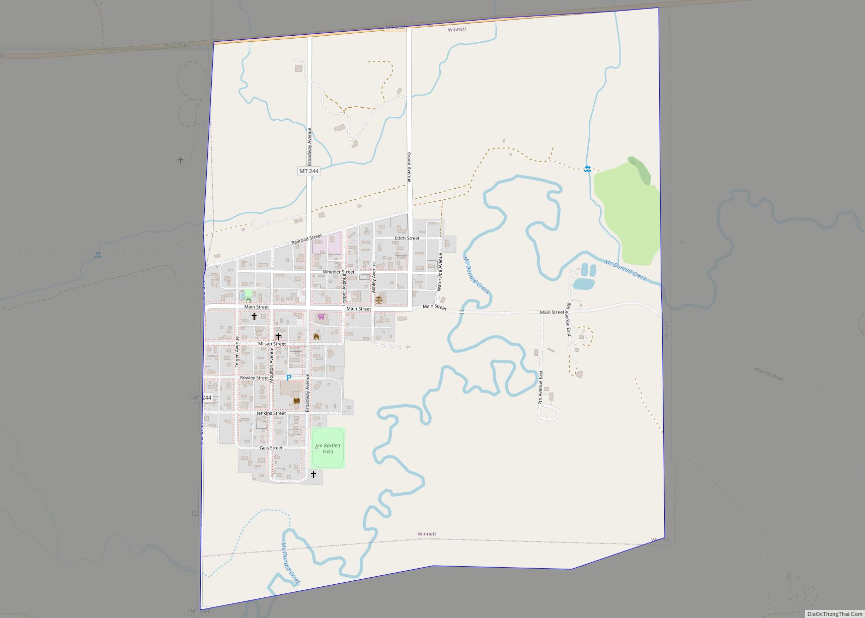
| Seat: | Winnett |
| Largest town: | Winnett |
| Total Area: | 1,674 sq mi (4,340 km²) |
| Land Area: | 1,655 sq mi (4,290 km²) |
| Total Population: | 496 |
| Population Density: | 0.30/sq mi (0.11/km²) |
| Time zone: | UTC−7 (Mountain) |
| Summer Time Zone (DST): | UTC−6 (MDT) |
| Website: | petroleumcountymt.org |
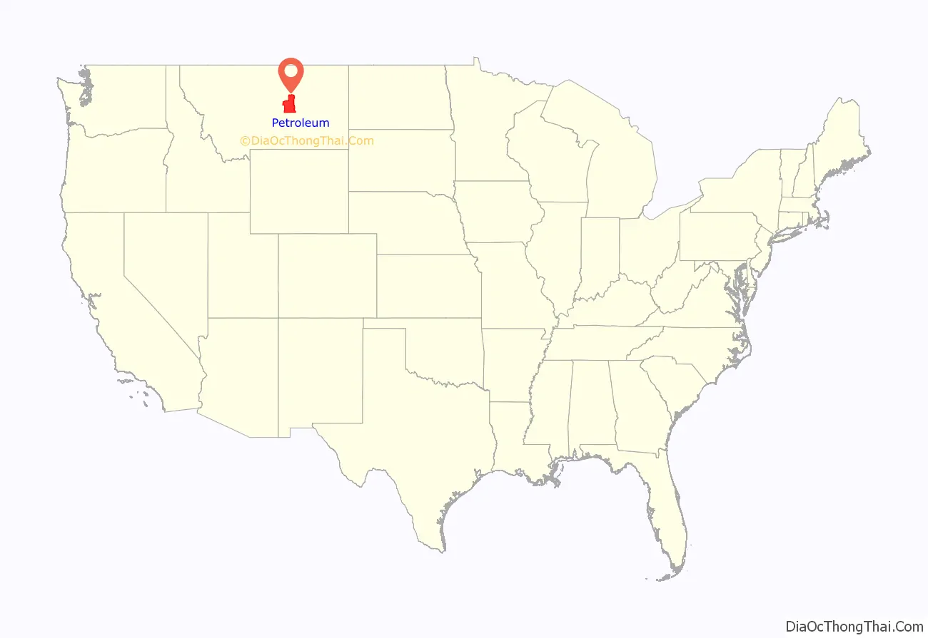
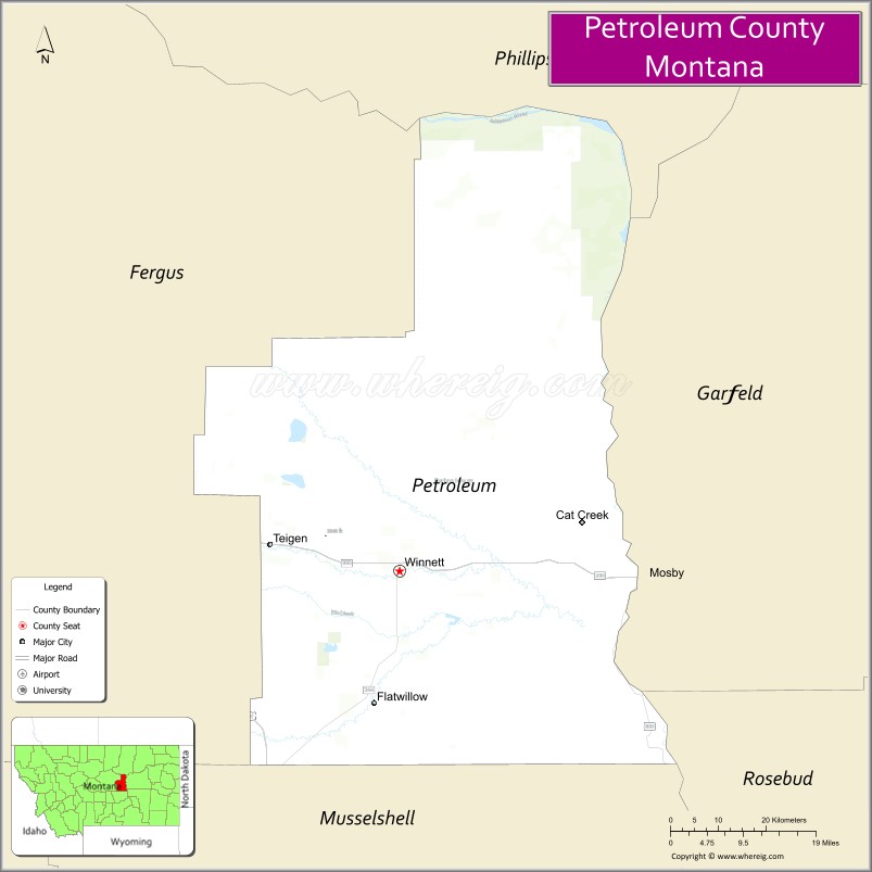
Petroleum County location map. Where is Petroleum County?
History
The area was home to Native American tribes of the Crow, Blackfoot, Nez Perce, and Sioux. In 1868 a trading post was established at the mouth of Musselshell River; it was named “Musselshell”. Walter John Winnett, a rancher who had been adopted into the Sioux tribe, started a ranch in Montana Territory in 1879. His ranch house (built 1900) became a gathering place for the area. In 1910, he built a store and petitioned for a post office; thus Winnett became an official town.
Fort Magginis (built in western Fergus County in 1880) subdued Indian raids in the area, allowing cattle raising to prosper. Gold was also discovered in the Fergus County mountains; from 1911 to 1915, stakes in the county were claimed by prospectors. Area claims were limited to 320 acres (130 ha); in 1930 many of these lands reverted to the federal government as settlers deserted the town.
In February 1920, oil was discovered in the SE part of the county. This area developed into the Cat Creek Field, producing high-grade crude. By 1922 it was producing 2.2 million barrels annually. The state legislature split the eastern area of Fergus County into a separate entity, named Petroleum County to denote its status as the first place in Montana where petroleum was discovered, in 1925, and designated Winnett as its seat.
The county was always one of the most sparsely populated areas of the US, and the population has continued to decline. The 1930 census listed 2,045 residents. The county was brought under administrative format of the “county manager” in 1944. By the time of the 1980 census, the population was reduced to 685.
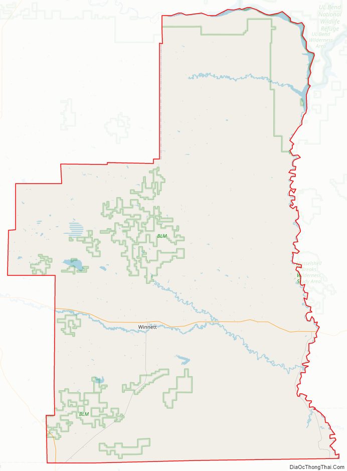
Petroleum County Road Map
Geography
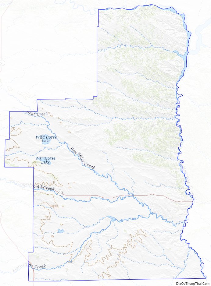
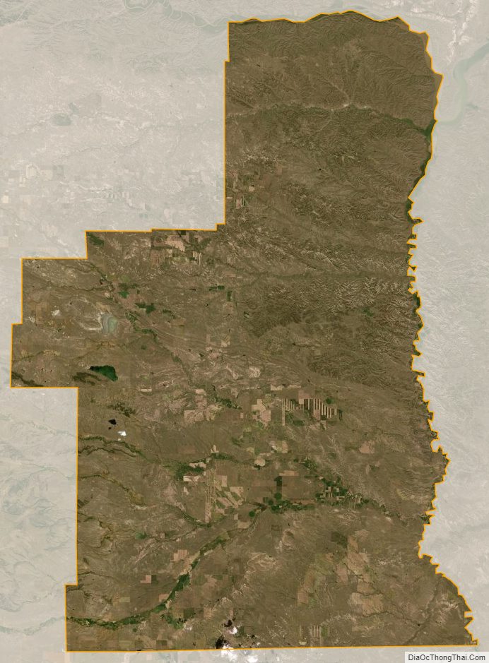
The county’s eastern boundary is formed by the Musselshell River. According to the United States Census Bureau, the county has a total area of 1,674 square miles (4,340 km), 1,655 square miles (4,290 km) land and 19 square miles (49 km) (1.1%) water. Its average elevation is 2,250–4,000 feet (690–1,220 m). The land lies in the Missouri Plateau section of the Great Plains. The uplands are generally of fairly level land and valleys while the general topography is of rolling hills and valleys except for sharp gullies on the side slopes of Missouri and Musselshell Rivers in certain stretches. The southern part of the county consists of moderate hill slopes and gentle valleys, interspersed with steep cliffs.
Highways
- U.S. Route 87
- State Highway 200
- State Highway 244
Rivers
- Missouri River
- Musselshell River
Lakes
- Wild Horse Lake
- Little Bear Lake
- War Horse Lake
- Petrolia Lake
- Yellow Water Reservoir
- Headman-Field Reservoir.
The northern part of the county has abundant surface water resources, with little agricultural land to use it. In other parts of the county, agriculture is reliant on underground water resources.
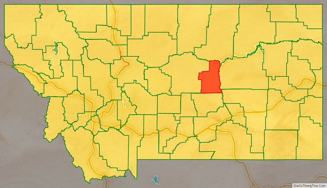
Adjacent counties
- Phillips County – north
- Garfield County – east
- Rosebud County – southeast
- Musselshell County – south
- Fergus County – west
Climate
The mean annual precipitation is 13 inches (330 mm). The mean annual temperature is in the range of 42–47 °F (6–8 °C). Frost is recorded during the season for 105–135 days. Rainfall is 13 inches (330 mm) in Flatwillow, it is 16 inches (410 mm) at Grass Range, and 13 inches (330 mm) at Mosby; at these locations, the mean winter temperatures are 24 °F (−4 °C), 25 °F (−4 °C) and 23 °F (−5 °C) respectively. The lowest temperature recorded at Mosby was on January 24, 1969, of −43 °F (−42 °C). The maximum temperature recorded was 108 °F (42 °C) on July 19, 1960, at Flatwillow. Nearly 70% of rainfall occurs from April to September, also the growing season for many crops in the county. The average seasonal snowfall is 40 in (100 cm) at Flatwillow, 63 in (160 cm) at Grass Range and 36 in (91 cm) at Mosby. Average wind speed is about 17 miles per hour (7.6 m/s) and is higher in winter months than summer months.
Protected areas
- War Horse National Wildlife Refuge
- Charles M. Russell National Wildlife Refuge
Petroleum County Topographic Map
Petroleum County Satellite Map
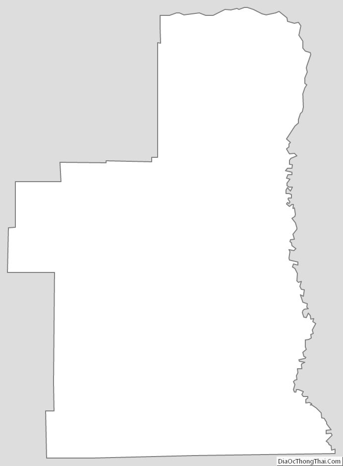
Petroleum County Outline Map