Winnett is a town in and the county seat of Petroleum County, Montana, United States. The population was 188 at the 2020 census.
| Name: | Winnett town |
|---|---|
| LSAD Code: | 43 |
| LSAD Description: | town (suffix) |
| State: | Montana |
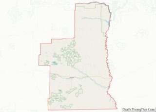
| County: | Petroleum County |
| Elevation: | 2,953 ft (900 m) |
| Total Area: | 1.02 sq mi (2.64 km²) |
| Land Area: | 1.02 sq mi (2.64 km²) |
| Water Area: | 0.00 sq mi (0.00 km²) |
| Total Population: | 188 |
| Population Density: | 184.68/sq mi (71.28/km²) |
| ZIP code: | 59084, 59087 |
| Area code: | 406 |
| FIPS code: | 3081100 |
| GNISfeature ID: | 0806828 |
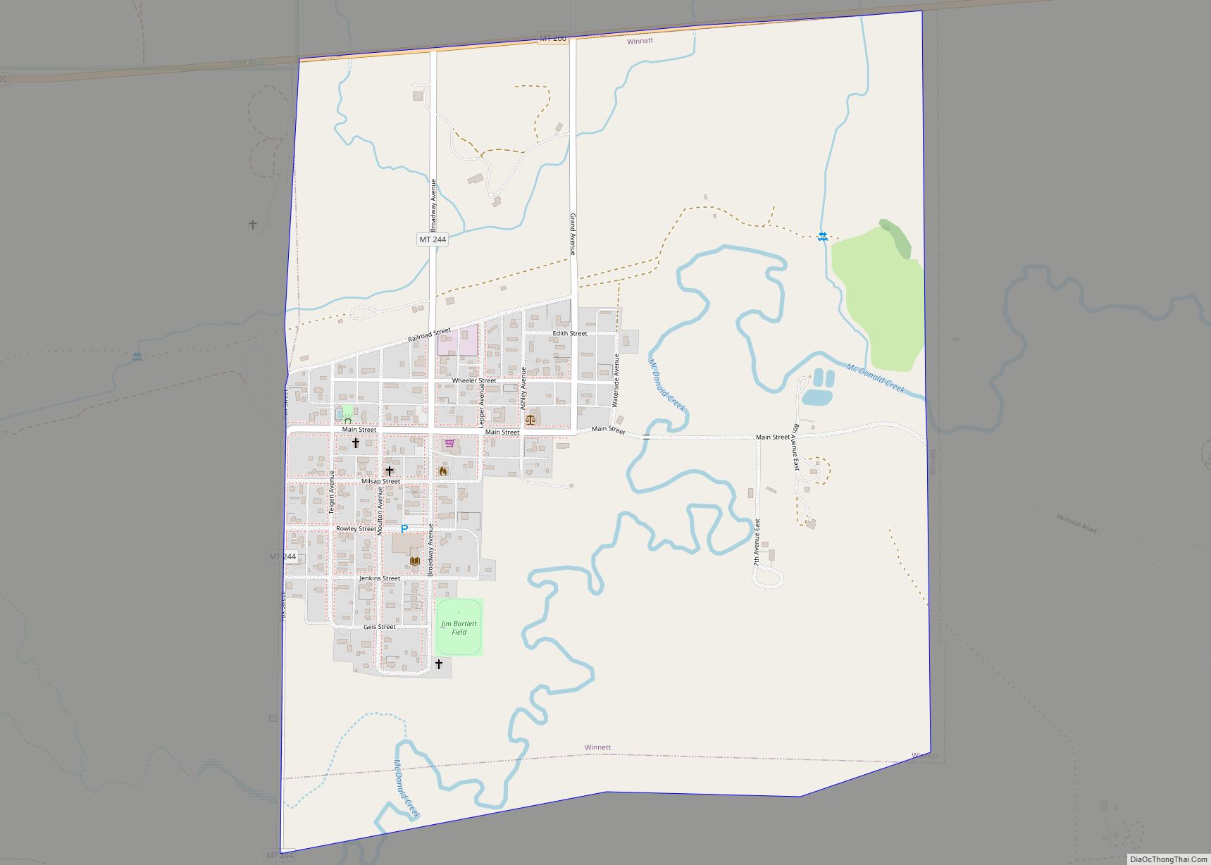
Online Interactive Map
Click on ![]() to view map in "full screen" mode.
to view map in "full screen" mode.
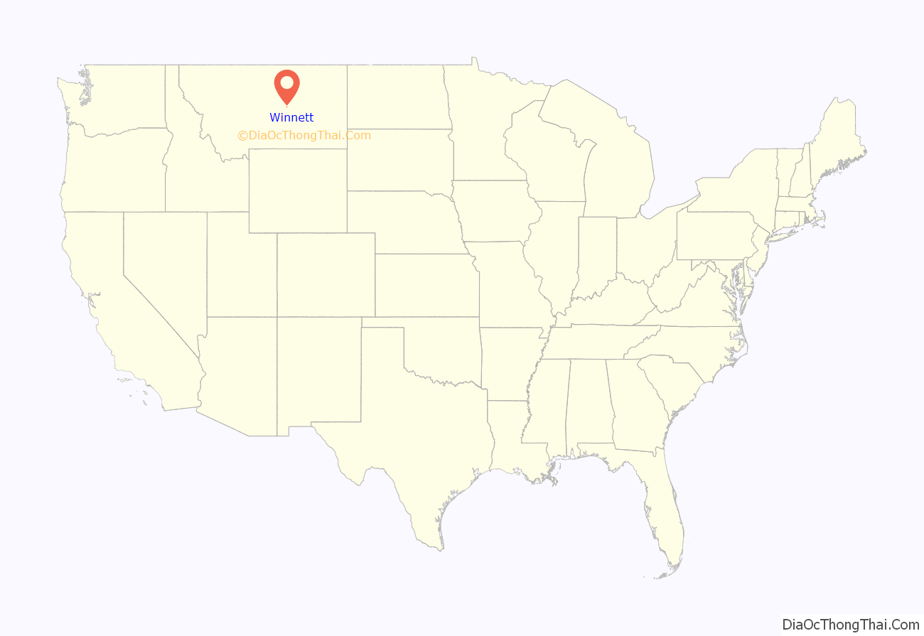
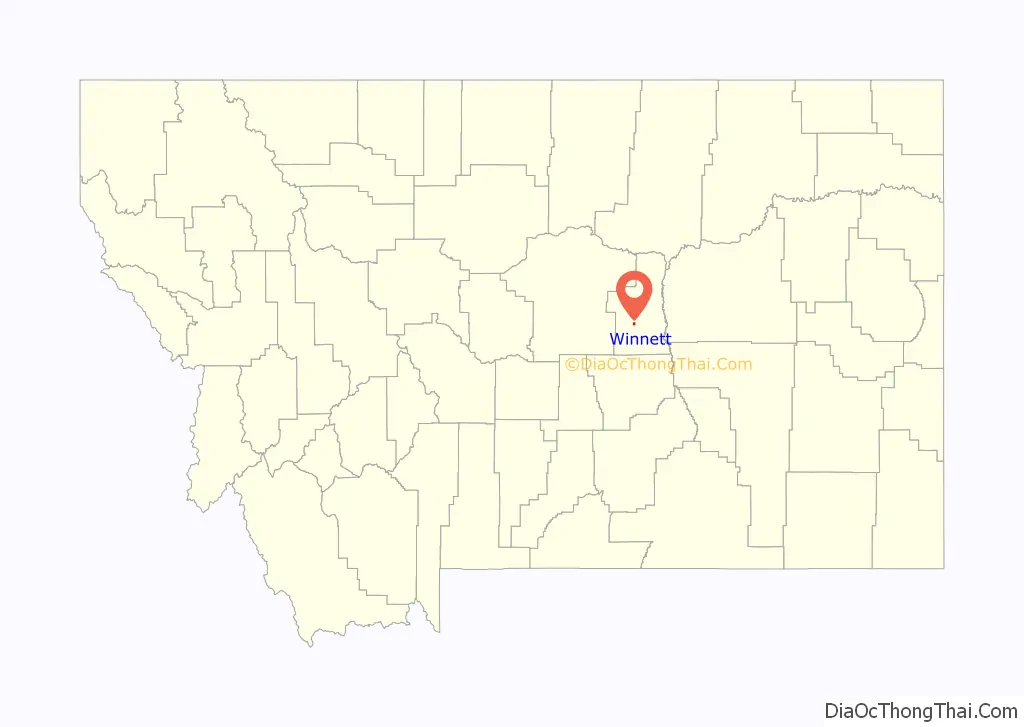
Winnett location map. Where is Winnett town?
History
Winnett was named for Walter John Winnett, who was born at the Queen’s Hotel in Toronto, Ontario, Canada. Winnett ran away from home as a boy, seeking adventure in “Indian country.” His excellent marksmanship abilities helped him get jobs with outfits who were always looking for someone who could keep them in fresh meat. When he was captured by Sioux Indians and later adopted into the tribe, he was given the name Eagle Eyes because of his remarkable shooting skills.
Winnett established a ranch in Montana Territory in 1879 near an active trading post and the Hangman’s Tree used by vigilantes in the area. The massive ranch house, which he built in 1900 housed his own family and served as a gathering place for the community. Dances, weddings, funerals, church services, and school were all held here. Billings was the closest town, so Winnett built up a freight line business to haul supplies. Each of his outfits consisted of ten to twenty horses and huge wagons. In 1910 he built a store and petitioned for a post office.
In addition to county government offices, Winnett’s businesses and services include a general store, two filling/service stations, a post office, a school system with grades K-12, a new event venue completed in 2023, a motel, 2 RV parks, a campground and a bar-and-grill. The nearest medical facilities are in Lewistown.
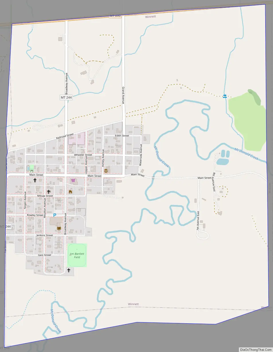
Winnett Road Map
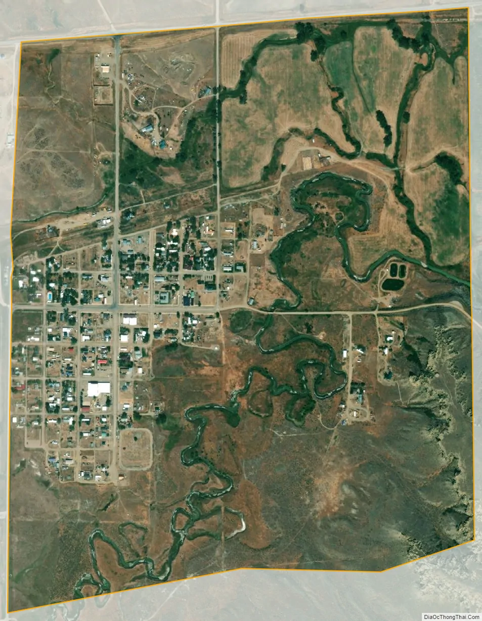
Winnett city Satellite Map
Geography
Winnett is located at 47°0′16″N 108°21′4″W / 47.00444°N 108.35111°W / 47.00444; -108.35111 (47.004381, -108.351052).
According to the United States Census Bureau, the town has a total area of 0.98 square miles (2.54 km), all land.
Climate
According to the Köppen Climate Classification system, Winnett has a semi-arid climate, abbreviated “BSk” on climate maps.
See also
Map of Montana State and its subdivision:- Beaverhead
- Big Horn
- Blaine
- Broadwater
- Carbon
- Carter
- Cascade
- Chouteau
- Custer
- Daniels
- Dawson
- Deer Lodge
- Fallon
- Fergus
- Flathead
- Gallatin
- Garfield
- Glacier
- Golden Valley
- Granite
- Hill
- Jefferson
- Judith Basin
- Lake
- Lewis and Clark
- Liberty
- Lincoln
- Madison
- McCone
- Meagher
- Mineral
- Missoula
- Musselshell
- Park
- Petroleum
- Phillips
- Pondera
- Powder River
- Powell
- Prairie
- Ravalli
- Richland
- Roosevelt
- Rosebud
- Sanders
- Sheridan
- Silver Bow
- Stillwater
- Sweet Grass
- Teton
- Toole
- Treasure
- Valley
- Wheatland
- Wibaux
- Yellowstone
- Alabama
- Alaska
- Arizona
- Arkansas
- California
- Colorado
- Connecticut
- Delaware
- District of Columbia
- Florida
- Georgia
- Hawaii
- Idaho
- Illinois
- Indiana
- Iowa
- Kansas
- Kentucky
- Louisiana
- Maine
- Maryland
- Massachusetts
- Michigan
- Minnesota
- Mississippi
- Missouri
- Montana
- Nebraska
- Nevada
- New Hampshire
- New Jersey
- New Mexico
- New York
- North Carolina
- North Dakota
- Ohio
- Oklahoma
- Oregon
- Pennsylvania
- Rhode Island
- South Carolina
- South Dakota
- Tennessee
- Texas
- Utah
- Vermont
- Virginia
- Washington
- West Virginia
- Wisconsin
- Wyoming