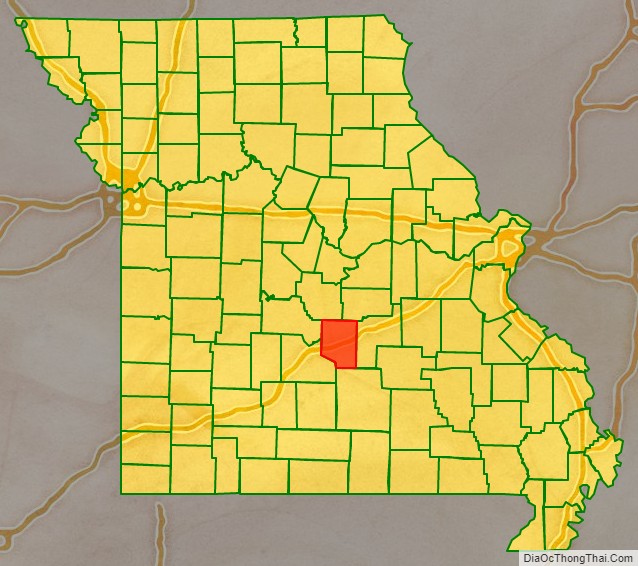
Pulaski County is a county located in the U.S. state of Missouri. As of the 2010 census, the population was 52,274. Its county seat is Waynesville. The county was organized in 1833 and named for Kazimierz Pułaski, a Polish patriot who died fighting in the American Revolution.
Pulaski County is the site of Fort Leonard Wood, a U.S. Army training base. It comprises the Fort Leonard Wood, MO Micropolitan Statistical Area which has nearly one-third of the total county population.
| Name: | Pulaski County |
|---|---|
| FIPS code: | 29-169 |
| State: | Missouri |
| Founded: | January 19, 1833 |
| Named for: | Kazimierz Pułaski |
| Seat: | Waynesville |
| Total Area: | 551 sq mi (1,430 km²) |
| Land Area: | 547 sq mi (1,420 km²) |
| Total Population: | 52,274 |
| Population Density: | 95/sq mi (37/km²) |
| Time zone: | UTC−6 (Central) |
| Summer Time Zone (DST): | UTC−5 (CDT) |
| Website: | www.pulaskicountymo.org/home.html |
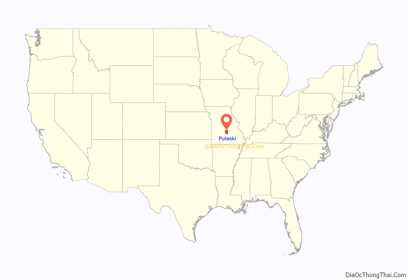
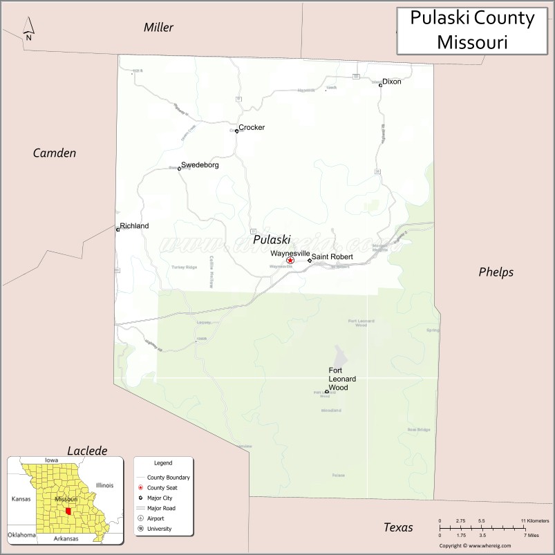
Pulaski County location map. Where is Pulaski County?
History
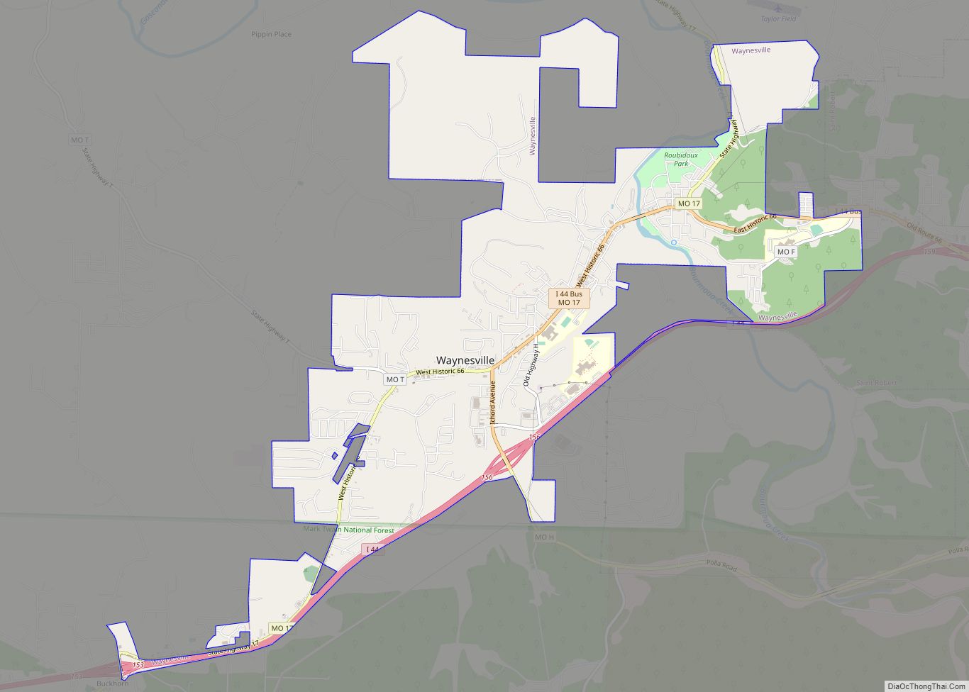
Pulaski County’s earliest settlers were the Quapaw, Missouria and Osage Native Americans. After the Lewis and Clark Expedition of the early 19th century, white settlers came to the area, many from Kentucky, Tennessee and the Carolinas; the earliest pioneers appeared to have settled as early as 1818, and the town of Waynesville was designated the county seat by the Missouri Legislature in 1833. Like the county, Waynesville is also named after an American Revolutionary hero, Mad Anthony Wayne.
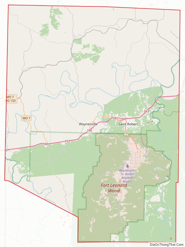
Pulaski County Road Map
Geography
According to the U.S. Census Bureau, the county has a total area of 551 square miles (1,430 km), of which 547 square miles (1,420 km) is land and 4.4 square miles (11 km) (0.8%) is water.
Adjacent counties
- Miller County (northwest)
- Maries County (northeast)
- Phelps County (east)
- Texas County (south)
- Laclede County (southwest)
- Camden County (west)
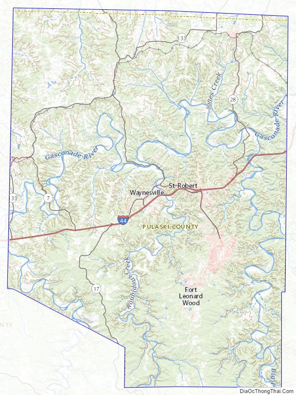
National protected area
- Mark Twain National Forest (part)
Pulaski County Topographic Map
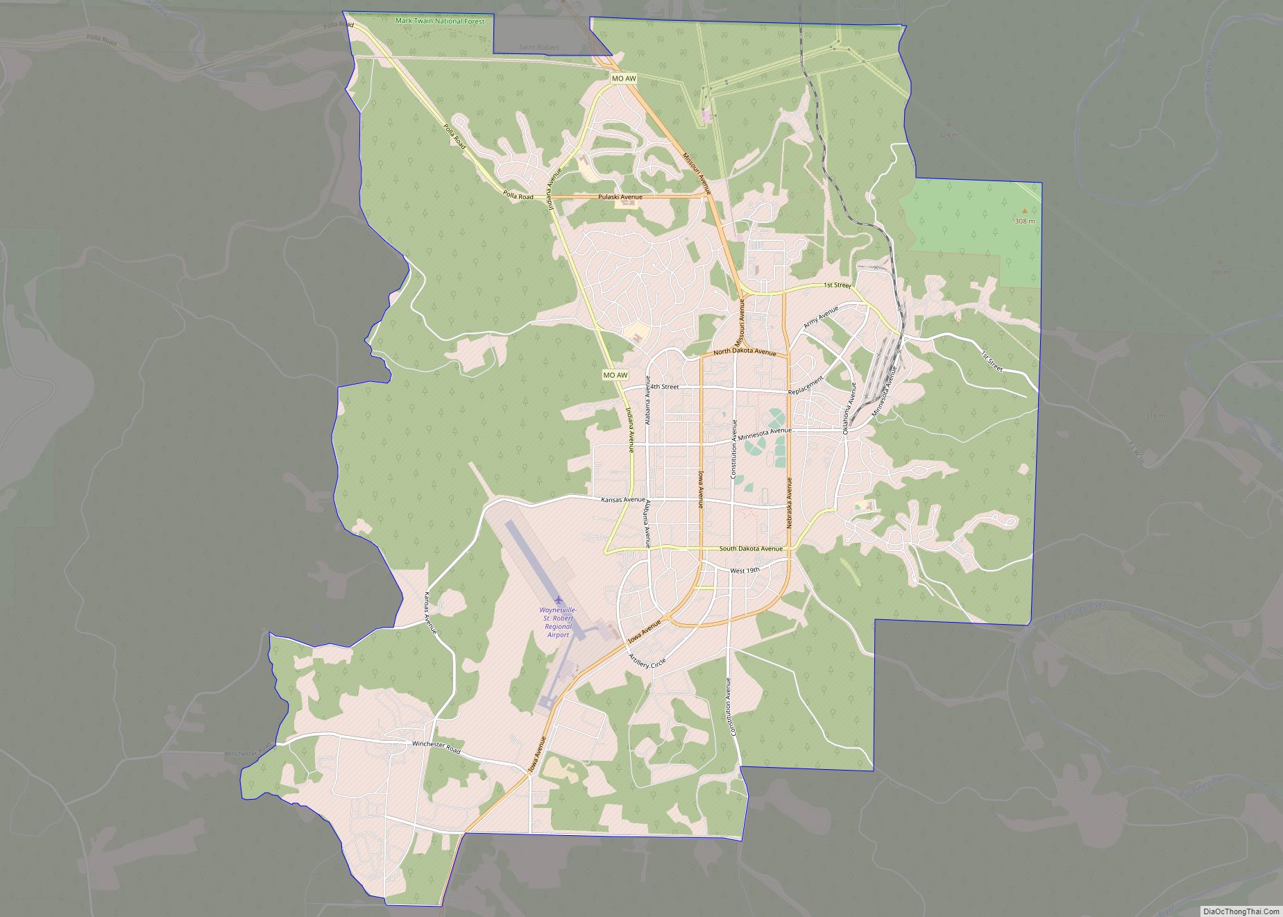
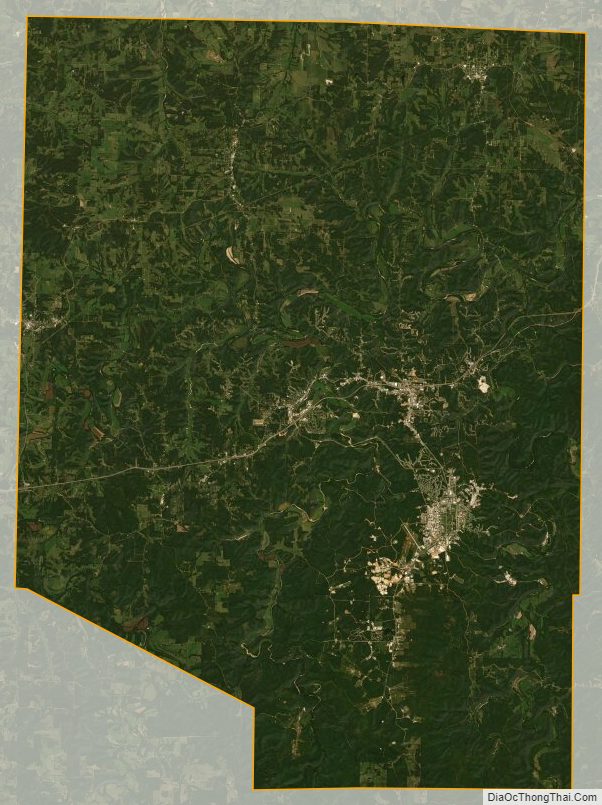
Pulaski County Satellite Map
Pulaski County Outline Map