Sevier County (/sɛˈvɪər/ sə-VEER) is a county in Utah, United States. As of the 2010 United States Census, the population was 20,802. Its county seat and largest city is Richfield.
| Name: | Sevier County |
|---|---|
| FIPS code: | 49-041 |
| State: | Utah |
| Founded: | January 16, 1865 |
| Named for: | Sevier River |
| Seat: | Richfield |
| Largest city: | Richfield |
| Total Area: | 1,918 sq mi (4,970 km²) |
| Land Area: | 1,911 sq mi (4,950 km²) |
| Total Population: | 21,522 |
| Population Density: | 11.3/sq mi (4.4/km²) |
| Time zone: | UTC−7 (Mountain) |
| Summer Time Zone (DST): | UTC−6 (MDT) |
| Website: | www.sevierutah.net |
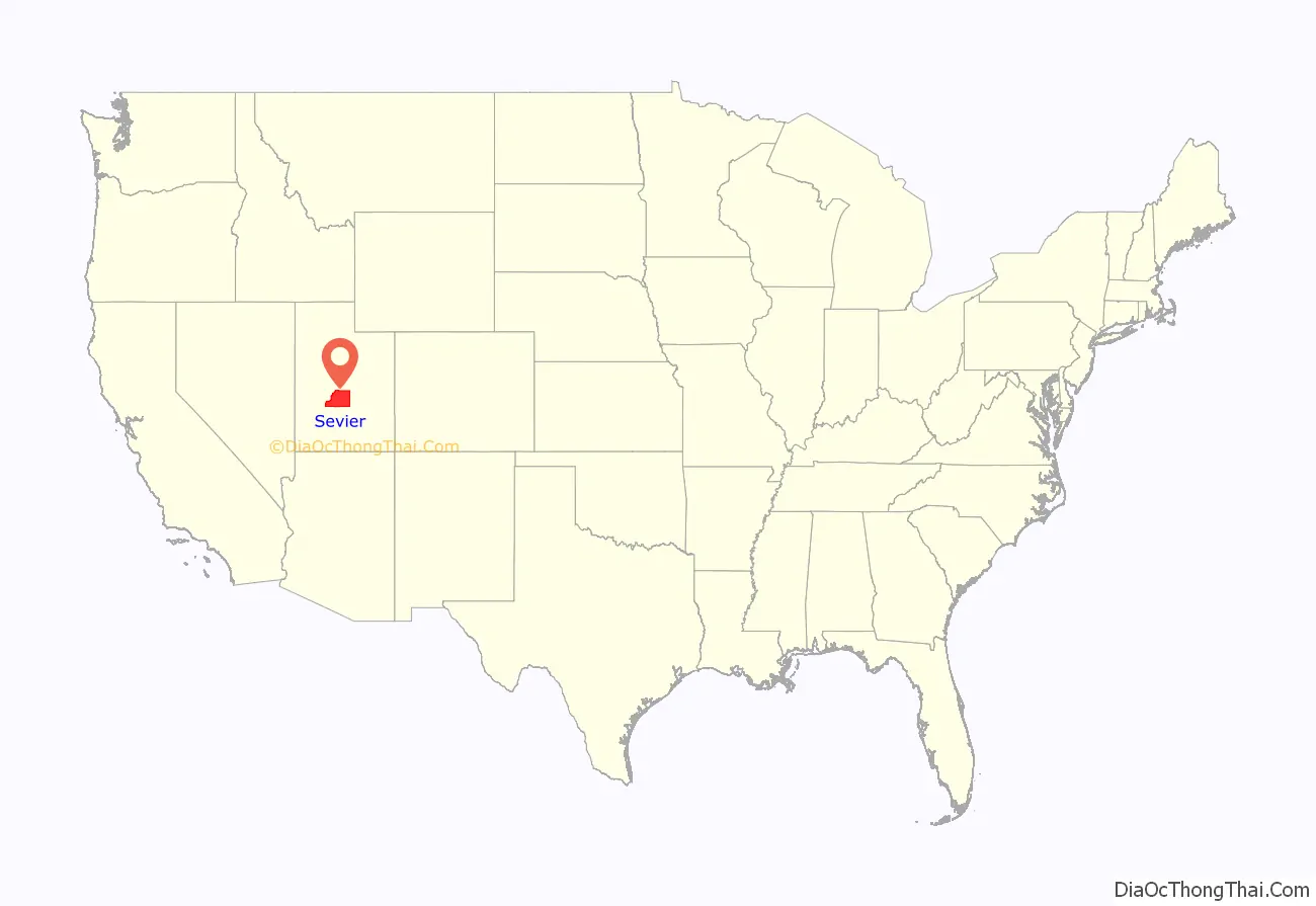
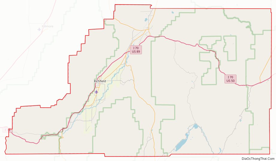
Sevier County location map. Where is Sevier County?

History
Evidence of indigenous peoples residing in Sevier County up to 5,000 BP has been unearthed. The Fremont culture of Native Americans occupied the area from about 2000 to 700 BP. The Clear Creek site contains native petroglyphs from that period.
In Utah, the Numic- (or Shoshonean) speaking peoples of the Uto-Aztecan language family evolved into four distinct groups in the historical period: the Northern Shoshone, Goshute or Western Shoshone, Southern Paiute, and Ute peoples. This territory’s central and eastern sections were occupied primarily by various bands of the Ute.
The first modern sighting of the Sevier River was most likely by the Catholic fathers Silvestre Vélez de Escalante and Francisco Atanasio Domínguez, on their expedition to California in 1776. The Old Spanish Trail was the route they mapped. Over the next century, this trail carried fur trappers, hunters, government officials, traders, and settlers.
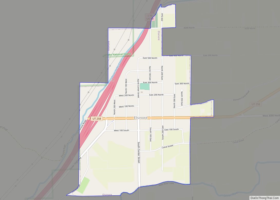
Settlement of this area began when Richfield was first settled. Mormon settlers arrived on June 15, 1864, most of whom had emigrated from Scandinavian countries. Because of the growth in this small community, the people soon petitioned Utah Territory officials about a separate county.
On January 16, 1865, the Utah Territory legislature created the county, with the area annexed from Sanpete County. It was named for the Sevier River. The county seat was Big Spring (later named Richfield). The county borders were adjusted in 1866, 1880, 1890, and in 1921. A clarification of boundary lines corresponding to government survey lines was completed in 1931, marking the present configuration of Sevier County.
Although the county was in place by 1865, much of Sevier County was abandoned in the Black Hawk War in 1867. Attempts to resettle the area were not successful until 1870. By 1874, 753 residents lived in the area.
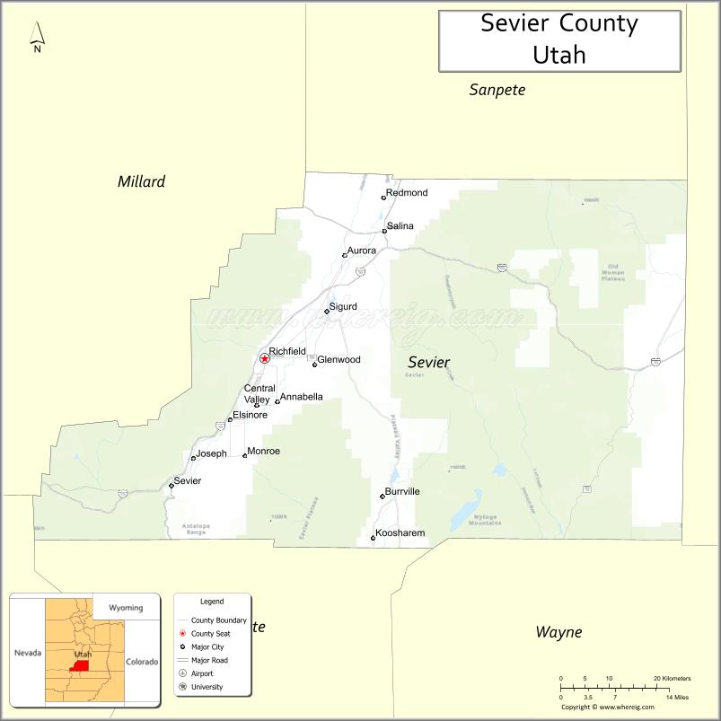
Sevier County Road Map
Geography
Sevier County terrain consists of semi-arid but arable rolling areas punctuated by northeast-southwest mountain ridges, usually forested. The highest point is Fish Lake Hightop in the Central Utah Plateau, at 11,633′ (3546m) ASL. The county has a total area of 1,918 square miles (4,970 km), of which 1,911 square miles (4,950 km) is land and 7.8 square miles (20 km) (0.4%) is water.
Major highways
- I-70
- I-70 BL / SR-120
- US 50
- US 89
- SR-10
- SR-24
- SR-62
- SR-72
- SR-76
- SR-118
- SR-119
Adjacent counties
- Sanpete County – north
- Emery County – east
- Wayne County – southeast
- Piute County – south
- Beaver County – southwest
- Millard County – west
Protected areas
- Capitol Reef National Park (part)
- Fishlake National Forest (part)
- Fremont Indian State Park and Museum
- Koosharem Reservoir Recreation Site
- Manti-La Sal National Forest (part)
- Sand Ledges Recreation Area
- Willow Creek Wildlife Management Area
Lakes
- Abes Reservoir
- Acord Lakes
- Annabella Reservoir
- Bear Valley Reservoir
- Big Lake
- Boobe Hole Reservoir
- Broadhead Lakes
- Cold Spring (near Twin Ponds)
- Coots Slough
- Crater Lakes
- Davis Hollow Reservoir
- Deep Lake
- Duck Lake
- Emerald Lakes
- Farnsworth Reservoir
- Farrell Pond
- Fish Lake
- Floating Island Lake
- Forsyth Reservoir
- Gardner Hollow Reservoirs
- Gates Lake
- Hamilton Reservoir
- Harves River Reservoir
- Hepplers Ponds
- Hunts Lakes
- Indian Springs
- Jeffery Reservoir
- Jensen Spring
- Johnson Valley Reservoir
- Killian Spring
- Koosharem Reservoir
- Lake Louise
- Lost Creek Reservoir
- Lower Hunts Lake
- Magelby Reservoir
- Meeks Lake
- Mill Meadow Reservoir (part)
- Morrell Pond
- Mud Lake
- Oles Pond
- Ox Spring
- Paradise Valley Lake
- Redmond Lake
- Rex Reservoir
- Rim Seep
- Rocky Ford Reservoir
- Saleratus Reservoir
- Salina Reservoir
- Sargent Lake
- Scrub Flat Reservoir
- Sheep Valley Reservoir
- Silas Spring
- Skutumpah Reservoir
- Slide Lake
- Snow Fence Pond
- Snow Lake
- Solomon Reservoir
- Spring Reservoir
- The Potholes
- Three Creeks Reservoir
- Three Lakes (two of the three)
- Tidwell Pond
- Twin Lake
- Twin Ponds
- Washburn Reservoir
- Willies Flat Reservoir
- Willow Creek Reservoir
- Willow Lake
- Wood Hollow Reservoir
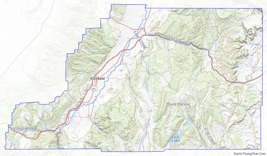
Sevier County Topographic Map
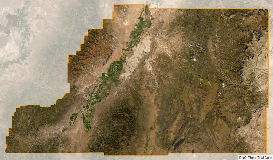
Sevier County Satellite Map
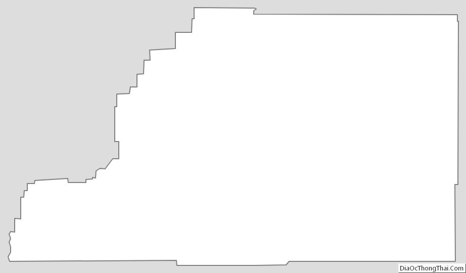
Sevier County Outline Map