Richfield is a city in and the county seat of Sevier County, Utah, United States, and is the largest city in southern-central Utah.
| Name: | Richfield city |
|---|---|
| LSAD Code: | 25 |
| LSAD Description: | city (suffix) |
| State: | Utah |
| County: | Sevier County |
| Elevation: | 5,354 ft (1,632 m) |
| Total Area: | 5.93 sq mi (15.36 km²) |
| Land Area: | 5.93 sq mi (15.36 km²) |
| Water Area: | 0.00 sq mi (0.00 km²) |
| Total Population: | 8,201 |
| Population Density: | 1,329.96/sq mi (513.52/km²) |
| ZIP code: | 84701 |
| Area code: | 435 |
| FIPS code: | 4963570 |
| GNISfeature ID: | 1444889 |
| Website: | www.richfieldcity.com |
Online Interactive Map
Click on ![]() to view map in "full screen" mode.
to view map in "full screen" mode.
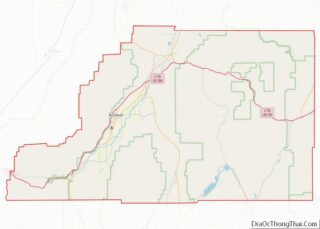
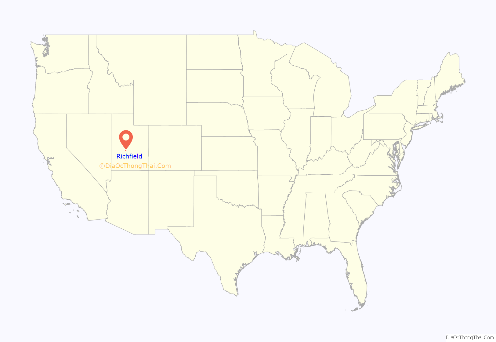
Richfield location map. Where is Richfield city?

History
Prehistoric people occupied the Richfield area for more than 7,000 years. Fremont culture remains are found near most community sites in the Sevier area. They are dated from approximately CE 1 to CE 1000. In the late summer of 1776, Father Escalante and his party of Spanish explorers passed through the general vicinity, looking for a trail to link Nuevo Mexico and California. During the late 1820s, Jedediah Smith and other fur traders crossed the area. Sevier County lay on one of the variants on the Old Spanish Trail between Santa Fe, New Mexico, and California and was used by travelers between 1830 and 1850.
In early January 1864, a party of ten men under the leadership of Albert Lewis came from Sanpete County, Utah, and arrived in what is now Richfield. The Mormon settlers found fertile soil, good water, and wood in the nearby hills. They decided that it was a desirable site for a settlement. These pioneers made a dwelling place for all ten men, which they called ‘The Hole in the Ground.’ They carefully covered this hole with brush willows and other materials and made a crude chimney of rocks. This dugout was located on today’s Main Street. These men spent the remainder of the winter in this dwelling, planning and preparing for when they could bring their families.
The early Mormon settlements were abandoned in 1867 due to the conflict known as the Black Hawk War. But, when resettled in 1871, Richfield grew to become a regional center. The coming of the Denver and Rio Grande Railroad in 1891 opened the valley for expanded agricultural commerce and mining.
In 1939, Utah Governor Henry H. Blood vetoed a proposal for a junior college in Richfield. Fifty-seven years later, Snow College opened a Richfield campus, which serves about 600 students annually.
Richfield Road Map
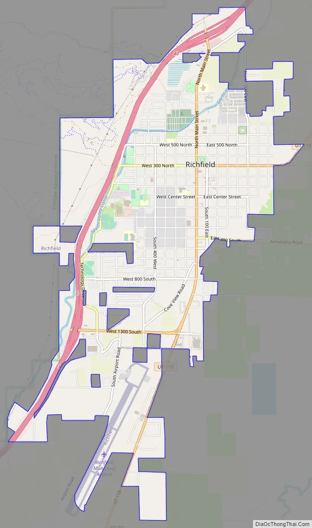
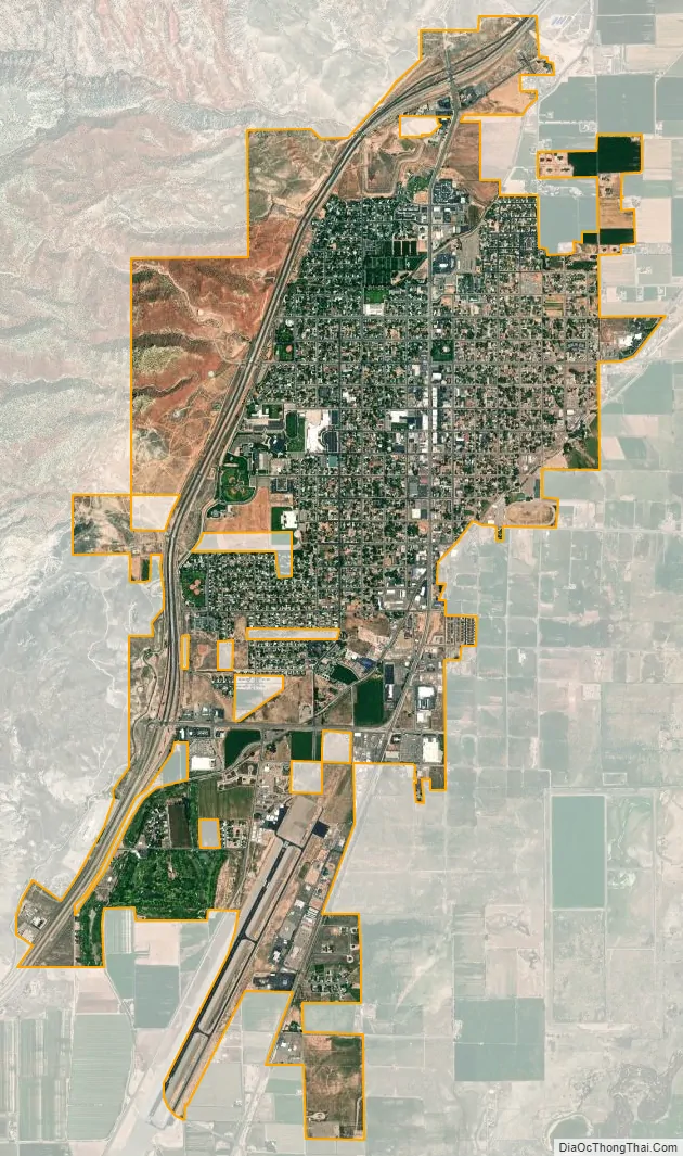
Richfield city Satellite Map
Geography
According to the United States Census Bureau, the city has a total area of 5.3 square miles (14 km), all land. Richfield is located 5,280 feet (1,610 m) above sea level.
Richfield is served by major transportation access – situated along Interstate 70 and within 30 minutes of Interstate 15. Richfield is located 159 miles (256 km) from Salt Lake City and 164 miles (264 km) from St. George.
Richfield experiences a cold semi-arid climate (Köppen BSk) with four distinct seasons. Winter high temperatures average in the 30s and 40s with many milder days; low temperatures average in the teens and twenties, with a few mornings starting near or below zero. Snowfall is common, but usually melts in a day or two; however, deeper lasting snow cover is not uncommon. Still, December and January average among Richfield’s drier months. Summer days are warm, with normal July highs in the 90s and occasional hot spells that near 100 °F or 37.8 °C. Nighttime temperatures during the summer are comfortable—usually in the 50s or 60s. From July through September, “monsoonal” thunderstorms frequently form over the nearby peaks contributing to over a third of the 8.12 inches or 206.2 millimetres of annual rainfall. Because of its low humidity and mile-high altitude, the Sevier Valley experiences its average first frost by late September and its last in late May, despite the typically warm fall and spring days. Richfield’s record high is 104 °F (40 °C), set on July 23, 1931 and July 13-14, 1939, and the record low is −33 °F (−36.1 °C), set on February 6, 1989.
Average January temperatures are a high of 41.0 °F (5.0 °C) and a low of 17.0 °F (−8.3 °C). Average July temperatures are a high of 90.4 °F (32.4 °C) and a low of 53.7 °F (12.1 °C). There are an average of 44.3 afternoons with highs of 90 °F (32.2 °C) or higher and an average of 176.0 mornings with lows of 32 °F (0 °C) or lower.
The wettest calendar year was 1936 with 13.00 inches (330.2 mm) and the driest 1976 with 4.36 inches (110.7 mm). The most rainfall in one month was 4.50 inches (114.3 mm) in October 1907. The most rainfall in 24 hours was 2.40 inches (61.0 mm) on December 12, 1906. There are an average of 64 days with measurable precipitation. Average snowfall is 17.8 inches (450 mm). The snowiest year was from July 2009 to June 2010 with 62.0 inches (1,570 mm). The most snow in one month was 30.0 inches (0.76 m) in April 1912.
See also
Map of Utah State and its subdivision: Map of other states:- Alabama
- Alaska
- Arizona
- Arkansas
- California
- Colorado
- Connecticut
- Delaware
- District of Columbia
- Florida
- Georgia
- Hawaii
- Idaho
- Illinois
- Indiana
- Iowa
- Kansas
- Kentucky
- Louisiana
- Maine
- Maryland
- Massachusetts
- Michigan
- Minnesota
- Mississippi
- Missouri
- Montana
- Nebraska
- Nevada
- New Hampshire
- New Jersey
- New Mexico
- New York
- North Carolina
- North Dakota
- Ohio
- Oklahoma
- Oregon
- Pennsylvania
- Rhode Island
- South Carolina
- South Dakota
- Tennessee
- Texas
- Utah
- Vermont
- Virginia
- Washington
- West Virginia
- Wisconsin
- Wyoming