Swift County is a county in the U.S. state of Minnesota. As of the 2020 census, the population was 9,838. Its county seat is Benson.
| Name: | Swift County |
|---|---|
| FIPS code: | 27-151 |
| State: | Minnesota |
| Founded: | February 18, 1870 |
| Named for: | Henry Adoniram Swift |
| Seat: | Benson |
| Largest city: | Benson |
| Total Area: | 752 sq mi (1,950 km²) |
| Land Area: | 742 sq mi (1,920 km²) |
| Total Population: | 9,838 |
| Population Density: | 13.3/sq mi (5.1/km²) |
| Time zone: | UTC−6 (Central) |
| Summer Time Zone (DST): | UTC−5 (CDT) |
| Website: | www.swiftcounty.com |
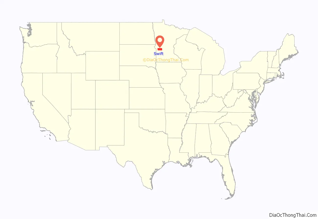
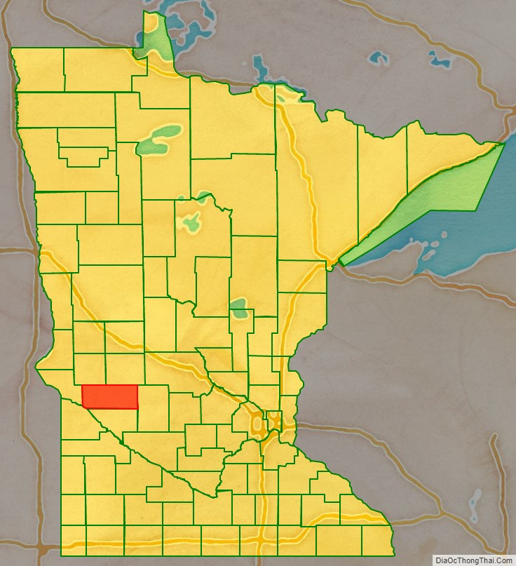
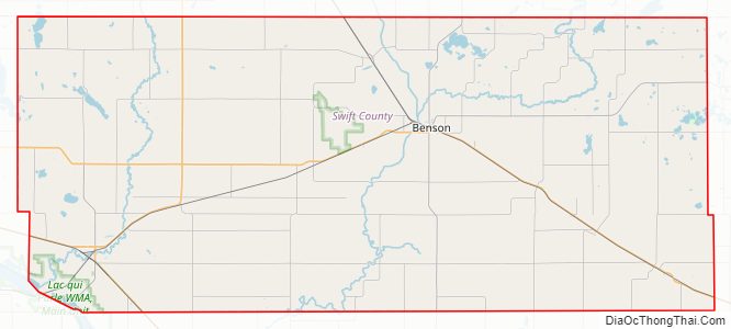
Swift County location map. Where is Swift County?
History
Swift County is in west central Minnesota and consists of 757 square miles (2,000 km) with three tiers of seven townships each. It was established on February 18, 1870, and named for Henry Adoniram Swift, the third governor of Minnesota (1863–64).
The Indians had grievances against the government, including delays in sending annuities that caused near starvation several times. In August 1862, an Indian rebellion broke out in Minnesota. The warfare reached the settlements just getting started in northeastern Swift County. By late September 1862, the Indian War was almost over but the settlers hesitated to venture back to Swift County until 1865, when all danger was apparently over. Scandinavians and Germans were in decided majority among the early settlers. A number of them came with the honor and privileges of Civil War veterans.
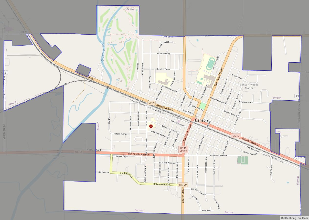
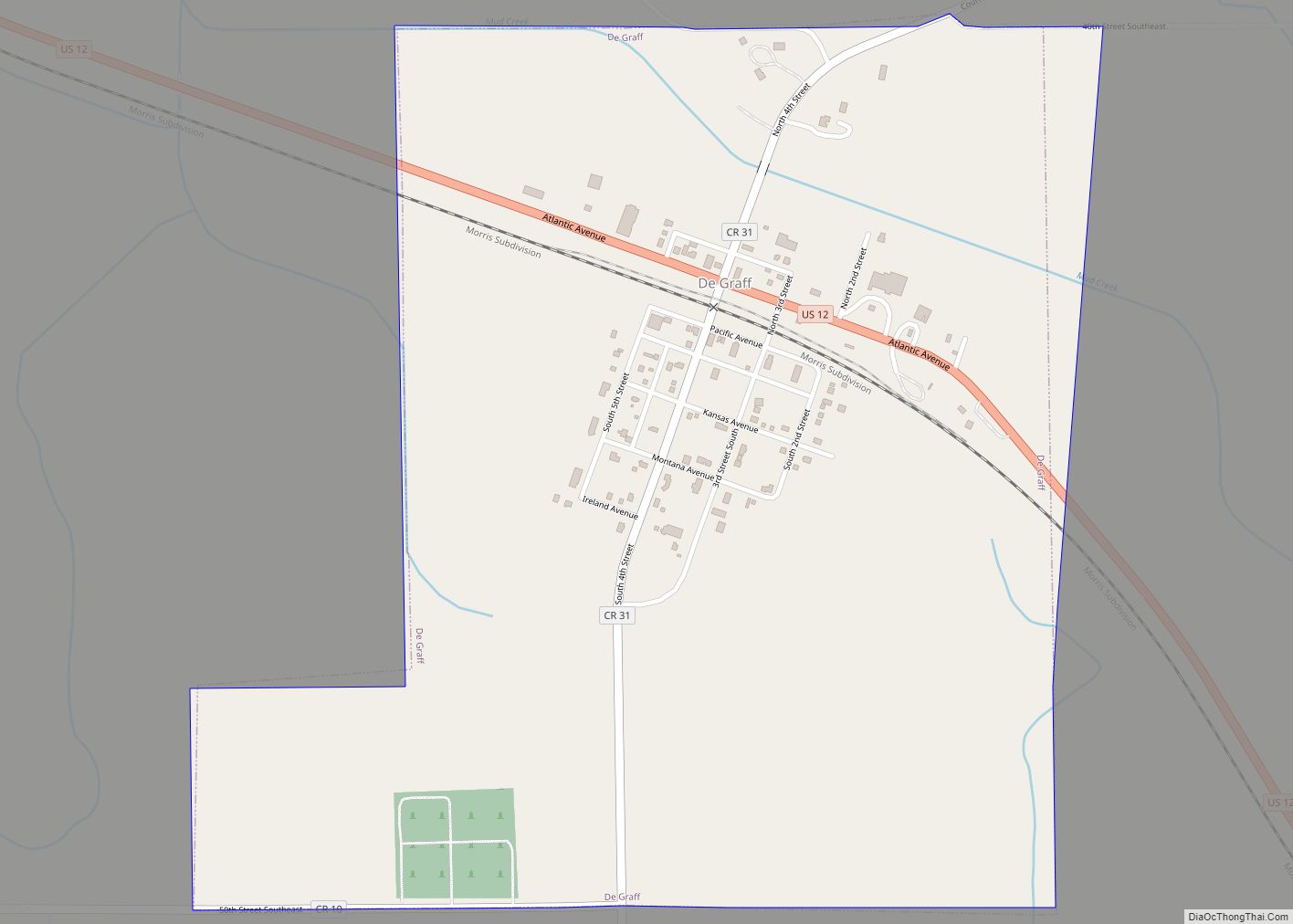
In 1869, the St. Paul & Pacific Railroad reached Willmar, and the next year it arrived in Benson. The railroad company determined the number of future trading centers (Kerkhoven, DeGraff, Benson, Randall) in the county by locating sites at intervals of approximately 8 miles (13 km). The Swift County Courthouse was built in 1897 and was listed on the National Register of Historic Places in 1976. Benson is the county seat. Railroad tracks run through Benson’s downtown business district with parks on each side.
Historic buildings
Historic buildings in Swift County include:
- Gethsemane Episcopal Church in Appleton built in 1879 and listed on the National Register of Historic Places in 2011.
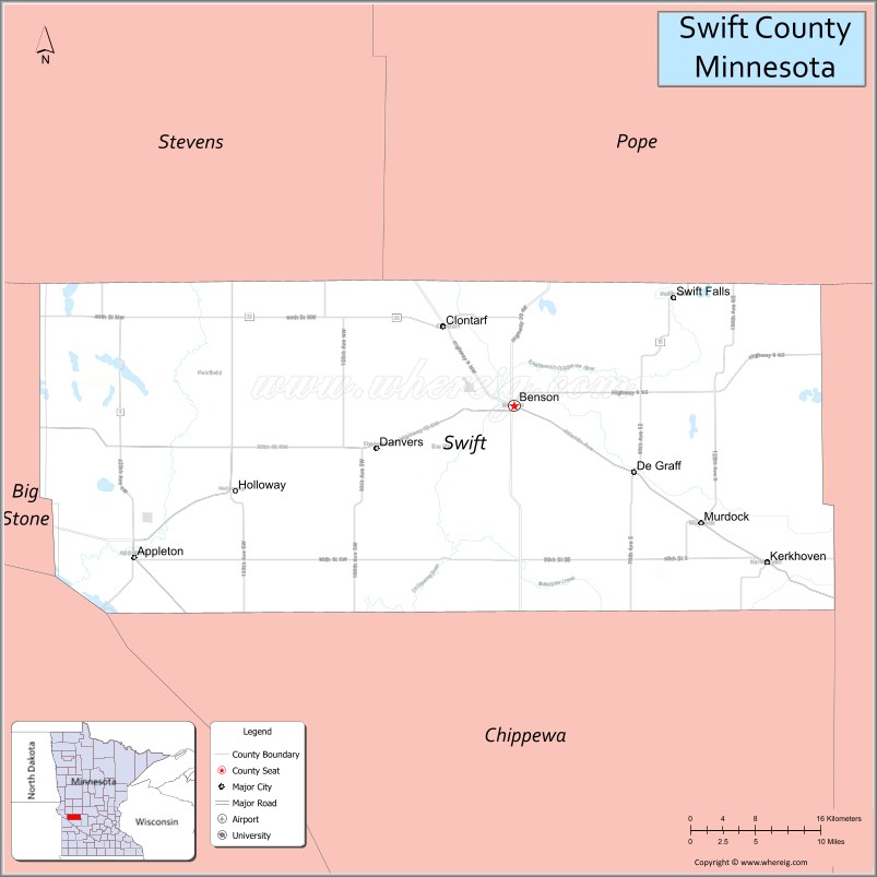
Swift County Road Map
Geography
The Minnesota River flows southeast along the county’s lower western border. The Pomme de Terre River flows south-southwest through the county’s western part, discharging into the Minnesota. The Chippewa River flows south-southwest through the county’s central part, discharging into the Minnesota south of the county. The county’s terrain consists of rolling hills, largely devoted to agriculture. It slopes to south and the west, with its highest point near its northeast corner at 1,240′ (378m) ASL. The county has an area of 752 square miles (1,950 km), of which 742 square miles (1,920 km) is land and 10 square miles (26 km) (1.3%) is water.
Swift County is primarily agricultural, but also hosts agriculture equipment manufacturers and an ethanol plant. It has 24 lakes and nine rivers and streams. Lake Oliver is one of the county’s biggest, at 416 acres (1.7 km). Caltopo shows the true highpoint to be 1300 ft in elevation about 1/3 of a mile southwest of the Monson State Wildlife Management Area:latitude 45.3046&longitude=-95.3031
Major highways
- U.S. Highway 12
- U.S. Highway 59
- Minnesota State Highway 7
- Minnesota State Highway 9
- Minnesota State Highway 29
- Minnesota State Highway 104
- Minnesota State Highway 119
Adjacent counties
- Stevens County – northwest
- Pope County – northeast
- Kandiyohi County – east
- Chippewa County – south
- Lac qui Parle County – southwest
- Big Stone County – west
Airport
Appleton Municipal Airport provides general aviation service for Swift County.
Protected areas
- Bench State Wildlife Management Area
- Camp Kerk State Wildlife Management Area
- Danvers State Wildlife Management Area
- Ehrenburg State Wildlife Management Area
- Hayes-Myhre State Wildlife Management Area
- Henry X State Wildlife Management Area
- Hollerberg Lake State Wildlife Management Area
- Monson Lake State Park
Swift County Topographic Map

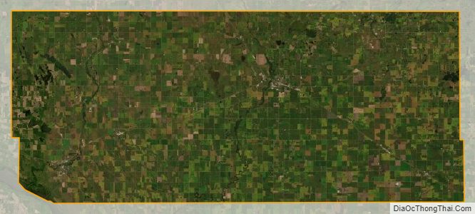
Swift County Satellite Map
Swift County Outline Map