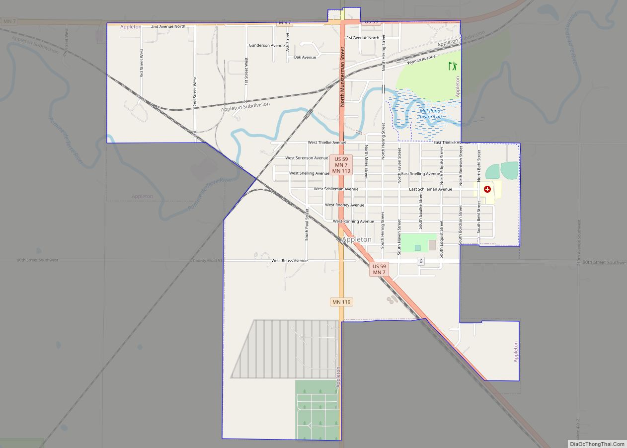
Appleton is a city in Swift County, Minnesota, United States. Its population was 1,412 at the 2010 census. The town is home to a vacant medium-security prison, the Prairie Correctional Facility, which is wholly owned and operated by Corrections Corporation of America. Appleton also includes a plant-protein factory operated by Eat Just, Inc.
Elmer A. Benson, who served as a United States Senator and as governor of Minnesota, was born in Appleton on September 22, 1895. Appleton is also home to many retirees and military veterans. All of its twenty-odd streets, except Minnesota Street, are named for local veterans who died in combat.
| Name: | Appleton city |
|---|---|
| LSAD Code: | 25 |
| LSAD Description: | city (suffix) |
| State: | Minnesota |
| County: | Swift County |
| Elevation: | 1,007 ft (307 m) |
| Total Area: | 1.92 sq mi (4.98 km²) |
| Land Area: | 1.87 sq mi (4.84 km²) |
| Water Area: | 0.05 sq mi (0.14 km²) |
| Total Population: | 1,392 |
| Population Density: | 744.39/sq mi (287.34/km²) |
| ZIP code: | 56208 |
| Area code: | 320 |
| FIPS code: | 2701864 |
| GNISfeature ID: | 0639416 |
| Website: | www.appletonmn.com |
Online Interactive Map
Click on ![]() to view map in "full screen" mode.
to view map in "full screen" mode.
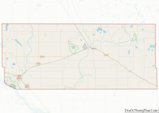
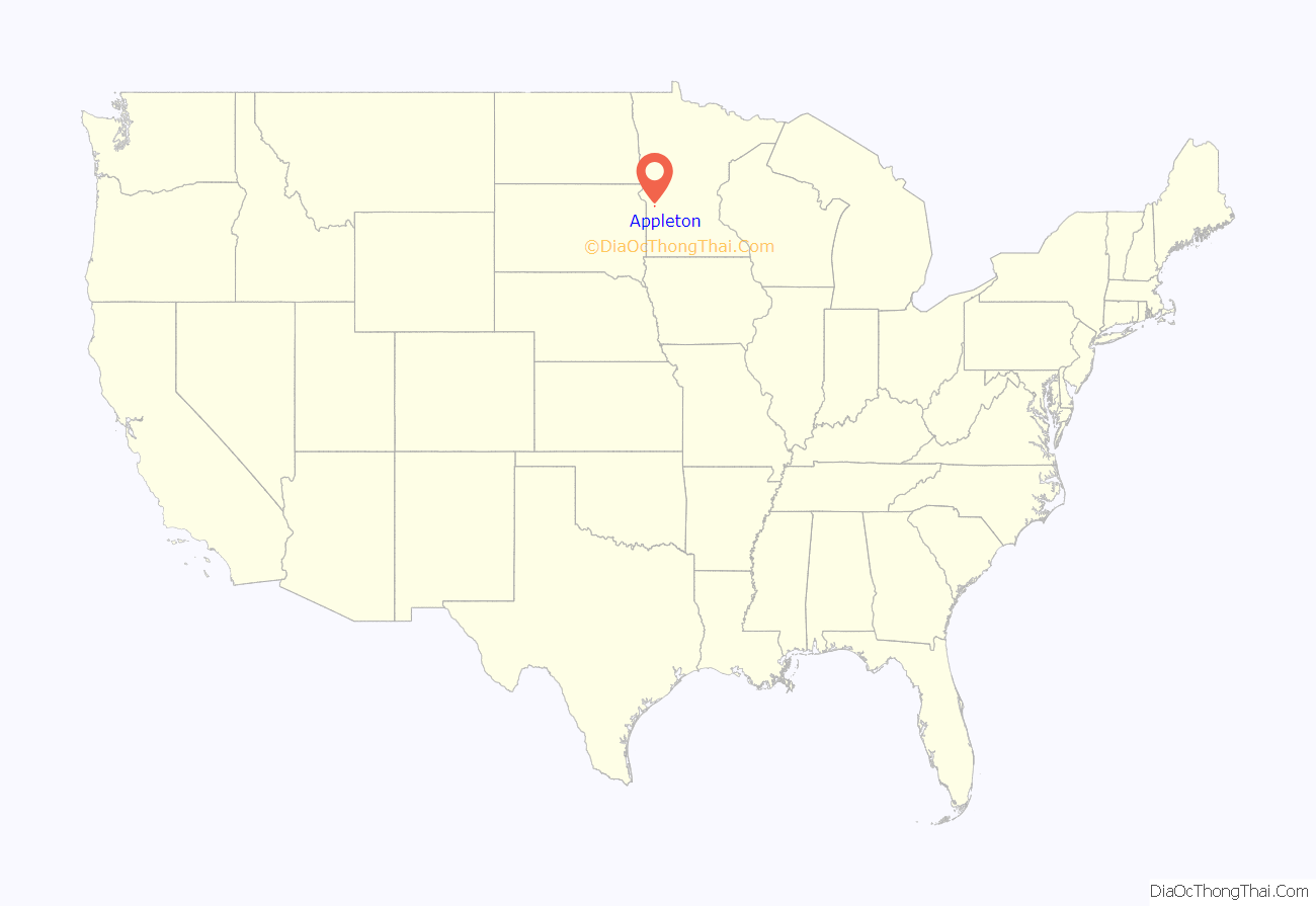
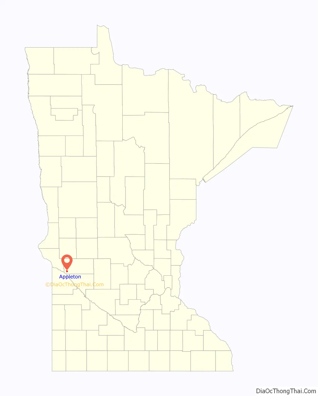
Appleton location map. Where is Appleton city?
History
Appleton was laid out in 1872, and named after Appleton, Wisconsin. A post office has been in operation at Appleton since 1873. Appleton was incorporated in 1881.
Gethsemane Episcopal Church, on North Hering Street at Snelling Avenue, was built in 1879 and was listed on the National Register of Historic Places in 2011.
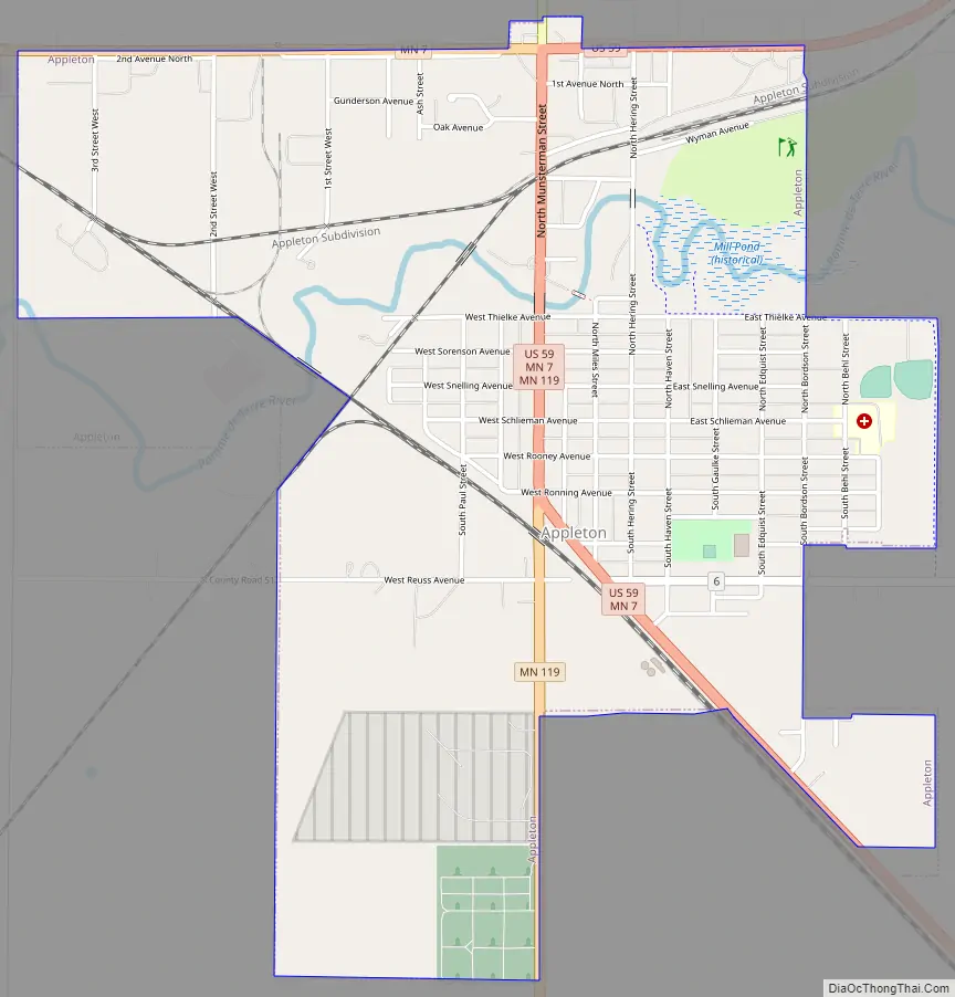
Appleton Road Map
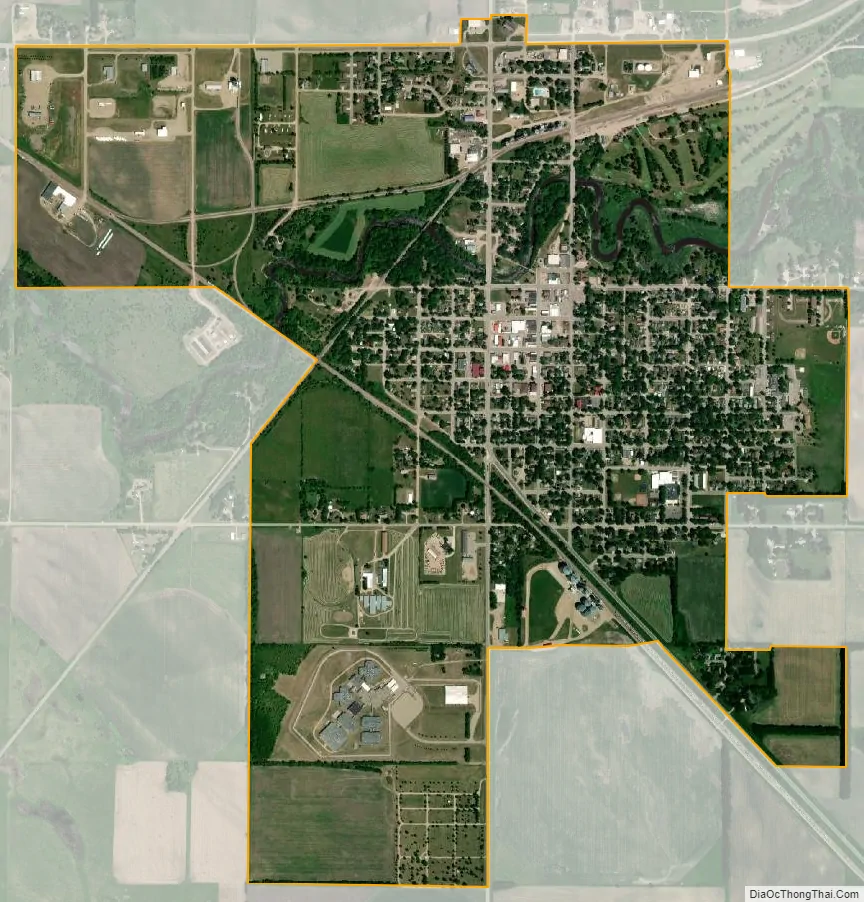
Appleton city Satellite Map
Geography
According to the United States Census Bureau, the city has a total area of 2.04 sq mi (5.28 km); 1.97 square miles (5.10 km) are land and 0.07 square miles (0.18 km) is covered by water. The Pomme de Terre River flows through the city and continues 10 miles to the west and south into Marsh Lake on the Minnesota River.
U.S. Highway 59 and Minnesota State Highways 7 and 119 are the main routes in the city.
See also
Map of Minnesota State and its subdivision:- Aitkin
- Anoka
- Becker
- Beltrami
- Benton
- Big Stone
- Blue Earth
- Brown
- Carlton
- Carver
- Cass
- Chippewa
- Chisago
- Clay
- Clearwater
- Cook
- Cottonwood
- Crow Wing
- Dakota
- Dodge
- Douglas
- Faribault
- Fillmore
- Freeborn
- Goodhue
- Grant
- Hennepin
- Houston
- Hubbard
- Isanti
- Itasca
- Jackson
- Kanabec
- Kandiyohi
- Kittson
- Koochiching
- Lac qui Parle
- Lake
- Lake of the Woods
- Lake Superior
- Le Sueur
- Lincoln
- Lyon
- Mahnomen
- Marshall
- Martin
- McLeod
- Meeker
- Mille Lacs
- Morrison
- Mower
- Murray
- Nicollet
- Nobles
- Norman
- Olmsted
- Otter Tail
- Pennington
- Pine
- Pipestone
- Polk
- Pope
- Ramsey
- Red Lake
- Redwood
- Renville
- Rice
- Rock
- Roseau
- Saint Louis
- Scott
- Sherburne
- Sibley
- Stearns
- Steele
- Stevens
- Swift
- Todd
- Traverse
- Wabasha
- Wadena
- Waseca
- Washington
- Watonwan
- Wilkin
- Winona
- Wright
- Yellow Medicine
- Alabama
- Alaska
- Arizona
- Arkansas
- California
- Colorado
- Connecticut
- Delaware
- District of Columbia
- Florida
- Georgia
- Hawaii
- Idaho
- Illinois
- Indiana
- Iowa
- Kansas
- Kentucky
- Louisiana
- Maine
- Maryland
- Massachusetts
- Michigan
- Minnesota
- Mississippi
- Missouri
- Montana
- Nebraska
- Nevada
- New Hampshire
- New Jersey
- New Mexico
- New York
- North Carolina
- North Dakota
- Ohio
- Oklahoma
- Oregon
- Pennsylvania
- Rhode Island
- South Carolina
- South Dakota
- Tennessee
- Texas
- Utah
- Vermont
- Virginia
- Washington
- West Virginia
- Wisconsin
- Wyoming