Benson is a city in Swift County, Minnesota, United States, along the Chippewa River. The population was 3,240 at the 2010 census. It is the county seat.
| Name: | Benson city |
|---|---|
| LSAD Code: | 25 |
| LSAD Description: | city (suffix) |
| State: | Minnesota |
| County: | Swift County |
| Elevation: | 1,047 ft (319 m) |
| Total Area: | 3.12 sq mi (8.08 km²) |
| Land Area: | 3.10 sq mi (8.03 km²) |
| Water Area: | 0.02 sq mi (0.05 km²) |
| Total Population: | 3,480 |
| Population Density: | 1,122.94/sq mi (433.55/km²) |
| ZIP code: | 56215 |
| Area code: | 320 |
| FIPS code: | 2705212 |
| GNISfeature ID: | 0639933 |
| Website: | www.bensonmn.org |
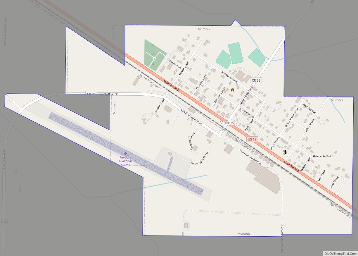
Online Interactive Map
Click on ![]() to view map in "full screen" mode.
to view map in "full screen" mode.
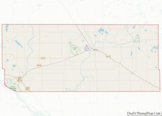
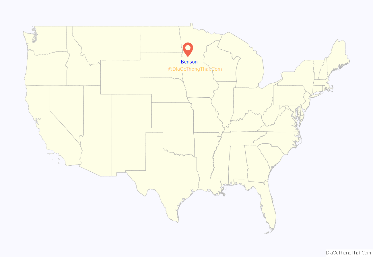
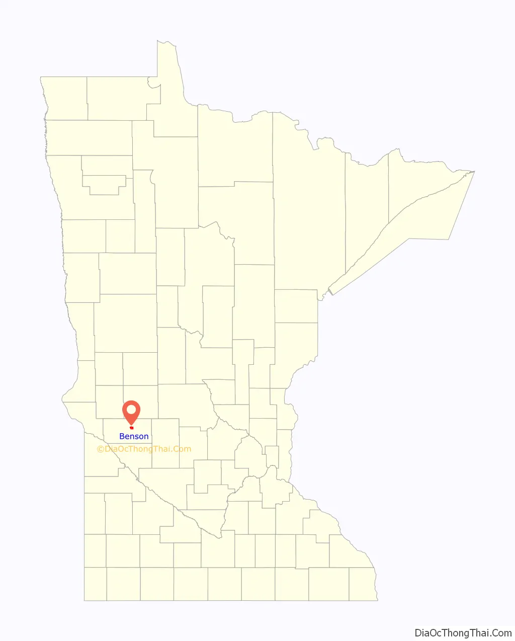
Benson location map. Where is Benson city?
History
Benson was platted in 1870 when the railroad was extended to that point. As the end of the tracks, Benson became a lively trading center. Benson was the market for a 100-mile area in almost all directions.
The city was named for Ben H. Benson, a Norwegian settler. Benson was incorporated as a city in 1908.
The town’s early history included many tragedies, such as an 1872 smallpox epidemic, an 1876 grasshopper plague, and a fire in 1880 that wiped out a whole city block.
In 1869, the first general store in Benson was established. A post office has been in operation at Benson since 1870. The Benson Public Library was established in 1911 after a generous donation. In 1912, the Swift County Hospital was built, originally housing 19 patients. The Swift County-Benson Hospital has since been repeatedly renovated. Benson’s first one-room schoolhouse still stands as a historic site in Ambush Park and is open to the public. The current schools were established in 1890 (Benson High School) and 1958 (Northside Elementary School).
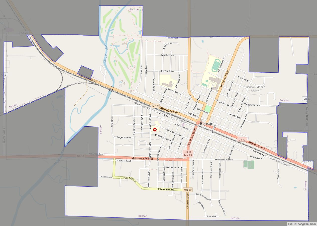
Benson Road Map

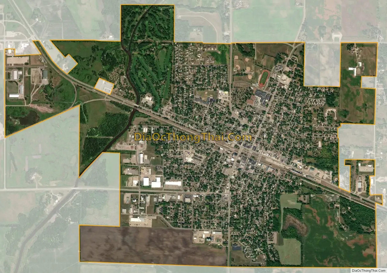
Benson city Satellite Map
Geography
According to the United States Census Bureau, Benson has an area of 3.02 square miles (7.82 km); 3.00 square miles (7.77 km) is land and 0.02 square miles (0.05 km) is water.
U.S. Highway 12 and Minnesota State Highways 9 and 29 are three of the main routes in the city.
Climate
See also
Map of Minnesota State and its subdivision:- Aitkin
- Anoka
- Becker
- Beltrami
- Benton
- Big Stone
- Blue Earth
- Brown
- Carlton
- Carver
- Cass
- Chippewa
- Chisago
- Clay
- Clearwater
- Cook
- Cottonwood
- Crow Wing
- Dakota
- Dodge
- Douglas
- Faribault
- Fillmore
- Freeborn
- Goodhue
- Grant
- Hennepin
- Houston
- Hubbard
- Isanti
- Itasca
- Jackson
- Kanabec
- Kandiyohi
- Kittson
- Koochiching
- Lac qui Parle
- Lake
- Lake of the Woods
- Lake Superior
- Le Sueur
- Lincoln
- Lyon
- Mahnomen
- Marshall
- Martin
- McLeod
- Meeker
- Mille Lacs
- Morrison
- Mower
- Murray
- Nicollet
- Nobles
- Norman
- Olmsted
- Otter Tail
- Pennington
- Pine
- Pipestone
- Polk
- Pope
- Ramsey
- Red Lake
- Redwood
- Renville
- Rice
- Rock
- Roseau
- Saint Louis
- Scott
- Sherburne
- Sibley
- Stearns
- Steele
- Stevens
- Swift
- Todd
- Traverse
- Wabasha
- Wadena
- Waseca
- Washington
- Watonwan
- Wilkin
- Winona
- Wright
- Yellow Medicine
- Alabama
- Alaska
- Arizona
- Arkansas
- California
- Colorado
- Connecticut
- Delaware
- District of Columbia
- Florida
- Georgia
- Hawaii
- Idaho
- Illinois
- Indiana
- Iowa
- Kansas
- Kentucky
- Louisiana
- Maine
- Maryland
- Massachusetts
- Michigan
- Minnesota
- Mississippi
- Missouri
- Montana
- Nebraska
- Nevada
- New Hampshire
- New Jersey
- New Mexico
- New York
- North Carolina
- North Dakota
- Ohio
- Oklahoma
- Oregon
- Pennsylvania
- Rhode Island
- South Carolina
- South Dakota
- Tennessee
- Texas
- Utah
- Vermont
- Virginia
- Washington
- West Virginia
- Wisconsin
- Wyoming