Union County is a county in the U.S. state of Indiana. As of the 2020 United States census, the population was 7,087. The county seat is Liberty.
Since 2018, Union County has been included in the Cincinnati-Middletown, OH-KY-IN Metropolitan Statistical Area. It is located on the Indiana-Ohio border.
| Name: | Union County |
|---|---|
| FIPS code: | 18-161 |
| State: | Indiana |
| Founded: | 5 January 1821 (created) 1 February 1821 (organized) |
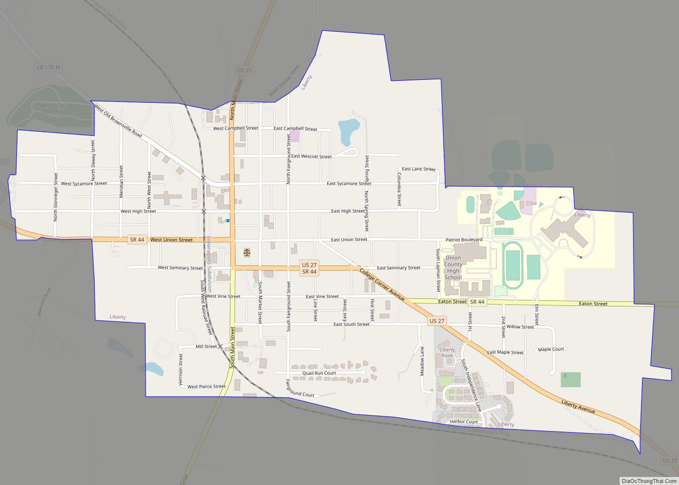
| Seat: | Liberty |
| Largest town: | Liberty |
| Total Area: | 165.18 sq mi (427.8 km²) |
| Land Area: | 161.22 sq mi (417.6 km²) |
| Total Population: | 7,087 |
| Population Density: | 43.6/sq mi (16.8/km²) |
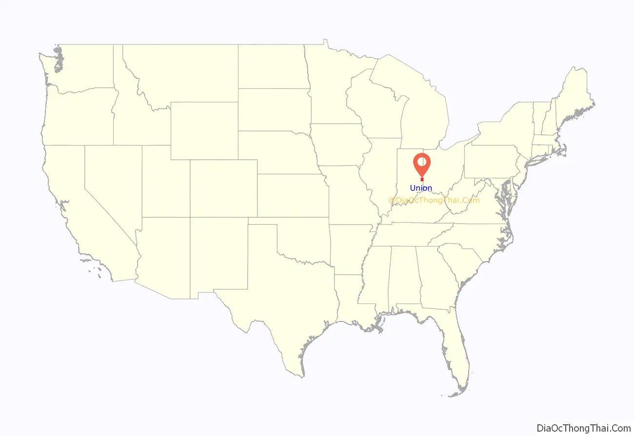
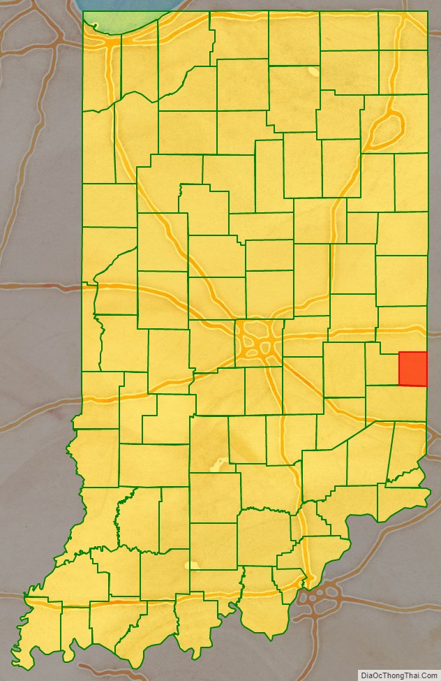
Union County location map. Where is Union County?
History
The future state of Indiana was first regulated by passage of the Northwest Ordinance in 1787. In 1790 the Territory was divided into two counties, with Knox covering much of present-day Indiana. In 1810, a portion of Knox was partitioned to create Wayne County; in 1811 a portion further south was partitioned to create Franklin. The area between those two counties was partitioned in 1818 to create Fayette; by the 1820s the eastern part of Fayette County was populated sufficiently to warrant separate representation. Thus on 5 January 1821 the state legislature authorized the creation of Union County, with areas ceded from Wayne County, Fayette County and Franklin County. The organization of the new county’s governing structure began on 1 February 1821.
It was so named because it united parts of Fayette, Franklin and Wayne counties. The first settlers were from Laurens District, South Carolina. John Templeton was the first settler to enter land at the Cincinnati land office in what would become Harmony Township, Union County Indiana. The first county seat was Brownsville, a small community on the East Fork of the Whitewater River. The seat was moved in 1824 to Liberty, a central location. The primary industry of Union County was and is farming.
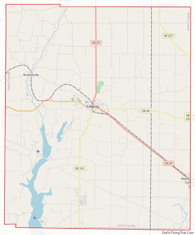
Union County Road Map
Geography
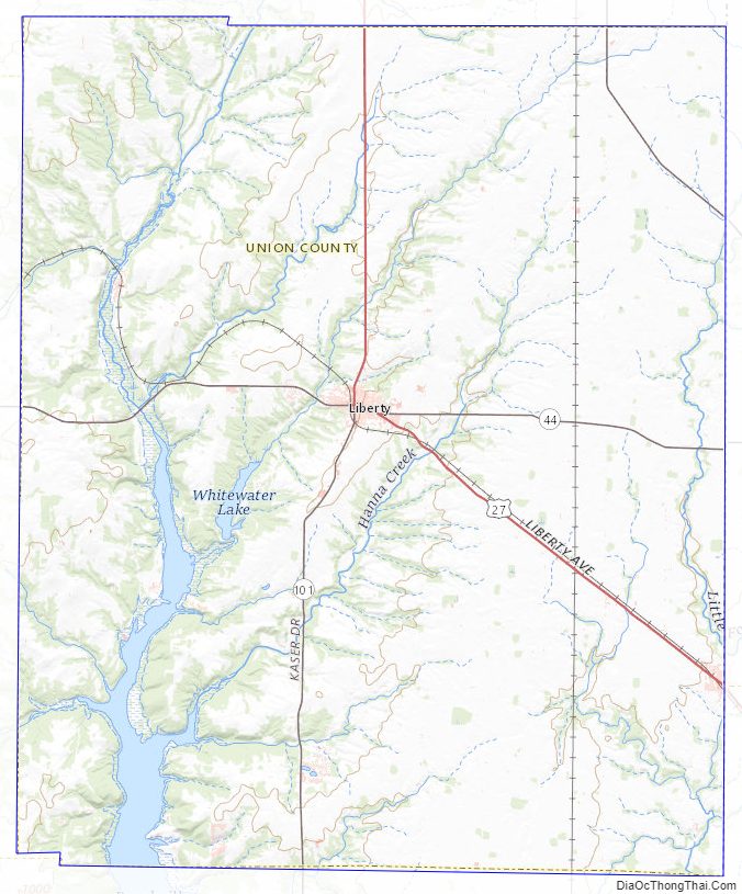
Union County lies on the east side of Indiana; its east border abuts the state of Ohio. Its low rolling hills have now been cleared of timber, although drainage areas are still largely brush-filled. The area is devoted to agricultural or recreational uses. The highest point on the terrain (1,140 feet/350 meters ASL) is a rise near the county’s north border, 1.0 mile (1.6 km) ENE from Witts Station.
Silver Creek flows southwestward through the northeastern part of the county, discharging into Whitewater Lake. The East Fork of Whitewater River flows southward through the upper western part of the county, discharging into Brookville Lake. The lower part of the county is drained by Dubois Creek, flowing westward into Brookville Lake.
According to the 2010 census, the county has a total area of 165.18 square miles (427.8 km), of which 161.22 square miles (417.6 km) (or 97.60%) is land and 3.95 square miles (10.2 km) (or 2.39%) is water.
Adjacent counties
- Wayne County – north
- Preble County, Ohio – east
- Butler County, Ohio – southeast
- Franklin County – south
- Fayette County – west
Major highways
- U.S. Route 27
- Indiana State Road 44
- Indiana State Road 101
- Indiana State Road 227
Lakes
- Brookville Lake (part)
- Whitewater Lake
Protected areas
- Whitewater Memorial State Park
Quakertown State Recreation Area
Incorporated towns
- Liberty (county seat)
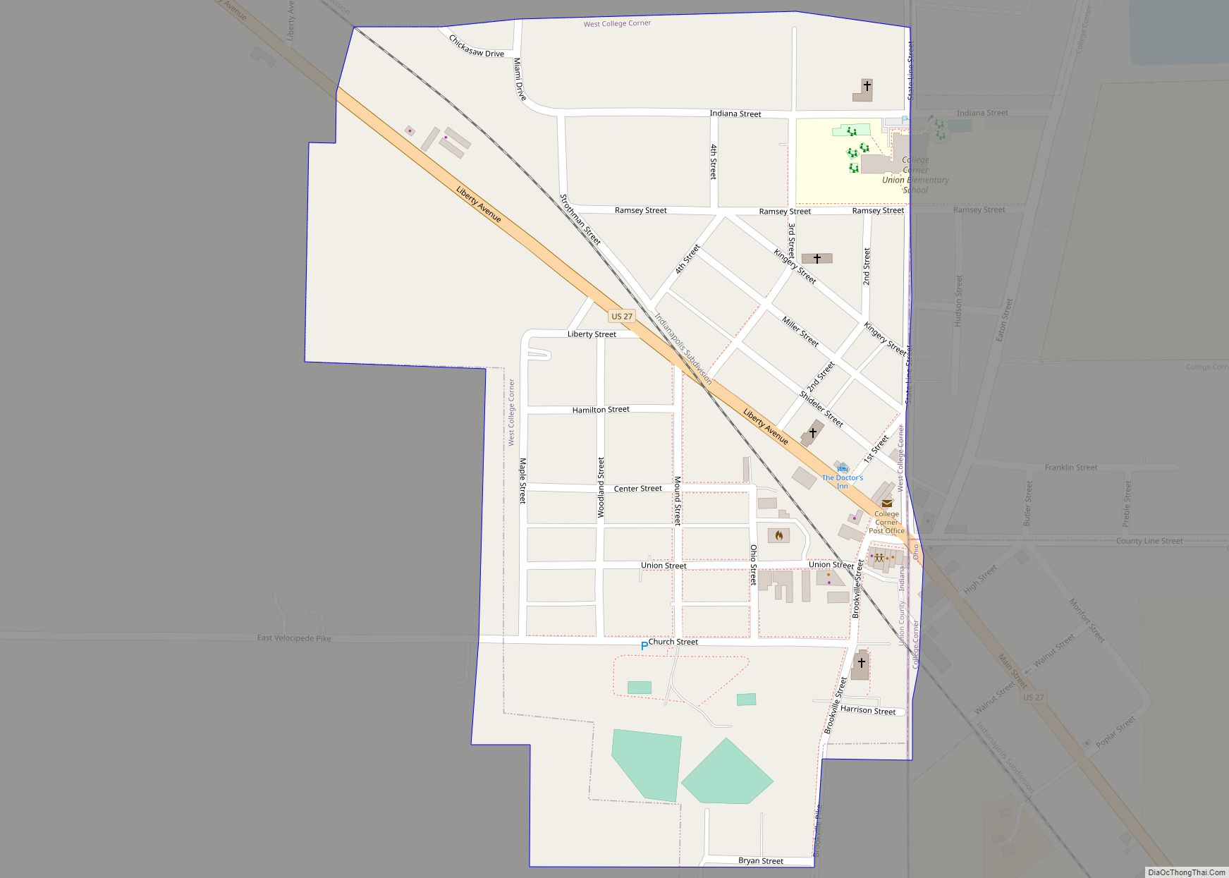
- West College Corner
Unincorporated communities
- Billingsville
- Brownsville
- Charlottesville
- Clifton
- Cottage Grove
- Dunlapsville
- Five Points
- Goodwins Corner
- Hopeville
- Kitchel
- Lotus
- Philomath
- Quakertown
- Roseburg
- Salem
- Witts Station
- Yankee Town
Townships
- Brownsville
- Center
- Harmony
- Harrison
- Liberty
- Union
Union County Topographic Map
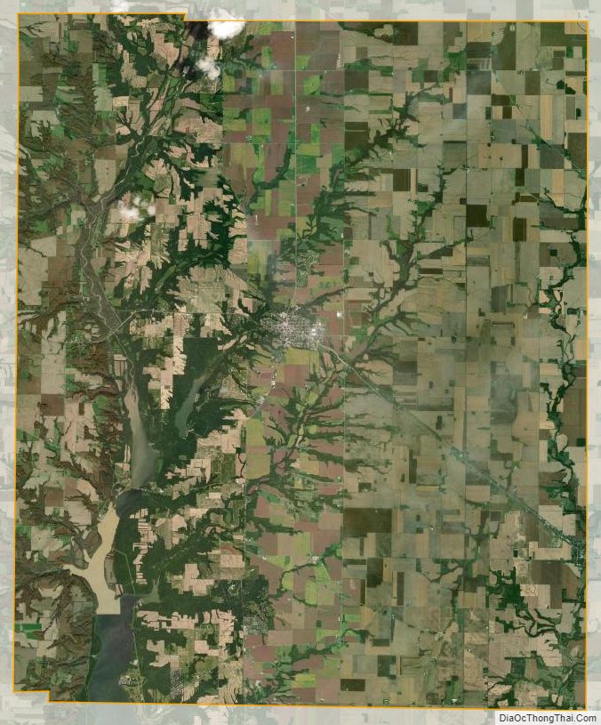
Union County Satellite Map
Union County Outline Map