Knox County is a county in the U.S. state of Indiana in the United States. The oldest county in Indiana, it was one of two original counties created in the Northwest Territory in 1790, alongside, St. Clair County, Illinois. Knox County was gradually reduced in size as subsequent counties were established. It was established in its present configuration when Daviess County was partitioned off (2 February 1818). At the 2010 United States Census, the county population was 38,440. The county seat is Vincennes.
Knox County comprises the Vincennes, IN Micropolitan Statistical Area.
| Name: | Knox County |
|---|---|
| FIPS code: | 18-083 |
| State: | Indiana |
| Founded: | June 6, 1790 |
| Named for: | Henry Knox |
| Seat: | Vincennes |
| Largest city: | Vincennes |
| Total Area: | 524.04 sq mi (1,357.3 km²) |
| Land Area: | 516.03 sq mi (1,336.5 km²) |
| Population Density: | 71.5/sq mi (27.61/km²) |
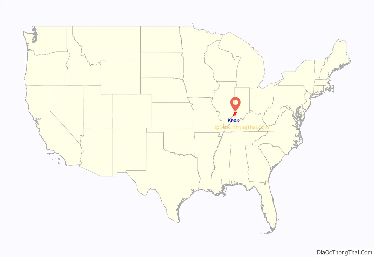
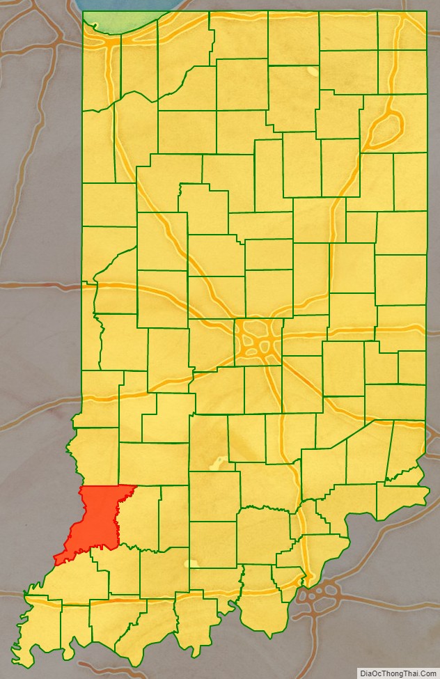
Knox County location map. Where is Knox County?
History
In 1790, Winthrop Sargent, Secretary of Northwest Territory, organized Knox County, the fourth in the Northwest Territory. It was named for Major General Henry Knox, who had completed his term as second U.S. Secretary of War the previous September. Knox County was created prior to the formation of the Indiana Territory. When it was created, Knox County extended to Canada and encompassed all or part of the present states of Indiana, Michigan, Illinois, and Ohio. When the Illinois Territory was formed in 1809, the portions of Knox County beyond the Wabash River became Saint Clair County, Illinois.
Many of Knox County townships and lots were surveyed with the French system, which employs non-cardinal compass points. Knox and Clark counties are the only ones laid out in this fashion.
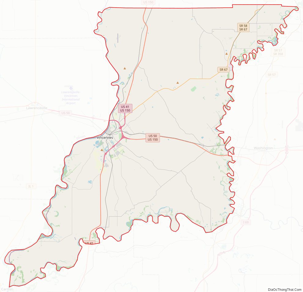
Knox County Road Map
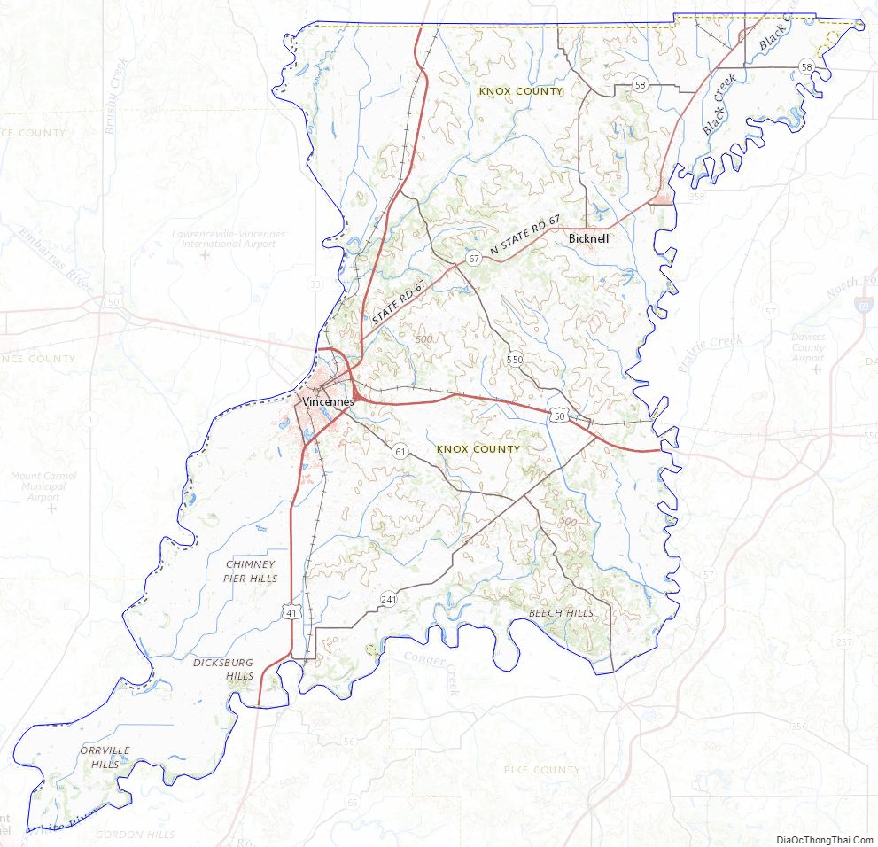
Geography
Knox County lies on the west edge of the state; its western border abuts the eastern border of Illinois across the Wabash River. According to the 2010 census, the county has a total area of 524.04 square miles (1,357.3 km), of which 516.03 square miles (1,336.5 km) (or 98.47%) is land and 8.01 square miles (20.7 km) (or 1.53%) is water. The county’s west border is defined by the south-flowing Wabash River, and its east border is defined by the south-southwest-flowing White River. Its southwesternmost point occurs at the confluence of the two rivers, near Mount Carmel, Illinois. The terrain consists of verdant low-rolling hills, largely devoted to agriculture. Its highest points (around 620 feet/190 meters ASL) occur in the hills midway between Bruceville and Bicknell.
Major highways
- US 41
- US 50
- US 150
- SR 58
- SR 59
- SR 61
- SR 67
- SR 159
- SR 241
- SR 358
- SR 441
- SR 550
Adjacent counties
- Sullivan County – north
- Greene County – northeast
- Daviess County – east
- Pike County – southeast
- Gibson County – south
- Wabash County, Illinois – southwest
- Lawrence County, Illinois – west
- Crawford County, Illinois – northwest
National protected area
- George Rogers Clark National Historical Park
Knox County Topographic Map
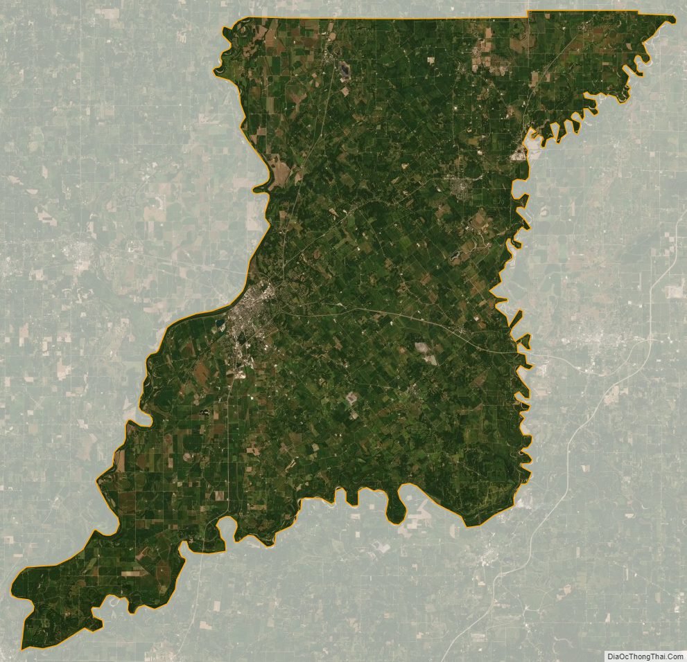
Knox County Satellite Map
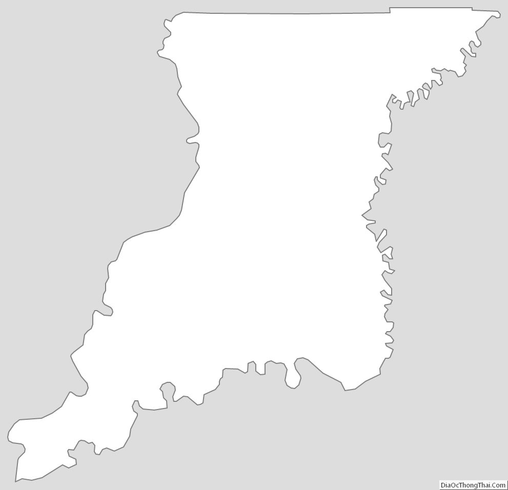
Knox County Outline Map