Washington Parish (French: Paroisse de Washington) is a parish located in the interior southeast corner of the U.S. state of Louisiana, one of the Florida Parishes. As of the 2020 census, the population was 45,463. Its parish seat is Franklinton. Its largest city is Bogalusa. The parish was founded in 1819.
Washington Parish comprises the Bogalusa, LA Micropolitan Statistical Area, which is included in the New Orleans–Metairie–Hammond, LA-MS Combined Statistical Area.
| Name: | Washington Parish |
|---|---|
| FIPS code: | 22-117 |
| State: | Louisiana |
| Founded: | 1819 |
| Named for: | George Washington |
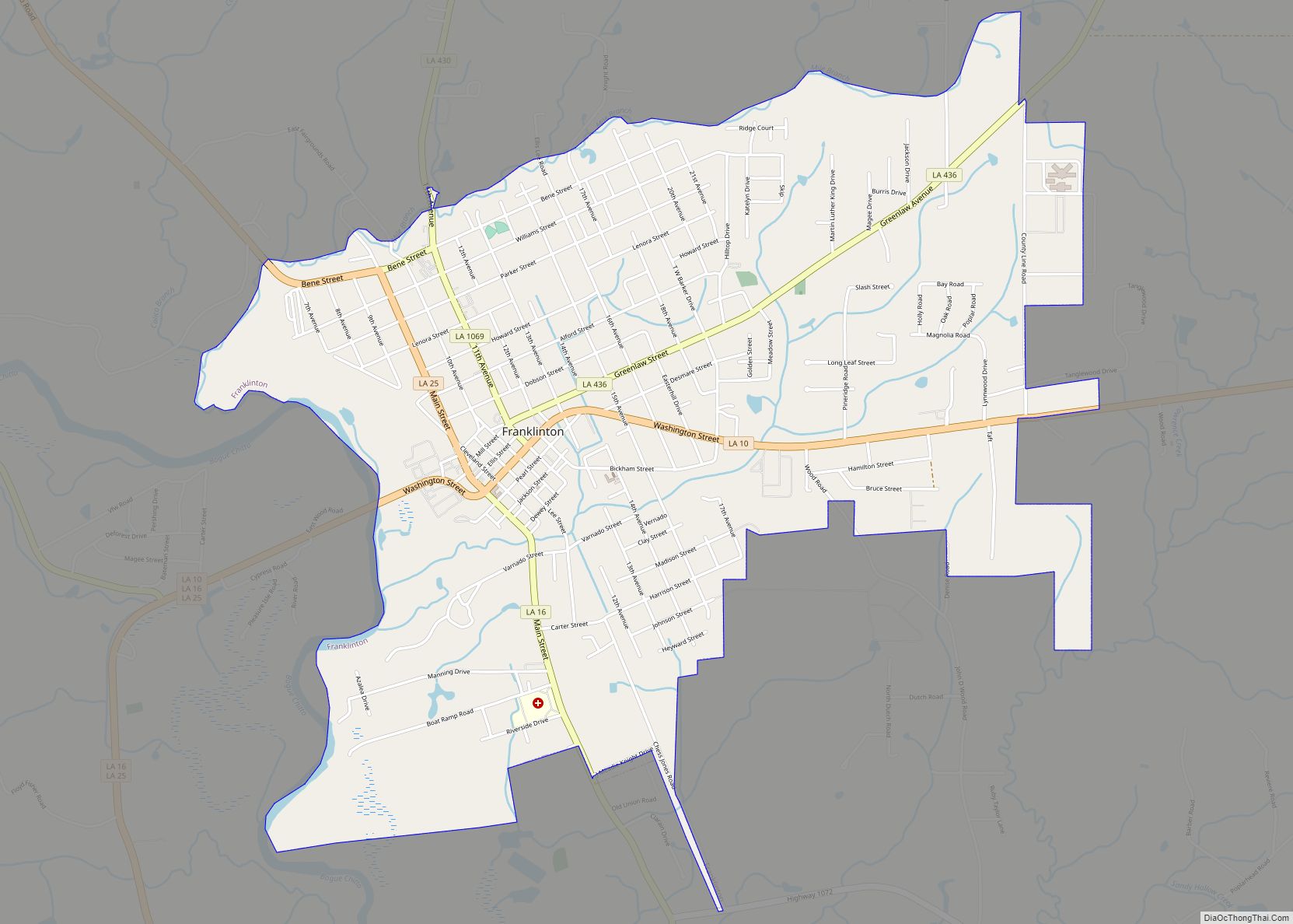
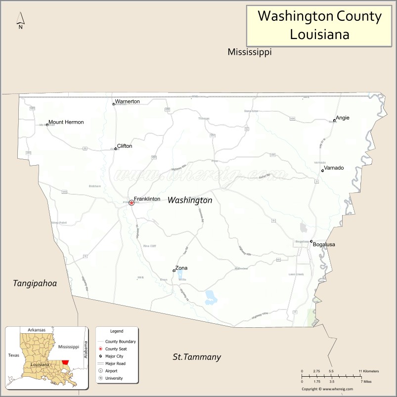
| Seat: | Franklinton |
| Largest city: | Bogalusa |
| Total Area: | 1,750 km² (676 sq mi) |
| Land Area: | 1,700 km² (670 sq mi) |
| Total Population: | 45,463 |
| Population Density: | 26/km² (67/sq mi) |
| Time zone: | UTC-6 (CST) |
| Summer Time Zone (DST): | UTC-5 (CDT) |
| Website: | Washington Parish, Louisiana |
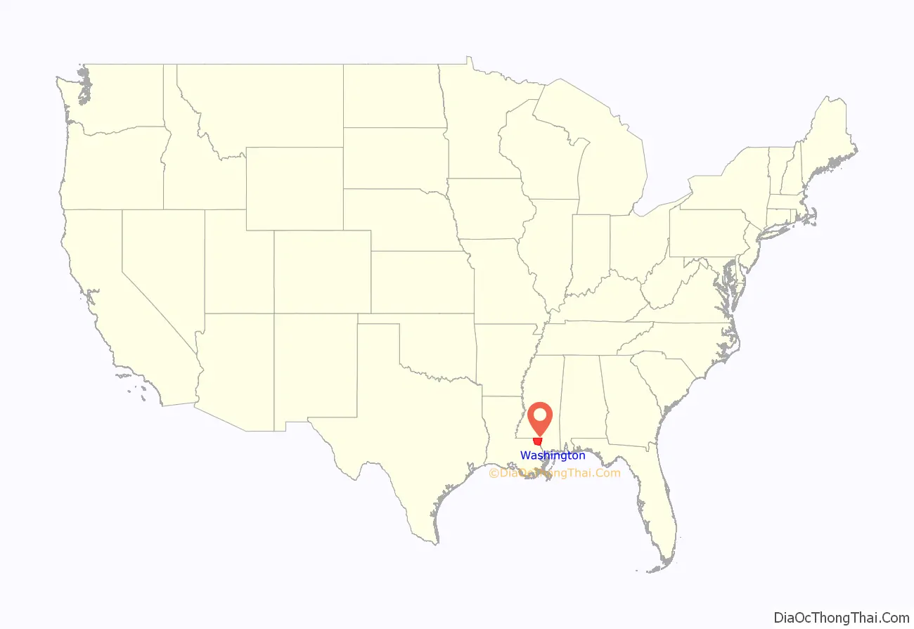
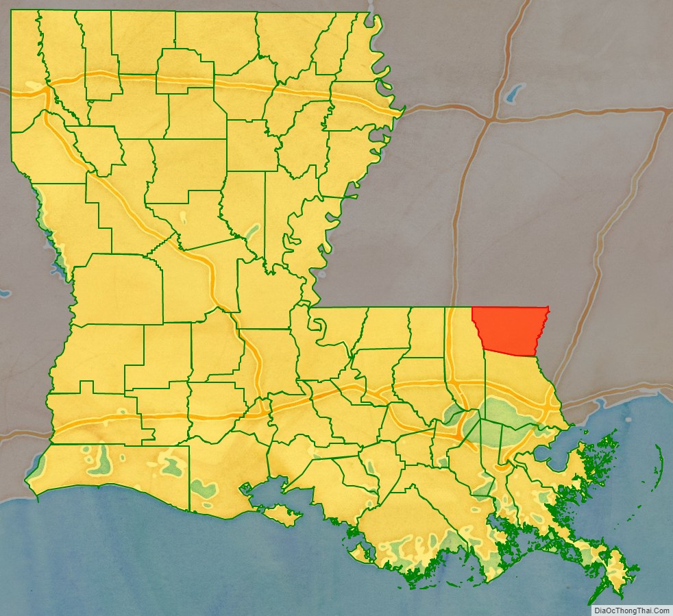
Washington Parish location map. Where is Washington Parish?
History
Washington Parish was formed in 1819 by splitting off from St. Tammany Parish. Franklinton was designated as the parish seat on February 10, 1821.
Washington Parish is the most northeasterly of what are called the Florida Parishes. Great Britain took over control of this French territory east of the Mississippi River in 1763 after defeating France in the Seven Years’ War. But France had also ceded some territory to Spain. This area was under contention, and English and American settlers tried to set up an independent state here in 1810. The United States annexed the territory, later settling with Spain in a treaty. Through much of this period, the French influence remained strong in the region, especially in its former colonial cities.
This area was rural and forested with virgin longleaf pine (Pinus palustris L.) In the early 20th century, entrepreneurial brothers Frank and Charles W. Goodyear, already successful businessmen from Buffalo, New York, purchased hundreds of thousands of acres of forest in this area and in southwestern Mississippi. They established the Great Southern Lumber Company, constructed a huge sawmill (the largest in the world at the time) in the middle of the forest, and developed Bogalusa, Louisiana, as a company mill town. In the early 20th century, there were numerous confrontations as workers attempted to unionize and companies hired private militia to suppress such activities.
The company housing for workers was divided by Jim Crow custom and state laws on racial segregation into sections for “Americans” and another for “colored” and foreign workers. It also built housing for supervisors, and supporting facilities, such as several hotels, churches, a YMCA and YWCA, schools, and other services within a year, opening facilities in 1907. To access the timber and transport processed lumber from the mill to markets, the company built the New Orleans Great Northern Railroad, connecting Bogalusa to the port of New Orleans.
Well before World War II, the virgin forest was harvested. Great Southern Lumber Company closed the sawmill in 1938. Its paper mill and chemical operations continued. Gradually in the late 20th century, these operations declined. As jobs left, the population dropped in such industrial towns. Some people moved to new or emerging industries in New Orleans and other major cities.
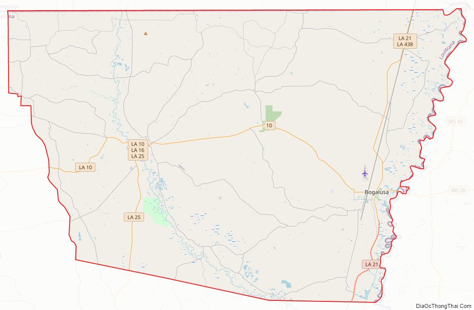
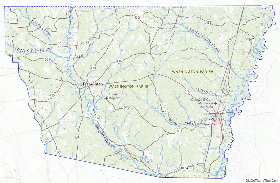
Washington Parish Road Map
Geography
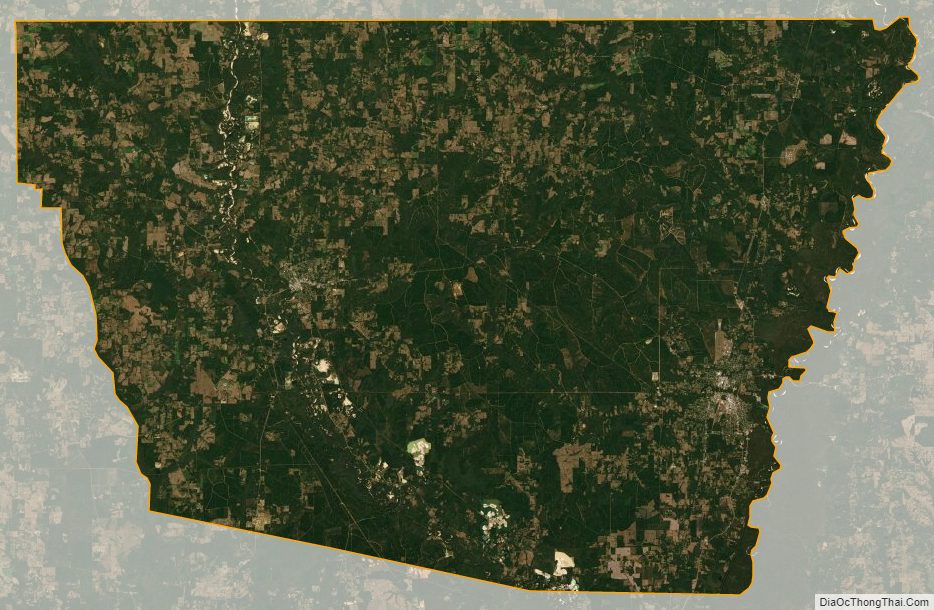
According to the U.S. Census Bureau, the parish has a total area of 676 square miles (1,750 km), of which 670 square miles (1,700 km) is land and 6.4 square miles (17 km) (0.9%) is water.
Adjacent counties and parishes
- Pike County, Mississippi (northwest)
- Walthall County, Mississippi (north)
- Marion County, Mississippi (northeast)
- Pearl River County, Mississippi (east)
- St. Tammany Parish (south)
- Tangipahoa Parish (west)
Major highways
- Louisiana Highway 10
- Louisiana Highway 16
- Louisiana Highway 21
- Louisiana Highway 25
National protected area
- Bogue Chitto National Wildlife Refuge (part)
State park
- Bogue Chitto State Park
Washington Parish Topographic Map
Washington Parish Satellite Map
Washington Parish Outline Map