St. Gabriel is a city in Iberville Parish, Louisiana, United States. The city of St. Gabriel includes the areas of Sunshine and Carville. Part of the Baton Rouge metropolitan statistical area, it had a population of 6,677 at the 2010 U.S. census, and 6,433 at the 2020 census.
St. Gabriel was incorporated as a town in 1994 and received city designation in 2001. It is located on the east bank of the Mississippi River, approximately 12 miles south of Baton Rouge. Bayou Manchac serves as the official boundary between St. Gabriel, Ascension Parish, and East Baton Rouge Parish. Over the years, the area has been transformed from a primarily agricultural economy to one that is now dominated by the petrochemical industry.
| Name: | St. Gabriel city |
|---|---|
| LSAD Code: | 25 |
| LSAD Description: | city (suffix) |
| State: | Louisiana |
| County: | Iberville Parish |
| Incorporated: | 1994 (town) |
| Elevation: | 23 ft (7 m) |
| Total Area: | 29.88 sq mi (77.39 km²) |
| Land Area: | 29.66 sq mi (76.81 km²) |
| Water Area: | 0.22 sq mi (0.58 km²) |
| Total Population: | 6,433 |
| Population Density: | 216.91/sq mi (83.75/km²) |
| Area code: | 225 |
| FIPS code: | 2267250 |
| Website: | http://www.cityofstgabriel.us |
Online Interactive Map
Click on ![]() to view map in "full screen" mode.
to view map in "full screen" mode.
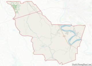
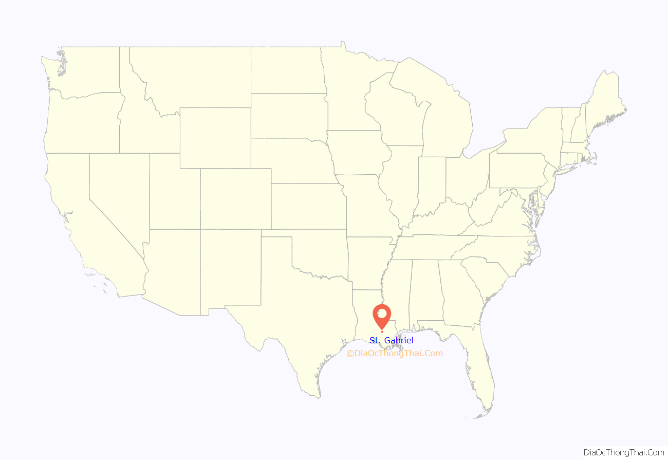
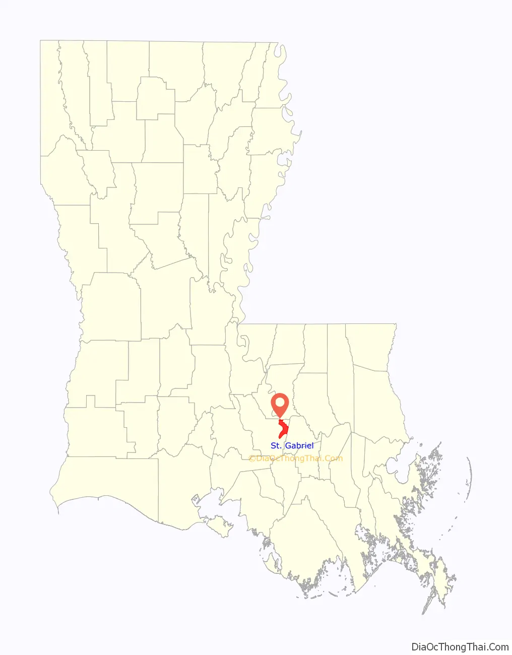
St. Gabriel location map. Where is St. Gabriel city?
History
This area is in a part of Acadiana, which was founded by the Acadians, after their expulsion from Nova Scotia in the mid-18th century.
At the end of 1769 Luis de Unzaga, then governor of New Orleans and from 1770 also of Louisiana, authorized Father Dragobert to create a parish for the Acadians on land near the Mississippi and located between Baton Rouge, Iberville and the town of Gonzales. Between 1771 and 1773, Governor Luis de Unzaga granted the land and the necessary permits for its construction; the construction could be carried out between 1774 and 1776, still within the period of the government of Luis de Unzaga.
In 2008 during Hurricane Gustav, St. Gabriel Catholic Church’s steeple was destroyed. It is one of Louisiana’s oldest churches, and tradition sets the date of the formation of the parish in 1769.
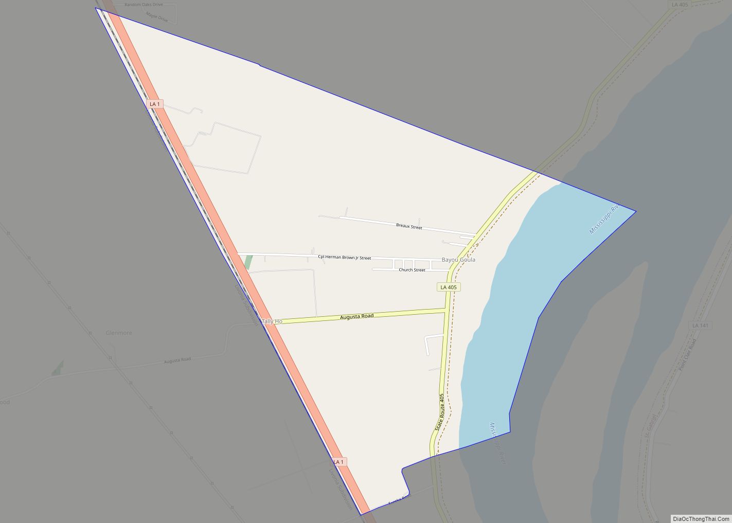
St. Gabriel Road Map
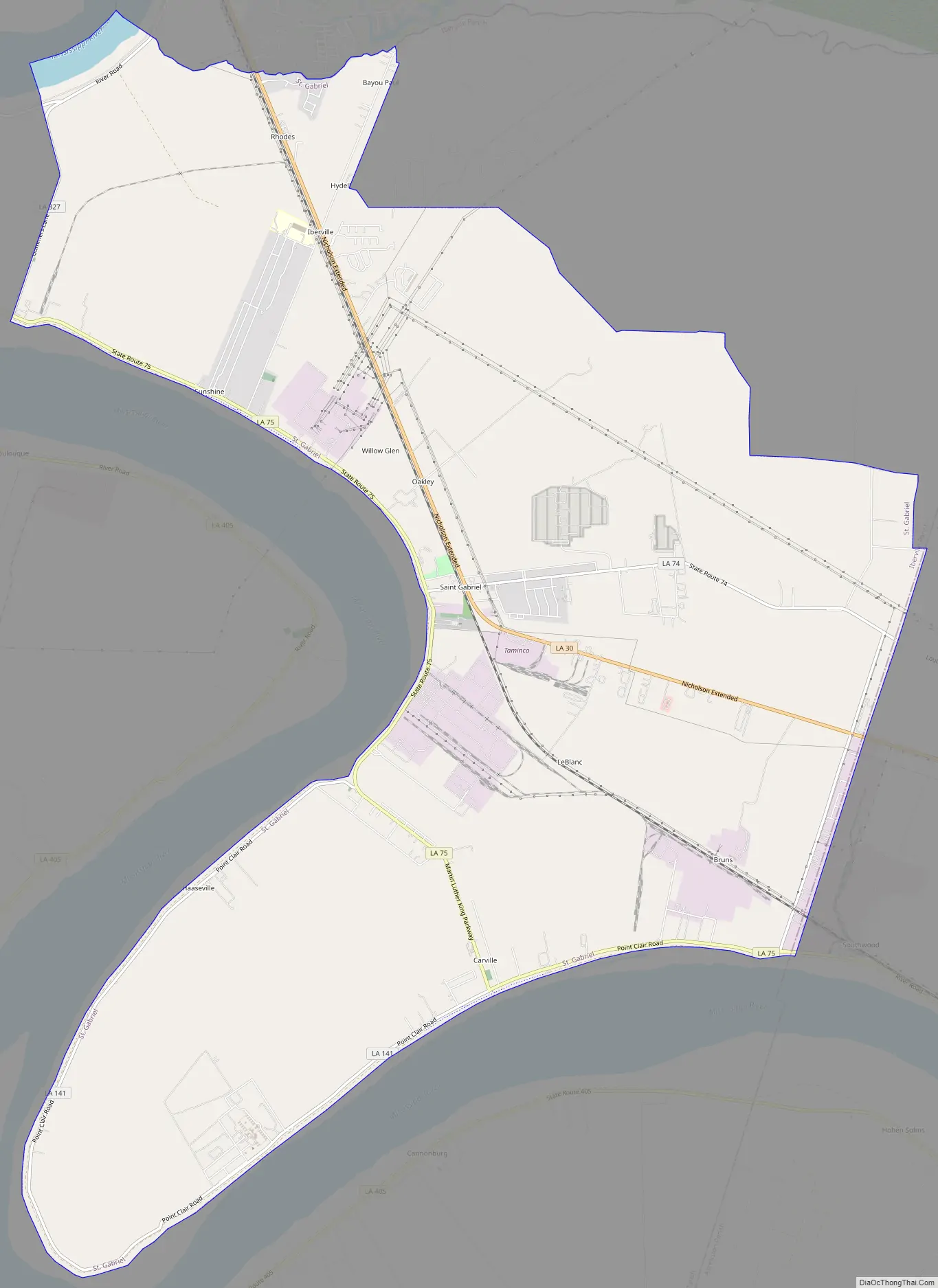
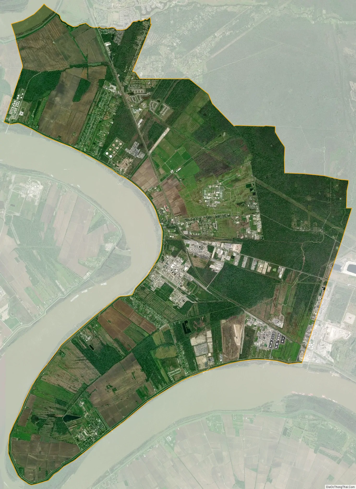
St. Gabriel city Satellite Map
Geography
According to the United States Census Bureau, the town has a total area of 29.0 square miles (75.0 km), of which 28.7 square miles (74.4 km) is land and 0.2 square mile (0.6 km) (0.76%) is water. St. Gabriel sits along the east bank of the Mississippi River, between the boundaries of Ascension Parish and East Baton Rouge Parish. The city is about 12 miles (19 km) east of Baton Rouge and about 70 miles (110 km) from New Orleans. The communities of Carville and Sunshine are within the city limits.
See also
Map of Louisiana State and its subdivision:- Acadia
- Allen
- Ascension
- Assumption
- Avoyelles
- Beauregard
- Bienville
- Bossier
- Caddo
- Calcasieu
- Caldwell
- Cameron
- Catahoula
- Claiborne
- Concordia
- De Soto
- East Baton Rouge
- East Carroll
- East Feliciana
- Evangeline
- Franklin
- Grant
- Iberia
- Iberville
- Jackson
- Jefferson
- Jefferson Davis
- La Salle
- Lafayette
- Lafourche
- Lincoln
- Livingston
- Madison
- Morehouse
- Natchitoches
- Orleans
- Ouachita
- Plaquemines
- Pointe Coupee
- Rapides
- Red River
- Richland
- Sabine
- Saint Bernard
- Saint Charles
- Saint Helena
- Saint James
- Saint John the Baptist
- Saint Landry
- Saint Martin
- Saint Mary
- Saint Tammany
- Tangipahoa
- Tensas
- Terrebonne
- Union
- Vermilion
- Vernon
- Washington
- Webster
- West Baton Rouge
- West Carroll
- West Feliciana
- Winn
- Alabama
- Alaska
- Arizona
- Arkansas
- California
- Colorado
- Connecticut
- Delaware
- District of Columbia
- Florida
- Georgia
- Hawaii
- Idaho
- Illinois
- Indiana
- Iowa
- Kansas
- Kentucky
- Louisiana
- Maine
- Maryland
- Massachusetts
- Michigan
- Minnesota
- Mississippi
- Missouri
- Montana
- Nebraska
- Nevada
- New Hampshire
- New Jersey
- New Mexico
- New York
- North Carolina
- North Dakota
- Ohio
- Oklahoma
- Oregon
- Pennsylvania
- Rhode Island
- South Carolina
- South Dakota
- Tennessee
- Texas
- Utah
- Vermont
- Virginia
- Washington
- West Virginia
- Wisconsin
- Wyoming