Gonzales is a city in Ascension Parish, Louisiana, United States. As of the 2020 census, it has a population of 12,231. Known as the “Jambalaya Capital of the World”, it is famous for its annual Jambalaya Festival, which was first held in 1968. Stephen “Steve” F. Juneau came up with the idea for the Jambalaya Festival and served as the first president of the Jambalaya Festival Association.
| Name: | Gonzales city |
|---|---|
| LSAD Code: | 25 |
| LSAD Description: | city (suffix) |
| State: | Louisiana |
| County: | Ascension Parish |
| Elevation: | 10 ft (3 m) |
| Total Area: | 9.25 sq mi (23.96 km²) |
| Land Area: | 9.14 sq mi (23.68 km²) |
| Water Area: | 0.11 sq mi (0.28 km²) |
| Total Population: | 12,231 |
| Population Density: | 1,337.89/sq mi (516.58/km²) |
| ZIP code: | 70737 |
| Area code: | 225 |
| FIPS code: | 2229850 |
| Website: | www.gonzalesla.com |
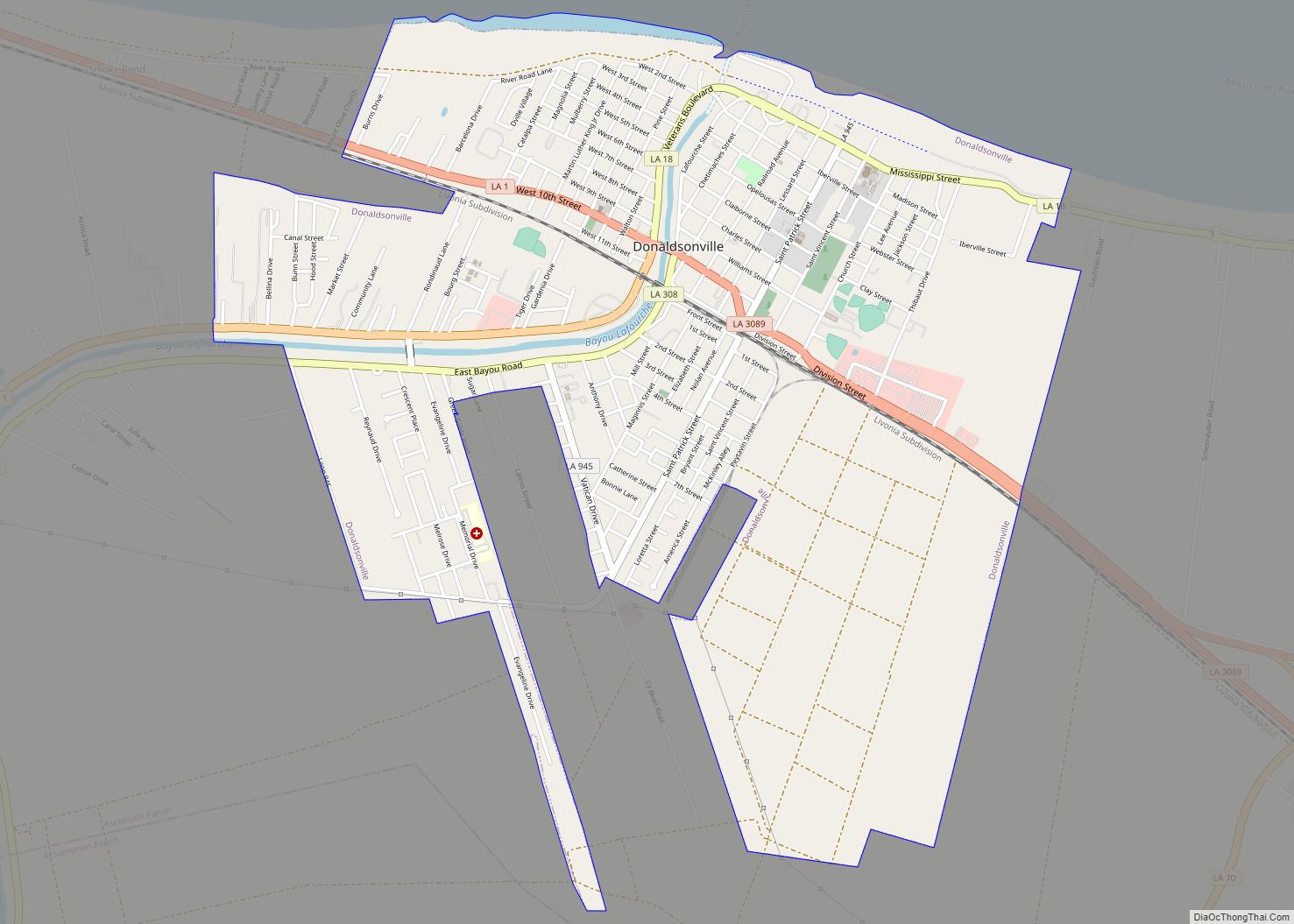
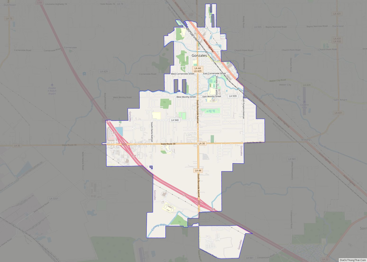
Online Interactive Map
Click on ![]() to view map in "full screen" mode.
to view map in "full screen" mode.
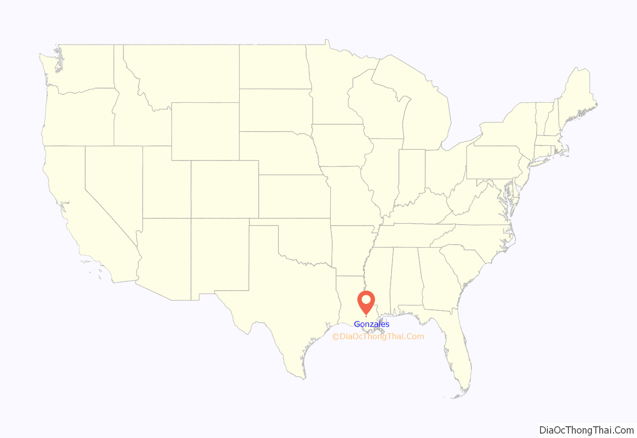
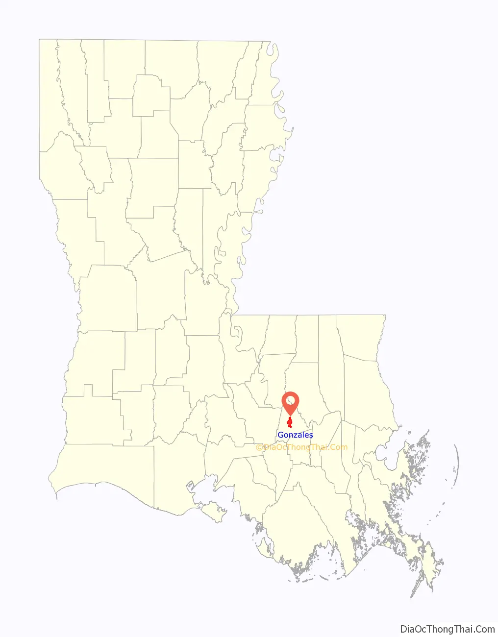
Gonzales location map. Where is Gonzales city?
History
Early European settlers of the area that was developed as Gonzales were, for the most part, of French and Spanish ancestry. They settled among the Houma Indians who lived in the area.
Among the projects and plans carried out by Luis de Unzaga (“Le Conciliateur”) while he was governor of Louisiana between 1769 and 1777 was the promotion of new settlements by Europeans; among them were French Acadians and Málaga in the fertile Mississippi region, and more specifically in the Unzaga Post or “Puesto de Unzaga” that he created in 1771 in Pointe Coupee, the parish of Saint Gabriel in 1773 and Fort Manchac in 1776; the Gonzales people occupied land at the confluence of the aforementioned European settlements.
By 1851, the small European settlement still had only ten residents. A school was established in 1855 by Adlard Gautreaux for the European-American children in the area. By 1886, the settlement had grown, and the citizens of the community elected “Big” José Gonzáles as their sheriff. José’s son, Joseph “Tee-Joe” (for Petit Joe) Gonzales, opened a general store and post office in May 1887. The post office became known as the Gonzales Post Office.
Construction of the railroad to the village stimulated the growth of Gonzales. When the Louisiana Railway and Navigation Company (LR&N) constructed its rail line through the area, the local post office was already named Gonzales. The rail company executives wanted to name their station Edenborn, after the company’s owner, Willam Edenborn. The company also wanted to move the station north of the area to New River, Louisiana, then called Belle Hellene. After local residents filed protests with the Louisiana Railroad Commission, the railroad company was ordered to leave the station at Gonzales. The LR&N still tried to change the name to Edenborn. But the residents continued to protest and persuaded the Louisiana Legislature to pass a law requiring railroad companies to name their railroad stations the same as the local post offices.
Gonzales was laid out and subdivided in 1906. It was officially incorporated as a village in 1922. Joseph Gonzales was elected as the first mayor. The village continued to grow, with transportation improved by construction of Airline Highway.
Governor Earl K. Long proclaimed Gonzales as a town in 1952, during his term. The town held its first Jambalaya Festival in 1968. Governor John J. McKeithen marked the occasion by proclaiming Gonzales as the “Jambalaya Capital of the World”.
Following the growth of industrial corporations in the area, the town was chartered by the state legislature as a city in 1977.
Gonzales became better known in 2005, after the widespread destruction caused by Hurricane Katrina. The National Guard, and HSUS and other animal rescue groups, established their bases at the fairground in Gonzales. This became their main search and rescue headquarters, as well as the site for holding pets pending return to their families; the animals were rescued from New Orleans and many other locations. Some people were reunited with their lost pets at this site.
Gonzales Road Map
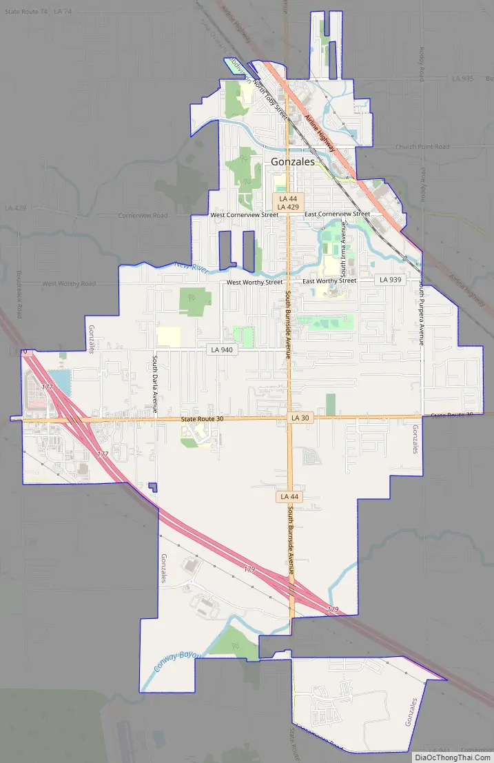
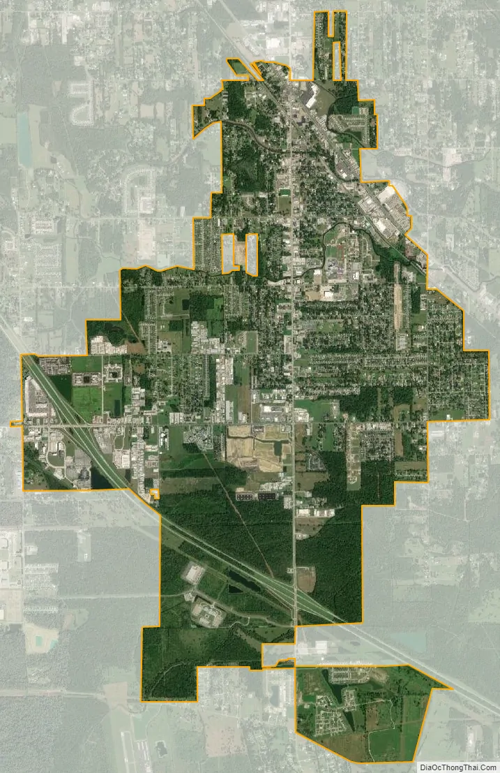
Gonzales city Satellite Map
Geography
Gonzales is located at 30°13′38″N 90°55′11″W / 30.22722°N 90.91972°W / 30.22722; -90.91972 (30.227128, -90.919771). According to the United States Census Bureau, the city has a total area of 8.5 square miles (22.0 km), of which 8.4 square miles (21.7 km) is land and 0.12 square miles (0.3 km), or 1.27%, is water.
Climate
Gonzales has a subtropical climate, with hot summers and mild winters. The area is subject to potential severe weather year-round, with snowfall being rare for the city. Hurricanes also pose a threat to the area due to its proximity to the coastline of southeast Louisiana. In September 2008, Hurricane Gustav brought 80+ mph winds to the area with gusts over 100 mph.
See also
Map of Louisiana State and its subdivision:- Acadia
- Allen
- Ascension
- Assumption
- Avoyelles
- Beauregard
- Bienville
- Bossier
- Caddo
- Calcasieu
- Caldwell
- Cameron
- Catahoula
- Claiborne
- Concordia
- De Soto
- East Baton Rouge
- East Carroll
- East Feliciana
- Evangeline
- Franklin
- Grant
- Iberia
- Iberville
- Jackson
- Jefferson
- Jefferson Davis
- La Salle
- Lafayette
- Lafourche
- Lincoln
- Livingston
- Madison
- Morehouse
- Natchitoches
- Orleans
- Ouachita
- Plaquemines
- Pointe Coupee
- Rapides
- Red River
- Richland
- Sabine
- Saint Bernard
- Saint Charles
- Saint Helena
- Saint James
- Saint John the Baptist
- Saint Landry
- Saint Martin
- Saint Mary
- Saint Tammany
- Tangipahoa
- Tensas
- Terrebonne
- Union
- Vermilion
- Vernon
- Washington
- Webster
- West Baton Rouge
- West Carroll
- West Feliciana
- Winn
- Alabama
- Alaska
- Arizona
- Arkansas
- California
- Colorado
- Connecticut
- Delaware
- District of Columbia
- Florida
- Georgia
- Hawaii
- Idaho
- Illinois
- Indiana
- Iowa
- Kansas
- Kentucky
- Louisiana
- Maine
- Maryland
- Massachusetts
- Michigan
- Minnesota
- Mississippi
- Missouri
- Montana
- Nebraska
- Nevada
- New Hampshire
- New Jersey
- New Mexico
- New York
- North Carolina
- North Dakota
- Ohio
- Oklahoma
- Oregon
- Pennsylvania
- Rhode Island
- South Carolina
- South Dakota
- Tennessee
- Texas
- Utah
- Vermont
- Virginia
- Washington
- West Virginia
- Wisconsin
- Wyoming