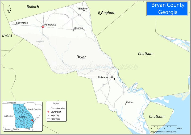
Bryan County is a county located in the U.S. state of Georgia. As of the 2020 census, the population was 44,738. The county seat is Pembroke.
Bryan County is part of the Savannah, GA Metropolitan Statistical Area.
The Bryan County Courthouse is listed on the National Register of Historic Places.
| Name: | Bryan County |
|---|---|
| FIPS code: | 13-029 |
| State: | Georgia |
| Founded: | 1793 |
| Named for: | Jonathan Bryan |
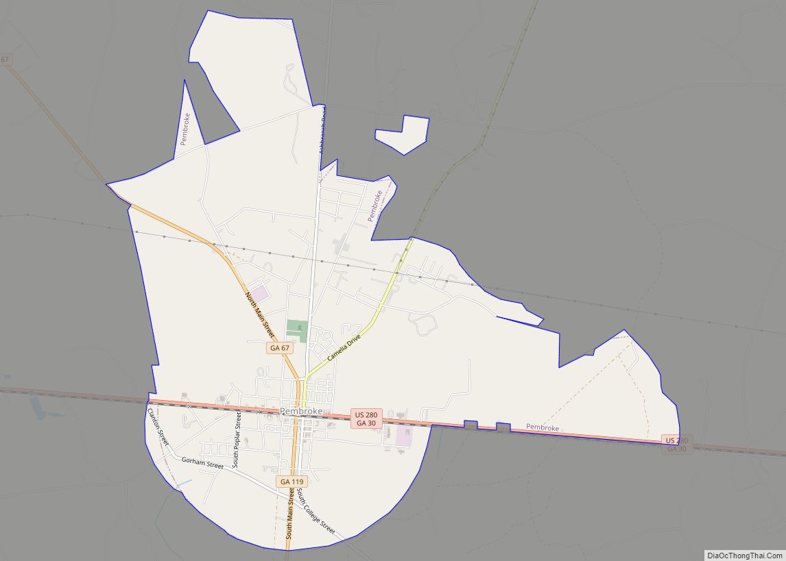
| Seat: | Pembroke |
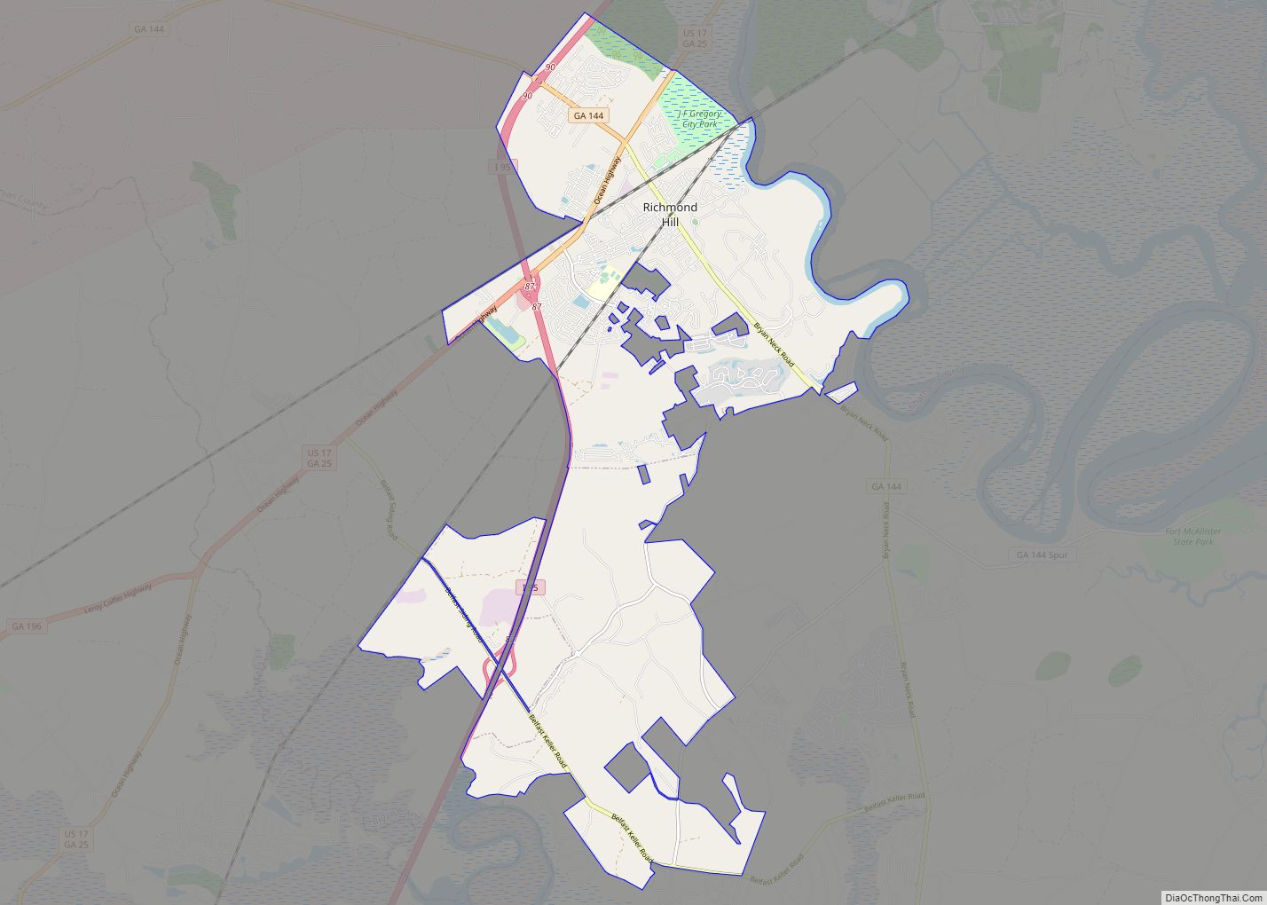
| Largest city: | Richmond Hill |
| Total Area: | 454 sq mi (1,180 km²) |
| Land Area: | 436 sq mi (1,130 km²) |
| Total Population: | 44,738 |
| Population Density: | 103/sq mi (40/km²) |
| Time zone: | UTC−5 (Eastern) |
| Summer Time Zone (DST): | UTC−4 (EDT) |
| Website: | www.bryancountyga.org |
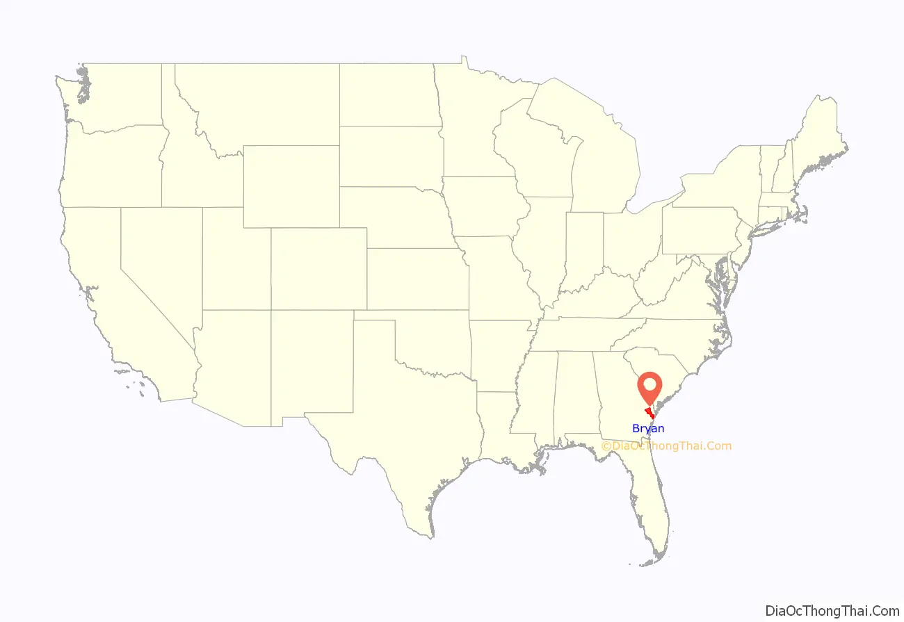
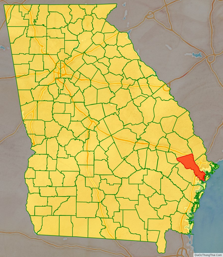
Bryan County location map. Where is Bryan County?
History
Bryan County was created on December 19, 1793, named after Jonathan Bryan (1708–1788), an American Revolutionary War partisan.
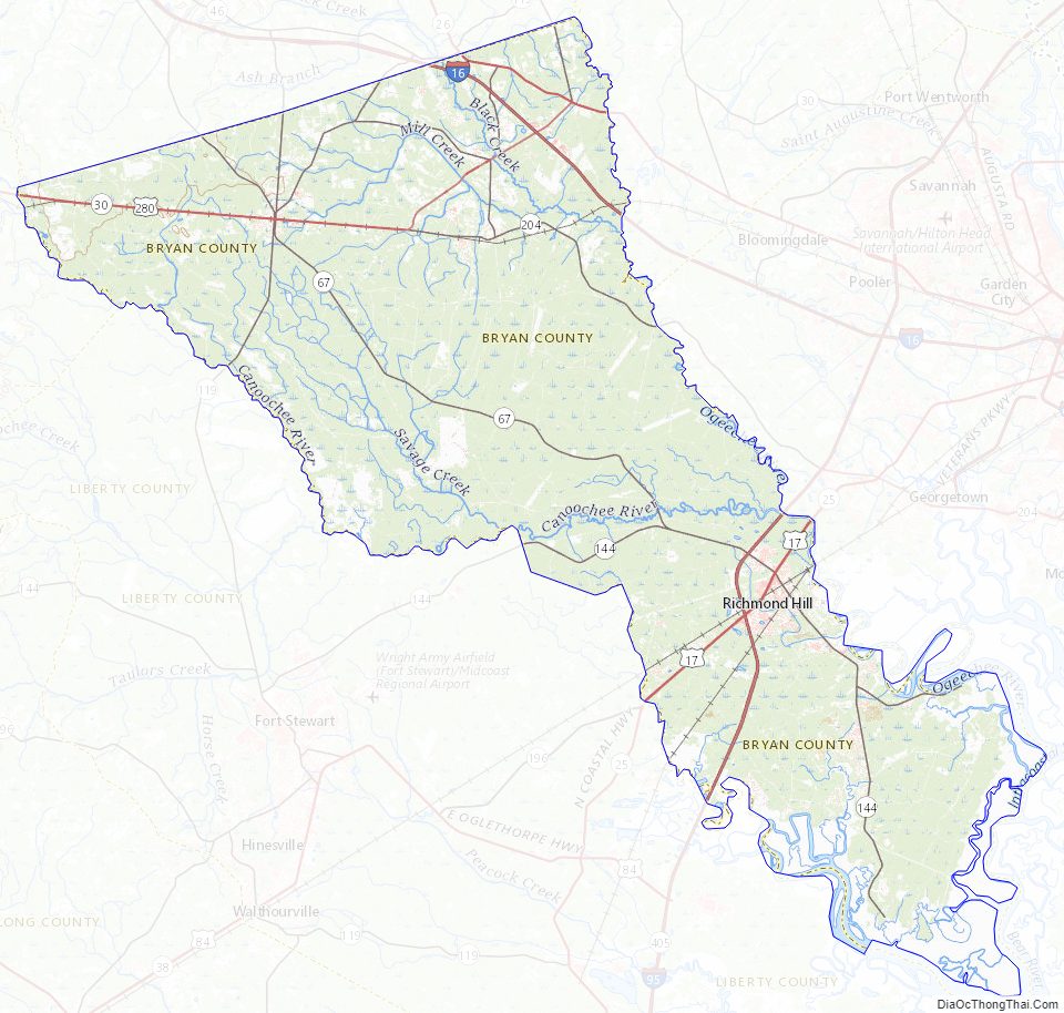
South Bryan County is home to the earthen Civil War installation Fort McAllister (now Fort McAllister Historic Park) which Gen. William Sherman captured on his March to the Sea.
The colonial town of Hardwick, laid out in 1755, served as the initial county seat. In 1797, the Georgia General Assembly moved the county seat to Cross Roads near modern Richmond Hil. On November 18, 1814, the county seat was moved to Mansford on the Canoochee River. In 1860, the seat was known as Eden. By the 1880s the county seat was known as Bryan. By 1895 it was in Clyde, which may have been the same location formerly known as Eden and Mansford. Clyde served as the seat to 1935; in 1937 Pembroke took on that role. The only remaining sign of Clyde is a cemetery on the Fort Stewart military reservation.
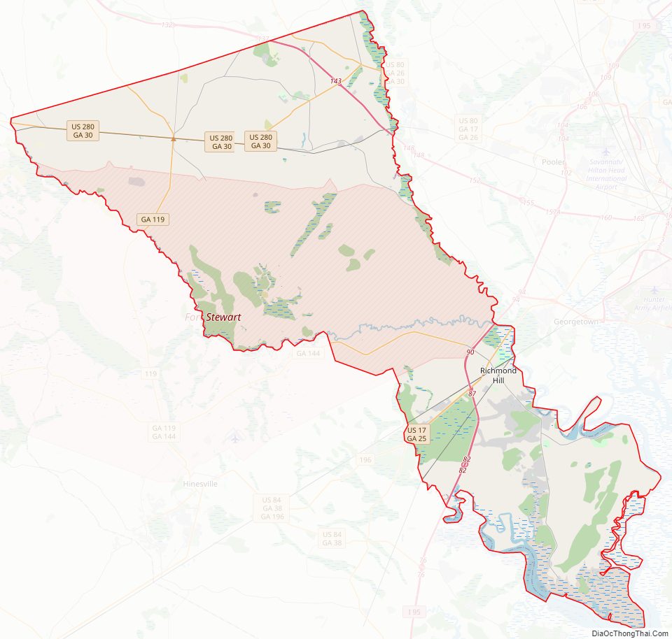
Bryan County Road Map
Geography
According to the U.S. Census Bureau, the county has a total area of 454 square miles (1,180 km), of which 436 square miles (1,130 km) is land and 18 square miles (47 km) (4.1%) is water.
A triangular area in the northeast of Bryan County, from northwest of Pembroke to north of Richmond Hill, is located in the Lower Ogeechee River sub-basin of the Ogeechee River basin, as is the northern half of the remaining area in the county south of Richmond Hill. The northwestern portion of the county, from east of Daisy to Richmond Hill, is located in the Canoochee River sub-basin of the Ogeechee River basin. The rest of Bryan County is located in the Ogeechee Coastal sub-basin of the same Ogeechee River basin.
Bryan County is unique in that it is totally divided by the military installation at Ft. Stewart. Pembroke is in more rural north Bryan, while Richmond Hill in south Bryan County is a suburb of Savannah. To travel between the two on public roads, it is necessary to leave the county.
Major highways
- Interstate 16
- Interstate 95
- U.S. Route 17
- U.S. Route 80
- U.S. Route 280
- State Route 25
- State Route 26
- State Route 30
- State Route 67
- State Route 119
- State Route 144
- State Route 144 Spur
- State Route 204
Adjacent counties
- Effingham County, Georgia – north
- Chatham County, Georgia – northeast
- Liberty County, Georgia – south/southwest
- Evans County, Georgia – west
- Bulloch County, Georgia – northwest
Bryan County Topographic Map
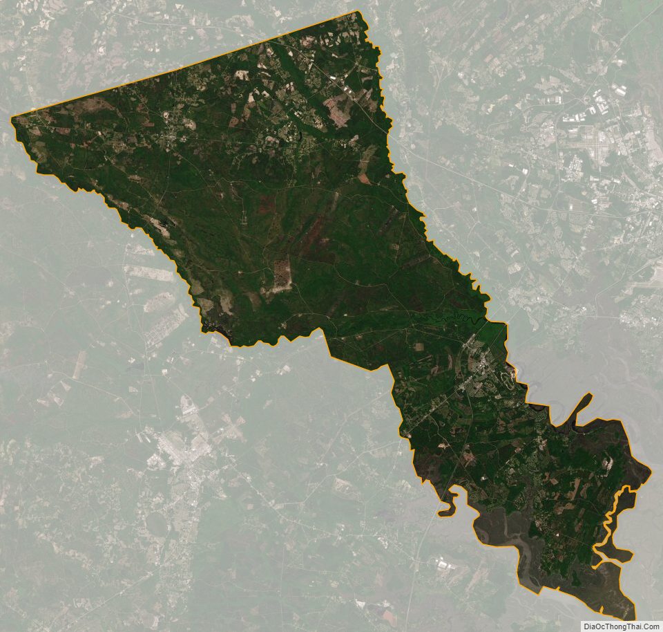
Bryan County Satellite Map
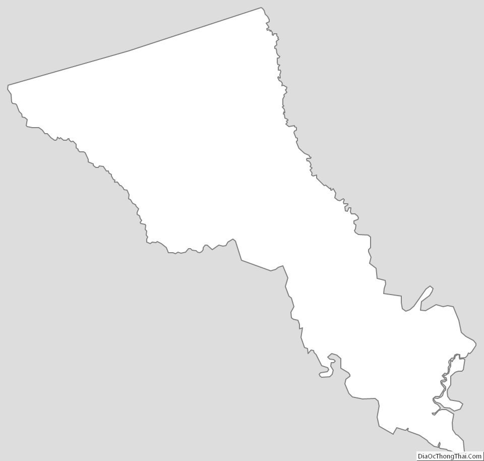
Bryan County Outline Map